Rubha na h-Aibhne Duibhe

Coastal Feature, Headland, Point in Inverness-shire

Scotland

Rubha na h-Aibhne Duibhe

Eilean Fuam The last skerry that the Sound of Harris ferry needs to avoid before docking in Berneray.
Eilean Fuam Credit: Anne Burgess

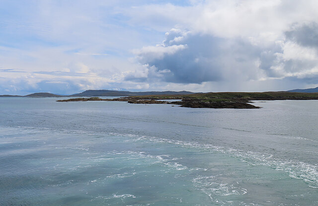
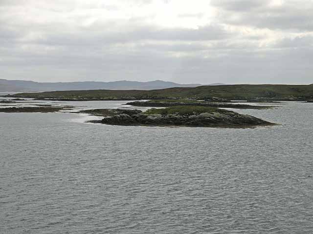
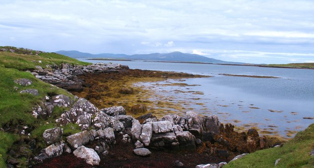
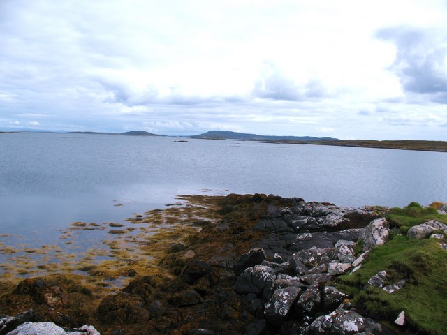
Rubha na h-Aibhne Duibhe, also known as Rubha na h-Aibhne Dhuibh, is a prominent coastal feature located in Inverness-shire, Scotland. It is a stunning headland that juts out into the North Atlantic Ocean, offering breathtaking views and a rich natural environment.

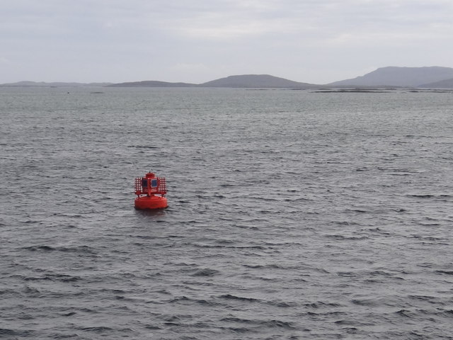
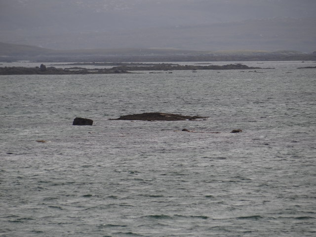
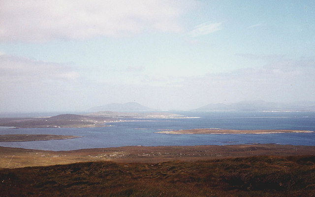
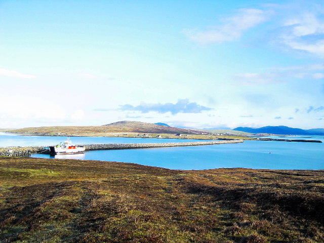
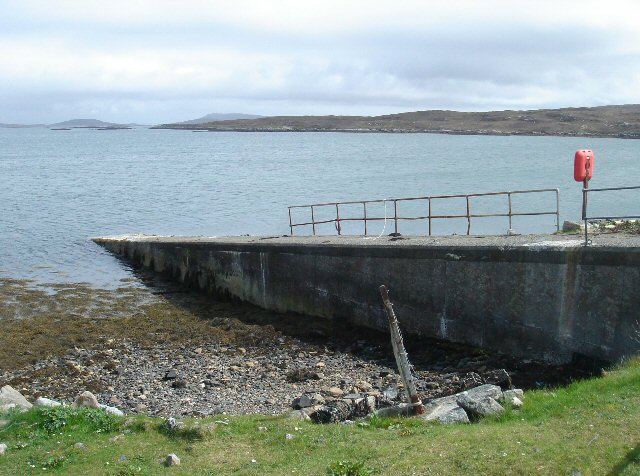
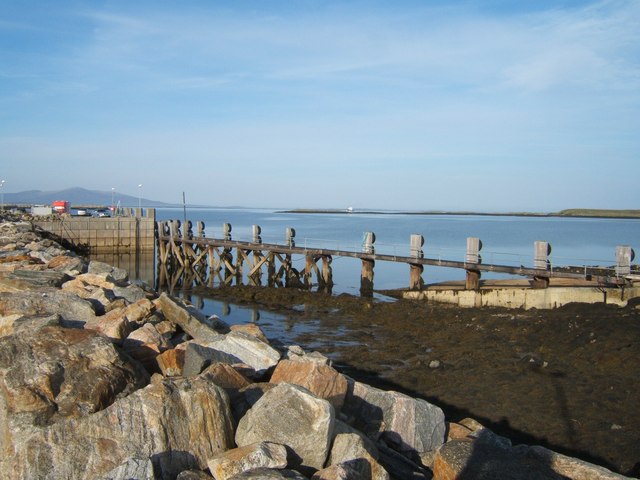
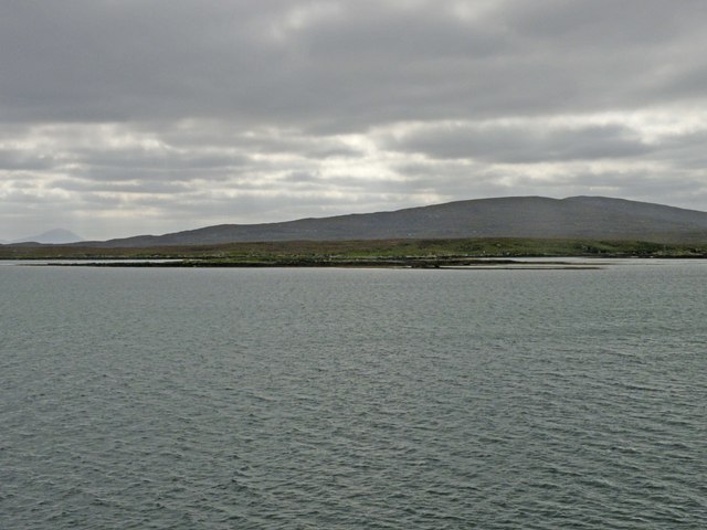
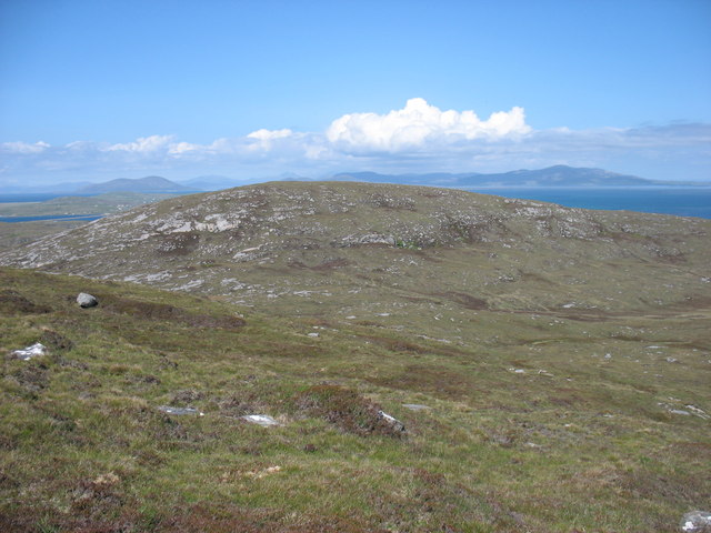
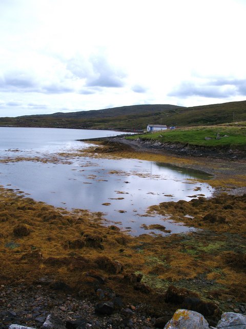
Situated on the western coast of Scotland, Rubha na h-Aibhne Duibhe is a rugged point that marks the entrance to the famous Loch Linnhe. The headland is characterized by its dramatic cliffs, towering above the sea, and its rocky shoreline, which provides a habitat for diverse marine life.

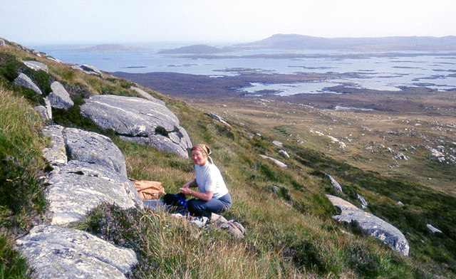
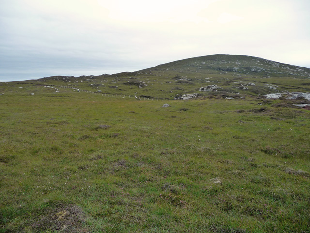
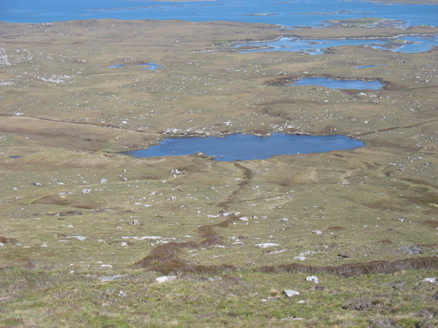
The headland is surrounded by a picturesque landscape, with green fields and hills rolling into the distance. The rocky terrain is interspersed with patches of heather and wildflowers, adding bursts of color to the landscape.

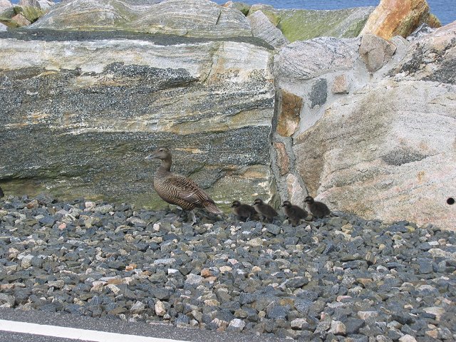
Rubha na h-Aibhne Duibhe is a popular destination for nature enthusiasts and photographers, who come to witness the stunning sunsets and capture the beauty of the rugged coastal scenery. The headland also attracts birdwatchers, as it is home to a variety of seabirds and migratory species.

Visitors to Rubha na h-Aibhne Duibhe can explore the area on foot, following the coastal paths that wind along the cliffs. The headland offers ample opportunities for hiking, as well as picnicking and enjoying the tranquility of the surroundings.

Overall, Rubha na h-Aibhne Duibhe is a remarkable coastal feature, offering a captivating blend of natural beauty, rugged cliffs, and stunning views.

If you have any feedback on the listing, please let us know in the comments section below.

Rubha na h-Aibhne Duibhe Images

Images are sourced within 2km of 57.682461/-7.1725601 or Grid Reference NF9177. Thanks to Geograph Open Source API. All images are credited.

Eilean Fuam The last skerry that the Sound of Harris ferry needs to avoid before docking in Berneray.
Eilean Fuam
The last skerry that the Sound of Harris ferry needs to avoid before docking in Berneray.
Berneray Spit Port Lateral Buoy This red canister buoy emits a red flashing light every three seconds at night.
Berneray Spit Port Lateral Buoy
This red canister buoy emits a red flashing light every three seconds at night.
Hidden danger Rocks near Torogay which appear at low tide but are otherwise submerged.
Hidden danger
Rocks near Torogay which appear at low tide but are otherwise submerged.
On the south slopes of Beinn Bhreac
The north slopes of Beinn Bhreac Berneray and the hills of Harris in the distance.
The north slopes of Beinn Bhreac
Berneray and the hills of Harris in the distance.
Berneray Causeway. Connecting Berneray with North Uist. Curiously, Berneray was always administratively part of Harris, so this could be a causeway from "Harris"  to Uist.  A real Harris connection is still a dream, and is a long term plan, it could be quite a powerful renewable energy source harnessing the tides.
Meanwhile this more modest structure is a problem for this eider family, they are walking over what they could have swum through a few years back.
Berneray Causeway.
Connecting Berneray with North Uist. Curiously, Berneray was always administratively part of Harris, so this could be a causeway from "Harris" to Uist. A real Harris connection is still a dream, and is a long term plan, it could be quite a powerful renewable energy source harnessing the tides. Meanwhile this more modest structure is a problem for this eider family, they are walking over what they could have swum through a few years back.
Berneray Causeway Berneray Causeway from North Uist
Berneray Causeway
Berneray Causeway from North Uist
Newton Jetty, North Uist Before the opening of the causeway in 1999, Newton Jetty was the terminal for a passenger ferry to Berneray. It is owned by the local authority, but is now seldom used.
Newton Jetty, North Uist
Before the opening of the causeway in 1999, Newton Jetty was the terminal for a passenger ferry to Berneray. It is owned by the local authority, but is now seldom used.
The Slipway at Otternish View from the southern end of the North Uist/Berneray Causeway.  In the middle distance can be seen MV Loch Portain on its way from Leverburgh to Berneray.
The Slipway at Otternish
View from the southern end of the North Uist/Berneray Causeway. In the middle distance can be seen MV Loch Portain on its way from Leverburgh to Berneray.
Beinn Bhreac The northern slopes of the hill, seen from boggy ground east of the road to Berneray.
Beinn Bhreac
The northern slopes of the hill, seen from boggy ground east of the road to Berneray.
Small building by the jetty By Loch nam Ban.
Small building by the jetty
By Loch nam Ban.
Eilean na Cloiche A small island in the Sound of Harris. It is not easy to pick out this island against the rather larger Torogaigh <a href="https://www.geograph.org.uk/gridref/NF9178">NF9178</a> behind it. On the skyline is Beinn Mhor <a href="https://www.geograph.org.uk/gridref/NF8976">NF8976</a> in the north east corner of North Uist.
Eilean na Cloiche
A small island in the Sound of Harris. It is not easy to pick out this island against the rather larger Torogaigh NF9178 behind it. On the skyline is Beinn Mhor NF8976 in the north east corner of North Uist.
Eilean Fuam One of the innumerable islands in the Sound of Harris. Torogaigh <a href="https://www.geograph.org.uk/gridref/NF9178">NF9178</a> lies beyond, with the hills of North Uist in the distance.
Eilean Fuam
One of the innumerable islands in the Sound of Harris. Torogaigh NF9178 lies beyond, with the hills of North Uist in the distance.
Beinn Bhreac from Beinn Mhor The hills of South Harris are in the distance.
Beinn Bhreac from Beinn Mhor
The hills of South Harris are in the distance.
Loch Dubh na Moine Taken from the east slopes of Beinn Mhor. What was presumably an old enclosure boundary leads down to the loch.
Loch Dubh na Moine
Taken from the east slopes of Beinn Mhor. What was presumably an old enclosure boundary leads down to the loch.
Loch nam Ban Seaweed covered rocks in a corner of this small sea loch.
Loch nam Ban
Seaweed covered rocks in a corner of this small sea loch.
Coastline at Loch nam Ban A quiet corner of North Uist. One wonders why someone came this far to drop a soft drinks can, crisp packet and Mars bar wrapper. The more public spirited amongst us took the litter away again.
Coastline at Loch nam Ban
A quiet corner of North Uist. One wonders why someone came this far to drop a soft drinks can, crisp packet and Mars bar wrapper. The more public spirited amongst us took the litter away again.
Rocky shoreline The rocky shoreline at Rubha Charnain Mhoir.
Rocky shoreline
The rocky shoreline at Rubha Charnain Mhoir.
Show me another place!

Rubha na h-Aibhne Duibhe is located at Grid Ref: NF9177 (Lat: 57.682461, Lng: -7.1725601)

Unitary Authority: Na h-Eileanan an Iar

Police Authority: Highlands and Islands

What 3 Words

///baths.irrigate.computer. Near Lochmaddy, Na h-Eileanan Siar

Related Wikis

Dun an Sticir

Dun an Sticir (Scottish Gaelic: Dùn an Sticir [ˈt̪un əɲ ˈʃtʲiçkʲɪɾʲ]) is an Iron Age broch situated approximately 9.5 kilometers north of Lochmaddy in...

Otternish

Otternish is the former North Uist terminal for the ferry to Berneray, in the Outer Hebrides, Scotland. The slipway lies 6 miles (10 km) north of Lochmaddy...

Newtonferry

Newtonferry (Scottish Gaelic: Port nan Long, "the harbour of the ships") is a small crofting community on the island of North Uist in the Western Isles...

Loch an Duin

Loch an Duin is a complex system of freshwater, brackish and sea lochs, tidal channels and islands, on and close to North Uist off the west coast of Scotland...

Have you been to Rubha na h-Aibhne Duibhe?

Leave your review of Rubha na h-Aibhne Duibhe below (or comments, questions and feedback).