Rubha na Cruachaig

Coastal Feature, Headland, Point in Inverness-shire

Scotland

Rubha na Cruachaig

A865 road by Traigh Athmor And another of those square "Passing Place" signs;  I much prefer the diamond shaped ones!
A865 road by Traigh Athmor Credit: Gordon Brown

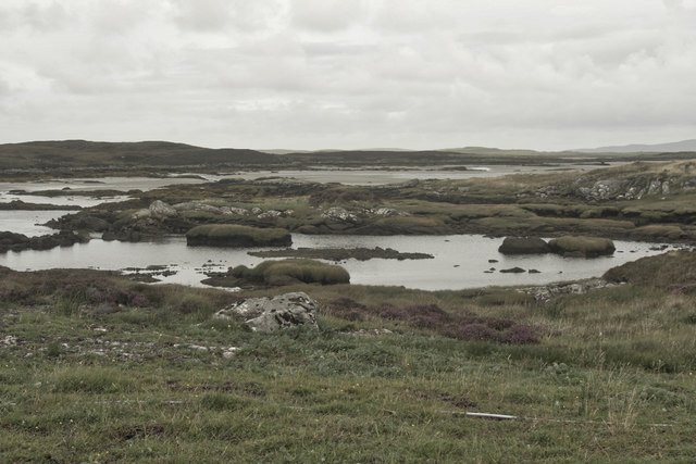
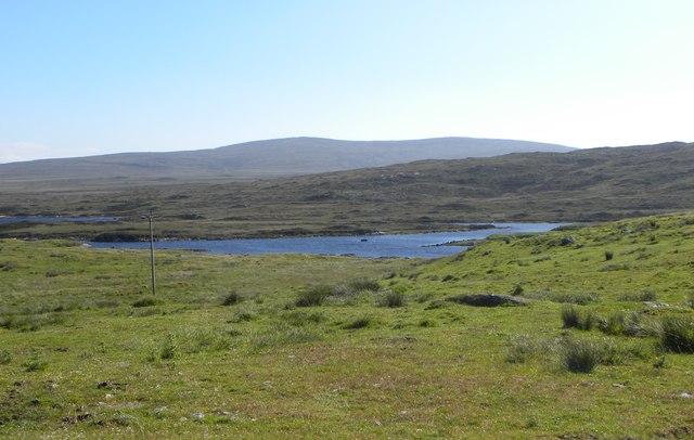
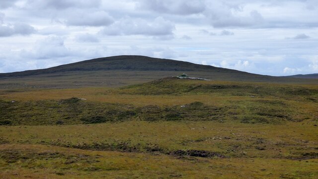
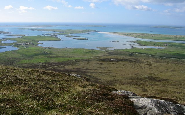
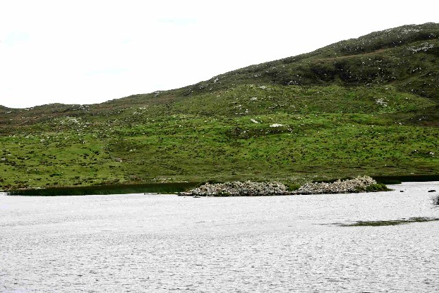
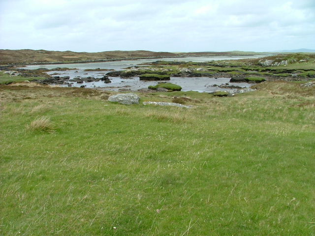
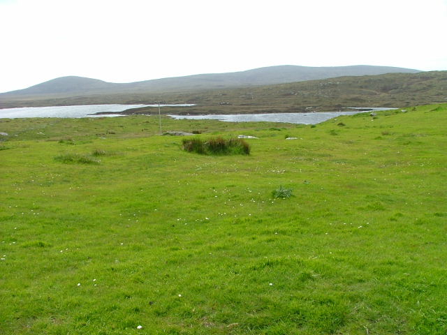
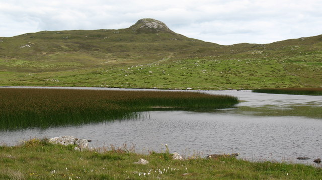
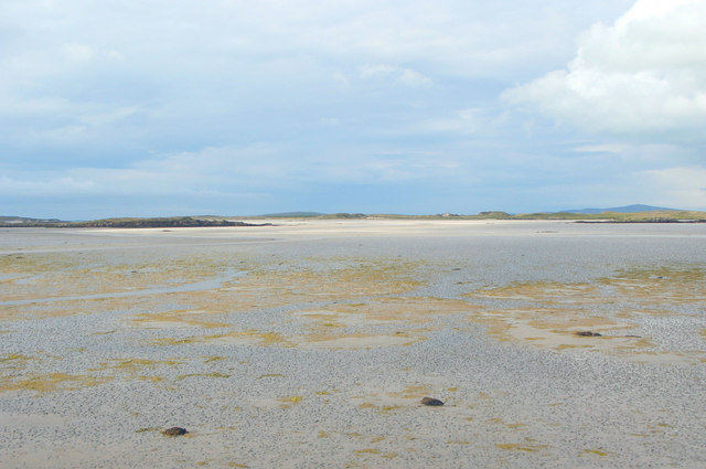
Rubha na Cruachaig is a prominent headland located in Inverness-shire, Scotland. This coastal feature is situated on the northwest coast of the Scottish Highlands, overlooking the North Atlantic Ocean. The headland is characterized by rugged cliffs that rise dramatically from the sea, providing stunning views of the surrounding landscape.

Rubha na Cruachaig is known for its diverse wildlife, including seabirds such as puffins, guillemots, and razorbills. The headland is also home to a variety of plant species, adding to its natural beauty. Visitors to the area can enjoy hiking along the coastal paths, exploring the rocky shoreline, and taking in the breathtaking scenery.

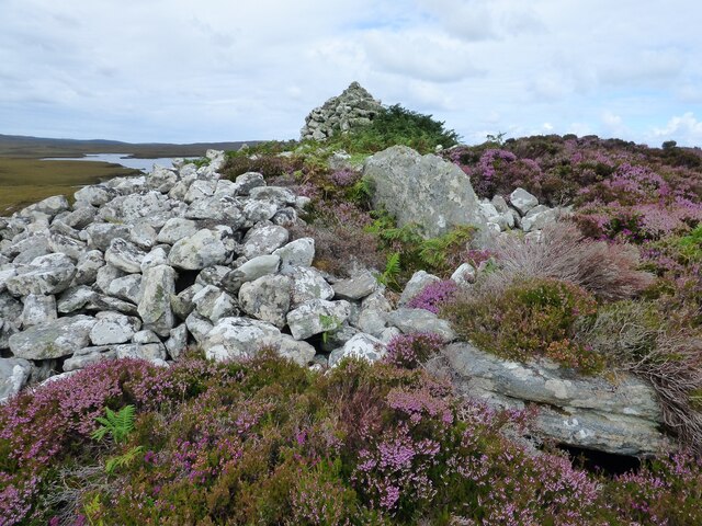
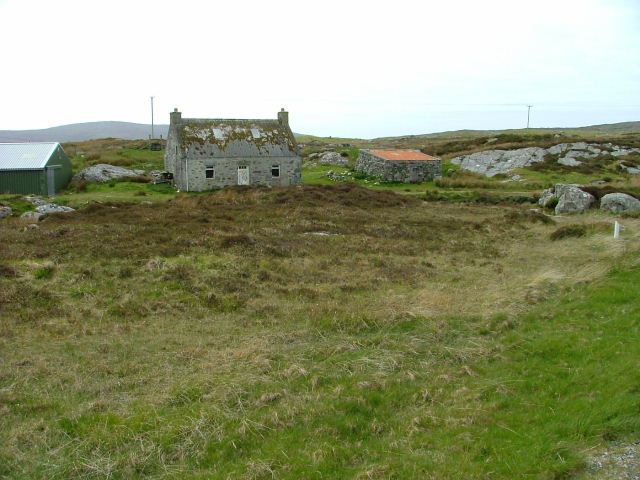
In addition to its natural beauty, Rubha na Cruachaig has historical significance as well. The headland has been inhabited for centuries, with evidence of ancient settlements and structures dating back to prehistoric times. Today, visitors can explore the ruins of old buildings and learn about the area's rich history.

Overall, Rubha na Cruachaig is a must-visit destination for nature lovers, history enthusiasts, and anyone looking to experience the rugged beauty of the Scottish coastline.

If you have any feedback on the listing, please let us know in the comments section below.

Rubha na Cruachaig Images

Images are sourced within 2km of 57.64206/-7.2890765 or Grid Reference NF8473. Thanks to Geograph Open Source API. All images are credited.

A865 road by Traigh Athmor And another of those square "Passing Place" signs;  I much prefer the diamond shaped ones!
A865 road by Traigh Athmor
And another of those square "Passing Place" signs; I much prefer the diamond shaped ones!
Traigh Athmor A typical scattering of Outer Hebrides houses above the shore.
Traigh Athmor
A typical scattering of Outer Hebrides houses above the shore.
Sea pinks, North Uist If you're lucky enough to be there at the right time, it's an amazing display.
Sea pinks, North Uist
If you're lucky enough to be there at the right time, it's an amazing display.
Loch nan Geireann
Loch nan Geireann
Low tide, Traigh Athmor The tide runs out a long way here, exposing many hectares of sand.
Low tide, Traigh Athmor
The tide runs out a long way here, exposing many hectares of sand.
View towards Loch nan Geireann A view across rough grassland and bog towards a corner of this irregularly shaped freshwater loch.
View towards Loch nan Geireann
A view across rough grassland and bog towards a corner of this irregularly shaped freshwater loch.
Dun Aonghuis The dun covers the whole of a small island in Loch Aonghais. <span class="nowrap"><a title="https://canmore.org.uk/site/10366/north-uist-loch-aonghais-dun-aonais" rel="nofollow ugc noopener" href="https://canmore.org.uk/site/10366/north-uist-loch-aonghais-dun-aonais">Link</a><img style="margin-left:2px;" alt="External link" title="External link - shift click to open in new window" src="https://s1.geograph.org.uk/img/external.png" width="10" height="10"/></span>
Dun Aonghuis
The dun covers the whole of a small island in Loch Aonghais. LinkExternal link
Barpa nam Feannag Chambered Long Cairn View of the chamber at the eastern end of the mound <span class="nowrap"><a title="https://www.megalithic.co.uk/article.php?sid=48278" rel="nofollow ugc noopener" href="https://www.megalithic.co.uk/article.php?sid=48278">Link</a><img style="margin-left:2px;" alt="External link" title="External link - shift click to open in new window" src="https://s1.geograph.org.uk/img/external.png" width="10" height="10"/></span>
Barpa nam Feannag Chambered Long Cairn
View of the chamber at the eastern end of the mound LinkExternal link
Barpa nam Feannag Chambered Long Cairn The hill beyond the cairn is Sgealtrabhal <span class="nowrap"><a title="https://www.megalithic.co.uk/article.php?sid=48278" rel="nofollow ugc noopener" href="https://www.megalithic.co.uk/article.php?sid=48278">Link</a><img style="margin-left:2px;" alt="External link" title="External link - shift click to open in new window" src="https://s1.geograph.org.uk/img/external.png" width="10" height="10"/></span>
Barpa nam Feannag Chambered Long Cairn
The hill beyond the cairn is Sgealtrabhal LinkExternal link
North from Crògearraidh Mòr This picture shows much of the square, moorland sloping up to the sharp summit of Crògearraidh Mòr (180m). Beyond are the beaches and lagoons of the north coast. North Uist is an island, barely above the water and land and water are very much mixed up.
North from Crògearraidh Mòr
This picture shows much of the square, moorland sloping up to the sharp summit of Crògearraidh Mòr (180m). Beyond are the beaches and lagoons of the north coast. North Uist is an island, barely above the water and land and water are very much mixed up.
Dun in Loch Aonghais A common sight on North Uist; an Iron Age Dun in an island in the middle of a Loch
Dun in Loch Aonghais
A common sight on North Uist; an Iron Age Dun in an island in the middle of a Loch
Old and New Old crofthouse and fairly new agricultural building.
Old and New
Old crofthouse and fairly new agricultural building.
The A865 Looking West. Tràigh Athmòr is on the right of picture.
The A865 Looking West.
Tràigh Athmòr is on the right of picture.
Loch nan Geirneann. Looking towards Machair Leathann.
Loch nan Geirneann.
Looking towards Machair Leathann.
Grazing Land Loch nan Geireann beyond.
Grazing Land
Loch nan Geireann beyond.
Road to Greintobht Looks like someone's had to make an emergency stop in the passing place.
Road to Greintobht
Looks like someone's had to make an emergency stop in the passing place.
Loch Aonghais Reedy loch at the roadside. The craggy top in the background is Crogearraidh at 180m.
Loch Aonghais
Reedy loch at the roadside. The craggy top in the background is Crogearraidh at 180m.
Traigh Athmor, North Uist Looking northwards over one of the several large expanses of sand on Uist's north coast which disappear beneath water at high tide.
Traigh Athmor, North Uist
Looking northwards over one of the several large expanses of sand on Uist's north coast which disappear beneath water at high tide.
Show me another place!

Rubha na Cruachaig is located at Grid Ref: NF8473 (Lat: 57.64206, Lng: -7.2890765)

Unitary Authority: Na h-Eileanan an Iar

Police Authority: Highlands and Islands

What 3 Words

///juggles.betrayal.swipes. Near Lochmaddy, Na h-Eileanan Siar

Related Wikis

Oronsay, Outer Hebrides

Oronsay (Gaelic Orasaigh) is a tidal island off North Uist in the Outer Hebrides. Lying to the north of Vallaquie Strand, the island has been uninhabited...

Sollas

Sollas (Scottish Gaelic: Solas) is a small crofting township on the northern coast of the island of North Uist, Scotland. == History == === The Battle... ===

Na Fir Bhrèige

Na Fir Bhrèige (pronounced [nə fiɾʲ ˈvɾʲeːkʲə]; can be translated from Gaelic into English as "The False Men") is a set of three standing stones on the...

Lingeigh, North Uist

Lingeigh is an uninhabited island off North Uist, south east of Boreray. It is separated from North Uist by Traigh Lingeigh. == Footnotes ==

Nearby Amenities

Located within 500m of 57.64206,-7.2890765
Passing Place
Lat/Long: 57.6410156/-7.2859084
Passing Place
Lat/Long: 57.6430127/-7.2969312
Passing Place
Lat/Long: 57.6413202/-7.2838426
Passing Place
Lat/Long: 57.6411521/-7.2910122
Passing Place
Lat/Long: 57.6417056/-7.2828518
Passing Place
Lat/Long: 57.6422171/-7.2954894
Passing Place
Lat/Long: 57.6426535/-7.2810818
Loch nan Geireann
Natural: bay
Lat/Long: 57.644805/-7.2878565
Passing Place
Lat/Long: 57.6411795/-7.2876484
Passing Place
Lat/Long: 57.6415142/-7.2930607
Passing Place
Lat/Long: 57.642246/-7.2817775
Power: pole
Lat/Long: 57.6420833/-7.281028
Power: pole
Lat/Long: 57.6414832/-7.2817603
Power: pole
Lat/Long: 57.6409004/-7.2825059
Power: pole
Lat/Long: 57.6404022/-7.2831108
Power: pole
Lat/Long: 57.6398093/-7.283839
Power: pole
Lat/Long: 57.639907/-7.2851881
Power: pole
Lat/Long: 57.6399917/-7.286599
Power: pole
Lat/Long: 57.6400663/-7.2877094
Power: pole
Lat/Long: 57.6401352/-7.2889003
Power: pole
Lat/Long: 57.6402171/-7.2900832
Power: pole
Lat/Long: 57.6403549/-7.2924033
Power: pole
Lat/Long: 57.6407439/-7.2935164
Power: pole
Lat/Long: 57.6410339/-7.2943157
Power: pole
Lat/Long: 57.6414689/-7.2955871
Power: pole
Lat/Long: 57.6418694/-7.2967511
Power: pole
Lat/Long: 57.6402956/-7.2912351
Power: pole
Lat/Long: 57.6402457/-7.2854422
Power: pole
Lat/Long: 57.6408559/-7.2858633
Power: pole
Lat/Long: 57.6411717/-7.2860779
The data included in this document is from www.openstreetmap.org. The data is made available under ODbL.

Have you been to Rubha na Cruachaig?

Leave your review of Rubha na Cruachaig below (or comments, questions and feedback).