Corran Àird a' Mhòrain

Coastal Feature, Headland, Point in Inverness-shire

Scotland

Corran Àird a' Mhòrain

Flat boggy tidal ground near Grenitote Traigh Ear (East shore or beach), a magnificent stretch of beach, to the right.
Flat boggy tidal ground near Grenitote Credit: Gordon Brown

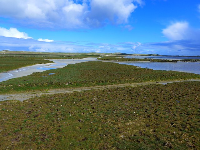
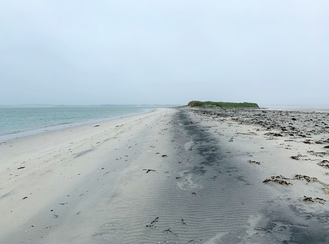
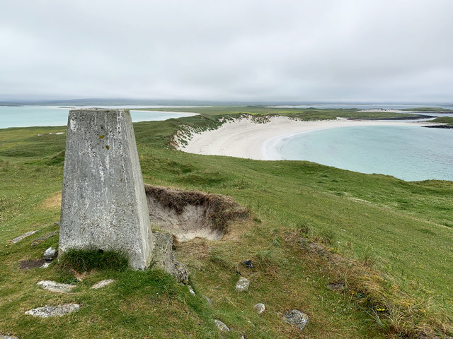
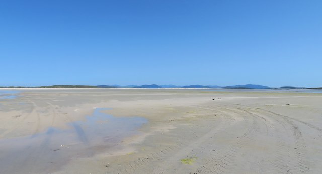
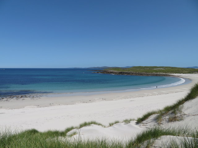
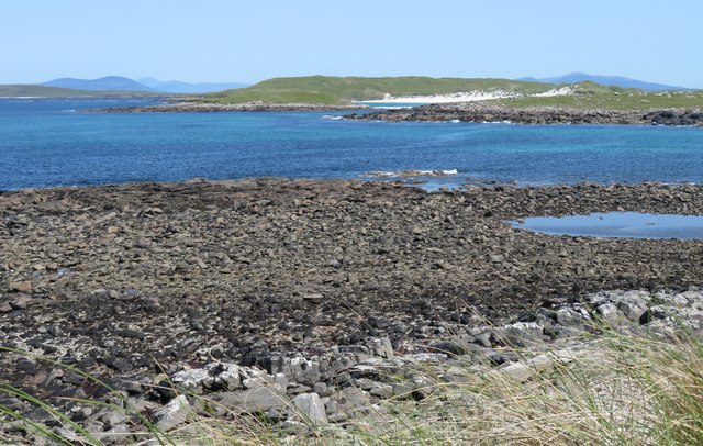
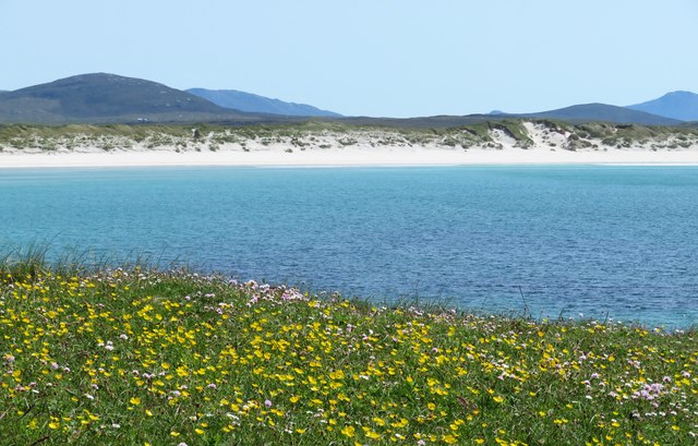
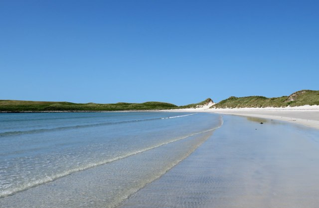
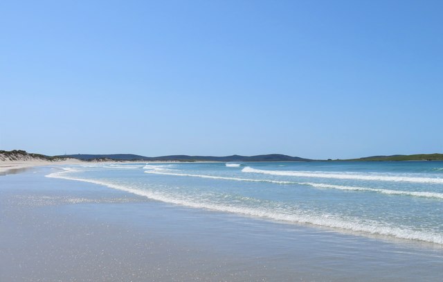
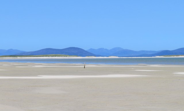
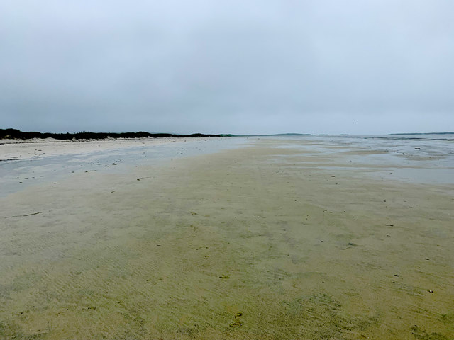
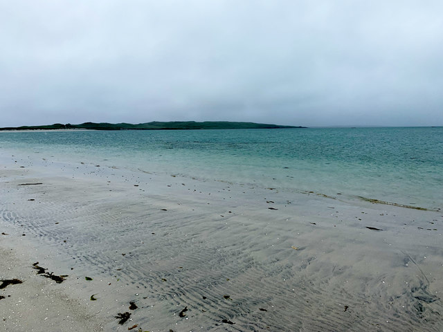
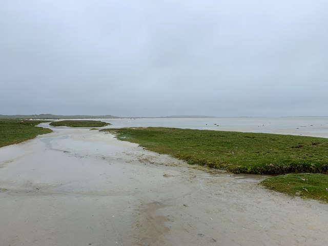
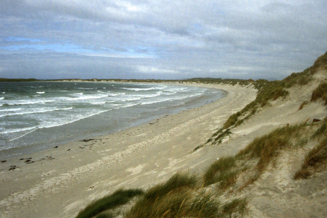
Corran Àird a' Mhòrain is a prominent headland located in Inverness-shire, Scotland. This coastal feature juts out into the Moray Firth, offering stunning views of the surrounding landscape and sea. The headland is known for its rugged cliffs, rocky shores, and diverse marine life.

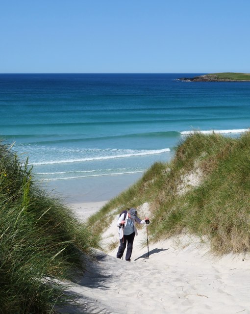
Corran Àird a' Mhòrain is a popular spot for outdoor enthusiasts, with opportunities for hiking, birdwatching, and wildlife photography. The headland is home to a variety of seabirds, including gannets, puffins, and guillemots, making it a prime location for birdwatching.

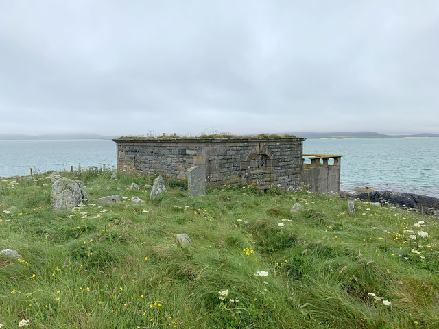
In addition to its natural beauty, Corran Àird a' Mhòrain also has historical significance. The headland is believed to have been inhabited by humans for thousands of years, with evidence of ancient settlements and burial sites found in the area.

Overall, Corran Àird a' Mhòrain is a must-visit destination for nature lovers and history buffs alike. Its stunning scenery, abundant wildlife, and rich history make it a truly unique and special place to explore on the Scottish coast.

If you have any feedback on the listing, please let us know in the comments section below.

Corran Àird a' Mhòrain Images

Images are sourced within 2km of 57.671652/-7.3183035 or Grid Reference NF8377. Thanks to Geograph Open Source API. All images are credited.

Flat boggy tidal ground near Grenitote Traigh Ear (East shore or beach), a magnificent stretch of beach, to the right.
Flat boggy tidal ground near Grenitote
Traigh Ear (East shore or beach), a magnificent stretch of beach, to the right.
Corran Àird a' Mhòrain Near the root of a long sand spit extending from Tràigh Ear (Greinetobht).
Corran Àird a' Mhòrain
Near the root of a long sand spit extending from Tràigh Ear (Greinetobht).
Àird a' Mhòrain trig point Looking back across the narrow part of the headland towards Greinetobht.
Àird a' Mhòrain trig point
Looking back across the narrow part of the headland towards Greinetobht.
A vast expanse of sand The sands of Traigh Ear at low tide. Taken as a wide angle view which makes the hills of Harris look a long way off.
A vast expanse of sand
The sands of Traigh Ear at low tide. Taken as a wide angle view which makes the hills of Harris look a long way off.
White sand beach, Udal The smallest of the bays and beaches on the Leathan peninsula.
White sand beach, Udal
The smallest of the bays and beaches on the Leathan peninsula.
Rocky foreshore, Rubha Bheilis Each small rocky headland along the Leathan peninsula represents a former island now linked by dunes. The whole peninsula is one large tombolo reaching out to the Aird a Mhorain, with small 'branches' to Rubha Bheilis and Rubha Huilis, which is the green mound left of centre.
Rocky foreshore, Rubha Bheilis
Each small rocky headland along the Leathan peninsula represents a former island now linked by dunes. The whole peninsula is one large tombolo reaching out to the Aird a Mhorain, with small 'branches' to Rubha Bheilis and Rubha Huilis, which is the green mound left of centre.
Traigh Iar from Rubha Bheilis Flower covered headland, azure sea, white sand......it could be the Seychelles. It was 25 degrees as well.
Traigh Iar from Rubha Bheilis
Flower covered headland, azure sea, white sand......it could be the Seychelles. It was 25 degrees as well.
On the tide line at Traigh Iar No deck chairs, donkey rides, ice creams or punch and judy show on this beach, but to compensate, the temperature was 25C.
On the tide line at Traigh Iar
No deck chairs, donkey rides, ice creams or punch and judy show on this beach, but to compensate, the temperature was 25C.
Traigh Iar Looking south west along this superb beach. In the distance, right of centre, are the outlines of the ruins on Vallay, one of which must be Vallay House.
Traigh Iar
Looking south west along this superb beach. In the distance, right of centre, are the outlines of the ruins on Vallay, one of which must be Vallay House.
Two steps forward, one back Taking the route up through the dunes can be hard work on a warm and sunny day, but then who's complaining in such a beautiful location?
Two steps forward, one back
Taking the route up through the dunes can be hard work on a warm and sunny day, but then who's complaining in such a beautiful location?
Incoming tide, Traigh Ear Slowly but surely the tide makes its way across the flat sands of Traigh Ear. By the time we reached the small channel 70m before the car park it was a case of paddling across with shoes and socks off.
Incoming tide, Traigh Ear
Slowly but surely the tide makes its way across the flat sands of Traigh Ear. By the time we reached the small channel 70m before the car park it was a case of paddling across with shoes and socks off.
Tràigh Ear, Greinetobht Looking towards Corran Àird a' Mhòrain.
Tràigh Ear, Greinetobht
Looking towards Corran Àird a' Mhòrain.
East side of Àird a' Mhòrain Looking to the higher ground at the end of the peninsula.
East side of Àird a' Mhòrain
Looking to the higher ground at the end of the peninsula.
Burial ground on Àird a' Mhòrain The resting place of many of the Macleans of Boreray, the island just to the north-east of here.
Burial ground on Àird a' Mhòrain
The resting place of many of the Macleans of Boreray, the island just to the north-east of here.
Tràigh Udal A fine beach south of Àird a' Mhòrain.
Tràigh Udal
A fine beach south of Àird a' Mhòrain.
The south end of Tràigh Ear, Greinetobht The access to a vast area of sand on the east side of Àird a' Mhòrain peninsula.
The south end of Tràigh Ear, Greinetobht
The access to a vast area of sand on the east side of Àird a' Mhòrain peninsula.
Cattle pens and a shed on the machair The sandy ground around here was once intensively cultivated. Today there are but a few patches of potatoes, some rapeseed and cattle grazings.
Cattle pens and a shed on the machair
The sandy ground around here was once intensively cultivated. Today there are but a few patches of potatoes, some rapeseed and cattle grazings.
Traigh Iar, Machair Leathann
Show me another place!

Corran Àird a' Mhòrain is located at Grid Ref: NF8377 (Lat: 57.671652, Lng: -7.3183035)

Unitary Authority: Na h-Eileanan an Iar

Police Authority: Highlands and Islands

What 3 Words

///opposites.trade.drags. Near Lochmaddy, Na h-Eileanan Siar

Related Wikis

Oronsay, Outer Hebrides

Oronsay (Gaelic Orasaigh) is a tidal island off North Uist in the Outer Hebrides. Lying to the north of Vallaquie Strand, the island has been uninhabited...

Sollas

Sollas (Scottish Gaelic: Solas) is a small crofting township on the northern coast of the island of North Uist, Scotland. == History == === The Battle... ===

Lingeigh, North Uist

Lingeigh is an uninhabited island off North Uist, south east of Boreray. It is separated from North Uist by Traigh Lingeigh. == Footnotes ==

Boreray, North Uist

Boreray (Scottish Gaelic: Boraraigh) is an island with a single croft, lying 2 kilometres (1.2 mi) north of North Uist in the Outer Hebrides of Scotland...

Have you been to Corran Àird a' Mhòrain?

Leave your review of Corran Àird a' Mhòrain below (or comments, questions and feedback).