Culagach

Coastal Feature, Headland, Point in Inverness-shire

Scotland

Culagach

Beinn nan Caorach View looking down the south ridge of Beinn nan Caorach, which is a small summit on the southern ridge of Beinn Mhor, and across Loch Aineort.
Beinn nan Caorach Credit: Andrew Spenceley

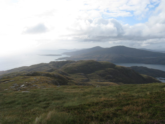
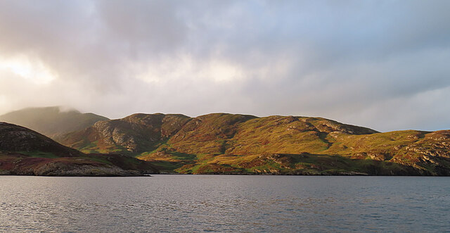
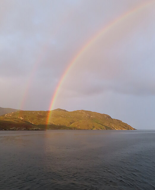
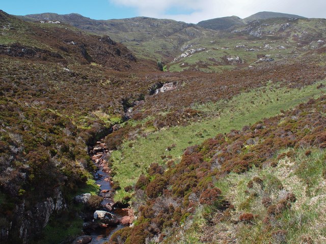
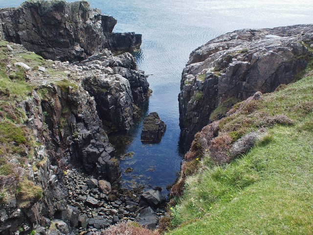
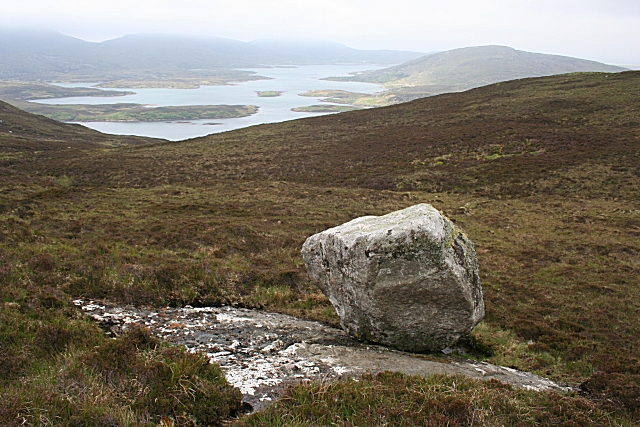
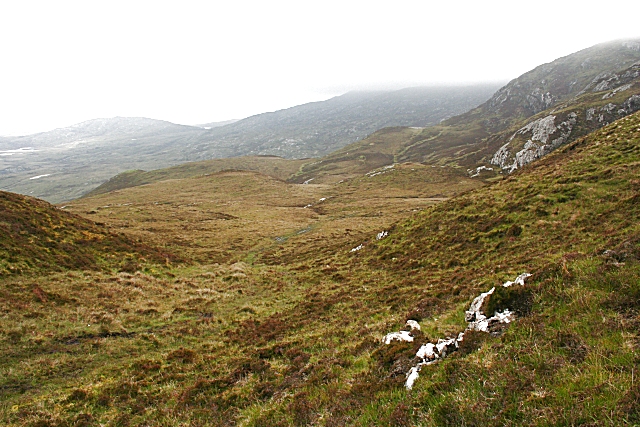
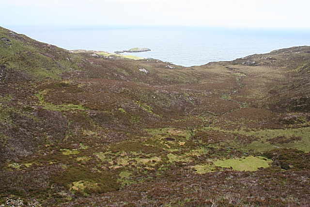
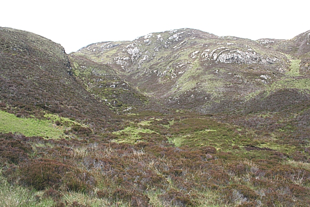
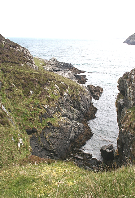
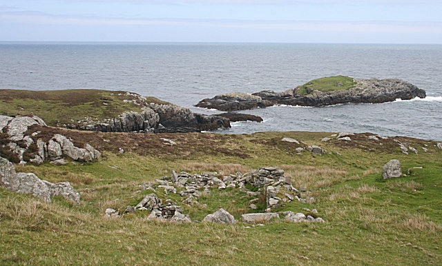
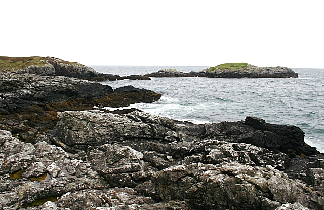
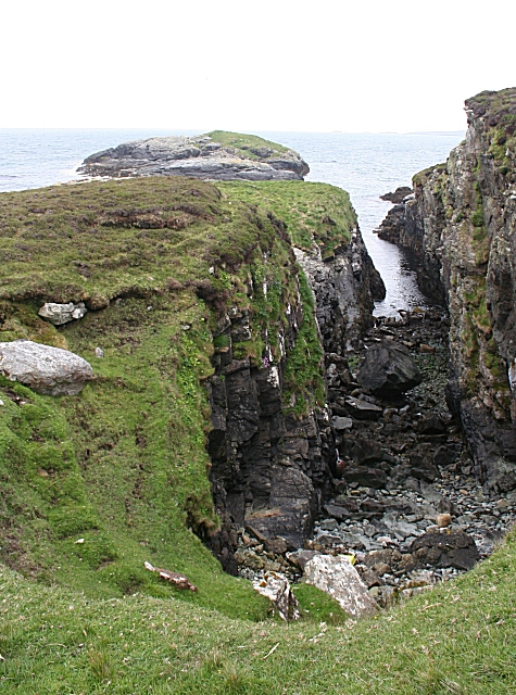
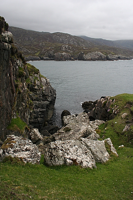
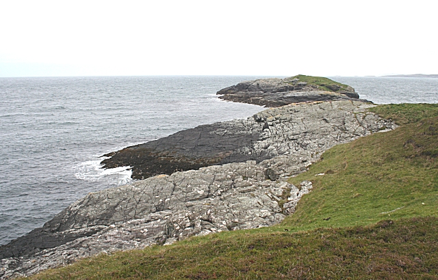
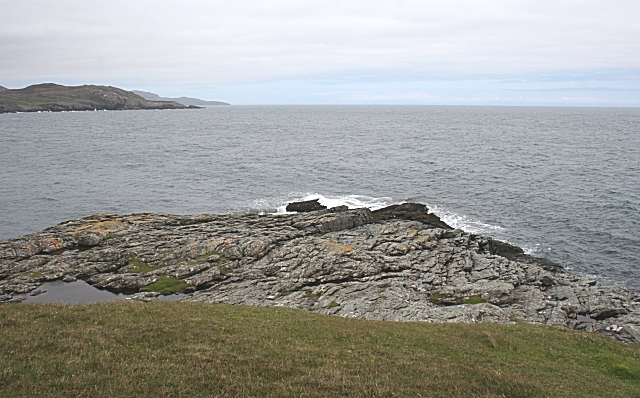
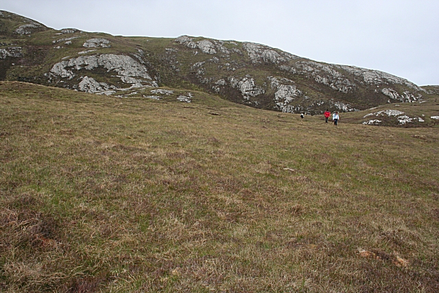
Culagach is a prominent headland located in Inverness-shire, Scotland. Situated along the rugged coastline, Culagach offers stunning views of the surrounding landscape and the nearby sea. The headland is characterized by its steep cliffs, rocky terrain, and grassy slopes, making it a popular destination for hikers and nature enthusiasts.

Culagach is known for its diverse wildlife, including seabirds, seals, and occasionally dolphins and whales. The headland is also home to a variety of plant species, adding to its natural beauty and ecological significance.

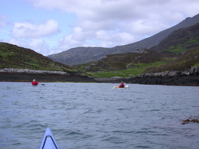
Visitors to Culagach can enjoy scenic walks along the coastal paths, taking in the breathtaking views and observing the diverse flora and fauna. The headland also offers opportunities for birdwatching and photography, with its picturesque vistas and dramatic seascapes.

Overall, Culagach is a must-visit destination for those seeking to experience the natural beauty of the Scottish coastline. Its rugged terrain, diverse wildlife, and stunning views make it a unique and memorable location for outdoor exploration and appreciation of the natural world.

If you have any feedback on the listing, please let us know in the comments section below.

Culagach Images

Images are sourced within 2km of 57.229816/-7.2600326 or Grid Reference NF8227. Thanks to Geograph Open Source API. All images are credited.

Beinn nan Caorach View looking down the south ridge of Beinn nan Caorach, which is a small summit on the southern ridge of Beinn Mhor, and across Loch Aineort.
Beinn nan Caorach
View looking down the south ridge of Beinn nan Caorach, which is a small summit on the southern ridge of Beinn Mhor, and across Loch Aineort.
Meall Mòr Evening light on the north side of Loch Aineort.
Meall Mòr
Evening light on the north side of Loch Aineort.
Evening Rainbow A double rainbow making landfall on the north side of Loch Aineort.
Evening Rainbow
A double rainbow making landfall on the north side of Loch Aineort.
Abhainn Cormasgot South Uist Looking up the Abhainn Cormasgot towards Beinn Mhor
Abhainn Cormasgot South Uist
Looking up the Abhainn Cormasgot towards Beinn Mhor
Geo south of Rubha na Brataich One of a number of geos to navigate on the coast of South Uist heading for Rubha Bholium
Geo south of Rubha na Brataich
One of a number of geos to navigate on the coast of South Uist heading for Rubha Bholium
Sloc Dubh na Thabhann, Loch Eynort South Uist Entering Sloc Dubh na Thabhann, from Loch Eynort South Uist
Sloc Dubh na Thabhann, Loch Eynort South Uist
Entering Sloc Dubh na Thabhann, from Loch Eynort South Uist
Erratic on Beinn na Tobha These hills are all sculpted by ice, and the melting glacier has dropped this boulder as it melted. Loch Aineort in the distance.
Erratic on Beinn na Tobha
These hills are all sculpted by ice, and the melting glacier has dropped this boulder as it melted. Loch Aineort in the distance.
Beinn nan Caorach Beinn nan Caorach is on the right. The summit of Beinn Mhòr is hidden in the clouds.
Beinn nan Caorach
Beinn nan Caorach is on the right. The summit of Beinn Mhòr is hidden in the clouds.
Bealach na Cridhich Looking down from the top of the bealach to the shoreline 200 metres below and a kilometre away.
Bealach na Cridhich
Looking down from the top of the bealach to the shoreline 200 metres below and a kilometre away.
Bealach Bholuim This bealach passes over the northern shoulder of Beinn na Tobha.
Bealach Bholuim
This bealach passes over the northern shoulder of Beinn na Tobha.
Bàgh Bholuim A narrow inlet, possibly a fault, cuts into the south side of Rubha Bholuim.
Bàgh Bholuim
A narrow inlet, possibly a fault, cuts into the south side of Rubha Bholuim.
Ruins at Bolum The remains of walls of the houses which once stood in this inaccessible place. The only ways in are over one of the bealachs, or by sea round an unforgiving and exposed stretch of coast.
Ruins at Bolum
The remains of walls of the houses which once stood in this inaccessible place. The only ways in are over one of the bealachs, or by sea round an unforgiving and exposed stretch of coast.
Rubha Bholuim Rocky foreshore, with Eilean Bholuim in the background.
Rubha Bholuim
Rocky foreshore, with Eilean Bholuim in the background.
Rubha Bholuim Only a short neck of land crosses this cleft, probably a geological fault. It does actually separate Eilean Bholuim from the mainland. The continuation of the fault is in <a href="https://www.geograph.org.uk/photo/1348698">NF8228 : Rubha Bholuim</a>.
Rubha Bholuim
Only a short neck of land crosses this cleft, probably a geological fault. It does actually separate Eilean Bholuim from the mainland. The continuation of the fault is in NF8228 : Rubha Bholuim.
Rubha Bholuim This is the continuation of the fault in <a href="https://www.geograph.org.uk/photo/1348689">NF8228 : Rubha Bholuim</a>, and I was standing on the narrow neck between the inlets on either side.
Rubha Bholuim
This is the continuation of the fault in NF8228 : Rubha Bholuim, and I was standing on the narrow neck between the inlets on either side.
Eilean Bholuim There is very little land in this square, and this is most of it. The island is the farthest point of land in this view, but the channel separating it from the mainland is hidden by the lie of the ice-smoothed rocks.
Eilean Bholuim
There is very little land in this square, and this is most of it. The island is the farthest point of land in this view, but the channel separating it from the mainland is hidden by the lie of the ice-smoothed rocks.
Rubha Bholuim This is the very tip of the headland which is the only land in this square. In the distance is Rubha na Brataich.
Rubha Bholuim
This is the very tip of the headland which is the only land in this square. In the distance is Rubha na Brataich.
On Beinn na Tobha The lower north slopes of Beinn na Tobha.
On Beinn na Tobha
The lower north slopes of Beinn na Tobha.
Show me another place!

Culagach is located at Grid Ref: NF8227 (Lat: 57.229816, Lng: -7.2600326)

Unitary Authority: Na h-Eileanan an Iar

Police Authority: Highlands and Islands

What 3 Words

///iron.joked.rival. Near Lochboisdale, Na h-Eileanan Siar

Nearby Locations

Culagach

Related Wikis

Beinn Mhòr (South Uist)

Beinn Mhòr is a mountain on the island of South Uist in the Outer Hebrides of Scotland. With a height of 620 metres (2,034 ft), it is the highest point...

Stuley

Stuley is an island lying to the east of South Uist in the Outer Hebrides, Scotland. It lies off the section of coastline between Loch Eynort and Loch...

South Uist

South Uist (Scottish Gaelic: Uibhist a Deas, [ˈɯ.ɪʃtʲ ə ˈtʲes̪] ; Scots: Sooth Uist) is the second-largest island of the Outer Hebrides in Scotland. At...

Hecla (South Uist)

Hecla or Thacla is a mountain on the island of South Uist in the Outer Hebrides of Scotland. With a height of 606 metres (1,988 ft), it is the second-highest...

Have you been to Culagach?

Leave your review of Culagach below (or comments, questions and feedback).