Church Grove
Wood, Forest in Suffolk East Suffolk
England
Church Grove

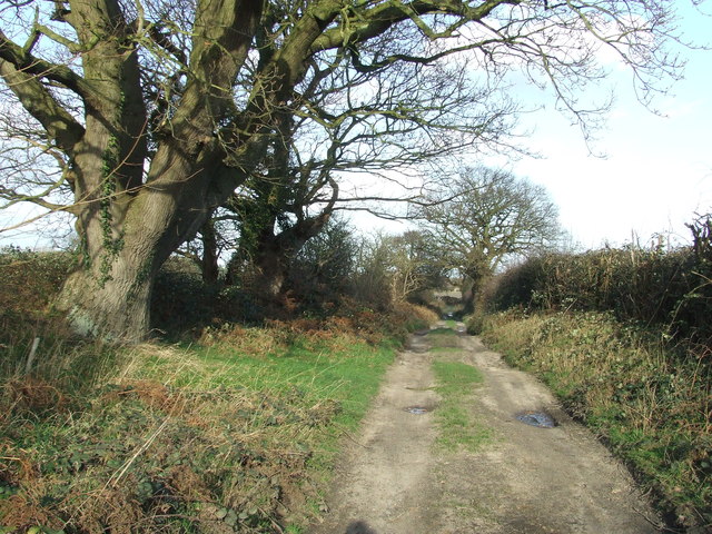
Church Grove is a picturesque woodland located in Suffolk, England. Situated in a rural area surrounded by natural beauty, it is a popular destination for nature lovers and outdoor enthusiasts alike. The grove is characterized by its dense forest cover, with towering trees that create a serene and tranquil atmosphere.
The woodland is named after the nearby Church of St. Mary, a historic place of worship that dates back to the medieval period. The grove is located just a short distance from the church, adding to its charm and providing a peaceful setting for reflection and contemplation.
Church Grove is home to a diverse range of flora and fauna, making it a haven for wildlife enthusiasts. Visitors can expect to encounter various species of birds, such as owls, woodpeckers, and songbirds, as well as small mammals like squirrels and deer. The forest floor is covered in a lush carpet of moss and ferns, adding to the enchanting ambiance.
The grove offers several walking trails and paths for visitors to explore, allowing them to immerse themselves in the natural beauty of the area. These trails wind through the forest, leading to hidden glades and tranquil ponds, providing ample opportunities for photography and nature observation.
In summary, Church Grove in Suffolk is a captivating woodland that offers a peaceful retreat from the bustling world. With its ancient trees, diverse wildlife, and scenic trails, it is a place where visitors can reconnect with nature and experience the serenity of the Suffolk countryside.
If you have any feedback on the listing, please let us know in the comments section below.
Church Grove Images
Images are sourced within 2km of 52.516851/1.6701933 or Grid Reference TM4997. Thanks to Geograph Open Source API. All images are credited.


Church Grove is located at Grid Ref: TM4997 (Lat: 52.516851, Lng: 1.6701933)
Administrative County: Suffolk
District: East Suffolk
Police Authority: Suffolk
What 3 Words
///automate.seriously.rests. Near Hopton on Sea, Norfolk
Nearby Locations
Related Wikis
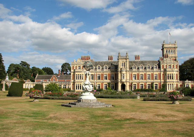
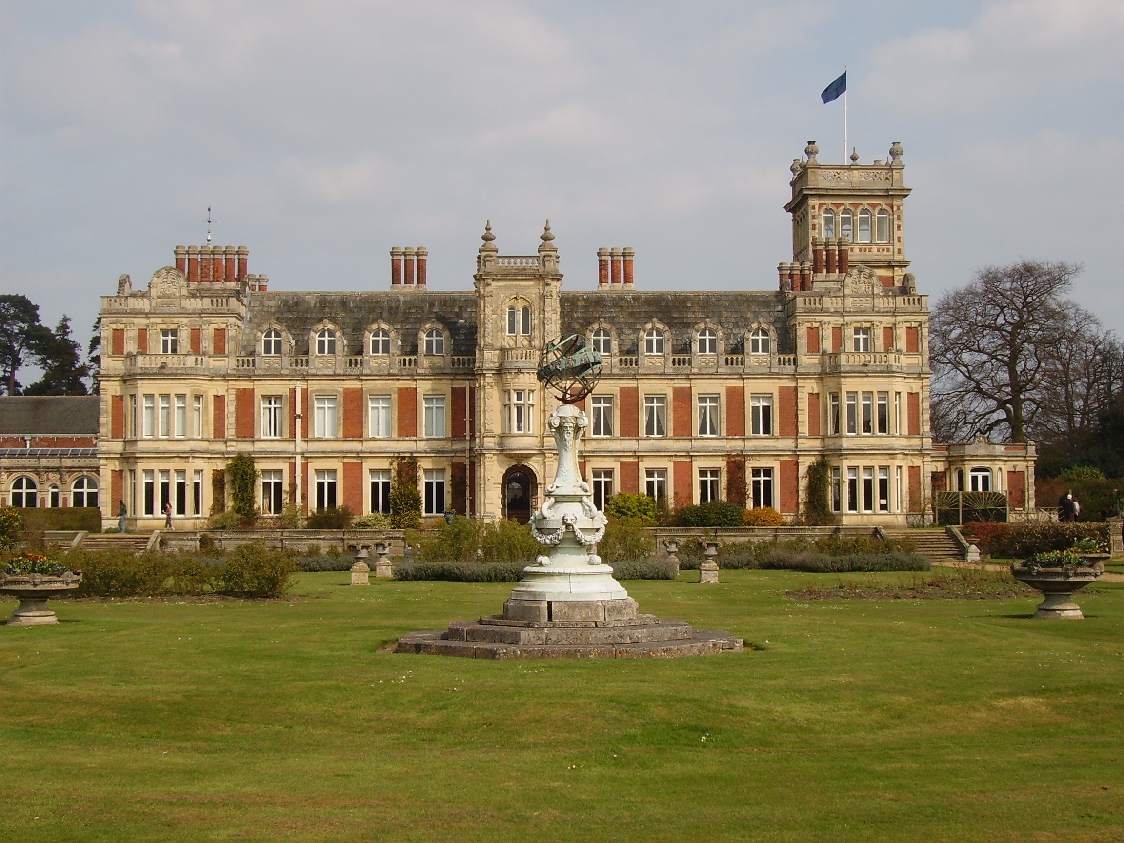
Somerleyton Hall
Somerleyton Hall is a country house and 5,000-acre (2,000 ha) estate near Somerleyton and Lowestoft in Suffolk, England owned and lived in by Hugh Crossley...
Somerleyton
Somerleyton is a village and former civil parish, now in the parish of Somerleyton, Ashby and Herringfleet, in the East Suffolk district, in the north...

Somerleyton, Ashby and Herringfleet
Somerleyton, Ashby and Herringfleet is a civil parish in the north of the English county of Suffolk. It is 5 miles (8.0 km) north-west of Lowestoft and...

Somerleyton railway station
Somerleyton railway station is on the Wherry Lines in the east of England, serving the village of Somerleyton, Suffolk. It is 18 miles (29 km) down the...
Nearby Amenities
Located within 500m of 52.516851,1.6701933Have you been to Church Grove?
Leave your review of Church Grove below (or comments, questions and feedback).