Auchtubh

Settlement in Perthshire

Scotland

Auchtubh

Old fingerpost On the old A84, now unclassified, at Kingshouse is this well photographed fingerpost. At one time it had a third finger pointing south and an A84 plate attached to the top of the north pointing finger.  In 2015 it was newly painted but now needs some refurbishment.  It is a shame that house builders are allowed to fasten their signs onto these almost 100 year old posts.  The Kingshouse Hotel on the opposite side of the road is now the Mhor 84 Motel.

Milestone Society National ID: STL_NN5620
Old fingerpost Credit: Chris Minto

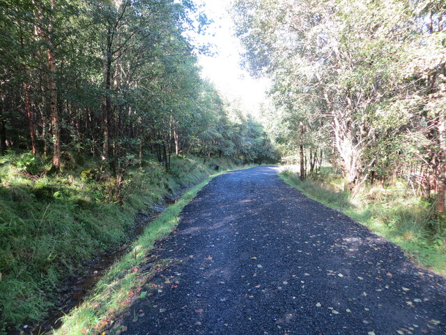
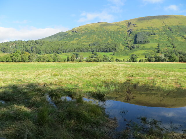
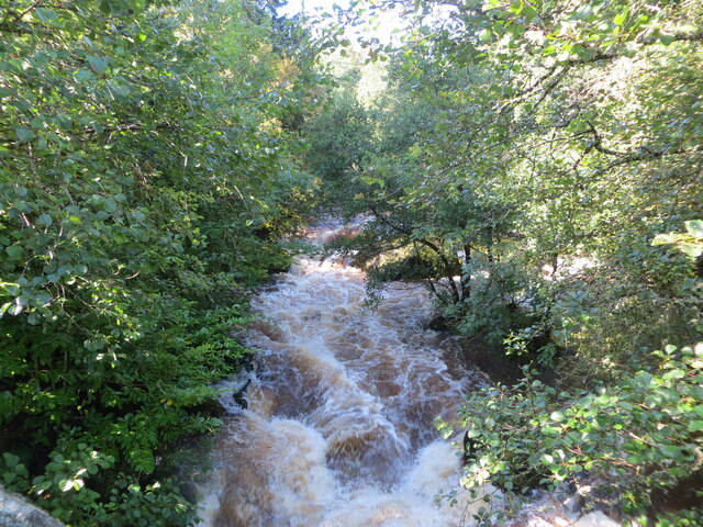
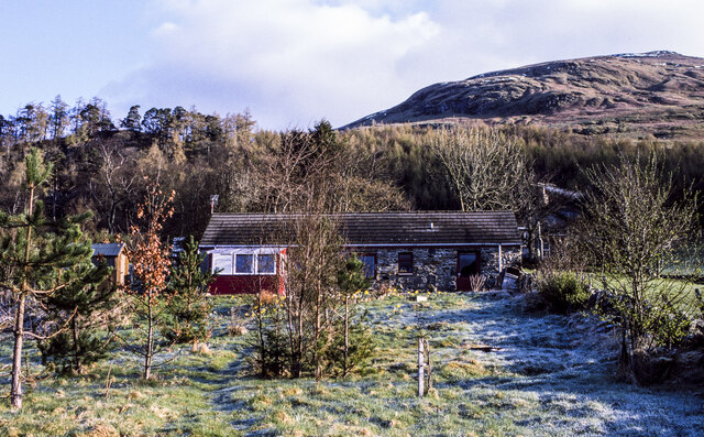
Auchtubh is a small village located in Perthshire, Scotland. Situated in the heart of the picturesque Scottish Highlands, it is surrounded by stunning natural beauty. The village is nestled amidst rolling hills, lush green forests, and the tranquil River Tay, offering a peaceful and idyllic setting for residents and visitors alike.

Auchtubh is known for its rural charm and traditional Scottish architecture. The village consists of a collection of quaint stone cottages and houses, giving it a timeless and characterful feel. The local community is tight-knit and friendly, making it a welcoming place for newcomers.

The village boasts a range of amenities to cater to its residents' needs. There is a local primary school, providing education for the younger members of the community. A few small shops and a post office serve as convenient resources for daily essentials. Additionally, there are several charming local pubs and cafes, offering a warm atmosphere and a taste of traditional Scottish cuisine.

For outdoor enthusiasts, Auchtubh is a paradise. The surrounding area offers numerous opportunities for hiking, cycling, and fishing. The nearby Loch Tay and Loch Tummel are popular spots for water sports enthusiasts, with sailing and kayaking being particularly popular. Wildlife enthusiasts can also enjoy the diverse flora and fauna present in the area, with deer, red squirrels, and various bird species being commonly spotted.

Overall, Auchtubh is a picturesque village that offers a tranquil and scenic escape from the hustle and bustle of city life. With its stunning natural surroundings and welcoming community, it is an ideal place to experience the beauty of Scotland's countryside.

If you have any feedback on the listing, please let us know in the comments section below.
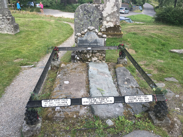
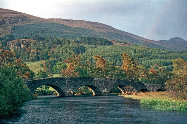
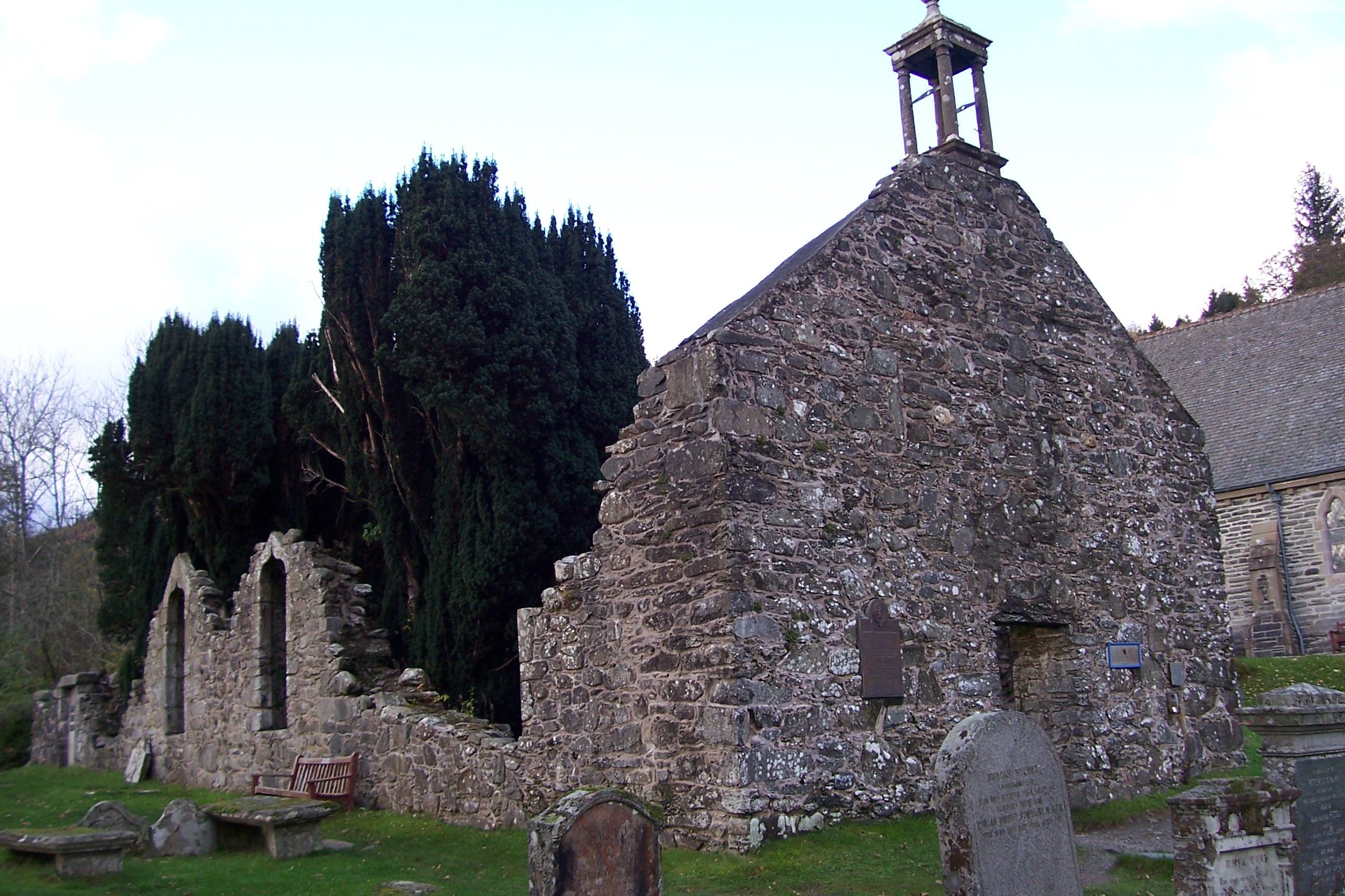
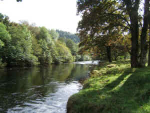
Auchtubh Images

Images are sourced within 2km of 56.356496/-4.340867 or Grid Reference NN5520. Thanks to Geograph Open Source API. All images are credited.

Old fingerpost On the old A84, now unclassified, at Kingshouse is this well photographed fingerpost. At one time it had a third finger pointing south and an A84 plate attached to the top of the north pointing finger.  In 2015 it was newly painted but now needs some refurbishment.  It is a shame that house builders are allowed to fasten their signs onto these almost 100 year old posts.  The Kingshouse Hotel on the opposite side of the road is now the Mhor 84 Motel.

Milestone Society National ID: STL_NN5620
Old fingerpost
On the old A84, now unclassified, at Kingshouse is this well photographed fingerpost. At one time it had a third finger pointing south and an A84 plate attached to the top of the north pointing finger. In 2015 it was newly painted but now needs some refurbishment. It is a shame that house builders are allowed to fasten their signs onto these almost 100 year old posts. The Kingshouse Hotel on the opposite side of the road is now the Mhor 84 Motel. Milestone Society National ID: STL_NN5620
Old milestone For many years a red telephone box stood behind this wall with its mileage plate.   It is on the old A84 now by-passed at Kingshouse.  A rare plate with a 'nought' mileage.   Inverlochlarig is at the end of the road, the site of Rob Roy's House.   It is west of Balquhidder where Rob Roy is buried, Loch Voil and Loch Doine.
Old milestone
For many years a red telephone box stood behind this wall with its mileage plate. It is on the old A84 now by-passed at Kingshouse. A rare plate with a 'nought' mileage. Inverlochlarig is at the end of the road, the site of Rob Roy's House. It is west of Balquhidder where Rob Roy is buried, Loch Voil and Loch Doine.
Lay-by on the A84 near Kinghouse
A84 near Balquhidder Station
Woodland track at Coille na Sròine Looking north-westward
Woodland track at Coille na Sròine
Looking north-westward
Pastureland that also acts as a flood plain for the River Balvag Looking northward in the direction of Auchleskine.
Pastureland that also acts as a flood plain for the River Balvag
Looking northward in the direction of Auchleskine.
Calair Burn near Gartnafuaran Looking south-westward from Calair Bridge.
Calair Burn near Gartnafuaran
Looking south-westward from Calair Bridge.
Recreational Trail beside the A84 at Kingshouse Looking north-eaastward. This is used by the Rob Roy Way path.
Recreational Trail beside the A84 at Kingshouse
Looking north-eaastward. This is used by the Rob Roy Way path.
Road (A84) at the Golden Larches Coffee Shop Looking north-eastward, The area on the right was the entrance to the former Balquhidder Railway Station.
Road (A84) at the Golden Larches Coffee Shop
Looking north-eastward, The area on the right was the entrance to the former Balquhidder Railway Station.
Ordnance Survey Flush Bracket 11991 This bracket can be found on the roadside wall of the former entrance to Balquhidder Railway Station.
The recorded details give a height of 150.373 metres above sea level.
For more detail see : <span class="nowrap"><a title="https://www.bench-marks.org.uk/bm11270" rel="nofollow ugc noopener" href="https://www.bench-marks.org.uk/bm11270">Link</a><img style="margin-left:2px;" alt="External link" title="External link - shift click to open in new window" src="https://s1.geograph.org.uk/img/external.png" width="10" height="10"/></span>
Ordnance Survey Flush Bracket 11991
This bracket can be found on the roadside wall of the former entrance to Balquhidder Railway Station. The recorded details give a height of 150.373 metres above sea level. For more detail see : LinkExternal link
Tigh na Puidrac in 1995 In 1995 Tigh na Puidrac was in use as a holiday let associated with the house at Broomfield in Balquhidder - perhaps it still is. It had been in an almost derelict state before restoration, c. 1980.
The eastern end of Creag Mhòr rises to the right.
Tigh na Puidrac in 1995
In 1995 Tigh na Puidrac was in use as a holiday let associated with the house at Broomfield in Balquhidder - perhaps it still is. It had been in an almost derelict state before restoration, c. 1980. The eastern end of Creag Mhòr rises to the right.
Rob Roy's Grave The resting place of the MacGregors
Rob Roy's Grave
The resting place of the MacGregors
Stronvar Bridge, Balquhidder The crossing of River Balvag at Balquhidder
Stronvar Bridge, Balquhidder
The crossing of River Balvag at Balquhidder
Recently felled hillside near Stronslaney, Strathyre Looking north-westward.
Recently felled hillside near Stronslaney, Strathyre
Looking north-westward.
A84 in Strathyre
A84 in Strathyre
Forested hillside, Strathyre Forest Looking down towards the A84.
Forested hillside, Strathyre Forest
Looking down towards the A84.
Track at Beananach in Strathyre
The Balvag floodplain north of Strathyre Rough unimproved pasture viewed from beside the Callander to Killin cycleway.

This photograph was taken during the Coronavirus (COVID-19) pandemic of 2020/21.
The Balvag floodplain north of Strathyre
Rough unimproved pasture viewed from beside the Callander to Killin cycleway. This photograph was taken during the Coronavirus (COVID-19) pandemic of 2020/21.
Show me another place!

Auchtubh is located at Grid Ref: NN5520 (Lat: 56.356496, Lng: -4.340867)

Unitary Authority: Stirling

Police Authority: Forth Valley

What 3 Words

///absent.flip.masters. Near Callander, Stirling

Nearby Locations

Auchtubh

Related Wikis

Auchtubh

Auchtubh is a hamlet in the Stirling council area of Scotland, less than 1 mile (2 kilometres) to the east of the village of Balquhidder. Auchtubh consisted...

Kingshouse railway station

Kingshouse was a railway station located at the hamlet of Kingshouse, Stirling where the road from Balquhidder joins the A84. The only building of note...

Balquhidder railway station

Balquhidder was a railway station around two miles south of Lochearnhead, Stirling (district). It was where the Callander and Oban Railway was joined by...

Balquhidder

Balquhidder ( ; Scottish Gaelic: Both Chuidir [ˌpɔˈxutʲɪɾʲ] or Both Phuidir [ˌpɔˈfutʲɪɾʲ]) is a small village in Perthshire located 10 miles (16 km) north...

River Balvaig

The River Balvaig (Scottish Gaelic: "Abhainn Balbhaig") is a short river, approximately 8 km (5.0 mi) long, draining from the head of Loch Voil near Balquhidder...

Meall an t-Seallaidh

Meall an t-Seallaidh (852 m) is a mountain in the Southern Highlands of Scotland. It is located in the Loch Lomond and The Trossachs National Park, west...

Strathyre

Strathyre (; from Scottish Gaelic: Srath Eadhair) is a district and settlement in the Stirling local government district of Scotland. It forms the south...

Strathyre railway station

Strathyre was a railway station located at the head of Loch Lubnaig, Stirling, in Strathyre. == History == This station opened on 1 June 1870 along with...

Nearby Amenities

Located within 500m of 56.356496,-4.340867
Post Box
Postal Code: FK19
Ref: FK19 194
Lat/Long: 56.3560954/-4.3377639
Communication Radio: no
Man Made: mast
Note: signage (July 2020) says this is a temporary mast for forestry work
Tower Type: communication
Lat/Long: 56.3597765/-4.3443149
Power: pole
Lat/Long: 56.3571339/-4.3338805
Power: pole
Lat/Long: 56.357094/-4.3350351
Power: pole
Lat/Long: 56.3570454/-4.3364967
Power: pole
Lat/Long: 56.3570002/-4.3376951
Power: pole
Lat/Long: 56.3569811/-4.3383859
Power: pole
Lat/Long: 56.3569386/-4.3395499
Power: pole
Lat/Long: 56.3568961/-4.3408079
Power: pole
Lat/Long: 56.3568484/-4.3421583
Power: pole
Lat/Long: 56.3568119/-4.3432768
Power: pole
Lat/Long: 56.3567711/-4.3445222
Power: pole
Lat/Long: 56.3566149/-4.344787
Power: pole
Lat/Long: 56.3560108/-4.3372987
Power: pole
Lat/Long: 56.3561063/-4.3367974
Power: pole
Lat/Long: 56.3562156/-4.3362068
Power: pole
Lat/Long: 56.3563823/-4.3356758
Power: pole
Lat/Long: 56.3565819/-4.3349552
Power: pole
Lat/Long: 56.3563502/-4.3482052
Power: pole
Lat/Long: 56.356266/-4.3467702
Power: pole
Lat/Long: 56.3566409/-4.3463739
Power: pole
Lat/Long: 56.3566175/-4.345658
The data included in this document is from www.openstreetmap.org. The data is made available under ODbL.

Have you been to Auchtubh?

Leave your review of Auchtubh below (or comments, questions and feedback).