The Grove

Wood, Forest in Suffolk East Suffolk

England

The Grove

Sizewell Beach Just north of the power station, looking towards Minsmere.
Sizewell Beach Credit: Roger Jones

The Grove, Suffolk, is a picturesque wood located in the county of Suffolk, England. Stretching across a vast expanse of land, this forested area is nestled within the charming countryside of East Anglia.

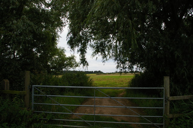
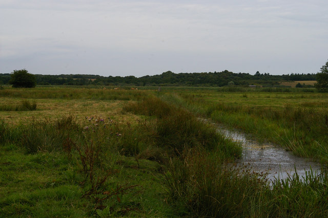
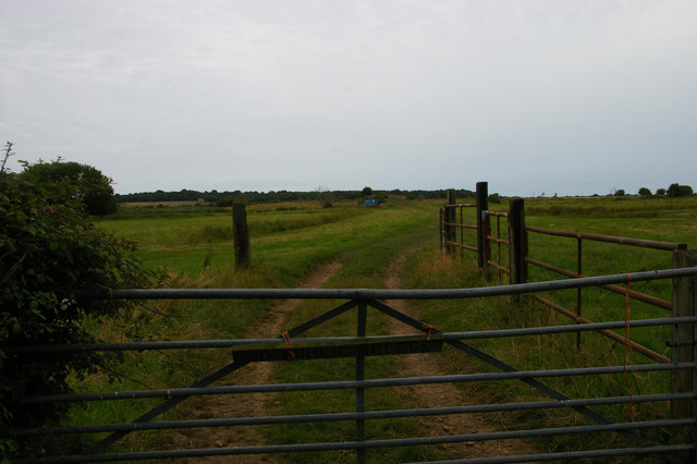
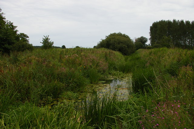
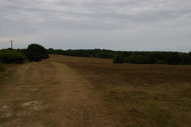
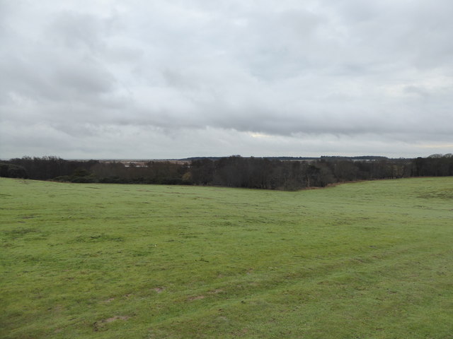
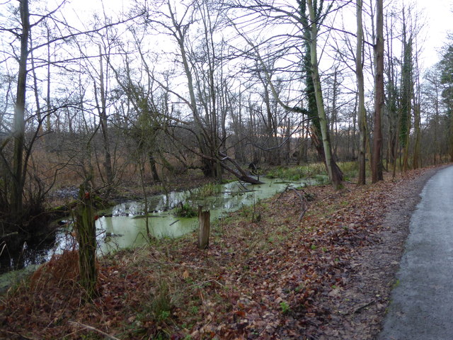
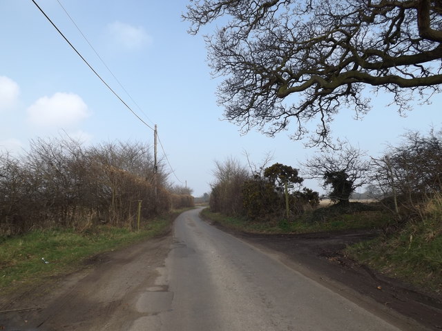
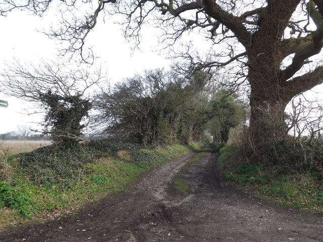
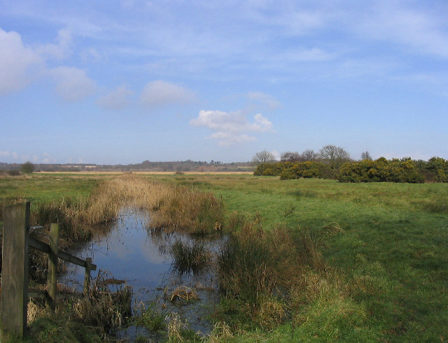
The Grove is renowned for its natural beauty and tranquil ambiance. It boasts a diverse range of tree species, including oak, beech, and birch, which form a dense canopy overhead. The forest floor is carpeted with a plethora of wildflowers and moss, creating a vibrant and enchanting atmosphere. Walking trails wind their way through the woodland, offering visitors the opportunity to explore this idyllic retreat.

The Grove is not only a haven for nature lovers, but also for wildlife enthusiasts. The forest is home to a variety of animal species, such as deer, foxes, badgers, and an array of birdlife. It provides a vital habitat for these creatures, ensuring their preservation and creating a rich ecosystem.

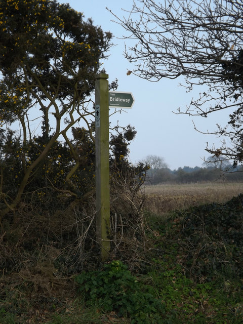
Throughout the year, The Grove offers a range of recreational activities for visitors. Hiking and walking are popular choices, with trails catering to different abilities. The forest also provides an excellent setting for photography, with its stunning vistas and captivating flora and fauna.

The Grove, Suffolk, is not only a natural sanctuary but also a place of historical significance. The forest has witnessed centuries of human activity and is believed to have played a role in local folklore and legends.

In conclusion, The Grove, Suffolk, is a captivating woodland retreat that combines natural beauty, wildlife, and historical significance. It offers a serene escape from the hustle and bustle of everyday life, inviting visitors to immerse themselves in its enchanting surroundings.

If you have any feedback on the listing, please let us know in the comments section below.

The Grove Images

Images are sourced within 2km of 52.232765/1.607062 or Grid Reference TM4665. Thanks to Geograph Open Source API. All images are credited.

Sizewell Beach Just north of the power station, looking towards Minsmere.
Sizewell Beach
Just north of the power station, looking towards Minsmere.
Minsmere Sluice The breakwater marks the site of the sluice draining the Minsmere marshes.  Beyond it can be seen the nuclear power stations at Sizewell.
Minsmere Sluice
The breakwater marks the site of the sluice draining the Minsmere marshes. Beyond it can be seen the nuclear power stations at Sizewell.
The outfall, Minsmere Sluice Under the concrete, water drains into the sea from the marshes inland at this point.  The sluice and shingle bank keep the marshland from becoming salt or being reclaimed by the sea; originally, before the shingle bank blocked its mouth, the whole Minsmere nature reserve would have been an estuary open to the sea.
Note how much higher the shingle is on the right of the concrete outfall, and how brown the sea is for some way out: an indication of the amount of sediment constantly moving north along this coast by longshore drift.
The outfall, Minsmere Sluice
Under the concrete, water drains into the sea from the marshes inland at this point. The sluice and shingle bank keep the marshland from becoming salt or being reclaimed by the sea; originally, before the shingle bank blocked its mouth, the whole Minsmere nature reserve would have been an estuary open to the sea. Note how much higher the shingle is on the right of the concrete outfall, and how brown the sea is for some way out: an indication of the amount of sediment constantly moving north along this coast by longshore drift.
Eastbridge chapel from the west This medieval chapel is all that remains of a Premonstratensian foundation set up in 1182 by Ranulf de Glanville, Chief Justiciar to Henry II.  The swampy site proved prone to flooding and in the second half of the fourteenth century the canons relocated inland to Leiston (see <a href="https://www.geograph.org.uk/photo/3236763">TM4464 : Leiston Abbey ruins</a>), dismantling the abbey church and taking most of the materials with them.  This chapel remained, functioning among other things as a sea-mark.  In the Second World War it was used as camouflage for an Army pill-box, which can be seen set within the walls at the far end: one of the many defensive structures to be set up along Britain's vulnerable east coast.
Eastbridge chapel from the west
This medieval chapel is all that remains of a Premonstratensian foundation set up in 1182 by Ranulf de Glanville, Chief Justiciar to Henry II. The swampy site proved prone to flooding and in the second half of the fourteenth century the canons relocated inland to Leiston (see TM4464 : Leiston Abbey ruins), dismantling the abbey church and taking most of the materials with them. This chapel remained, functioning among other things as a sea-mark. In the Second World War it was used as camouflage for an Army pill-box, which can be seen set within the walls at the far end: one of the many defensive structures to be set up along Britain's vulnerable east coast.
Eastbridge chapel from the north-west This medieval chapel is all that remains of a Premonstratensian foundation set up in 1182 by Ranulf de Glanville, Chief Justiciar to Henry II.  The swampy site proved prone to flooding and in the second half of the fourteenth century the canons relocated inland to Leiston (see <a href="https://www.geograph.org.uk/photo/3236763">TM4464 : Leiston Abbey ruins</a>), dismantling the abbey church and taking most of the materials with them.  This chapel remained, functioning among other things as a sea-mark.  In the Second World War it was used as camouflage for an Army pill-box, which can be seen set within the walls: one of the many defensive structures to be set up along Britain's vulnerable east coast.
Eastbridge chapel from the north-west
This medieval chapel is all that remains of a Premonstratensian foundation set up in 1182 by Ranulf de Glanville, Chief Justiciar to Henry II. The swampy site proved prone to flooding and in the second half of the fourteenth century the canons relocated inland to Leiston (see TM4464 : Leiston Abbey ruins), dismantling the abbey church and taking most of the materials with them. This chapel remained, functioning among other things as a sea-mark. In the Second World War it was used as camouflage for an Army pill-box, which can be seen set within the walls: one of the many defensive structures to be set up along Britain's vulnerable east coast.
Gateway past Sandypytle Plantation
Minsmere Level
Minsmere Level
Minsmere Level: track towards Twopenny Arch The red brick of the bridge, Twopenny Arch, can just be made out in the distance.
Minsmere Level: track towards Twopenny Arch
The red brick of the bridge, Twopenny Arch, can just be made out in the distance.
Wheatfield south of Eastbridge
Minsmere New Cut from Dam Bridge
View towards Vault Hill and Scott's Hall Farm, on Westleton Walks Vault Hill and Scott's Hall Farm lie in <a href="https://www.geograph.org.uk/gridref/TM4667">TM4667</a>.
View towards Vault Hill and Scott's Hall Farm, on Westleton Walks
Vault Hill and Scott's Hall Farm lie in TM4667.
Scott's Hall from Sheepwash Lane
View across the Minsmere Nature Reserve towards Sizewell
Boggy area beside the road On the road up to Scott's Hall and Minsmere Nature Reserve
Boggy area beside the road
On the road up to Scott's Hall and Minsmere Nature Reserve
Trigpoint Pillar OSBM  S6216 Goose Hill Pillar type trig station, bracket number S6216. Third order station.
Trigpoint Pillar OSBM S6216 Goose Hill
Pillar type trig station, bracket number S6216. Third order station.
Eastbridge Lane & Bridleway Near The Round House
Eastbridge Lane & Bridleway
Near The Round House
Bridleway sign on Eastbridge Lane At the entrance to The Round House
Bridleway sign on Eastbridge Lane
At the entrance to The Round House
Bridleway to Lovers Lane & entrance to The Round House Off Eastbridge Lane
Bridleway to Lovers Lane & entrance to The Round House
Off Eastbridge Lane
Show me another place!

The Grove is located at Grid Ref: TM4665 (Lat: 52.232765, Lng: 1.607062)

Administrative County: Suffolk

District: East Suffolk

Police Authority: Suffolk

What 3 Words

///subject.paddocks.onto. Near Leiston, Suffolk

Related Wikis

Eastbridge

Eastbridge is a village in the English county of Suffolk. It is located approximately 4 miles (6.4 km) north of Leiston, 2 miles (3.2 km) from the North...

RSPB Minsmere

RSPB Minsmere is a nature reserve owned and managed by the Royal Society for the Protection of Birds (RSPB) at Minsmere, Suffolk. The 1,000-hectare (2...

Sizewell Belts

Sizewell Marshes form a 260-acre (105.4 ha) biological Site of Special Scientific Interest adjacent to Sizewell in Suffolk. It is in the Suffolk Coast...

Minsmere River

Minsmere River is a river in the English county of Suffolk which flows into the North Sea at Minsmere. The river is formed from the River Yox at Yoxford...

Minsmere

Minsmere is a place in the English county of Suffolk. It is located on the North Sea coast around 3.5 miles (5.6 km) north of Leiston and 1.5 miles (2...

Sizewell C nuclear power station

Sizewell C nuclear power station is a project to construct a 3,200 MWe nuclear power station with two EPR reactors in Suffolk, England. The project was...

Leiston Abbey

Leiston Abbey outside the town of Leiston, Suffolk, England, was a religious house of Canons Regular following the Premonstratensian rule (White canons...

Suffolk Coast and Heaths

The Suffolk Coast and Heaths AONB is an Area of Outstanding Natural Beauty in Suffolk and Essex, England. The AONB covers ancient woodland, commercial...

Related Videos

WALKING at DUNWICH HEATH and MINSMERE Suffolk | Spring 2022 | Vlog 486

We left Mill Hill Farm Caravan Park in Darsham Suffolk and headed towards Dunwich. We parked Smirf in the National Trust ...

A Common Lizard at Minsmere - spot the ladybird

A very tame basking Common or Viviparous Lizard at RSPB Minsmere. After filming, I noticed a small 22-spot Ladybird ...

Exploring Leiston Abbey ruins

A visit to Leiston Abbey ruins, exploring them and finding out more about the history and the current residents of the farmhouse ...

Spring at last! A glimpse of ReVamp ReTreat Staycation near Minsmere, Suffolk in the spring.

We wanted to share the beautiful surroundings at our lodge, so here is a short video taken in the spring. Just a short walk away ...

Have you been to The Grove?

Leave your review of The Grove below (or comments, questions and feedback).