Westhill Covert
Wood, Forest in Suffolk East Suffolk
England
Westhill Covert
Westhill Covert is a picturesque woodland located in Suffolk, England. Nestled within the charming countryside, this enchanting forest covers an area of approximately 50 hectares and offers visitors a tranquil escape from the bustling city life.
The woodland is characterized by a diverse range of trees, including oak, beech, and birch, which form a dense canopy overhead, providing a cool and shaded environment. The forest floor is covered with a thick carpet of moss, ferns, and wildflowers, creating a vibrant and colorful landscape.
The Covert boasts an extensive network of well-maintained walking trails, allowing visitors to explore the woodland at their leisure. These paths wind through the forest, offering breathtaking views of the surrounding countryside and providing an opportunity to observe the local wildlife in their natural habitat. Birdwatchers, in particular, will be delighted by the abundance of species that call Westhill Covert home, including woodpeckers, jays, and various songbirds.
For those seeking a more immersive experience, the woodland also offers designated camping areas, where visitors can spend the night under the stars, surrounded by the peaceful sounds of nature. Additionally, there are picnic spots scattered throughout the forest, providing a perfect setting for a leisurely outdoor lunch.
Westhill Covert is a haven for nature enthusiasts, offering a serene and idyllic retreat from the pressures of everyday life. Whether you're a keen hiker, a birdwatcher, or simply seeking solace in nature, this enchanting woodland is sure to captivate and inspire all who venture into its depths.
If you have any feedback on the listing, please let us know in the comments section below.
Westhill Covert Images
Images are sourced within 2km of 52.456498/1.5914151 or Grid Reference TM4490. Thanks to Geograph Open Source API. All images are credited.


Westhill Covert is located at Grid Ref: TM4490 (Lat: 52.456498, Lng: 1.5914151)
Administrative County: Suffolk
District: East Suffolk
Police Authority: Suffolk
What 3 Words
///clan.disarmed.cupboards. Near Beccles, Suffolk
Nearby Locations
Related Wikis

Worlingham Hall
Worlingham Hall is a Grade I listed Georgian country house in Worlingham, 1 mile (1.6 km) to the east of Beccles in the English county of Suffolk. The...

Worlingham
Worlingham is a village and civil parish in the East Suffolk district of the English county of Suffolk. It is about 1.3 miles (2.1 km) east of Beccles...

Beccles Town F.C.
Beccles Town Football Club is an English football club based in Beccles, Suffolk. They are nicknamed 'The Wherrymen', because Beccles was once a busy trading...
SET Beccles School
SET Beccles School (formerly Beccles Free School) is a coeducational secondary free school located in Beccles in the English county of Suffolk. == History... ==
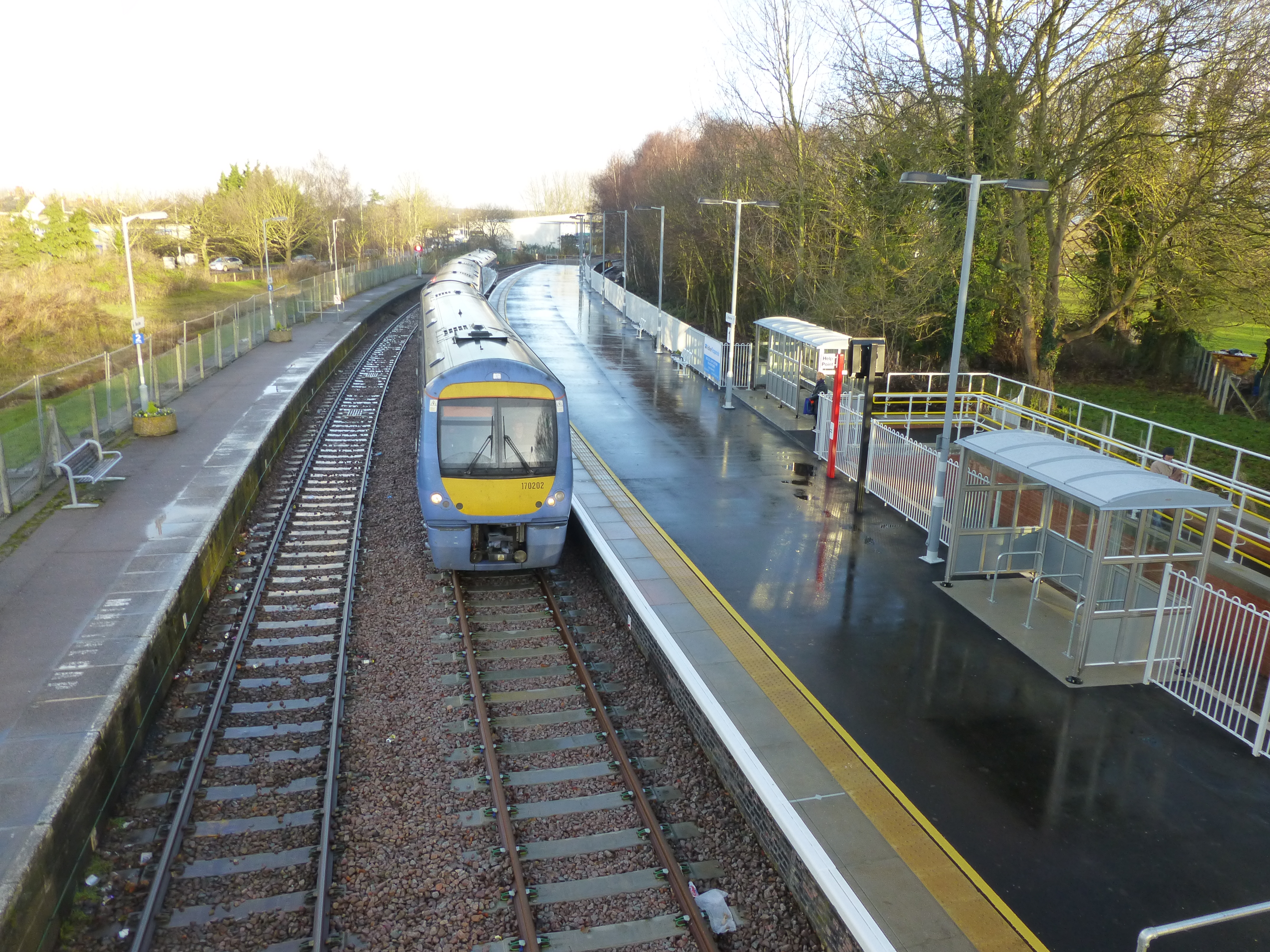
Beccles railway station
Beccles railway station is on the East Suffolk Line in the east of England, serving the town of Beccles, Suffolk. It is 40 miles 34 chains (65.1 km) down...
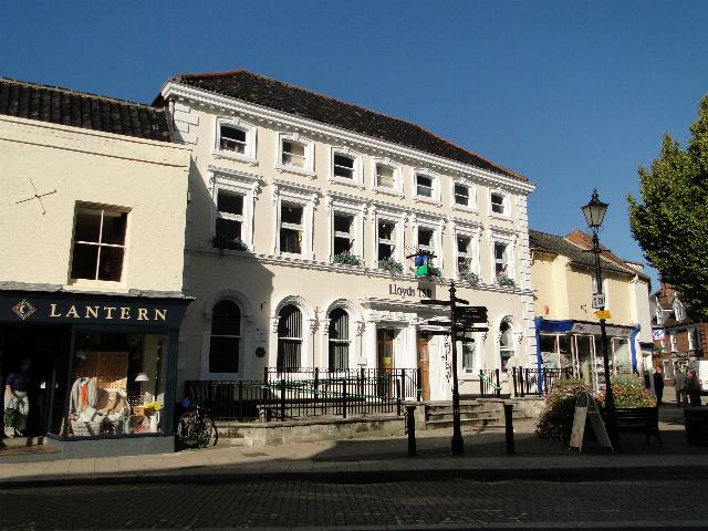
Corn Exchange, Beccles
The Corn Exchange is a commercial building in Exchange Square in Beccles, Suffolk, England. The structure, which is now used as a branch of Lloyds Bank...

Beccles
Beccles ( BEK-əlz) is a market town and civil parish in the English county of Suffolk. The town is shown on the milestone as 109 miles (175 km) from London...
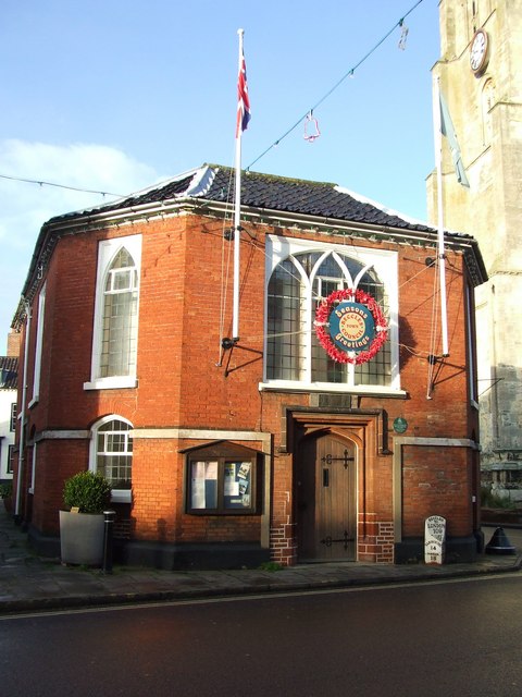
Beccles Town Hall
Beccles Town Hall is a municipal structure in New Market, Beccles, Suffolk, England. The structure, which accommodates the offices and meeting place of...
Related Videos
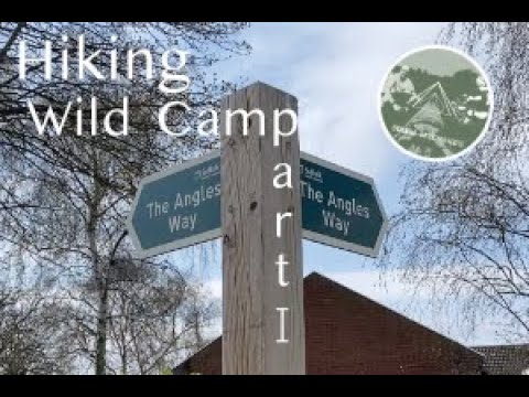
The Angles Way Footpath (First Leg) Great Yarmouth to Oulton Broad | Hiking Wild Camp
First Leg of a series of videos covering The Angles Way Footpath, in this leg we cover Great Yarmouth to Oulton Broad and spend ...

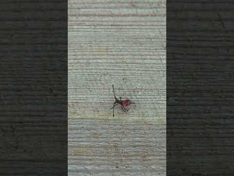
A bizarre looking Dock Bug nymph
I am pretty sure that this is a first instar nymph of the Dock Bug (Coreus marginatus) Please comment if you can confirm or refute ...
Nearby Amenities
Located within 500m of 52.456498,1.5914151Have you been to Westhill Covert?
Leave your review of Westhill Covert below (or comments, questions and feedback).