Church Carr

Wood, Forest in Suffolk East Suffolk

England

Church Carr

Suffolk Coast Path at Iken Cliff
Suffolk Coast Path at Iken Cliff Credit: Christopher Hilton

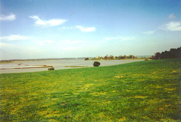
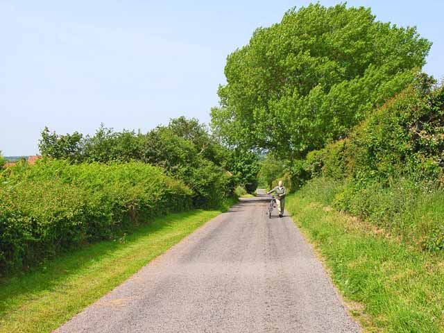
Church Carr is a small woodland area located in the county of Suffolk, England. Situated near the village of Woodbridge, this forested region covers an approximate area of 200 acres. The woodland is known for its serene and peaceful atmosphere, attracting visitors who seek a nature retreat away from the bustling city life.

Church Carr is characterized by its diverse range of tree species, including oak, beech, and birch. These trees create a dense canopy that provides shade and shelter for various wildlife inhabitants. The forest floor is adorned with a carpet of wildflowers, adding to its natural beauty.

The woodland is intersected by several walking trails, enabling visitors to explore its hidden gems. These paths meander through the trees, offering glimpses of the local flora and fauna. Birdwatchers will be delighted to spot various avian species, such as woodpeckers, owls, and warblers, which call Church Carr their home.

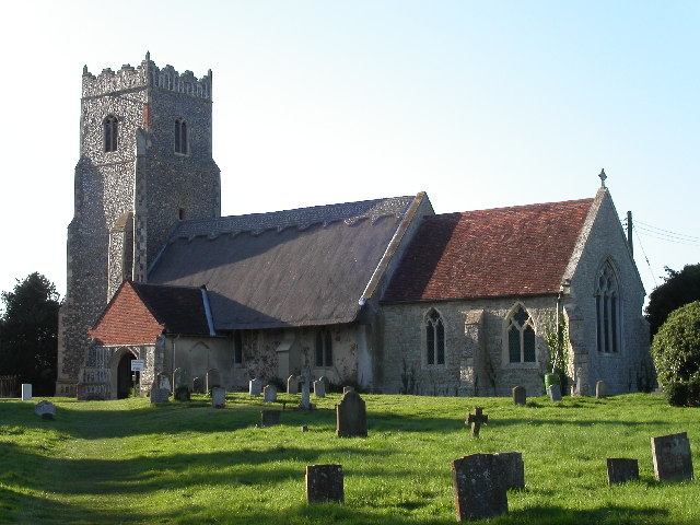
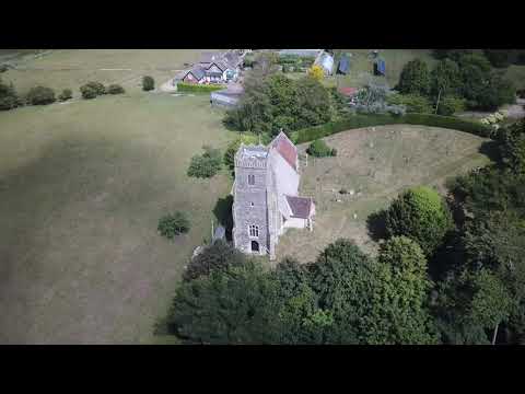
In addition to its natural appeal, Church Carr holds historical significance. The remains of an ancient church can be found within its boundaries, dating back to the medieval period. These ruins provide a glimpse into the region's past and offer a sense of intrigue to visitors.

Church Carr is managed by a local conservation organization, ensuring its preservation and protection for future generations. The woodland serves as an important habitat for wildlife and contributes to the overall biodiversity of the area.

Overall, Church Carr, Suffolk is a picturesque woodland retreat that offers a tranquil escape for nature enthusiasts, history buffs, and those seeking solace in the beauty of the natural world.

If you have any feedback on the listing, please let us know in the comments section below.

Church Carr Images

Images are sourced within 2km of 52.152898/1.5286948 or Grid Reference TM4156. Thanks to Geograph Open Source API. All images are credited.

Suffolk Coast Path at Iken Cliff
On the Suffolk Coast Path
Junction on Tunstall Road west of Iken The track to the left leads to a picnic site and car park by The River Alde.
Junction on Tunstall Road west of Iken
The track to the left leads to a picnic site and car park by The River Alde.
Looking towards Snape Taken on film in 1998.

We are on the Suffolk Coast Path, though the view is approximate after so many years.
Looking towards Snape
Taken on film in 1998. We are on the Suffolk Coast Path, though the view is approximate after so many years.
River Alde, looking downriver towards Snape Warren The land on the right was formerly farmland and has been reclaimed by the river after the river wall was breached.  On the horizon above that, the tower of Iken church.
River Alde, looking downriver towards Snape Warren
The land on the right was formerly farmland and has been reclaimed by the river after the river wall was breached. On the horizon above that, the tower of Iken church.
River Alde downstream of Snape The land on the far side of the river was formerly farmland and has been reclaimed by the water after the river wall was breached. The breach seen here is one of several that interrupt the wall (this one is too small to appear on the 1:50,000 OS map): the path along the river wall remains a public right of way but can no longer be walked.
In the distance, large numbers of roosting gulls: the photo was taken some 30 minutes before sunset and a steady stream of gulls was passing over to join the flock.
River Alde downstream of Snape
The land on the far side of the river was formerly farmland and has been reclaimed by the water after the river wall was breached. The breach seen here is one of several that interrupt the wall (this one is too small to appear on the 1:50,000 OS map): the path along the river wall remains a public right of way but can no longer be walked. In the distance, large numbers of roosting gulls: the photo was taken some 30 minutes before sunset and a steady stream of gulls was passing over to join the flock.
River Alde downstream of Snape The land on the far side of the river was formerly farmland and has been reclaimed by the water after the river wall was breached. The breach seen here on the far right is one of several that interrupt the wall (this one is too small to appear on the 1:50,000 OS map): the path along the river wall remains a public right of way but can no longer be walked.
In the distance, large numbers of roosting gulls: the photo was taken some 30 minutes before sunset and a steady stream of gulls was passing over to join the flock.
River Alde downstream of Snape
The land on the far side of the river was formerly farmland and has been reclaimed by the water after the river wall was breached. The breach seen here on the far right is one of several that interrupt the wall (this one is too small to appear on the 1:50,000 OS map): the path along the river wall remains a public right of way but can no longer be walked. In the distance, large numbers of roosting gulls: the photo was taken some 30 minutes before sunset and a steady stream of gulls was passing over to join the flock.
Looking down the River Alde towards Iken, below Snape The land on the far side of the river was formerly farmland and has been reclaimed by the water after the river wall was breached. The breach seen here on the far right is one of several that interrupt the wall (this one is too small to appear on the 1:50,000 OS map): the path along the river wall remains a public right of way but can no longer be walked.
In the distance, large numbers of roosting gulls: the photo was taken some 30 minutes before sunset and a steady stream of gulls was passing over to join the flock.
Looking down the River Alde towards Iken, below Snape
The land on the far side of the river was formerly farmland and has been reclaimed by the water after the river wall was breached. The breach seen here on the far right is one of several that interrupt the wall (this one is too small to appear on the 1:50,000 OS map): the path along the river wall remains a public right of way but can no longer be walked. In the distance, large numbers of roosting gulls: the photo was taken some 30 minutes before sunset and a steady stream of gulls was passing over to join the flock.
Towards Snape Bridge
River Alde downstream of Snape The wide area of muddy marsh on the far side of the river was, until the twentieth century, reclaimed agricultural land, but a breach in the river defences led to its being taken back by the river.  The public right of way along the river wall is now broken at several points.
In the middle distance, on the far bank of the river, a pair of shelduck.
River Alde downstream of Snape
The wide area of muddy marsh on the far side of the river was, until the twentieth century, reclaimed agricultural land, but a breach in the river defences led to its being taken back by the river. The public right of way along the river wall is now broken at several points. In the middle distance, on the far bank of the river, a pair of shelduck.
River Alde downstream of Snape The wide area of muddy marsh on the far side of the river was, until the twentieth century, reclaimed agricultural land, but a breach in the river defences led to its being taken back by the river.  The public right of way along the river wall is now broken at several points.
River Alde downstream of Snape
The wide area of muddy marsh on the far side of the river was, until the twentieth century, reclaimed agricultural land, but a breach in the river defences led to its being taken back by the river. The public right of way along the river wall is now broken at several points.
Lower Troublesome Reach, Iken, Suffolk An appropriate name for this stretch of the River Alde. Photograph taken at high tide looking north-east towards Iken church.
Lower Troublesome Reach, Iken, Suffolk
An appropriate name for this stretch of the River Alde. Photograph taken at high tide looking north-east towards Iken church.
Iken, near Snape, looking towards the river In the background is the River Alde and in the far distance is St. Botolph's Church on its promontory.
Iken, near Snape, looking towards the river
In the background is the River Alde and in the far distance is St. Botolph's Church on its promontory.
The River Alde at Iken
St Botolph's Church, Iken The Anglo-Saxon Chronicle records that in AD 654 'Botwulf began to build the minster at Icanho'. Better known now as St Botolph.
St Botolph's Church, Iken
The Anglo-Saxon Chronicle records that in AD 654 'Botwulf began to build the minster at Icanho'. Better known now as St Botolph.
Thatching in progress Alde Cottage, Iken
Thatching in progress
Alde Cottage, Iken
Decoy Cottage, Iken Very large for a cottage! The "decoy" refers to a duck decoy pond, about 500 m to the east.
Decoy Cottage, Iken
Very large for a cottage! The "decoy" refers to a duck decoy pond, about 500 m to the east.
Who said Suffolk was flat? Even in the coastal plain, steep little hills, like this one at the appropriately named Hill Farm which is only 15 metres high, can still cause cyclists to get off and push.
Who said Suffolk was flat?
Even in the coastal plain, steep little hills, like this one at the appropriately named Hill Farm which is only 15 metres high, can still cause cyclists to get off and push.
Show me another place!

Church Carr is located at Grid Ref: TM4156 (Lat: 52.152898, Lng: 1.5286948)

Administrative County: Suffolk

District: East Suffolk

Police Authority: Suffolk

What 3 Words

///polite.spud.garage. Near Aldeburgh, Suffolk

Nearby Locations

Church Carr

Related Wikis

Iken

Iken is a small village and civil parish in the sandlands of the English county of Suffolk, an area formerly of heathland and sheep pasture. It is near...
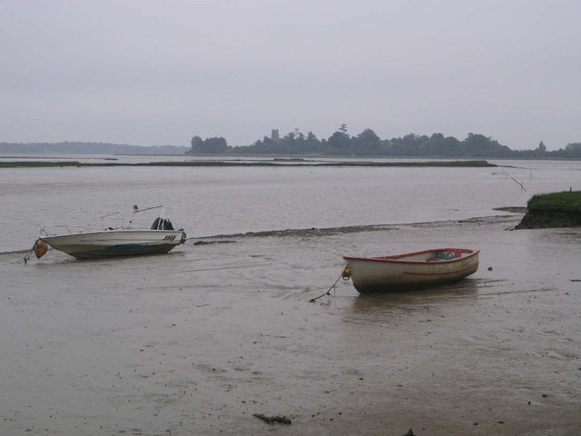
Alde Mudflats

Alde Mudflats is a 22 hectare nature reserve west of Iken in Suffolk. It is owned by the Crown Estate and managed by the Suffolk Wildlife Trust. It is...

Suffolk Coastal (UK Parliament constituency)

Suffolk Coastal (sometimes known as Coastal Suffolk) is a parliamentary constituency in the county of Suffolk, England which has been represented in the...

Plomesgate Hundred

Plomesgate is a hundred of Suffolk, consisting of 41,579 acres (168.26 km2).Plomesgate Hundred comprises the historic ports of Aldeburgh and Orford, the...

Related Videos

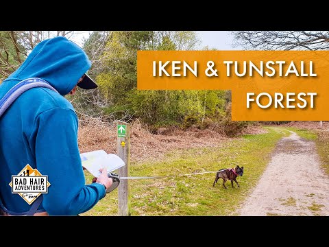
Iken & Tunstall Forest || Firepot Dehydrated Meal Review #Review #Drone

Join us on a near 8 mile circular walk, starting at Iken, going through Tunstall Forest, passing by the famous Snape Maltings ...

Venetia R Campbell Mindful Nature Walks, Healing & Transpersonal Hypnotherapy

Venetia R-Campbell, Tame Wild Walks in Nature, Energy Healing and Transpersonal Hypnotherapy.
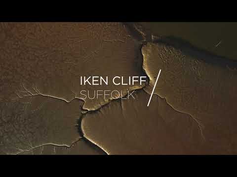
Iken Cliff by Drone

Evening down on the River Alde. Location: Iken Cliff, Suffolk, England. Shot on the DJI Mini 2. #suffolk #drone #4k #dji #djimini2 ...

Nearby Amenities

Located within 500m of 52.152898,1.5286948
Source: PGS
Lat/Long: 52.1568164/1.5296622
Source: PGS
Lat/Long: 52.1569476/1.5285235
Source: PGS
Lat/Long: 52.1557685/1.5237045
Source: PGS
Lat/Long: 52.1550822/1.5237474
Source: PGS
Lat/Long: 52.1544513/1.523834
Source: PGS
Lat/Long: 52.1542047/1.5239248
Source: PGS
Lat/Long: 52.1539082/1.5240904
Entrance: main
Lat/Long: 52.1552437/1.5247459
Parking
Access: private
Lat/Long: 52.1487328/1.5266651
Parking
Access: private
Lat/Long: 52.149661/1.5257961
Turning Circle
Lat/Long: 52.1492487/1.5244724
Parking
Access: private
Lat/Long: 52.1556003/1.5258014
Leisure: slipway
Lat/Long: 52.154125/1.5242243
The data included in this document is from www.openstreetmap.org. The data is made available under ODbL.

Have you been to Church Carr?

Leave your review of Church Carr below (or comments, questions and feedback).