Broom Covert

Wood, Forest in Suffolk East Suffolk

England

Broom Covert

Orford Castle <span class="nowrap"><a title="https://historicengland.org.uk/listing/the-list/list-entry/1014860?section=official-listing" rel="nofollow ugc noopener" href="https://historicengland.org.uk/listing/the-list/list-entry/1014860?section=official-listing">Link</a><img style="margin-left:2px;" alt="External link" title="External link - shift click to open in new window" src="https://s1.geograph.org.uk/img/external.png" width="10" height="10"/></span>
Orford Castle Credit: Sandy Gerrard

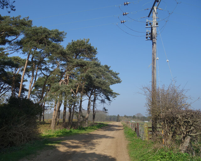
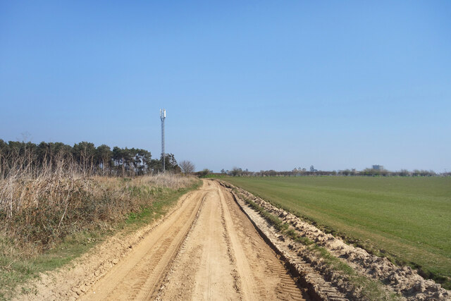
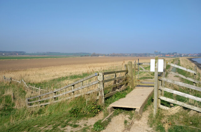
Broom Covert, located in Suffolk, England, is a charming wooded area known for its picturesque scenery and serene ambiance. This beautiful wood is situated near the village of Broom, hence its name, and covers a vast expanse of land, making it an ideal destination for nature lovers and outdoor enthusiasts.

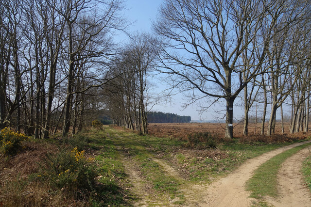
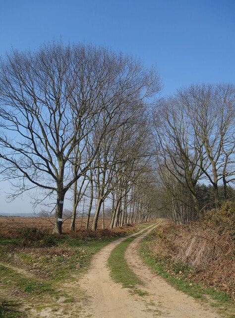
The woodland is predominantly composed of native tree species such as oak, birch, and beech, creating a diverse and vibrant ecosystem. The dense canopy formed by these trees provides ample shade, creating a cool and refreshing atmosphere, particularly in the summer months. The forest floor is covered in a thick layer of leaf litter, which supports a rich variety of flora and fauna.

The woodland is crisscrossed by a network of well-maintained trails, offering visitors the opportunity to explore its hidden gems. These paths wind their way through the woods, taking visitors on a journey through towering trees, wildflower meadows, and bubbling streams. Along the way, one may encounter an array of wildlife, including deer, squirrels, and a multitude of bird species.

Broom Covert is not only a haven for wildlife but also a popular spot for recreational activities. It offers ample opportunities for hiking, birdwatching, and photography. The peaceful ambiance and natural beauty of this woodland make it an ideal place for a leisurely stroll or a family picnic.

Overall, Broom Covert in Suffolk is an enchanting woodland that captivates visitors with its beauty and tranquility. Whether one seeks solace in nature or wishes to engage in outdoor activities, this wood offers a delightful escape from the hustle and bustle of everyday life.

If you have any feedback on the listing, please let us know in the comments section below.
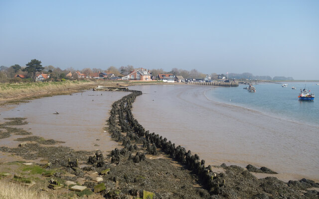
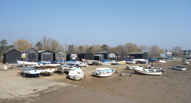
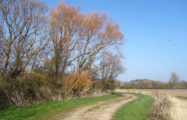
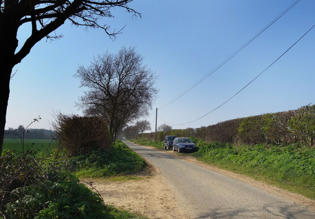
Broom Covert Images

Images are sourced within 2km of 52.094656/1.5158121 or Grid Reference TM4049. Thanks to Geograph Open Source API. All images are credited.

Orford Castle <span class="nowrap"><a title="https://historicengland.org.uk/listing/the-list/list-entry/1014860?section=official-listing" rel="nofollow ugc noopener" href="https://historicengland.org.uk/listing/the-list/list-entry/1014860?section=official-listing">Link</a><img style="margin-left:2px;" alt="External link" title="External link - shift click to open in new window" src="https://s1.geograph.org.uk/img/external.png" width="10" height="10"/></span>
Orford Castle
Church Street, Orford St Bartholomew's Church at the top of the road leading up from the waterfront.
Church Street, Orford
St Bartholomew's Church at the top of the road leading up from the waterfront.
Orford Craft Centre
Orford Craft Centre
Orford Sailing Club
Orford Sailing Club
Stakes in the Mud Like some fossilised prehistoric snaky thing, the remains of a bygone wooden structure are exposed in the mud at low tide. 
An earlier attempt at coastal defence at a guess.
Stakes in the Mud
Like some fossilised prehistoric snaky thing, the remains of a bygone wooden structure are exposed in the mud at low tide. An earlier attempt at coastal defence at a guess.
Boats on the Beach Small boats up on the foreshore near Orford Sailing Club.
Boats on the Beach
Small boats up on the foreshore near Orford Sailing Club.
Abandoned Old Boats Poor old things. I always wonder what the story is behind scenes like this.
The foreshore at Orford on the non sailing club side.
Abandoned Old Boats
Poor old things. I always wonder what the story is behind scenes like this. The foreshore at Orford on the non sailing club side.
Gate onto Gedgrave Marshes The public footpath comes down off the levee and heads inland. 
Gedgrave is a small rural parish with a population of 30 at  the last count. It once had a church, St Andrew's, but that's gone and the parish is now just a few scattered houses, including Gedgrave Hall.
<span class="nowrap"><a title="https://en.wikipedia.org/wiki/Gedgrave" rel="nofollow ugc noopener" href="https://en.wikipedia.org/wiki/Gedgrave">Link</a><img style="margin-left:2px;" alt="External link" title="External link - shift click to open in new window" src="https://s1.geograph.org.uk/img/external.png" width="10" height="10"/></span>
Gate onto Gedgrave Marshes
The public footpath comes down off the levee and heads inland. Gedgrave is a small rural parish with a population of 30 at the last count. It once had a church, St Andrew's, but that's gone and the parish is now just a few scattered houses, including Gedgrave Hall. LinkExternal link
Drain on Gedgrave Marshes One of the many channels draining the marsh.
Drain on Gedgrave Marshes
One of the many channels draining the marsh.
Tree Colours on Gedgrave Marshes Willow trees coming back to life after the winter.
Tree Colours on Gedgrave Marshes
Willow trees coming back to life after the winter.
Gedgrave Road A no through road leading to Gedgrave Hall and a few other houses.
The soil is very sandy round here.
Gedgrave Road
A no through road leading to Gedgrave Hall and a few other houses. The soil is very sandy round here.
Track past Pine Trees Away from the marshes by the coast the land is dry and sandy.
Track past Pine Trees
Away from the marshes by the coast the land is dry and sandy.
Flat countryside near Orford A walk through farmland west of the town.
Flat countryside near Orford
A walk through farmland west of the town.
Tracks, Gedgrave Broom A lot of this has been cut down by the look of it.
Tracks, Gedgrave Broom
A lot of this has been cut down by the look of it.
Track to The Broom A road to a premises called The Broom. On the right is Broom Covert, on the left is Gedgrave Broom.
TM4049 is kind of Broomy.
Track to The Broom
A road to a premises called The Broom. On the right is Broom Covert, on the left is Gedgrave Broom. TM4049 is kind of Broomy.
Gate onto the Levee The path passes the last house on the edge of town and heads out along the levee which goes for miles beside the River Ore.
The pole is probably one of those underwater cable markers.
Gate onto the Levee
The path passes the last house on the edge of town and heads out along the levee which goes for miles beside the River Ore. The pole is probably one of those underwater cable markers.
Gate at a Footpath Junction A path leaves the levee for a shortcut avoiding the slightly longer walk round Chantry Point.
Gate at a Footpath Junction
A path leaves the levee for a shortcut avoiding the slightly longer walk round Chantry Point.
Orford Quay, Suffolk Orford Quay. A working quay and departure point for the ferry across the River Ore to Orford Ness
Orford Quay, Suffolk
Orford Quay. A working quay and departure point for the ferry across the River Ore to Orford Ness
Show me another place!

Broom Covert is located at Grid Ref: TM4049 (Lat: 52.094656, Lng: 1.5158121)

Administrative County: Suffolk

District: East Suffolk

Police Authority: Suffolk

What 3 Words

///highbrow.purses.whimpered. Near Rendlesham, Suffolk

Related Wikis

Richmond Farm Pit, Gedgrave

Richmond Farm Pit, Gedgrave is a 0.57-hectare (1.4-acre) geological Site of Special Scientific Interest south-west of Orford in Suffolk. It is a Geological...
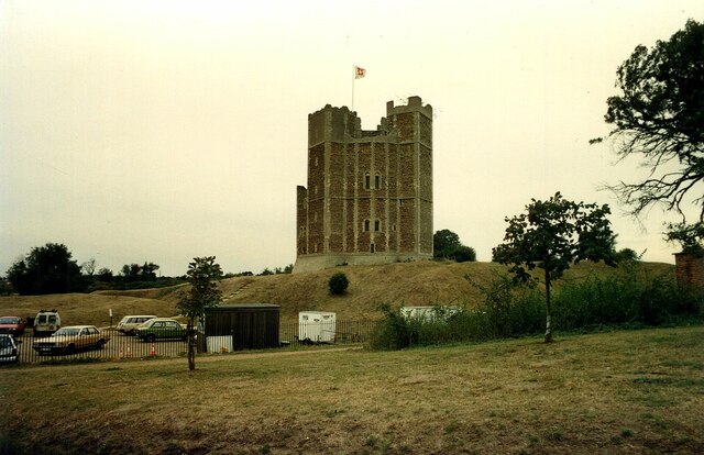
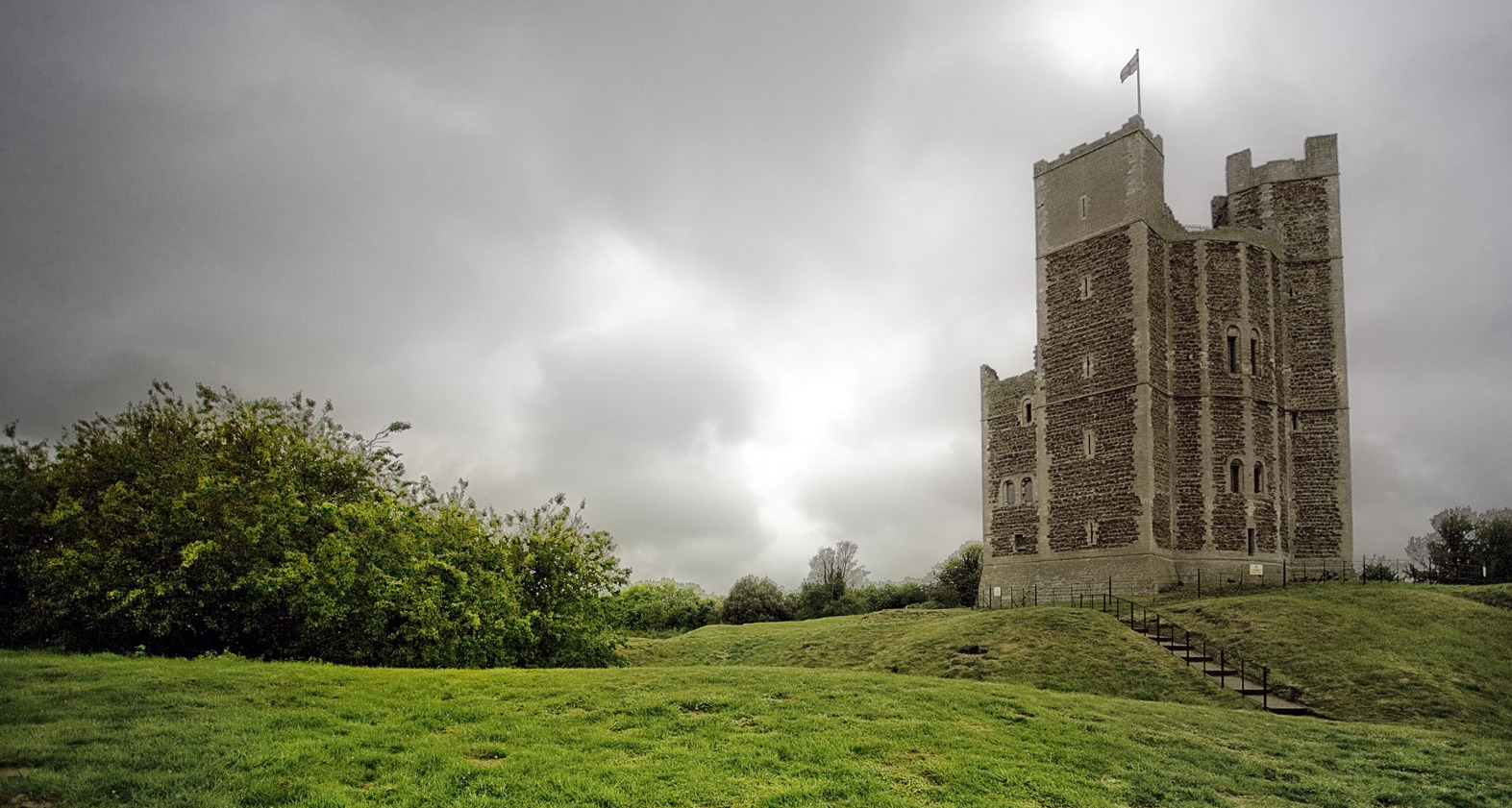
Orford Castle

Orford Castle is a castle in Orford in the English county of Suffolk, 12 miles (19 km) northeast of Ipswich, with views over Orford Ness. It was built...

Alde–Ore Estuary

Alde–Ore Estuary is a 2,534 hectare biological and geological Site of Special Scientific Interest which stretches along the Suffolk coast between Aldeburgh...
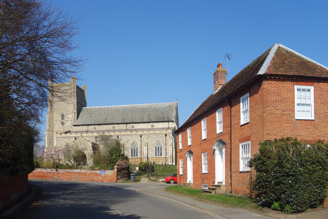
Orford, Suffolk

Orford is a village in Suffolk, England, within the Suffolk Coast and Heaths Area of Outstanding Natural Beauty. It is 9 miles (14 km) east of Woodbridge...

Nearby Amenities

Located within 500m of 52.094656,1.5158121
The data included in this document is from www.openstreetmap.org. The data is made available under ODbL.

Have you been to Broom Covert?

Leave your review of Broom Covert below (or comments, questions and feedback).