Coe Wood

Wood, Forest in Suffolk East Suffolk

England

Coe Wood

Field of barley near Wolseyhouse Farm
Field of barley near Wolseyhouse Farm Credit: Oliver Dixon

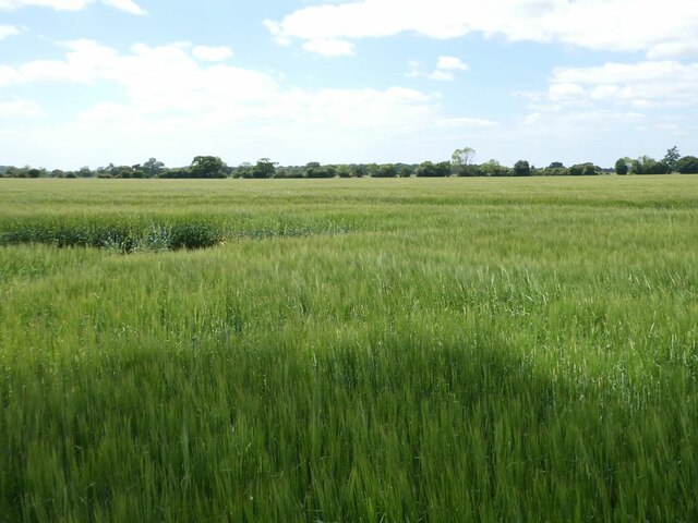
Coe Wood is a picturesque forest located in Suffolk, England. Covering an area of approximately 200 acres, it is a prominent natural attraction in the region. The wood is characterized by its dense canopy of trees, which primarily consists of oak, beech, and silver birch. These towering trees create a serene and tranquil environment, offering visitors a peaceful retreat from the hustle and bustle of everyday life.

The forest is home to a diverse range of flora and fauna, making it an ideal destination for nature enthusiasts and wildlife lovers. The forest floor is adorned with an array of wildflowers, including bluebells and primroses, which bloom in vibrant colors during the spring season. Numerous species of birds, such as woodpeckers and owls, can be spotted among the treetops. Additionally, Coe Wood is known to harbor various mammals, including deer, squirrels, and foxes, which roam freely in their natural habitat.

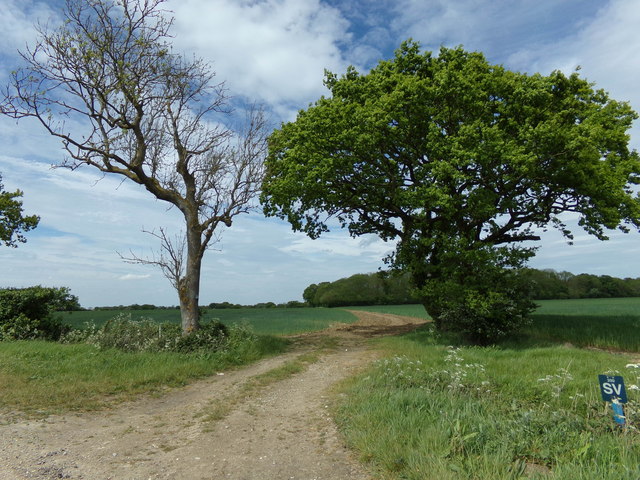
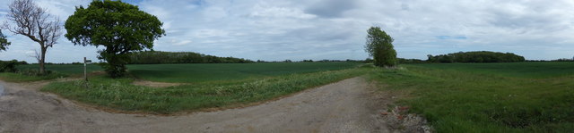
Visitors to Coe Wood can explore its enchanting trails, which meander through the forest and offer breathtaking views of the surrounding landscape. The forest is equipped with well-maintained footpaths, making it accessible for hikers and walkers of all abilities. The serene atmosphere and the abundance of natural beauty make Coe Wood a popular spot for photography and picnics.

Coe Wood's rich history and cultural significance add another layer of interest to the area. The forest has been a part of Suffolk's heritage for centuries, and remnants of ancient settlements and structures can still be found within its boundaries. These archaeological sites provide valuable insights into the region's past and attract history enthusiasts from far and wide.

Overall, Coe Wood is a captivating natural haven that offers visitors a chance to immerse themselves in the beauty of the Suffolk countryside.

If you have any feedback on the listing, please let us know in the comments section below.

Coe Wood Images

Images are sourced within 2km of 52.254405/1.4664335 or Grid Reference TM3667. Thanks to Geograph Open Source API. All images are credited.

Field of barley near Wolseyhouse Farm
Concrete farm road at Wolseyhouse Farm
Pond at Hog Hill Holiday Cottages
Wildflower meadow at Hog Hill House
Pump House Lane, Sibton Road No.U2503
Pump House Lane, Sibton
Road No.U2503
Farmland off Pump House Lane Looking towards Hill Farm
Farmland off Pump House Lane
Looking towards Hill Farm
Geograph East Anglian Backup Kindly donated by Peter Facey
Setup helped by David Pugh & Barry Hunter
Monitored by Adrian Cable
Geograph East Anglian Backup
Kindly donated by Peter Facey Setup helped by David Pugh & Barry Hunter Monitored by Adrian Cable
Main Road (A12) Looking south west near The Red House Farm.
Main Road (A12)
Looking south west near The Red House Farm.
Young crop field near Lodge Farm
Track (footpath) to Lodge Farm Off the A12.
Track (footpath) to Lodge Farm
Off the A12.
Newly Dug Ditch off Rendham Road <span class="nowrap"><a title="https://en.wikipedia.org/wiki/Sibton" rel="nofollow ugc noopener" href="https://en.wikipedia.org/wiki/Sibton">Link</a><img style="margin-left:2px;" alt="External link" title="External link - shift click to open in new window" src="https://s1.geograph.org.uk/img/external.png" width="10" height="10"/></span>
Newly Dug Ditch off Rendham Road
Culvert under Rendham Road <span class="nowrap"><a title="https://en.wikipedia.org/wiki/Sibton" rel="nofollow ugc noopener" href="https://en.wikipedia.org/wiki/Sibton">Link</a><img style="margin-left:2px;" alt="External link" title="External link - shift click to open in new window" src="https://s1.geograph.org.uk/img/external.png" width="10" height="10"/></span>
Culvert under Rendham Road
The A12 south of Yoxford
The entrance to Lodge Farm
Footpath to Rotten End Kelsale footpath No.11
Footpath to Rotten End
Kelsale footpath No.11
Panorama of Kelsale farmland <span class="nowrap"><a title="https://en.wikipedia.org/wiki/Kelsale" rel="nofollow ugc noopener" href="https://en.wikipedia.org/wiki/Kelsale">Link</a><img style="margin-left:2px;" alt="External link" title="External link - shift click to open in new window" src="https://s1.geograph.org.uk/img/external.png" width="10" height="10"/></span>
Panorama of Kelsale farmland
Show me another place!

Coe Wood is located at Grid Ref: TM3667 (Lat: 52.254405, Lng: 1.4664335)

Administrative County: Suffolk

District: East Suffolk

Police Authority: Suffolk

What 3 Words

///utter.lighters.jumpy. Near Saxmundham, Suffolk

Nearby Locations

Coe Wood Rotten End

Related Wikis

Peasenhall

Peasenhall is a village and civil parish in the East Suffolk district, in the English county of Suffolk. The population of the civil parish at the 2021...

Sibton

Sibton is a village and civil parish on the A1120 road, in the East Suffolk district, in the English county of Suffolk. It is near the towns of Saxmundham...

The Ancient House, Peasenhall

The Ancient House is a grade II* listed house in Peasenhall, Suffolk, England. The house is timber-framed and is not ancient, dating from the mid-sixteenth...

Sibton Abbey

Sibton Abbey, an early Cistercian abbey located near Yoxford, Suffolk, was founded about 1150 by William de Chesney, High Sheriff of Norfolk and Suffolk...

Nearby Amenities

Located within 500m of 52.254405,1.4664335
White House Farm
Naptan AtcoCode: 390060228
Naptan Bearing: S
Naptan BusStopType: CUS
Naptan CommonName: White House Farm
Naptan Indicator: opp
Naptan Landmark: White House Farm
Naptan NaptanCode: sufgpajt
Naptan Street: Rendham Road
Naptan Verified: no
Source: naptan_import
Lat/Long: 52.2564152/1.4606928
White House Farm
Naptan AtcoCode: 390060229
Naptan Bearing: N
Naptan BusStopType: CUS
Naptan CommonName: White House Farm
Naptan Indicator: o/s
Naptan Landmark: White House Farm
Naptan NaptanCode: sufgpajw
Naptan Street: Rendham Road
Naptan Verified: no
Source: naptan_import
Lat/Long: 52.2564981/1.460626
Power: pole
Lat/Long: 52.2581386/1.465441
Power: pole
Lat/Long: 52.2575295/1.4670154
Power: pole
Lat/Long: 52.2569861/1.4684826
Power: pole
Lat/Long: 52.2564246/1.4699256
Power: pole
Lat/Long: 52.2557941/1.4719105
The data included in this document is from www.openstreetmap.org. The data is made available under ODbL.

Have you been to Coe Wood?

Leave your review of Coe Wood below (or comments, questions and feedback).