Auchterarder

Settlement in Perthshire

Scotland

Auchterarder

Abbey Road Bridge, A9 The A9 is a strategic link between the Highlands of Scotland and the Central Belt. It runs 279 miles from junction 5 of the M9 at Polmont to Scrabster. Originally it ran from Edinburgh.
<span class="nowrap"><a title="https://www.sabre-roads.org.uk/wiki/index.php?title=A9" rel="nofollow ugc noopener" href="https://www.sabre-roads.org.uk/wiki/index.php?title=A9">Link</a><img style="margin-left:2px;" alt="External link" title="External link - shift click to open in new window" src="https://s1.geograph.org.uk/img/external.png" width="10" height="10"/></span>
Abbey Road Bridge, A9 Credit: N Chadwick

Auchterarder is a small town located in Perthshire, Scotland. Situated approximately 13 miles south of Perth, Auchterarder is surrounded by picturesque rolling hills and farmland. The town has a population of around 4,500 residents.

Auchterarder has a rich history that dates back to the early medieval period. The town's name is derived from the Gaelic term "Achadh nan Dearcan," meaning "field of the oaks," reflecting its ancient woodland surroundings. Auchterarder grew as a market town during the 19th century, primarily due to its strategic location on the main road between Perth and Stirling.

One of the most notable landmarks in Auchterarder is the Gleneagles Hotel and Golf Course, which attracts tourists from around the world. The hotel hosted the 2005 G8 summit and has three championship golf courses, including the world-renowned PGA Centenary Course, designed by Jack Nicklaus.

Auchterarder's town center offers a range of amenities, including shops, cafes, restaurants, and traditional pubs. The town also has a primary and secondary school, providing education to local residents.

The surrounding countryside provides ample opportunities for outdoor activities such as walking, cycling, and fishing. The nearby Ochil Hills offer stunning views over the town and beyond, making them a popular destination for hikers and nature enthusiasts.

Auchterarder is well-connected to other parts of Scotland, with good transport links including regular bus services and a train station in nearby Gleneagles. Overall, Auchterarder offers a charming blend of history, natural beauty, and modern amenities, making it an attractive place to live or visit in Perthshire.

If you have any feedback on the listing, please let us know in the comments section below.
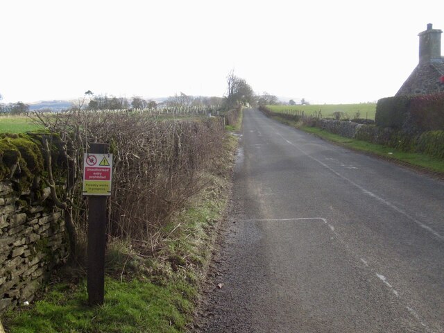
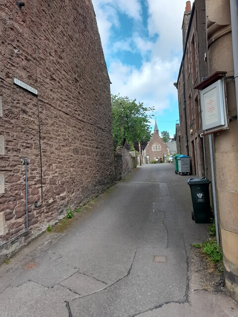
Auchterarder Images

Images are sourced within 2km of 56.296434/-3.706391 or Grid Reference NN9412. Thanks to Geograph Open Source API. All images are credited.

Abbey Road Bridge, A9 The A9 is a strategic link between the Highlands of Scotland and the Central Belt. It runs 279 miles from junction 5 of the M9 at Polmont to Scrabster. Originally it ran from Edinburgh.
<span class="nowrap"><a title="https://www.sabre-roads.org.uk/wiki/index.php?title=A9" rel="nofollow ugc noopener" href="https://www.sabre-roads.org.uk/wiki/index.php?title=A9">Link</a><img style="margin-left:2px;" alt="External link" title="External link - shift click to open in new window" src="https://s1.geograph.org.uk/img/external.png" width="10" height="10"/></span>
Abbey Road Bridge, A9
The A9 is a strategic link between the Highlands of Scotland and the Central Belt. It runs 279 miles from junction 5 of the M9 at Polmont to Scrabster. Originally it ran from Edinburgh. LinkExternal link
Layby - A9 northbound
Abbey Road bridge - A9 northbound
Another inappropriate forestry sign, B8062 A stupid person placed, or ordered the placement of a forestry keep out sign on the B8062.  This is not the usual road closure sign, you will see those just about every time you go out, just unthinking following of instructions.  Needless to say there was no forestry work anywhere near although some trees were cut down on land to the left at one time - you can see the Tuley tubes of the new plantings.
Another inappropriate forestry sign, B8062
A stupid person placed, or ordered the placement of a forestry keep out sign on the B8062. This is not the usual road closure sign, you will see those just about every time you go out, just unthinking following of instructions. Needless to say there was no forestry work anywhere near although some trees were cut down on land to the left at one time - you can see the Tuley tubes of the new plantings.
Auto & Plant, Auchterarder Closed and fenced off along with an office of Stuart Milne on the site.  More houses coming?
Auto & Plant, Auchterarder
Closed and fenced off along with an office of Stuart Milne on the site. More houses coming?
Stuart Milne, former office in Auchterarder
High Street, Auchterarder
Shop, Auchterarder High Street A health food shop.
Shop, Auchterarder High Street
A health food shop.
High Street, Auchterarder
A9 passing Auchterarder
New houses, Broadfold
Auchterarder seen from Black Maller
Feus, Auchterarder Eastern end of Auchterarder's long street (former A9).
Feus, Auchterarder
Eastern end of Auchterarder's long street (former A9).
High Street
High Street
North Crofts
North Crofts
St Kessog's Place
St Kessog's Place
Castleton Road
Castleton Road
Show me another place!

Auchterarder is located at Grid Ref: NN9412 (Lat: 56.296434, Lng: -3.706391)

Unitary Authority: Perth and Kinross

Police Authority: Tayside

What 3 Words

///concerts.detonated.bake. Near Auchterarder, Perth & Kinross

Nearby Locations

Auchterarder

Related Wikis

Aytoun Hall

Aytoun Hall, also referred to as Auchterarder Town Hall, is a municipal building in the High Street, Auchterarder, Perth and Kinross, Scotland. The structure...

Community School of Auchterarder

The Community School of Auchterarder (TCSoA) (formerly Auchterarder High School) is a small to medium-sized school with a nursery, primary and secondary...

Auchterarder

Auchterarder ( ; Scottish Gaelic: Uachdar Àrdair, meaning Upper Highland) is a town north of the Ochil Hills in Perth and Kinross, Scotland, and home to...

St Margaret's Hospital, Auchterarder

St Margaret's Hospital is a health facility in Western Road, Auchterarder, Scotland. It is managed by NHS Tayside. It is a Category B listed building....

Auchterarder railway station

Auchterarder railway station served the village of Auchterarder near Gleneagles in the Scottish county of Perth and Kinross. == History == Opened by the...

Kincardine Castle, Auchterarder

Kincardine Castle is a 19th-century manor house near Auchterarder in Perth and Kinross, Scotland. The building lies 1.5 kilometres (0.93 mi) south-west...

Old Kincardine Castle, Auchterarder

Old Kincardine Castle was a 13th-century castle near Auchterarder in Perth and Kinross, Scotland. The castle was located on a promontory overlooking the...

Tullibardine railway station

Tullibardine railway station served the town of Tullibardine, Perth and Kinross in Scotland. == History == It was built in 1857 for the Crieff Junction...

Nearby Amenities

Located within 500m of 56.296434,-3.706391
Auchterarder
Is In: Perthshire, Scotland, United Kingdom
Name En: Auchterarder
Name Gd: Uachdar Àrdair
Name Sco: Auchterairder
Place: town
Population: 5350
Wikidata: Q758623
Wikipedia: en:Auchterarder
Lat/Long: 56.2963188/-3.7065827
Post Office
Auchterarder Post Office
Addr Country: GB
Addr Housenumber: 95
Addr Postcode: PH3 1BJ
Addr Street: High Street
Brand: Post Office
Brand Wikidata: Q1783168
Contact Website: https://www.postoffice.co.uk/branch-finder/3098206/auchterarder
Ref Pol Id: 136059
Lat/Long: 56.2964404/-3.7065307
Turning Circle
Lat/Long: 56.2952918/-3.699349
Spar Auchterarder
Addr Housenumber: 200
Addr Postcode: PH3 1AF
Brand: Spar
Brand Wikidata: Q610492
Brand Wikipedia: en:Spar (retailer)
Shop: convenience
Website: https://www.spar.co.uk/store-locator/lan11534-spar-auchterarder/
Lat/Long: 56.2947435/-3.7111026
Brand: Royal Mail
Brand Wikidata: Q638098
Brand Wikipedia: en:Royal Mail
Collection Times: Mo-Fr 09:00; Sa 07:00
Colour: black
Disused Amenity: post_box
Disused Ref: PH3 44D
Manufacturer: W.T.Allen & Co. London
Operator: Royal Mail
Operator Wikidata: Q638098
Post Box Mounting: stone_wall
Post Box Type: wall
Royal Cypher: GVIR
Source: survey;local knowledge
Lat/Long: 56.2968611/-3.7043231
Post Box
Collection Times: Mo-Fr 09:00; Sa 07:00
Manufacturer: W.T.Allen & Co. London
Operator: Royal Mail
Post Box Mounting: building
Post Box Type: wall
Ref: PH3 40D
Royal Cypher: EVIIR
Royal Cypher Wikidata: Q33102324
Source: survey;local knowledge
Lat/Long: 56.2952223/-3.7102945
Addr City: Auchterarder
Addr Housenumber: 141
Addr Postcode: PH3 1AD
Addr Street: High Street
Check Date: 2015-10-28
Disused Amenity: pharmacy
Old Name: Lloyds Pharmacy
Lat/Long: 56.2958649/-3.7083243
Toilets
Fee: yes
Lat/Long: 56.2959047/-3.7065912
Post Box
Collection Times: Mo-Fr 17:00; Sa 12:30
Operator: Royal Mail
Post Box Design: type_k
Post Box Type: pillar
Ref: PH3 1
Royal Cypher: scottish_crown
Source: survey;local knowledge
Lat/Long: 56.2962225/-3.70697
Post Box
Collection Times: Mo-Fr 17:00; Sa 12:30
Operator: Royal Mail
Post Box Design: type_k
Post Box Type: pillar
Ref: PH3 2
Royal Cypher: scottish_crown
Source: survey;local knowledge
Lat/Long: 56.296227/-3.7069503
Historic: memorial
Memorial: war_memorial
Lat/Long: 56.2969104/-3.7060599
Entrance: main
Lat/Long: 56.2956367/-3.7084597
Pub
The Niblick
Addr City: Auchterarder
Addr Parentstreet: High Street
Addr Postcode: PH3 1BJ
Addr Street: Crown Court
Lat/Long: 56.2958726/-3.7069079
Give Way
Direction: forward
Lat/Long: 56.2982385/-3.6996611
Post Box
Collection Times: Mo-Fr 09:00; Sa 07:00
Manufacturer: Carronade
Operator: Royal Mail
Post Box Mounting: pier
Post Box Type: lamp
Ref: PH3 64D
Royal Cypher: scottish_crown
Source: survey;local knowledge
Lat/Long: 56.2929471/-3.7082291
Post Box
Collection Plate: CP1D
Collection Times: Mo-Fr 09:00; Sa 07:00
Manufacturer: W.T.Allen & Co. London
Operator: Royal Mail
Post Box Mounting: stone_wall
Post Box Type: wall
Ref: PH3 45D
Royal Cypher: GR
Royal Cypher Wikidata: Q33102273
Source: survey;local knowledge
Lat/Long: 56.2983045/-3.699823
Crossing
Crossing: traffic_signals
Crossing Island: no
Tactile Paving: yes
Lat/Long: 56.2963156/-3.7065072
Bus Stop
Bus: yes
Naptan AtcoCode: 64804241
Naptan NaptanCode: 73727537
Public Transport: platform
Lat/Long: 56.2980079/-3.7005206
Generator Method: photovoltaic
Generator Output Electricity: yes
Generator Source: solar
Generator Type: solar_photovoltaic_panel
Power: generator
Lat/Long: 56.2986703/-3.7018907
Pharmacy
Davidsons Chemists
Addr City: Auchterarder
Addr Housenumber: 54-56
Addr Postcode: PH3 1BN
Addr Street: High Street
Dispensing: yes
Healthcare: pharmacy
Lat/Long: 56.2967221/-3.7047139
Cafe
Lat/Long: 56.295804/-3.7078708
Bench
Lat/Long: 56.2965251/-3.7061609
Defibrillator
Defibrillator Location: On outside wall of building next to Ayton Hall on High Street
Emergency: defibrillator
Indoor: no
Lat/Long: 56.2966141/-3.7059831
Bus Stop
Bus: yes
Naptan AtcoCode: 64801057
Naptan NaptanCode: 73725754
Public Transport: platform
Shelter: yes
Lat/Long: 56.296609/-3.7059105
Bench
Lat/Long: 56.2965794/-3.7060104
Waste Basket
Lat/Long: 56.2965467/-3.706109
Information: board
Tourism: information
Lat/Long: 56.2965106/-3.7062056
Bicycle Parking
Bicycle Parking: stands
Capacity: 8
Covered: no
Lat/Long: 56.2963602/-3.7062723
Shop: hairdresser
Lat/Long: 56.2962811/-3.7061567
Shop: bakery
Lat/Long: 56.2962518/-3.7064016
Post Box
Collection Times: Mo-Fr 09:00; Sa 07:00
Manufacturer: Lion Foundry Co Ltd Kirkintilloch
Operator: Royal Mail
Post Box Mounting: pier
Post Box Type: lamp
Ref: PH3 54D
Royal Cypher: scottish_crown
Source: survey;local knowledge
Lat/Long: 56.293826/-3.7003929
The data included in this document is from www.openstreetmap.org. The data is made available under ODbL.

Have you been to Auchterarder?

Leave your review of Auchterarder below (or comments, questions and feedback).