Church Wood
Wood, Forest in Kent Dover
England
Church Wood

Church Wood is a picturesque woodland located in the county of Kent, England. Situated near the village of Blean, just a few miles northwest of Canterbury, this ancient forest is a renowned natural attraction in the region. Covering an area of approximately 300 acres, Church Wood is a diverse mix of broadleaf and coniferous trees, creating a rich and vibrant ecosystem.
The woodland is predominantly made up of oak, beech, and chestnut trees, providing a dense canopy that filters sunlight and creates a cool and tranquil atmosphere. In addition to these dominant species, visitors will also find a variety of other tree species such as hazel, birch, and holly. The forest floor is adorned with a carpet of bluebells in the spring, creating a stunning floral display.
Church Wood is home to a wide range of wildlife, including numerous bird species such as woodpeckers, tawny owls, and nuthatches. Mammals such as deer, squirrels, and rabbits can also be spotted roaming through the forest. Visitors may even catch a glimpse of the elusive dormouse, a protected species that finds sanctuary in the wood's ancient trees.
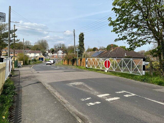
The woodland offers several walking trails, allowing visitors to explore its natural beauty at their own pace. These paths wind through the forest, offering breathtaking views and an opportunity to immerse oneself in the peaceful surroundings. Church Wood is a popular destination for nature lovers, hikers, and families seeking a day out in the countryside.
As a designated Site of Special Scientific Interest (SSSI), Church Wood is not only a place of natural beauty but also holds significant ecological importance. Its ancient woodland status ensures the preservation and protection of this precious habitat for generations to come.
If you have any feedback on the listing, please let us know in the comments section below.
Church Wood Images
Images are sourced within 2km of 51.188442/1.286424 or Grid Reference TR2948. Thanks to Geograph Open Source API. All images are credited.


Church Wood is located at Grid Ref: TR2948 (Lat: 51.188442, Lng: 1.286424)
Administrative County: Kent
District: Dover
Police Authority: Kent
What 3 Words
///euphoric.spelled.nicknames. Near Eythorne, Kent
Nearby Locations
Related Wikis

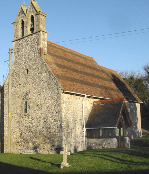
All Saints Church, Waldershare
All Saints Church is a redundant Anglican church in Waldershare, Kent, England. It is recorded in the National Heritage List for England as a designated...
Ashley, Kent
Ashley (also known, signposted and marked on some maps as Sutton) is a hamlet located in the parish of Sutton, some five miles (8 km) north of Dover on...

Eythorne
Eythorne is a civil parish and small village located 7.3 miles north-northwest of Dover in Kent, with a combined population of approximately 2,500 residents...

Eythorne Baptist Church
Eythorne Baptist Church originated in the meetings of early 16th century Baptists who had crossed the English Channel from the low countries to Kent to...
Waldershare
Waldershare is a village near Dover in Kent, England. In 1086, the village was in the hundred of Eastry in the ancient Lathe of Eastry. By 1295 the ancient...
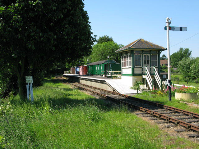
Eythorne railway station
Eythorne railway station is a station on the East Kent Railway. Originally a station on the East Kent Light Railway, It opened on 16 October 1916 but closed...
West Studdal
West Studdal is a village near Dover in Kent, England. The population of the village is included in the civil parish of Sutton.
Coldred
Coldred is a settlement and former civil parish, now in the parish of Shepherdswell with Coldred, in the Dover district of Kent, England. The main part...
Nearby Amenities
Located within 500m of 51.188442,1.286424Have you been to Church Wood?
Leave your review of Church Wood below (or comments, questions and feedback).