Frizington

Settlement in Cumberland Copeland

England

Frizington

Site of Arlecdon station View south towards Winder Brow. Until closed finally from 7/8/38 - to passengers on 1/1/27, the branch from Distington (to the left) of the former Cleator & Workington Junction Railway had run to Rowrah (to the right). The Pullman car now used at the Hound Inn, Arlecdon  as a restaurant must have been brought by road!
Site of Arlecdon station Credit: Ben Brooksbank

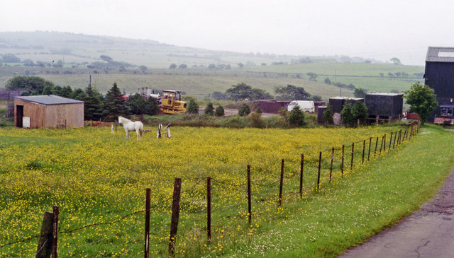
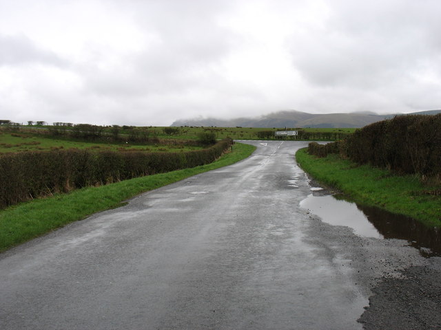
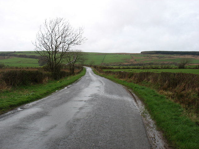
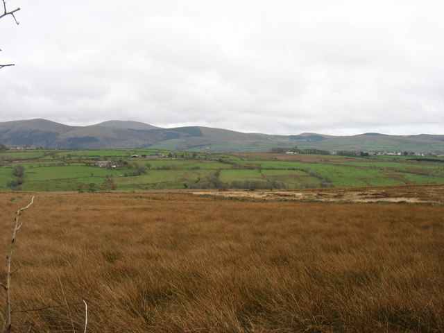
Frizington is a small village located in the county of Cumberland, England. Situated in the western part of the county, it lies approximately 5 miles southeast of Whitehaven and 6 miles west of Cleator Moor. The village is nestled in the picturesque landscape of the Lake District National Park, offering stunning views of the surrounding countryside.

Historically, Frizington was an important center for coal mining, with several collieries operating in the area during the 19th and 20th centuries. The village grew rapidly during this time, accommodating the influx of workers and their families. However, the decline of the mining industry in the latter half of the 20th century led to a significant decrease in population.

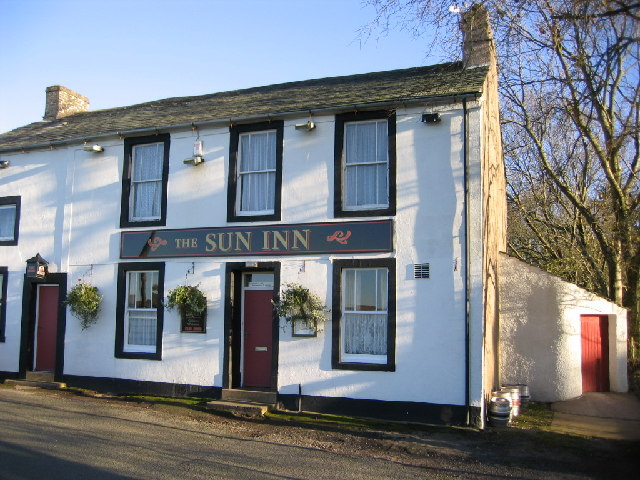
Today, Frizington retains its rural charm and serves as a residential area for locals and those seeking a quieter lifestyle. The village features a range of amenities, including a primary school, shops, and a public house, providing essential services for its residents. The nearby towns of Whitehaven and Cleator Moor offer additional facilities and employment opportunities.

Frizington is also known for its close proximity to beautiful natural attractions, such as Ennerdale Water and the Cumbrian coast. Outdoor enthusiasts can enjoy hiking, cycling, and fishing in the surrounding area, while nature lovers can explore the diverse flora and fauna of the Lake District.

Overall, Frizington offers a peaceful and scenic setting for residents and visitors alike, combining the tranquility of rural living with easy access to both nature and urban amenities.

If you have any feedback on the listing, please let us know in the comments section below.
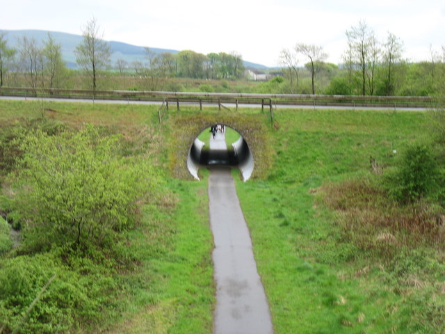
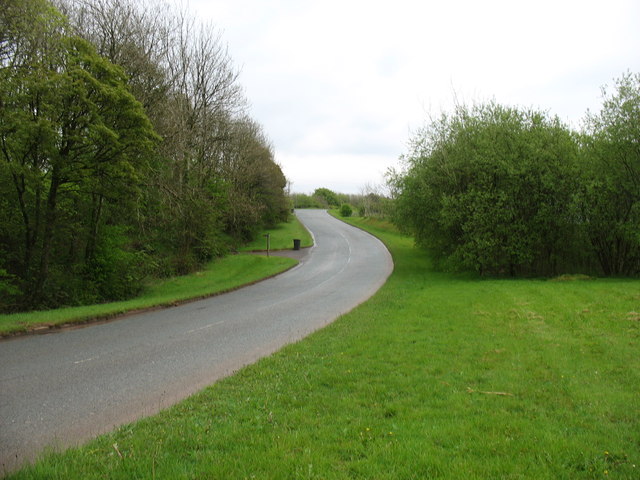
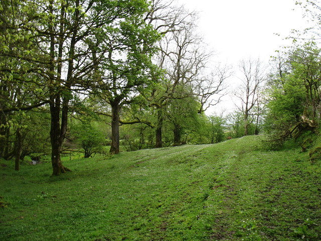
Frizington Images

Images are sourced within 2km of 54.543545/-3.493222 or Grid Reference NY0317. Thanks to Geograph Open Source API. All images are credited.

Site of Arlecdon station View south towards Winder Brow. Until closed finally from 7/8/38 - to passengers on 1/1/27, the branch from Distington (to the left) of the former Cleator & Workington Junction Railway had run to Rowrah (to the right). The Pullman car now used at the Hound Inn, Arlecdon  as a restaurant must have been brought by road!
Site of Arlecdon station
View south towards Winder Brow. Until closed finally from 7/8/38 - to passengers on 1/1/27, the branch from Distington (to the left) of the former Cleator & Workington Junction Railway had run to Rowrah (to the right). The Pullman car now used at the Hound Inn, Arlecdon as a restaurant must have been brought by road!
Approaching the A5086 The hill in the distance is Grike, south-west of Ennerdale Water.
Approaching the A5086
The hill in the distance is Grike, south-west of Ennerdale Water.
The minor road from Arlecdon to Whitehaven
Farmland near Arlecdon The hills south of Ennerdale Water are on the skyline.
Farmland near Arlecdon
The hills south of Ennerdale Water are on the skyline.
Cycle track at Winder The cycle track is on the line of a disused railway. The overbridge carries a fairly new (ca. 2000) private access road to the Eskett Quarries, which relieved Winder itself of the heavy traffic.
Cycle track at Winder
The cycle track is on the line of a disused railway. The overbridge carries a fairly new (ca. 2000) private access road to the Eskett Quarries, which relieved Winder itself of the heavy traffic.
The road to Eskett Quarries This private road was built, I think about 15 years ago, to relieve the village of Winder from heavy quarry traffic.
The road to Eskett Quarries
This private road was built, I think about 15 years ago, to relieve the village of Winder from heavy quarry traffic.
Woodland near Winder Pleasant country on the footpath to Rowrah. If, of course, you can ignore the activity in the quarry behind you!
Woodland near Winder
Pleasant country on the footpath to Rowrah. If, of course, you can ignore the activity in the quarry behind you!
The Recycling Centre at Frizington Not identified on the map and difficult to find using road signs.
The Recycling Centre at Frizington
Not identified on the map and difficult to find using road signs.
Rough ground at Frizington The sign says "No Trespassing, No Footpath".
Rough ground at Frizington
The sign says "No Trespassing, No Footpath".
Looking towards Frizington from the B5294 outside the old vicarage This is taken from just outside of where I live.
Looking towards Frizington from the B5294 outside the old vicarage
This is taken from just outside of where I live.
Acre Walls Farmland Acre Walls farm itself is in the Dark woods mid photo and the background is the western lake district mountains.
Acre Walls Farmland
Acre Walls farm itself is in the Dark woods mid photo and the background is the western lake district mountains.
Arlecdon Hill from the road
Private road to Hesketh Quarry. Roadstone quarry still in operation.
Private road to Hesketh Quarry.
Roadstone quarry still in operation.
Routen Syke.
Routen Syke.
Eskett Quarry. A huge working quarry.
Eskett Quarry.
A huge working quarry.
Winder and phone box. There can not be many red ones left are there?
Winder and phone box.
There can not be many red ones left are there?
Frizington Junior School. No they are not giant crayons they are fenceposts painted to look like crayons.
Frizington Junior School.
No they are not giant crayons they are fenceposts painted to look like crayons.
Main road left, no through road right, farm ahead. Men at work sign, hydrant post this junction is just oversigned.
Main road left, no through road right, farm ahead.
Men at work sign, hydrant post this junction is just oversigned.
Show me another place!

Frizington is located at Grid Ref: NY0317 (Lat: 54.543545, Lng: -3.493222)

Administrative County: Cumbria

District: Copeland

Police Authority: Cumbria

What 3 Words

///lunch.active.consoles. Near Frizington, Cumbria

Nearby Locations

Frizington

Related Wikis

St Paul, Frizington

St Paul's is in Frizington, Cumbria, England. It is an active Anglican parish church in the deanery of Calder, and the diocese of Carlisle. Its benefice...

High Leys

High Leys is located to the south-east of Rowrah in Cumbria (map), along the C2C cycle route prior to Sheriffs Gate. The status of national nature reserve...

Yeathouse railway station

Yeathouse railway station was a later addition to the Whitehaven, Cleator and Egremont Railway. It served the communities of Yeathouse and Eskett, near...

Arlecdon

Arlecdon is a village in the Borough of Copeland in Cumbria, England, near the town of Whitehaven. == Church == St Michael's Parish church is an historic...

Nearby Amenities

Located within 500m of 54.543545,-3.493222
Frizington
Place: village
Source: npe
Wikidata: Q5505085
Wikipedia: en:Frizington
Lat/Long: 54.539383/-3.4937716
Mini Roundabout
Direction: clockwise
Lat/Long: 54.5403622/-3.495137
Post Box
Ref: CA26 81
Lat/Long: 54.5407327/-3.495127
iron mine
Historic: mine
Mineral: iron
Source: npe
Lat/Long: 54.5433528/-3.4907917
Bus Stop
Harras Villas
Local Ref: AT
Naptan AtcoCode: 090050010048
Naptan Bearing: N
Naptan CommonName: Harras Villas
Naptan Indicator: at
Naptan Landmark: Bus Turning Area
Naptan NaptanCode: cumatjtd
Naptan Street: No name
Naptan Verified: no
Source: naptan_import
Lat/Long: 54.5456434/-3.4886596
Bus Stop
Kangol Factory
Local Ref: AT
Naptan AtcoCode: 090050010336
Naptan Bearing: S
Naptan CommonName: Kangol Factory
Naptan Indicator: at
Naptan Landmark: factory car park
Naptan NaptanCode: cumatjtm
Naptan Street: A5086
Naptan Verified: no
Shelter: yes
Source: naptan_import
Lat/Long: 54.5397006/-3.494904
Bus Stop
Main Street at Yeathouse Road (N bound)
Naptan AtcoCode: 090050010342
Naptan Bearing: N
Naptan BusStopType: CUS
Naptan CommonName: Main Street at Yeathouse Road (N bound)
Naptan Indicator: opp
Naptan Landmark: junction with Yeathouse Road
Naptan NaptanCode: cumatjwd
Naptan Street: Main Street
Naptan Verified: no
Source: naptan_import
Lat/Long: 54.5423791/-3.4931629
Bus Stop
Main Street at Yeathouse Road (S bound)
Naptan AtcoCode: 090050010343
Naptan Bearing: S
Naptan CommonName: Main Street at Yeathouse Road (S bound)
Naptan Indicator: o/s
Naptan Landmark: Chapel near Yeathouse Road
Naptan NaptanCode: cumatjwg
Naptan Street: Main Street
Naptan Verified: no
Source: naptan_import
Lat/Long: 54.5424726/-3.4928726
Bus Stop
Library (S bound)
Naptan AtcoCode: 090050010348
Naptan Bearing: S
Naptan CommonName: Library (S bound)
Naptan Indicator: o/s
Naptan Landmark: School complex
Naptan NaptanCode: cumatjwj
Naptan Street: A5086
Naptan Verified: no
Source: naptan_import
Lat/Long: 54.5448762/-3.4903786
Bus Stop
Library (N bound)
Naptan AtcoCode: 090050010349
Naptan Bearing: N
Naptan CommonName: Library (N bound)
Naptan Indicator: o/s
Naptan Landmark: The Misty Isle
Naptan NaptanCode: cumatjwm
Naptan Street: Main Street
Naptan Verified: no
Source: naptan_import
Lat/Long: 54.5451014/-3.4903404
Bus Stop
Moor Place
Bench: no
Covered: no
Naptan AtcoCode: 090050010351
Naptan Bearing: S
Naptan CommonName: Moor Place
Naptan Indicator: near
Naptan Landmark: junction with Moor Place
Naptan NaptanCode: cumatjwp
Naptan Street: A5086
Naptan Verified: no
Shelter: yes
Source: naptan_import
Lat/Long: 54.5462969/-3.4889392
Bus Stop
Main Street- Chemist
Naptan AtcoCode: 090050012716
Naptan Bearing: N
Naptan CommonName: Main Street- Chemist
Naptan Indicator: o/s
Naptan Landmark: Chemist Shop
Naptan NaptanCode: cumatmaw
Naptan Street: A5086
Naptan Verified: no
Source: naptan_import
Lat/Long: 54.5412135/-3.494388
Turning Circle
Lat/Long: 54.5423385/-3.4948148
Turning Circle
Lat/Long: 54.5397834/-3.4897829
Pharmacy
Boots
Addr City: Frizington
Addr Housenumber: 6-8
Addr Postcode: CA26 3SA
Addr Street: Main Street
Brand Wikidata: Q6123139
Operator: Boots
Phone: +44 1946 810352
Website: https://www.boots.com/stores/1406-frizington-main-street-ca26-3sa
Lat/Long: 54.5411805/-3.4944891
Historic: memorial
Lat/Long: 54.5444093/-3.4912171
Traffic Signals
Crossing: traffic_signals
Crossing Ref: puffin
Lat/Long: 54.5444262/-3.4909611
Post Box
Ref: CA26 96
Lat/Long: 54.5406361/-3.4884296
Post Box
Post Box Type: lamp
Ref: CA26 143
Lat/Long: 54.545343/-3.4899448
Man Made: tower
Lat/Long: 54.5443637/-3.4921356
The Cutting Room
Addr City: Frizington
Addr Housenumber: 148
Addr Postcode: CA26 3SB
Addr Street: Main Street
Phone: +44 1946 810460
Shop: hairdresser
Lat/Long: 54.5416235/-3.493723
Cumbrian Beauty And Nails
Addr City: Frizington
Addr Housenumber: 148
Addr Postcode: CA26 3SB
Addr Street: Main Street
Phone: +44 7570 950 083
Shop: beauty
Website: http://cumbrianbeauty.com/
Lat/Long: 54.5416042/-3.4935918
Stephen Burns
Addr City: Frizington
Addr Housenumber: 151
Addr Postcode: CA26 3SB
Addr Street: Main Street
Shop: bookmaker
Lat/Long: 54.5415619/-3.4938286
F Irving & Sons.
Addr City: Frizington
Addr Housenumber: 53
Addr Postcode: CA26 3SB
Addr Street: Main Street
Craft: carpenter
Phone: +44 1946 810473
Lat/Long: 54.5414777/-3.4938569
F Irving & Sons
Addr City: Frizington
Addr Housenumber: 153
Addr Postcode: CA26 3SB
Addr Street: Main Street
Phone: +44 1946 810473
Shop: funeral_directors
Website: https://www.irvingsfunerals.com/
Lat/Long: 54.5414223/-3.4938481
Traffic Signals
Lat/Long: 54.5408256/-3.4946686
Thompson's Bakery
Addr City: Frizington
Addr Housenumber: 165
Addr Postcode: CA26 3SB
Addr Street: Main Street
Phone: +44 1946 810572
Shop: bakery
Lat/Long: 54.5410205/-3.494346
M Parker
Addr City: Frizington
Addr Housenumber: 138
Addr Postcode: CA26 3SB
Addr Street: Main Street
Phone: +44 1946 812 255
Shop: butcher
Lat/Long: 54.5416103/-3.4937868
Post Office
Frizington Post Office
Addr City: Frizington
Addr Country: GB
Addr Postcode: CA26 3SA
Addr Street: Main Street
Branch: Frizington
Brand: Post Office
Brand Wikidata: Q1783168
Check Date: 2022-05-27
Check Date Opening Hours: 2022-05-27
Contact Website: https://www.postoffice.co.uk/branch-finder/2844109/frizington
Opening Hours: Mo 08:30-17:00; Tu-Fr 09:00-17:00; Sa 09:00-12:00
Ref Pol Id: 11409
Lat/Long: 54.5407907/-3.4951465
Lifestyle Choice
Addr City: Frizington
Addr Street: Main Street
Shop: convenience
Lat/Long: 54.5407419/-3.4949994
Simply Booze
Addr City: Frizington
Addr Street: Frizington Road
Shop: alcohol
Lat/Long: 54.5400037/-3.495293
Noexit: yes
Lat/Long: 54.5394198/-3.4915382
Power: pole
Lat/Long: 54.5403804/-3.4987014
Give Way
Direction: forward
Lat/Long: 54.5412253/-3.4900649
Give Way
Direction: forward
Lat/Long: 54.5413614/-3.4902398
Power: pole
Lat/Long: 54.5402788/-3.4962363
Power: pole
Lat/Long: 54.5400229/-3.4974716
Power: pole
Lat/Long: 54.5410731/-3.4983333
Power: pole
Lat/Long: 54.5426085/-3.489443
Power: pole
Lat/Long: 54.5427871/-3.4876361
Power: pole
Lat/Long: 54.5433629/-3.4864045
Power: pole
Lat/Long: 54.5449539/-3.4870588
Power: pole
Lat/Long: 54.5444698/-3.4858333
Power: pole
Lat/Long: 54.5420921/-3.4975274
Power: pole
Lat/Long: 54.5432225/-3.4960872
The data included in this document is from www.openstreetmap.org. The data is made available under ODbL.

Have you been to Frizington?

Leave your review of Frizington below (or comments, questions and feedback).