Charters Copse

Wood, Forest in Kent Dover

England

Charters Copse

Kepple Downe, London Road A house destined to be demolished.
Kepple Downe, London Road Credit: John Baker

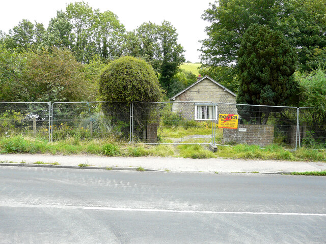
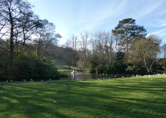
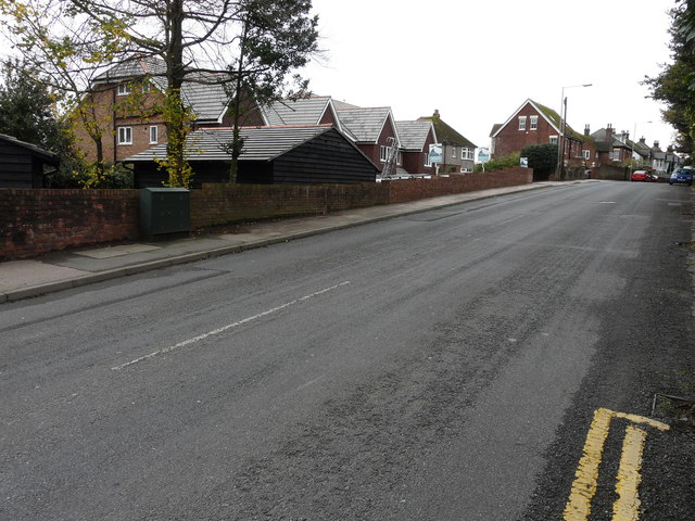
Charters Copse is a picturesque woodland located in the county of Kent, England. Situated on the outskirts of the charming village of Charters Copse, this woodland is a haven for nature lovers and outdoor enthusiasts alike. Stretching across an area of approximately 100 acres, Charters Copse is a thriving ecosystem that boasts a diverse range of plant and animal species.

The woodland is primarily composed of broad-leafed trees such as oak, beech, and chestnut, which create a dense canopy overhead. This canopy provides shade and shelter for an array of wildlife, including squirrels, rabbits, and various species of birds. The forest floor is carpeted with an assortment of wildflowers and ferns, adding to the overall beauty and tranquility of the area.

Charters Copse is crisscrossed by a network of well-maintained footpaths and trails, allowing visitors to explore the woodland at their leisure. These paths wind their way through the trees, leading to secluded clearings and hidden glades, providing ample opportunities for peaceful picnics or simply enjoying the serenity of nature.

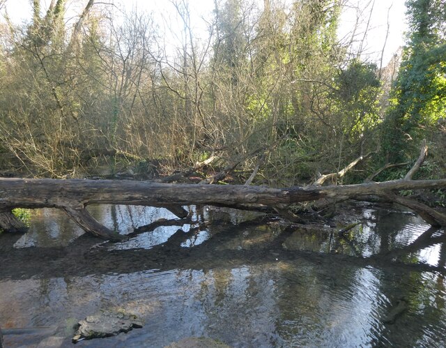
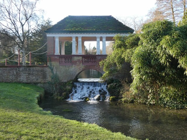
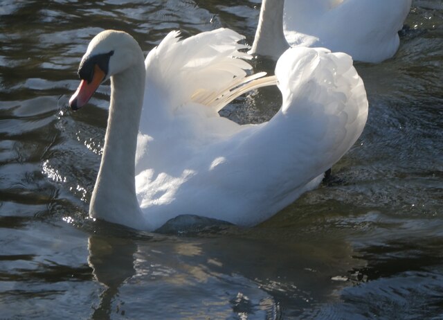
The woodland is also home to a small stream that meanders through its heart, adding to the charm and natural beauty of Charters Copse. This stream attracts a variety of aquatic wildlife, including frogs, newts, and dragonflies.

Charters Copse is a popular destination for hikers, dog walkers, and nature photographers, who come to appreciate its natural splendor throughout the year. With its breathtaking scenery and abundance of wildlife, Charters Copse is a true gem in the Kent countryside.

If you have any feedback on the listing, please let us know in the comments section below.

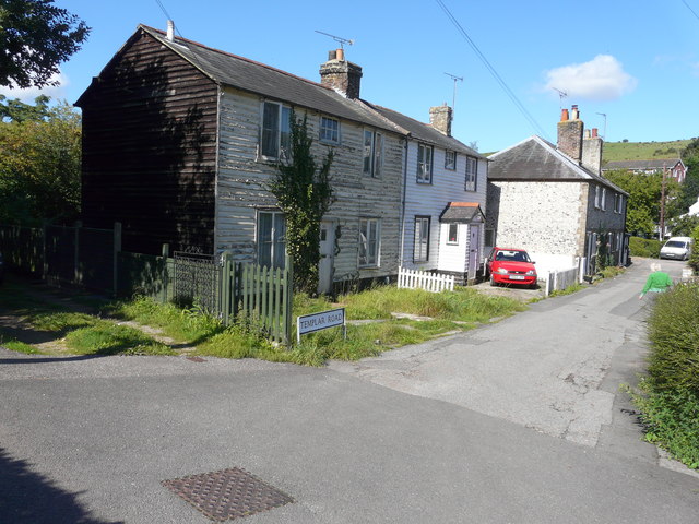
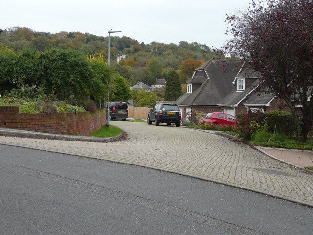
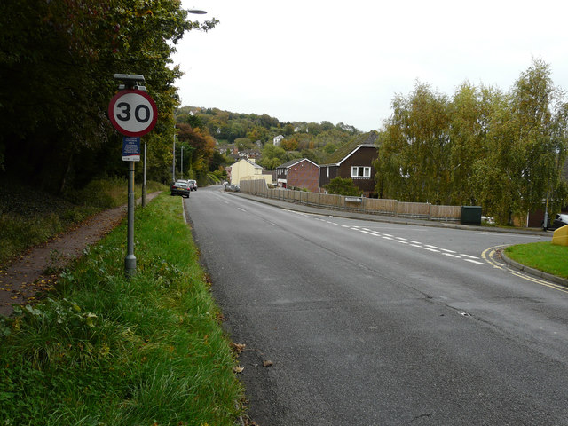
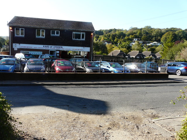
Charters Copse Images

Images are sourced within 2km of 51.146793/1.2524008 or Grid Reference TR2743. Thanks to Geograph Open Source API. All images are credited.

Kepple Downe, London Road A house destined to be demolished.
Kepple Downe, London Road
A house destined to be demolished.
Vacant plot, London Road The plot is for sale through the estate agents Thomas & partners of Dover. It was the location of <a href="https://www.geograph.org.uk/photo/6943975">TR2744 : Kepple Downe, London Road</a>, until the house was demolished.

Planning permission has been granted by Dover District Council under application number DOV/21/01728 for the “erection of a detached dwelling, solar panel to roof slope, car port, cycle store, turning area, new vehicular access, associated parking and landscaping (existing dwelling to be demolished)”.
Vacant plot, London Road
The plot is for sale through the estate agents Thomas & partners of Dover. It was the location of TR2744 : Kepple Downe, London Road, until the house was demolished. Planning permission has been granted by Dover District Council under application number DOV/21/01728 for the “erection of a detached dwelling, solar panel to roof slope, car port, cycle store, turning area, new vehicular access, associated parking and landscaping (existing dwelling to be demolished)”.
Lebanon cedar, Kearsney Abbey Cedrus libani, or Cedar of Lebanon. An ancient tree, believed to be 400 - 500 years old, that is fenced off because it is considered dangerous due to branches that fall off each year.
Lebanon cedar, Kearsney Abbey
Cedrus libani, or Cedar of Lebanon. An ancient tree, believed to be 400 - 500 years old, that is fenced off because it is considered dangerous due to branches that fall off each year.
The lake, Kearsney Abbey
Fallen tree, Kearsney Abbey Viewed from the footbridge at the south eastern end of the boating lake.
Fallen tree, Kearsney Abbey
Viewed from the footbridge at the south eastern end of the boating lake.
Russell Gardens, Kearsney Russell Gardens is Grade II Listed. It covers 10 hectares and is laid out in a formal style. They were designed by the renowned Edwardian landscape architect, Thomas H. Mawson (1861-1933). The 170m long canal pond, and Palladian-style pergola bridges and boathouse pavilion form the central architectural features of the park.
Russell Gardens, Kearsney
Russell Gardens is Grade II Listed. It covers 10 hectares and is laid out in a formal style. They were designed by the renowned Edwardian landscape architect, Thomas H. Mawson (1861-1933). The 170m long canal pond, and Palladian-style pergola bridges and boathouse pavilion form the central architectural features of the park.
Kearsney Court, Russell Gardens Kearsney Court was planned in 1899 for Alfred Leney, a brewer and drinks manufacturer. However, the project was soon sold on to Edward Percy Barlow, the owner of Wiggins Teape, a paper manufacturer. The house was completed about 1900, and at about the same time the grounds were laid out by Thomas Mawson (1861-1933). On Barlow's death in 1912 the property passed to Mr. Johnstone, a London newspaper man, and was later a nursing home and, in the Second World War, a military hospital. About 1950 the whole estate was bought by a development company; the main house was split into seven residential freeholds, and later several new houses were erected off the main drive. Part of the grounds, including the lowest third of the formal gardens, was acquired by the local authority for a park, now known as Russell Gardens.
Kearsney Court, Russell Gardens
Kearsney Court was planned in 1899 for Alfred Leney, a brewer and drinks manufacturer. However, the project was soon sold on to Edward Percy Barlow, the owner of Wiggins Teape, a paper manufacturer. The house was completed about 1900, and at about the same time the grounds were laid out by Thomas Mawson (1861-1933). On Barlow's death in 1912 the property passed to Mr. Johnstone, a London newspaper man, and was later a nursing home and, in the Second World War, a military hospital. About 1950 the whole estate was bought by a development company; the main house was split into seven residential freeholds, and later several new houses were erected off the main drive. Part of the grounds, including the lowest third of the formal gardens, was acquired by the local authority for a park, now known as Russell Gardens.
Mute swan, Kearsney Abbey On the Boating Lake. There are dozens of swans and cygnets on the lakes.
Mute swan, Kearsney Abbey
On the Boating Lake. There are dozens of swans and cygnets on the lakes.
The lake, Kearsney Abbey
Temple Ewell’s Christmas tree 2021 The tree stands near to a substantial bus stop shelter. The shelter and bus stop  are visible in the image of <a href="https://www.geograph.org.uk/photo/6748552">TR2844 : Laying a gas main</a>.
Temple Ewell’s Christmas tree 2021
The tree stands near to a substantial bus stop shelter. The shelter and bus stop are visible in the image of TR2844 : Laying a gas main.
Living Well Church, Canterbury Road Planning permission has been granted by Dover District Council under application number DOV/22/01181  for a “change of use and conversion to 2 dwellings with associated parking and landscaping”.
Living Well Church, Canterbury Road
Planning permission has been granted by Dover District Council under application number DOV/22/01181  for a “change of use and conversion to 2 dwellings with associated parking and landscaping”.
Maraval, 113, London Road, Temple Ewell Planning permission has been granted by Dover District Council under application number DOV/
22/01551 for the ”erection of single storey side/rear extensions, alterations to windows/doors, new porch roof, and external materials (existing garage, outbuilding and front extension to be demolished)”.
Maraval, 113, London Road, Temple Ewell
Planning permission has been granted by Dover District Council under application number DOV/ 22/01551 for the ”erection of single storey side/rear extensions, alterations to windows/doors, new porch roof, and external materials (existing garage, outbuilding and front extension to be demolished)”.
34, Templar Road The exterior of the house, with its flaking paint, gives it the appearance of being uninhabited. However one of the first floor windows was slightly ajar.
34, Templar Road
The exterior of the house, with its flaking paint, gives it the appearance of being uninhabited. However one of the first floor windows was slightly ajar.
Close off Watersend This close could be the access to ten semi-detached dwellings. Planning permission has been granted by Dover District Council under application number DOV/15/00123 for the “erection of ten semi-detached dwellings and creation of vehicular access and parking spaces (existing bungalow and garage to be demolished)(amended plans)”. It has been pointed out in comments, made by objectors, that the block-paving road surface would have to be replaced with one that is more suitable for greater use, should the houses be built.
Close off Watersend
This close could be the access to ten semi-detached dwellings. Planning permission has been granted by Dover District Council under application number DOV/15/00123 for the “erection of ten semi-detached dwellings and creation of vehicular access and parking spaces (existing bungalow and garage to be demolished)(amended plans)”. It has been pointed out in comments, made by objectors, that the block-paving road surface would have to be replaced with one that is more suitable for greater use, should the houses be built.
London Road The building, opposite the parked cars, is a garage at 191, London Road. Planning permission has been granted by Dover District Council under application number DOV/15/00123 for the “erection of ten semi-detached dwellings and creation of vehicular access and parking spaces (existing bungalow and garage to be demolished)(amended plans)”. Access to the dwellings would be via Watersend (the road to the right) and the <a href="https://www.geograph.org.uk/photo/4719057">TR2844 : Close off Watersend</a>. The location of the planning application reads land at 191 and Forge Bungalow, London Road, Temple Ewell.
London Road
The building, opposite the parked cars, is a garage at 191, London Road. Planning permission has been granted by Dover District Council under application number DOV/15/00123 for the “erection of ten semi-detached dwellings and creation of vehicular access and parking spaces (existing bungalow and garage to be demolished)(amended plans)”. Access to the dwellings would be via Watersend (the road to the right) and the TR2844 : Close off Watersend. The location of the planning application reads land at 191 and Forge Bungalow, London Road, Temple Ewell.
Kars of Lydden, 191, London Road Planning permission has been granted by Dover District Council under application number DOV/15/00123 for the “erection of ten semi-detached dwellings and creation of vehicular access and parking spaces (existing bungalow and garage to be demolished)(amended plans)”. The location of the planning application reads land at 191 and Forge Bungalow, London Road, Temple Ewell. Only the chimney of Forge Bungalow can be seen, to the right of the garage, as it lies downhill from the garage.
Kars of Lydden, 191, London Road
Planning permission has been granted by Dover District Council under application number DOV/15/00123 for the “erection of ten semi-detached dwellings and creation of vehicular access and parking spaces (existing bungalow and garage to be demolished)(amended plans)”. The location of the planning application reads land at 191 and Forge Bungalow, London Road, Temple Ewell. Only the chimney of Forge Bungalow can be seen, to the right of the garage, as it lies downhill from the garage.
Hamilton Mews, London Road Compared with <a href="https://www.geograph.org.uk/photo/4524700">TR2943 : 107, London Road</a>, their construction has been completed and the houses sold.
Hamilton Mews, London Road
Compared with TR2943 : 107, London Road, their construction has been completed and the houses sold.
London Road Compared with <a href="https://www.geograph.org.uk/photo/4719103">TR2844 : London Road</a>, a row of conifers has been planted along the grass verge and it is now only possible for cars to park, along this verge, beyond the planting.
London Road
Compared with TR2844 : London Road, a row of conifers has been planted along the grass verge and it is now only possible for cars to park, along this verge, beyond the planting.
Show me another place!

Charters Copse is located at Grid Ref: TR2743 (Lat: 51.146793, Lng: 1.2524008)

Administrative County: Kent

District: Dover

Police Authority: Kent

What 3 Words

///admit.legend.shins. Near Dover, Kent

Nearby Locations

Ghost Hill Charters Copse

Related Wikis

Kearsney, Kent

Kearsney is a village in Kent, England. At one time it would have been called a hamlet, there being no church there. The population of the village is included...
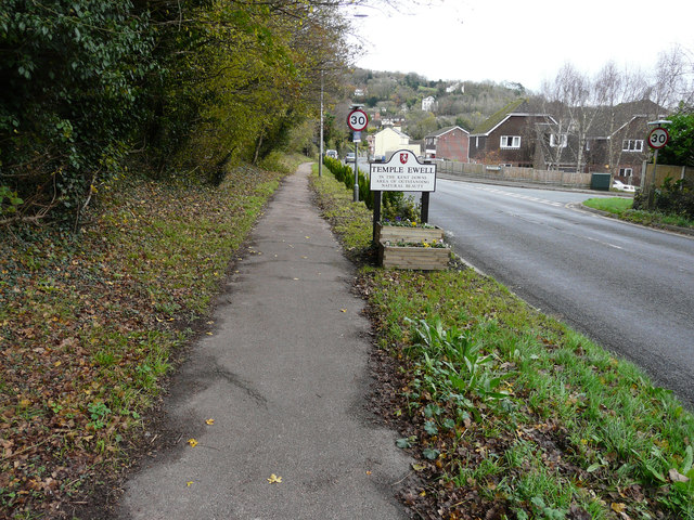
Temple Ewell

Temple Ewell is a civil parish and historic village in the county of Kent, England. The village is part of the Dover district of Kent, and forms part...

Ewell Minnis

Ewell Minnis is a village near Dover in Kent, England. The population is included in the civil parish of Alkham. See Stelling Minnis for information on...

Kearsney railway station

Kearsney railway station is on the Dover branch of the Chatham Main Line in England, and serves Kearsney and Temple Ewell. It is 75 miles 9 chains (120...

Nearby Amenities

Located within 500m of 51.146793,1.2524008
Barrier: stile
Lat/Long: 51.1484915/1.2530906
The data included in this document is from www.openstreetmap.org. The data is made available under ODbL.

Have you been to Charters Copse?

Leave your review of Charters Copse below (or comments, questions and feedback).