Garglehill Plantation

Wood, Forest in Norfolk Broadland

England

Garglehill Plantation

Pound Lane past Belmore Plantation, Thorpe St Andrew Belmore Plantation is one of three woodlands (Racecourse, Belmore and Brown’s Plantations) in Thorpe St Andrew, just outside Norwich. Their total area is 205 acres (82 hectares), and together they form the largest area of woodland within several miles of Norwich. The woodlands are owned by the Thorpe & Felthorpe Trust, the Trustees of which are five members of the Gurney family. Local residents are opposing a developer's plan to build 631 housing 'units' here.
Pound Lane past Belmore Plantation, Thorpe St Andrew Credit: Evelyn Simak

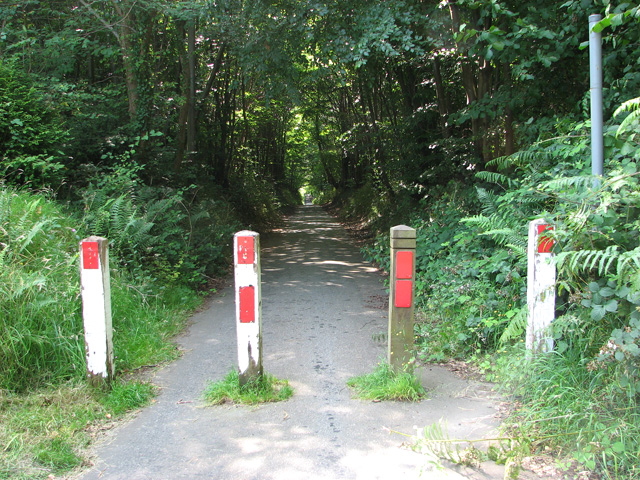
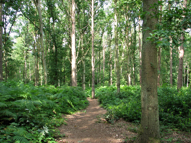
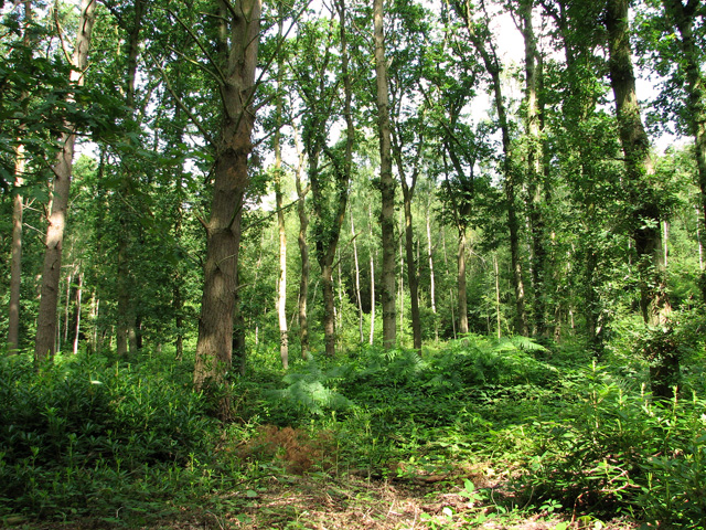
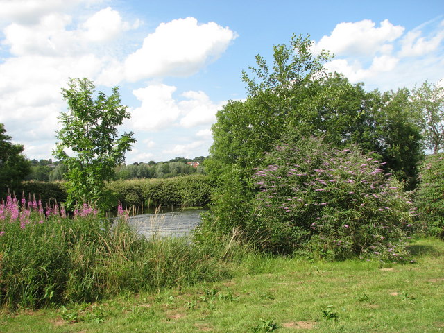
Garglehill Plantation is a charming woodland area located in Norfolk, England. Situated in the heart of picturesque countryside, this plantation is a haven for nature enthusiasts and outdoor adventurers alike. Spanning a vast area of lush greenery, Garglehill Plantation is primarily composed of a diverse mix of deciduous and evergreen trees, creating a beautiful and serene forest ecosystem.

The plantation is well-maintained and offers a network of well-marked trails that wind through the woods, providing visitors with the opportunity to explore and immerse themselves in the natural surroundings. The trails range in difficulty, catering to both casual walkers and experienced hikers.

Within the plantation, there is a variety of flora and fauna to discover. Native wildflowers dot the forest floor, while birds chirp melodiously from the treetops. It is not uncommon to spot squirrels scurrying through the branches or deer grazing peacefully in the open meadows.

Garglehill Plantation is a popular destination for outdoor activities such as hiking, birdwatching, and nature photography. The tranquil atmosphere and stunning scenery make it an ideal location for those seeking a peaceful retreat from the hustle and bustle of everyday life.

The plantation is open to the public year-round, and there are picnic areas and benches strategically placed throughout the site, allowing visitors to relax and enjoy the beauty of their surroundings. Whether you're a nature lover, an adventurer, or simply someone looking to unwind in a tranquil setting, Garglehill Plantation is sure to captivate and rejuvenate all who visit.

If you have any feedback on the listing, please let us know in the comments section below.

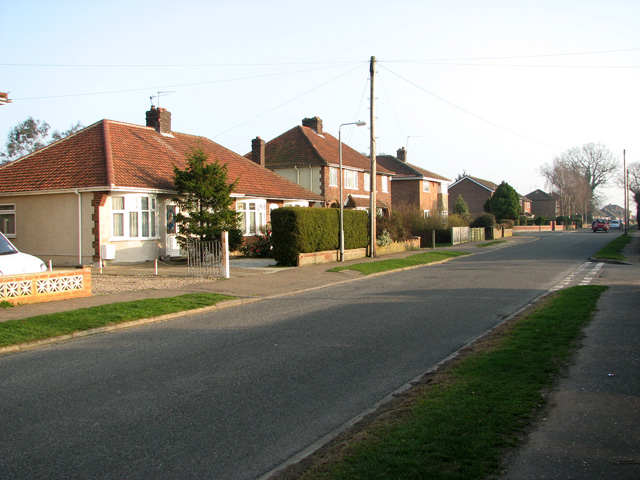
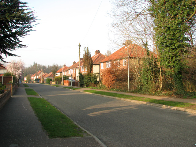
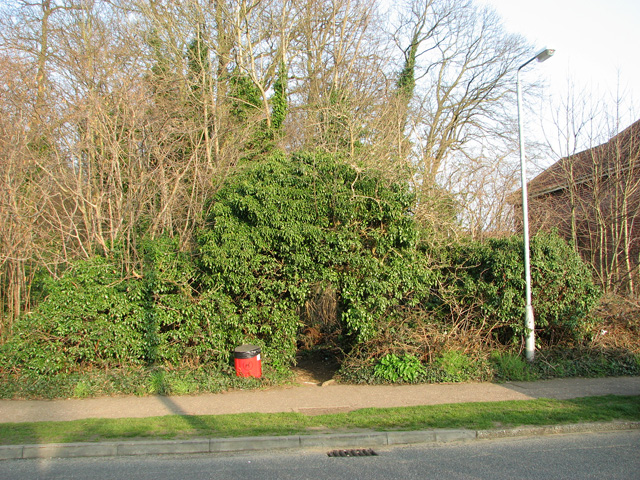
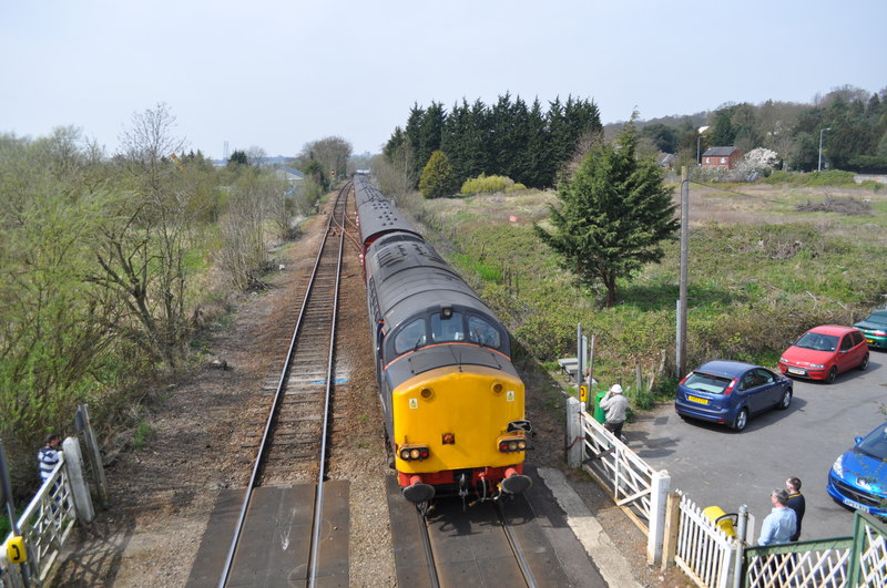
Garglehill Plantation Images

Images are sourced within 2km of 52.631935/1.3529153 or Grid Reference TG2609. Thanks to Geograph Open Source API. All images are credited.

Pound Lane past Belmore Plantation, Thorpe St Andrew Belmore Plantation is one of three woodlands (Racecourse, Belmore and Brown’s Plantations) in Thorpe St Andrew, just outside Norwich. Their total area is 205 acres (82 hectares), and together they form the largest area of woodland within several miles of Norwich. The woodlands are owned by the Thorpe & Felthorpe Trust, the Trustees of which are five members of the Gurney family. Local residents are opposing a developer's plan to build 631 housing 'units' here.
Pound Lane past Belmore Plantation, Thorpe St Andrew
Belmore Plantation is one of three woodlands (Racecourse, Belmore and Brown’s Plantations) in Thorpe St Andrew, just outside Norwich. Their total area is 205 acres (82 hectares), and together they form the largest area of woodland within several miles of Norwich. The woodlands are owned by the Thorpe & Felthorpe Trust, the Trustees of which are five members of the Gurney family. Local residents are opposing a developer's plan to build 631 housing 'units' here.
Belmore Plantation as seen from Pound Lane, Thorpe St Andrew Belmore Plantation is one of three woodlands (Racecourse, Belmore and Brown’s Plantations) in Thorpe St Andrew, just outside Norwich. Their total area is 205 acres (82 hectares), and together they form the largest area of woodland within several miles of Norwich. The woodlands are owned by the Thorpe & Felthorpe Trust, the Trustees of which are five members of the Gurney family. Local residents are opposing a developer's plan to build 631 housing 'units' here.
Belmore Plantation as seen from Pound Lane, Thorpe St Andrew
Belmore Plantation is one of three woodlands (Racecourse, Belmore and Brown’s Plantations) in Thorpe St Andrew, just outside Norwich. Their total area is 205 acres (82 hectares), and together they form the largest area of woodland within several miles of Norwich. The woodlands are owned by the Thorpe & Felthorpe Trust, the Trustees of which are five members of the Gurney family. Local residents are opposing a developer's plan to build 631 housing 'units' here.
Cottages in Pound Lane, Thorpe St Andrew
Cottages on the edge of Belmore Plantation, Thorpe St Andrew The tree in the foreground (right) is a large redwood tree. The term 'redwood' generally refers to one of several species of tree with red or reddish coloured wood; the bark of mature trees is commonly orange to red-brown in colour and of a stringy texture. Redwoods are conifers of the Cupressaceae or cypress family that has a worldwide distribution ranging from arctic Norway to southern Chile.

Belmore Plantation is one of three woodlands (Racecourse, Belmore and Brown’s Plantations) in Thorpe St Andrew, just outside Norwich. Their total area is 205 acres (82 hectares), and together they form the largest area of woodland within several miles of Norwich. The woodlands are owned by the Thorpe & Felthorpe Trust, the Trustees of which are five members of the Gurney family. Local residents are opposing a developer's plan to build 631 housing 'units' here.
Cottages on the edge of Belmore Plantation, Thorpe St Andrew
The tree in the foreground (right) is a large redwood tree. The term 'redwood' generally refers to one of several species of tree with red or reddish coloured wood; the bark of mature trees is commonly orange to red-brown in colour and of a stringy texture. Redwoods are conifers of the Cupressaceae or cypress family that has a worldwide distribution ranging from arctic Norway to southern Chile. Belmore Plantation is one of three woodlands (Racecourse, Belmore and Brown’s Plantations) in Thorpe St Andrew, just outside Norwich. Their total area is 205 acres (82 hectares), and together they form the largest area of woodland within several miles of Norwich. The woodlands are owned by the Thorpe & Felthorpe Trust, the Trustees of which are five members of the Gurney family. Local residents are opposing a developer's plan to build 631 housing 'units' here.
Redwood tree on the edge of Belmore Plantation, Thorpe St Andrew In a class of its own and standing out from the surrounding broadleaf trees this large redwood tree is growing on the edge of Belmore Plantation. The term 'redwood' generally refers to one of several species of tree with red or reddish coloured wood; the bark of mature trees is commonly orange to red-brown in colour and of a stringy texture. Redwoods are conifers of the Cupressaceae or cypress family that has a worldwide distribution ranging from arctic Norway to southern Chile.

Belmore Plantation is one of three woodlands (Racecourse, Belmore and Brown’s Plantations) in Thorpe St Andrew, just outside Norwich. Their total area is 205 acres (82 hectares), and together they form the largest area of woodland within several miles of Norwich. The woodlands are owned by the Thorpe & Felthorpe Trust, the Trustees of which are five members of the Gurney family. Local residents are opposing a developer's plan to build 631 housing 'units' here.
Redwood tree on the edge of Belmore Plantation, Thorpe St Andrew
In a class of its own and standing out from the surrounding broadleaf trees this large redwood tree is growing on the edge of Belmore Plantation. The term 'redwood' generally refers to one of several species of tree with red or reddish coloured wood; the bark of mature trees is commonly orange to red-brown in colour and of a stringy texture. Redwoods are conifers of the Cupressaceae or cypress family that has a worldwide distribution ranging from arctic Norway to southern Chile. Belmore Plantation is one of three woodlands (Racecourse, Belmore and Brown’s Plantations) in Thorpe St Andrew, just outside Norwich. Their total area is 205 acres (82 hectares), and together they form the largest area of woodland within several miles of Norwich. The woodlands are owned by the Thorpe & Felthorpe Trust, the Trustees of which are five members of the Gurney family. Local residents are opposing a developer's plan to build 631 housing 'units' here.
Dry pond in Belmore Plantation, Thorpe St Andrew Belmore Plantation is one of three woodlands (Racecourse, Belmore and Brown’s Plantations) in Thorpe St Andrew, just outside Norwich. Their total area is 205 acres (82 hectares), and together they form the largest area of woodland within several miles of Norwich. The woodlands are owned by the Thorpe & Felthorpe Trust, the Trustees of which are five members of the Gurney family. Local residents are opposing a developer's plan to build 631 housing 'units' here.
Dry pond in Belmore Plantation, Thorpe St Andrew
Belmore Plantation is one of three woodlands (Racecourse, Belmore and Brown’s Plantations) in Thorpe St Andrew, just outside Norwich. Their total area is 205 acres (82 hectares), and together they form the largest area of woodland within several miles of Norwich. The woodlands are owned by the Thorpe & Felthorpe Trust, the Trustees of which are five members of the Gurney family. Local residents are opposing a developer's plan to build 631 housing 'units' here.
Path past ponds in Belmore Plantation, Thorpe St Andrew Belmore Plantation is one of three woodlands (Racecourse, Belmore and Brown’s Plantations) in Thorpe St Andrew, just outside Norwich. Their total area is 205 acres (82 hectares), and together they form the largest area of woodland within several miles of Norwich. The woodlands are owned by the Thorpe & Felthorpe Trust, the Trustees of which are five members of the Gurney family. Local residents are opposing a developer's plan to build 631 housing 'units' here.
Path past ponds in Belmore Plantation, Thorpe St Andrew
Belmore Plantation is one of three woodlands (Racecourse, Belmore and Brown’s Plantations) in Thorpe St Andrew, just outside Norwich. Their total area is 205 acres (82 hectares), and together they form the largest area of woodland within several miles of Norwich. The woodlands are owned by the Thorpe & Felthorpe Trust, the Trustees of which are five members of the Gurney family. Local residents are opposing a developer's plan to build 631 housing 'units' here.
Path in Belmore Plantation, Thorpe St Andrew Belmore Plantation is one of three woodlands (Racecourse, Belmore and Brown’s Plantations) in Thorpe St Andrew, just outside Norwich. Their total area is 205 acres (82 hectares), and together they form the largest area of woodland within several miles of Norwich. The woodlands are owned by the Thorpe & Felthorpe Trust, the Trustees of which are five members of the Gurney family. Local residents are opposing a developer's plan to build 631 housing 'units' here.
Path in Belmore Plantation, Thorpe St Andrew
Belmore Plantation is one of three woodlands (Racecourse, Belmore and Brown’s Plantations) in Thorpe St Andrew, just outside Norwich. Their total area is 205 acres (82 hectares), and together they form the largest area of woodland within several miles of Norwich. The woodlands are owned by the Thorpe & Felthorpe Trust, the Trustees of which are five members of the Gurney family. Local residents are opposing a developer's plan to build 631 housing 'units' here.
Pound Lane past Brown's Plantation, Thorpe St Andrew The woodland to the right (west) of the lane is Belmore Plantation. Belmore Plantation is one of three woodlands (Racecourse, Belmore and Brown’s Plantations) in Thorpe St Andrew, just outside Norwich. Their total area is 205 acres (82 hectares), and together they form the largest area of woodland within several miles of Norwich. The woodlands are owned by the Thorpe & Felthorpe Trust, the Trustees of which are five members of the Gurney family. Local residents are opposing a developer's plan to build 631 housing 'units' here.
Pound Lane past Brown's Plantation, Thorpe St Andrew
The woodland to the right (west) of the lane is Belmore Plantation. Belmore Plantation is one of three woodlands (Racecourse, Belmore and Brown’s Plantations) in Thorpe St Andrew, just outside Norwich. Their total area is 205 acres (82 hectares), and together they form the largest area of woodland within several miles of Norwich. The woodlands are owned by the Thorpe & Felthorpe Trust, the Trustees of which are five members of the Gurney family. Local residents are opposing a developer's plan to build 631 housing 'units' here.
The northern end of Pound Lane, Thorpe St Andrew
Bungalows by the southern edge of Belmore Plantation, Thorpe St Andrew
Path through bracken in Belmore Plantation, Thorpe St Andrew Belmore Plantation is one of three woodlands (Racecourse, Belmore and Brown’s Plantations) in Thorpe St Andrew, just outside Norwich. Their total area is 205 acres (82 hectares), and together they form the largest area of woodland within several miles of Norwich. The woodlands are owned by the Thorpe & Felthorpe Trust, the Trustees of which are five members of the Gurney family. Local residents are opposing a developer's plan to build 631 housing 'units' here.
Path through bracken in Belmore Plantation, Thorpe St Andrew
Belmore Plantation is one of three woodlands (Racecourse, Belmore and Brown’s Plantations) in Thorpe St Andrew, just outside Norwich. Their total area is 205 acres (82 hectares), and together they form the largest area of woodland within several miles of Norwich. The woodlands are owned by the Thorpe & Felthorpe Trust, the Trustees of which are five members of the Gurney family. Local residents are opposing a developer's plan to build 631 housing 'units' here.
Belmore Plantation, Thorpe St Andrew Belmore Plantation is one of three woodlands (Racecourse, Belmore and Brown’s Plantations) in Thorpe St Andrew, just outside Norwich. Their total area is 205 acres (82 hectares), and together they form the largest area of woodland within several miles of Norwich. The woodlands are owned by the Thorpe & Felthorpe Trust, the Trustees of which are five members of the Gurney family. Local residents are opposing a developer's plan to build 631 housing 'units' here.
Belmore Plantation, Thorpe St Andrew
Belmore Plantation is one of three woodlands (Racecourse, Belmore and Brown’s Plantations) in Thorpe St Andrew, just outside Norwich. Their total area is 205 acres (82 hectares), and together they form the largest area of woodland within several miles of Norwich. The woodlands are owned by the Thorpe & Felthorpe Trust, the Trustees of which are five members of the Gurney family. Local residents are opposing a developer's plan to build 631 housing 'units' here.
Cottages in South Hill Road, Thorpe St Andrew
Path into Belmore Plantation, Thorpe St Andrew Belmore Plantation is one of three woodlands (Racecourse, Belmore and Brown’s Plantations) in Thorpe St Andrew, just outside Norwich. Their total area is 205 acres (82 hectares), and together they form the largest area of woodland within several miles of Norwich. The woodlands are owned by the Thorpe & Felthorpe Trust, the Trustees of which are five members of the Gurney family. Local residents are opposing a developer's plan to build 631 housing 'units' here.
Path into Belmore Plantation, Thorpe St Andrew
Belmore Plantation is one of three woodlands (Racecourse, Belmore and Brown’s Plantations) in Thorpe St Andrew, just outside Norwich. Their total area is 205 acres (82 hectares), and together they form the largest area of woodland within several miles of Norwich. The woodlands are owned by the Thorpe & Felthorpe Trust, the Trustees of which are five members of the Gurney family. Local residents are opposing a developer's plan to build 631 housing 'units' here.
Footpath into Belmore Plantation Belmore Plantation is one of three woodlands (Racecourse, Belmore and Brown’s Plantations) in Thorpe St Andrew, just outside Norwich. Their total area is 205 acres (82 hectares), and together they form the largest area of woodland within several miles of Norwich. The woodlands are owned by the Thorpe & Felthorpe Trust, the Trustees of which are five members of the Gurney family. Local residents are opposing a developer's plan to build 631 housing 'units' here.
Footpath into Belmore Plantation
Belmore Plantation is one of three woodlands (Racecourse, Belmore and Brown’s Plantations) in Thorpe St Andrew, just outside Norwich. Their total area is 205 acres (82 hectares), and together they form the largest area of woodland within several miles of Norwich. The woodlands are owned by the Thorpe & Felthorpe Trust, the Trustees of which are five members of the Gurney family. Local residents are opposing a developer's plan to build 631 housing 'units' here.
Access into Belmore Plantation, Thorpe St Andrew Belmore Plantation is one of three woodlands (Racecourse, Belmore and Brown’s Plantations) in Thorpe St Andrew, just outside Norwich. Their total area is 205 acres (82 hectares), and together they form the largest area of woodland within several miles of Norwich. The woodlands are owned by the Thorpe & Felthorpe Trust, the Trustees of which are five members of the Gurney family. Local residents are opposing a developer's plan to build 631 housing 'units' here.
Access into Belmore Plantation, Thorpe St Andrew
Belmore Plantation is one of three woodlands (Racecourse, Belmore and Brown’s Plantations) in Thorpe St Andrew, just outside Norwich. Their total area is 205 acres (82 hectares), and together they form the largest area of woodland within several miles of Norwich. The woodlands are owned by the Thorpe & Felthorpe Trust, the Trustees of which are five members of the Gurney family. Local residents are opposing a developer's plan to build 631 housing 'units' here.
Show me another place!

Garglehill Plantation is located at Grid Ref: TG2609 (Lat: 52.631935, Lng: 1.3529153)

Administrative County: Norfolk

District: Broadland

Police Authority: Norfolk

What 3 Words

///agents.defend.pink. Near Thorpe Hamlet, Norfolk

Related Wikis

Broadland

Broadland is a local government district in Norfolk, England, named after the Norfolk Broads. Its council is based at the Broadland Business Park on the...

Thorpe St Andrew School

Thorpe St. Andrew School is an 11 to 18 mixed secondary school in Thorpe St. Andrew on the outskirts of the city of Norwich in the English county of Norfolk...

Thorpe St Andrew

Thorpe St Andrew is a town and civil parish in the Broadland district of Norfolk, England. It is situated on the River Yare, two miles east of the centre...

Whitlingham railway station

Whitlingham was a station in Whitlingham, Norfolk. The simple station has been demolished leaving no trace of its existence. However the footbridge is...

Thorpe Marshes

Thorpe Marshes is a 25-hectare (62-acre) nature reserve east of Norwich in Norfolk. It is managed by the Norfolk Wildlife Trust.This site has a lake called...

St Andrew's Hospital, Norwich

St Andrew's Hospital was a mental health facility in Thorpe St Andrew, Norwich, Norfolk, England. The main building survives and it is a Grade II listed...

Thorpe rail accident

The Thorpe rail accident occurred on 10 September 1874 when two trains were involved in a head-on collision at Thorpe St Andrew, Norfolk, England.The accident...

Whitlingham Marsh

Whitlingham Marsh is a 15.5-hectare (38-acre) Local Nature Reserve in Norwich in Norfolk. It is owned by South Norfolk District Council and managed by...

Nearby Amenities

Located within 500m of 52.631935,1.3529153
Crossing
Crossing: unmarked
Tactile Paving: yes
Lat/Long: 52.6303087/1.3590846
Noexit: yes
Lat/Long: 52.6313988/1.3593382
Post Box
Collection Times: Mo-Fr 09:00; Sa 07:00
Operator: Royal Mail
Post Box Type: pillar
Ref: NR7 712D
Royal Cypher: EIIR
Royal Cypher Wikidata: Q33102113
Lat/Long: 52.6283658/1.353035
Post Box
Collection Times: Mo-Fr 17:30; Sa 11:00
Operator: Royal Mail
Postal Code: NR7
Ref: NR7 717
Lat/Long: 52.6335832/1.3462329
Post Box
Collection Times: Mo-Fr 09:00; Sa 07:00
Operator: Royal Mail
Postal Code: NR7
Ref: NR7 714
Lat/Long: 52.6325284/1.3584289
Recycling
Thorpe Park, Laundry Lane
Recycling Glass Bottles: yes
Recycling Paper: yes
Url: http://www.norwich.gov.uk/intranet_docs/A-Z/Recycling/Recycling_Centres.pdf
Lat/Long: 52.634885/1.355291
Bus Stop
No 42, opp
Naptan AtcoCode: 2900T1317
Naptan Bearing: NE
Naptan CommonName: No 42
Naptan Indicator: opp
Naptan Landmark: South Hill Road
Naptan Locality: Thorpe St Andrew
Naptan NaptanCode: nfodwtwd
Naptan PlusbusZoneRef: NRCH
Naptan Street: Laundry Lane
Naptan Verified: no
Source: naptan_import
Lat/Long: 52.6350512/1.3502048
Bus Stop
Eastern Road, opp
Bench: no
Bin: no
Naptan AtcoCode: 2900T1347
Naptan Bearing: S
Naptan CommonName: Eastern Road
Naptan Indicator: opp
Naptan Landmark: Eastern Road
Naptan Locality: Thorpe St Andrew
Naptan NaptanCode: nfogadmg
Naptan PlusbusZoneRef: NRCH
Naptan Street: Pound Lane
Naptan Verified: no
Shelter: yes
Source: naptan_import
Tactile Paving: yes
Lat/Long: 52.6327449/1.3593002
Bus Stop
Eastern Road, adj
Bench: no
Bin: no
Lit: yes
Naptan AtcoCode: 2900T1348
Naptan Bearing: N
Naptan CommonName: Eastern Road
Naptan Indicator: adj
Naptan Landmark: Easton Road
Naptan Locality: Thorpe St Andrew
Naptan NaptanCode: nfogadmj
Naptan PlusbusZoneRef: NRCH
Naptan Street: Pound Lane
Naptan Verified: no
Shelter: no
Source: naptan_import
Tactile Paving: yes
Lat/Long: 52.6328551/1.3591429
Bus Stop
St Andrews Avenue, adj
Bench: no
Bin: no
Naptan AtcoCode: 2900T1366
Naptan Bearing: NE
Naptan CommonName: St Andrews Avenue
Naptan Indicator: adj
Naptan Locality: Thorpe St Andrew
Naptan NaptanCode: nfogadwd
Naptan PlusbusZoneRef: NRCH
Naptan Street: Yarmouth Road
Naptan Verified: no
Shelter: no
Source: naptan_import
Lat/Long: 52.6280557/1.3536312
Bus Stop
St Andrews Avenue, opp
Bench: no
Bin: yes
Lit: yes
Naptan AtcoCode: 2900T1367
Naptan Bearing: SW
Naptan CommonName: St Andrews Avenue
Naptan Indicator: opp
Naptan Locality: Thorpe St Andrew
Naptan NaptanCode: nfogadwg
Naptan PlusbusZoneRef: NRCH
Naptan Street: Yarmouth Road
Naptan Verified: no
Shelter: no
Source: naptan_import
Tactile Paving: yes
Lat/Long: 52.6277061/1.3529541
Bus Stop
Camping Store, opp
Naptan AtcoCode: 2900T1380
Naptan Bearing: S
Naptan CommonName: Camping Store
Naptan Indicator: opp
Naptan Landmark: Charles Avenue
Naptan Locality: Thorpe St Andrew
Naptan NaptanCode: nfogagdj
Naptan PlusbusZoneRef: NRCH
Naptan Street: South Hill Road
Naptan Verified: no
Source: naptan_import
Lat/Long: 52.6359783/1.3504975
Bus Stop
Davidson Close, adj
Naptan AtcoCode: 2900T1381
Naptan Bearing: E
Naptan CommonName: Davidson Close
Naptan Indicator: adj
Naptan Landmark: Davidson Close
Naptan Locality: Thorpe St Andrew
Naptan NaptanCode: nfogagdm
Naptan PlusbusZoneRef: NRCH
Naptan Street: Laundry Lane
Naptan Verified: no
Source: naptan_import
Lat/Long: 52.6351899/1.3519746
Bus Stop
Davidson Close, opp
Naptan AtcoCode: 2900T1382
Naptan Bearing: W
Naptan CommonName: Davidson Close
Naptan Indicator: opp
Naptan Landmark: Davidson Close
Naptan Locality: Thorpe St Andrew
Naptan NaptanCode: nfogagdp
Naptan PlusbusZoneRef: NRCH
Naptan Street: Laundry Lane
Naptan Verified: no
Source: naptan_import
Lat/Long: 52.6351307/1.3521623
Turning Circle
Lat/Long: 52.629967/1.348012
Crossing
Crossing: uncontrolled
Lat/Long: 52.6289225/1.3505057
Turning Circle
Lat/Long: 52.631361/1.349518
Crossing
Lat/Long: 52.6278781/1.3531108
Turning Circle
Lat/Long: 52.630531/1.355731
Turning Circle
Lat/Long: 52.63326/1.351279
Barrier: motorcycle_barrier
Motorcycle: no
Lat/Long: 52.6346832/1.3517392
Turning Circle
Lat/Long: 52.633208/1.356601
Noexit: yes
Lat/Long: 52.6321978/1.359231
Traffic Calming: bump
Lat/Long: 52.6357949/1.3551496
Crossing
Bicycle: yes
Crossing: traffic_signals
Lat/Long: 52.6306924/1.3595517
Traffic Signals
Lat/Long: 52.6307502/1.3595419
Turning Circle
Lat/Long: 52.632505/1.360102
Traffic Signals
Lat/Long: 52.6302485/1.3594992
Crossing
Bicycle: yes
Crossing: traffic_signals
Tactile Paving: yes
Lat/Long: 52.6302945/1.3594919
Give Way
Lat/Long: 52.6304411/1.3589182
Crossing
Crossing: unmarked
Tactile Paving: yes
Lat/Long: 52.6304516/1.3591256
Crossing
Crossing: unmarked
Tactile Paving: yes
Lat/Long: 52.630511/1.359144
Traffic Signals
Lat/Long: 52.630526/1.3590366
Cycleway: asl
Lat/Long: 52.630515/1.3591142
Crossing
Crossing: unmarked
Lat/Long: 52.6312748/1.3594848
Crossing
Bicycle: yes
Crossing: traffic_signals
Tactile Paving: yes
Lat/Long: 52.6302363/1.3596593
Traffic Signals
Lat/Long: 52.6304758/1.3598762
Crossing
Bicycle: yes
Crossing: traffic_signals
Tactile Paving: yes
Lat/Long: 52.6304699/1.3598113
Crossing
Bicycle: yes
Crossing: traffic_signals
Tactile Paving: yes
Lat/Long: 52.6305619/1.3598616
Crossing
Crossing: uncontrolled
Lat/Long: 52.633794/1.3463199
Recycling
Lat/Long: 52.6308613/1.3598493
Crossing
Crossing: unmarked
Tactile Paving: yes
Lat/Long: 52.6305612/1.3591633
Traffic Signals
Lat/Long: 52.6305711/1.3590629
Crossing
Bicycle: yes
Crossing: traffic_signals
Lat/Long: 52.6306843/1.3594241
Man Made: beacon
Lat/Long: 52.6327645/1.3553273
Bench
Backrest: yes
Material: wood
Seats: 3
Lat/Long: 52.6356198/1.3544845
Bench
Backrest: yes
Material: wood
Seats: 3
Lat/Long: 52.6357854/1.3539228
Bench
Backrest: yes
Material: wood
Seats: 3
Lat/Long: 52.6362709/1.3545665
Bus Stop
Pound Lane Sainsburys, opp
Naptan AtcoCode: 2900T1318
Naptan Bearing: N
Naptan CommonName: Pound Lane Sainsburys
Naptan Indicator: opp
Naptan Landmark: Sainsburys
Naptan Locality: Thorpe St Andrew
Naptan NaptanCode: nfogtgda
Naptan Street: Pound Lane
Naptan Verified: no
Source: naptan_import
Lat/Long: 52.6307814/1.3593239
Crossing
Crossing: marked
Crossing Island: yes
Tactile Paving: yes
Lat/Long: 52.628108/1.3546741
Give Way
Lat/Long: 52.6361362/1.3504628
Give Way
Lat/Long: 52.6287171/1.3573974
Give Way
Lat/Long: 52.6287247/1.3574795
Give Way
Lat/Long: 52.6292088/1.3585121
Give Way
Lat/Long: 52.6291899/1.3586058
Generator Method: photovoltaic
Generator Output Electricity: yes
Generator Source: solar
Generator Type: solar_photovoltaic_panel
Location: roof
Power: generator
Lat/Long: 52.6353419/1.3526005
Generator Method: photovoltaic
Generator Output Electricity: yes
Generator Source: solar
Generator Type: solar_photovoltaic_panel
Location: roof
Power: generator
Lat/Long: 52.6342545/1.3494033
Generator Method: photovoltaic
Generator Output Electricity: yes
Generator Source: solar
Generator Type: solar_photovoltaic_panel
Location: roof
Power: generator
Lat/Long: 52.6341975/1.3486576
Generator Method: photovoltaic
Generator Output Electricity: yes
Generator Source: solar
Generator Type: solar_photovoltaic_panel
Location: roof
Power: generator
Lat/Long: 52.6341617/1.3471663
Generator Method: photovoltaic
Generator Output Electricity: yes
Generator Source: solar
Generator Type: solar_photovoltaic_panel
Location: roof
Power: generator
Lat/Long: 52.6340461/1.3474399
Generator Method: photovoltaic
Generator Output Electricity: yes
Generator Source: solar
Generator Type: solar_photovoltaic_panel
Location: roof
Power: generator
Lat/Long: 52.6338133/1.3479495
Generator Method: photovoltaic
Generator Output Electricity: yes
Generator Source: solar
Generator Type: solar_photovoltaic_panel
Location: roof
Power: generator
Lat/Long: 52.6333445/1.3515142
Generator Method: photovoltaic
Generator Output Electricity: yes
Generator Source: solar
Generator Type: solar_photovoltaic_panel
Location: roof
Power: generator
Lat/Long: 52.6333461/1.3515839
Generator Method: photovoltaic
Generator Output Electricity: yes
Generator Source: solar
Generator Type: solar_photovoltaic_panel
Location: roof
Power: generator
Lat/Long: 52.6339452/1.348553
Generator Method: photovoltaic
Generator Output Electricity: yes
Generator Source: solar
Generator Type: solar_photovoltaic_panel
Location: roof
Power: generator
Lat/Long: 52.6335871/1.3503018
Generator Method: photovoltaic
Generator Output Electricity: yes
Generator Source: solar
Generator Type: solar_photovoltaic_panel
Location: roof
Power: generator
Lat/Long: 52.6338557/1.3503259
Generator Method: photovoltaic
Generator Output Electricity: yes
Generator Source: solar
Generator Type: solar_photovoltaic_panel
Location: roof
Power: generator
Lat/Long: 52.633854/1.3502374
Generator Method: photovoltaic
Generator Output Electricity: yes
Generator Source: solar
Generator Type: solar_photovoltaic_panel
Location: roof
Power: generator
Lat/Long: 52.6338378/1.3500443
Generator Method: photovoltaic
Generator Output Electricity: yes
Generator Source: solar
Generator Type: solar_photovoltaic_panel
Location: roof
Power: generator
Lat/Long: 52.6338019/1.349363
Generator Method: photovoltaic
Generator Output Electricity: yes
Generator Source: solar
Generator Type: solar_photovoltaic_panel
Location: roof
Power: generator
Lat/Long: 52.6335008/1.3492611
Generator Method: photovoltaic
Generator Output Electricity: yes
Generator Source: solar
Generator Type: solar_photovoltaic_panel
Location: roof
Power: generator
Lat/Long: 52.632918/1.3497466
Generator Method: photovoltaic
Generator Output Electricity: yes
Generator Source: solar
Generator Type: solar_photovoltaic_panel
Location: roof
Power: generator
Lat/Long: 52.6330743/1.3470939
Generator Method: photovoltaic
Generator Output Electricity: yes
Generator Source: solar
Generator Type: solar_photovoltaic_panel
Location: roof
Power: generator
Lat/Long: 52.6324199/1.3485557
Generator Method: photovoltaic
Generator Output Electricity: yes
Generator Source: solar
Generator Type: solar_photovoltaic_panel
Location: roof
Power: generator
Lat/Long: 52.6298038/1.3475901
Generator Method: photovoltaic
Generator Output Electricity: yes
Generator Source: solar
Generator Type: solar_photovoltaic_panel
Location: roof
Power: generator
Lat/Long: 52.6287651/1.3495883
Generator Method: photovoltaic
Generator Output Electricity: yes
Generator Source: solar
Generator Type: solar_photovoltaic_panel
Location: roof
Power: generator
Lat/Long: 52.6288449/1.3538638
Generator Method: photovoltaic
Generator Output Electricity: yes
Generator Source: solar
Generator Type: solar_photovoltaic_panel
Location: roof
Power: generator
Lat/Long: 52.6308701/1.3527265
Generator Method: photovoltaic
Generator Output Electricity: yes
Generator Source: solar
Generator Type: solar_photovoltaic_panel
Location: roof
Power: generator
Lat/Long: 52.6328806/1.3588983
Generator Method: photovoltaic
Generator Output Electricity: yes
Generator Source: solar
Generator Type: solar_photovoltaic_panel
Location: roof
Power: generator
Lat/Long: 52.6328952/1.3593958
Cycleway: asl
Lat/Long: 52.6305633/1.3591244
Give Way
Lat/Long: 52.6323417/1.3592549
Give Way
Lat/Long: 52.6321412/1.3595049
Give Way
Lat/Long: 52.6320067/1.3598955
Colour: grey
Communication Mobile Phone: yes
Man Made: mast
Material: metal
Operator: O2-UK;Vodafone UK
Tower Construction: freestanding
Tower Type: communication
Lat/Long: 52.6301326/1.3593972
Colour: grey
Communication Mobile Phone: yes
Man Made: mast
Material: metal
Operator: Three UK;EE
Tower Construction: freestanding
Tower Type: communication
Lat/Long: 52.6302832/1.3592215
The data included in this document is from www.openstreetmap.org. The data is made available under ODbL.

Have you been to Garglehill Plantation?

Leave your review of Garglehill Plantation below (or comments, questions and feedback).