Heath Plantation

Wood, Forest in Norfolk North Norfolk

England

Heath Plantation

Pack Lane A footpath between single rows of trees and bushes, not really hedgerows, heading for Aldborough from near Alby Church in TG2033. There was Dog's Mercury in the ground flora, indicating ancient woodland in the past.
Pack Lane Credit: Robin Stott

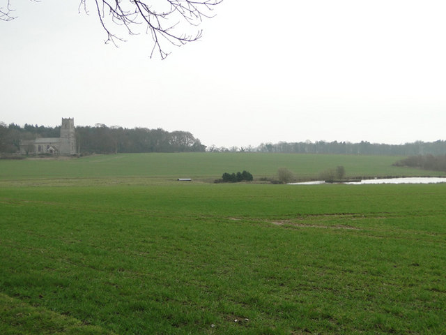
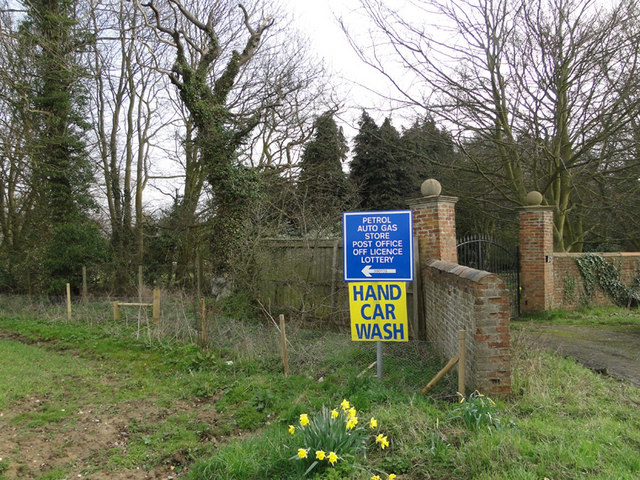
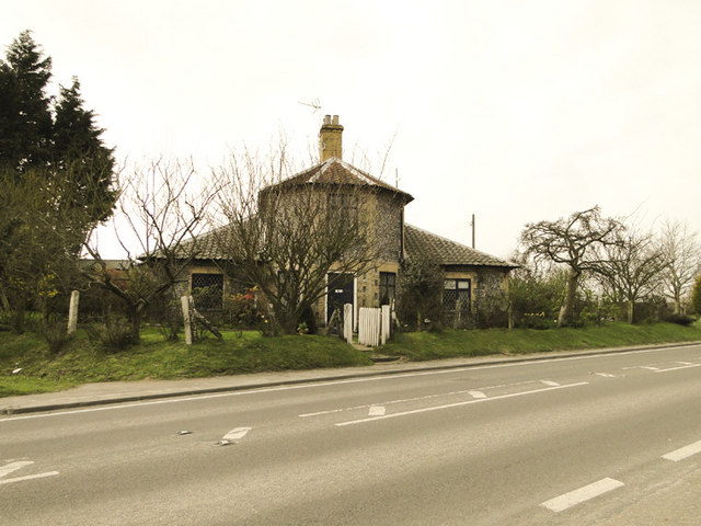
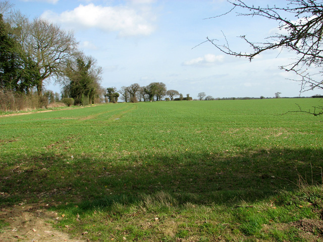
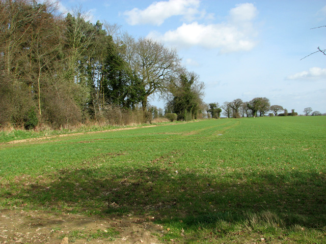
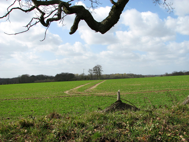
Heath Plantation, located in Norfolk, England, is a picturesque woodland area renowned for its natural beauty and diverse ecosystem. Spread across a vast expanse, the plantation is predominantly covered by dense woodlands and heathland, offering a serene escape from the hustle and bustle of urban life.

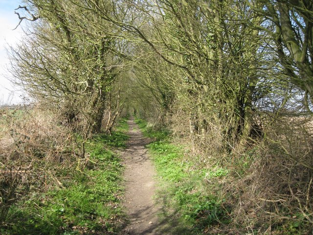
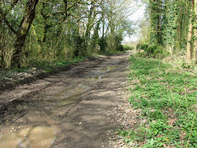
The woodland, composed of a variety of tree species such as oak, birch, and beech, creates a rich tapestry of colors throughout the seasons. It provides a habitat for numerous wildlife species, including deer, rabbits, and a variety of bird species, making it a popular spot for nature enthusiasts and birdwatchers alike.

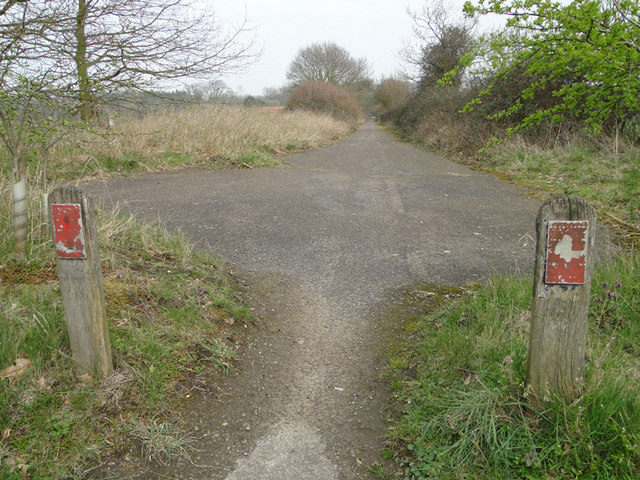
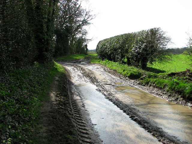
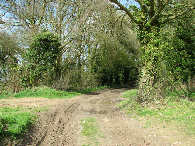
The plantation also boasts an extensive network of walking trails, allowing visitors to explore the woodlands at their own pace. These trails lead through tranquil glades, alongside babbling brooks, and up to panoramic viewpoints, providing breathtaking views of the surrounding countryside.

In addition to its natural beauty, Heath Plantation holds historical significance. The area was once used for timber production, and remnants of old sawmills and charcoal pits can still be found within the woodland. These remnants offer a glimpse into the area's past and serve as a reminder of the importance of sustainable forestry practices.

Heath Plantation is a true haven for nature lovers, offering a serene retreat and an opportunity to immerse oneself in the beauty of Norfolk's woodlands. Whether it's a leisurely stroll, birdwatching, or simply enjoying the tranquility of the surroundings, this plantation has something to offer for everyone seeking a connection with nature.

If you have any feedback on the listing, please let us know in the comments section below.

Heath Plantation Images

Images are sourced within 2km of 52.855798/1.2912054 or Grid Reference TG2133. Thanks to Geograph Open Source API. All images are credited.

Pack Lane A footpath between single rows of trees and bushes, not really hedgerows, heading for Aldborough from near Alby Church in TG2033. There was Dog's Mercury in the ground flora, indicating ancient woodland in the past.
Pack Lane
A footpath between single rows of trees and bushes, not really hedgerows, heading for Aldborough from near Alby Church in TG2033. There was Dog's Mercury in the ground flora, indicating ancient woodland in the past.
Winter wheat, lake and Hanworth church in the background
Bus stop shelters on the A140 at Alby Although these are normally called bus shelters, they do not shelter buses. They are people shelters at bus stops.
Bus stop shelters on the A140 at Alby
Although these are normally called bus shelters, they do not shelter buses. They are people shelters at bus stops.
GR wallbox at Alby on the A140 Postbox number NR11 1148 Alby Horseshoes.
GR wallbox at Alby on the A140
Postbox number NR11 1148 Alby Horseshoes.
Information boards on the A140 near gated entrance
Daffodils beside the A140 at Alby
Hanworth cross at the junction A140 junction These crosses predate the building of churches. In the 6th and 7th centuries, wooden crosses marked the spots where priests or monks preached to the local community. These were later replaced with stone crosses such as this one but became redundant to a great extent when the churches were built and were eventually phased out altogether. Many villages still have the remains of the old preaching crosses even if it's only a stump.
Hanworth cross at the junction A140 junction
These crosses predate the building of churches. In the 6th and 7th centuries, wooden crosses marked the spots where priests or monks preached to the local community. These were later replaced with stone crosses such as this one but became redundant to a great extent when the churches were built and were eventually phased out altogether. Many villages still have the remains of the old preaching crosses even if it's only a stump.
Unusual flint house on the A140 at Alby
Once a road, now a cycleway and footpath When the A140 bypass was built this road became redundant and has been turned into a cycleway and footpath. The old road markings can still be seen.
Once a road, now a cycleway and footpath
When the A140 bypass was built this road became redundant and has been turned into a cycleway and footpath. The old road markings can still be seen.
Muddy track in Hanworth The track serves as a public footpath, leading from St Bartholomew's church > <a title="https://www.geograph.org.uk/photo/1545521" href="https://www.geograph.org.uk/photo/1545521">Link</a> to Manor Farm, further to the south.
Muddy track in Hanworth
The track serves as a public footpath, leading from St Bartholomew's church > Link to Manor Farm, further to the south.
Track past St Bartholomew's church, Hanworth The track serves as a public footpath, leading from St Bartholomew's church > <a title="https://www.geograph.org.uk/photo/1545521" href="https://www.geograph.org.uk/photo/1545521">Link</a> to Manor Farm, further to the south.
Track past St Bartholomew's church, Hanworth
The track serves as a public footpath, leading from St Bartholomew's church > Link to Manor Farm, further to the south.
View across field towards Hanworth Hall
Track through woodland north of Manor Farm, Hanworth The track serves as a public footpath, leading from St Bartholomew's church > <a title="https://www.geograph.org.uk/photo/1545521" href="https://www.geograph.org.uk/photo/1545521">Link</a> to Manor Farm, further to the south.
Track through woodland north of Manor Farm, Hanworth
The track serves as a public footpath, leading from St Bartholomew's church > Link to Manor Farm, further to the south.
Fields north of Manor Farm, Hanworth
Woodland north of Manor Farm, Hanworth
Track to St Bartholomew's church, Hanworth The track serves as a public footpath, leading from St Bartholomew's church > <a title="https://www.geograph.org.uk/photo/1545521" href="https://www.geograph.org.uk/photo/1545521">Link</a> to Manor Farm, further to the south.
Track to St Bartholomew's church, Hanworth
The track serves as a public footpath, leading from St Bartholomew's church > Link to Manor Farm, further to the south.
Cultivated field north of Manor Farm, Hanworth
Show me another place!

Heath Plantation is located at Grid Ref: TG2133 (Lat: 52.855798, Lng: 1.2912054)

Administrative County: Norfolk

District: North Norfolk

Police Authority: Norfolk

What 3 Words

///bills.ends.profited. Near Aylsham, Norfolk

Related Wikis

Gunton Park Lake

Gunton Park Lake is a 18.3-hectare (45-acre) biological Site of Special Scientific Interest by Gunton Hall, north-west of North Walsham in Norfolk. It...

Alby with Thwaite

Alby with Thwaite is a civil parish in the English county of Norfolk. The parish straddles the A140 some 10 km south of Cromer and 30 km north of Norwich...

Hagon Beck

Hagon Beck is a minor watercourse which rises in the north of the English county of Norfolk. It falls into Great Lake in Gunton Park, which in turn feeds...
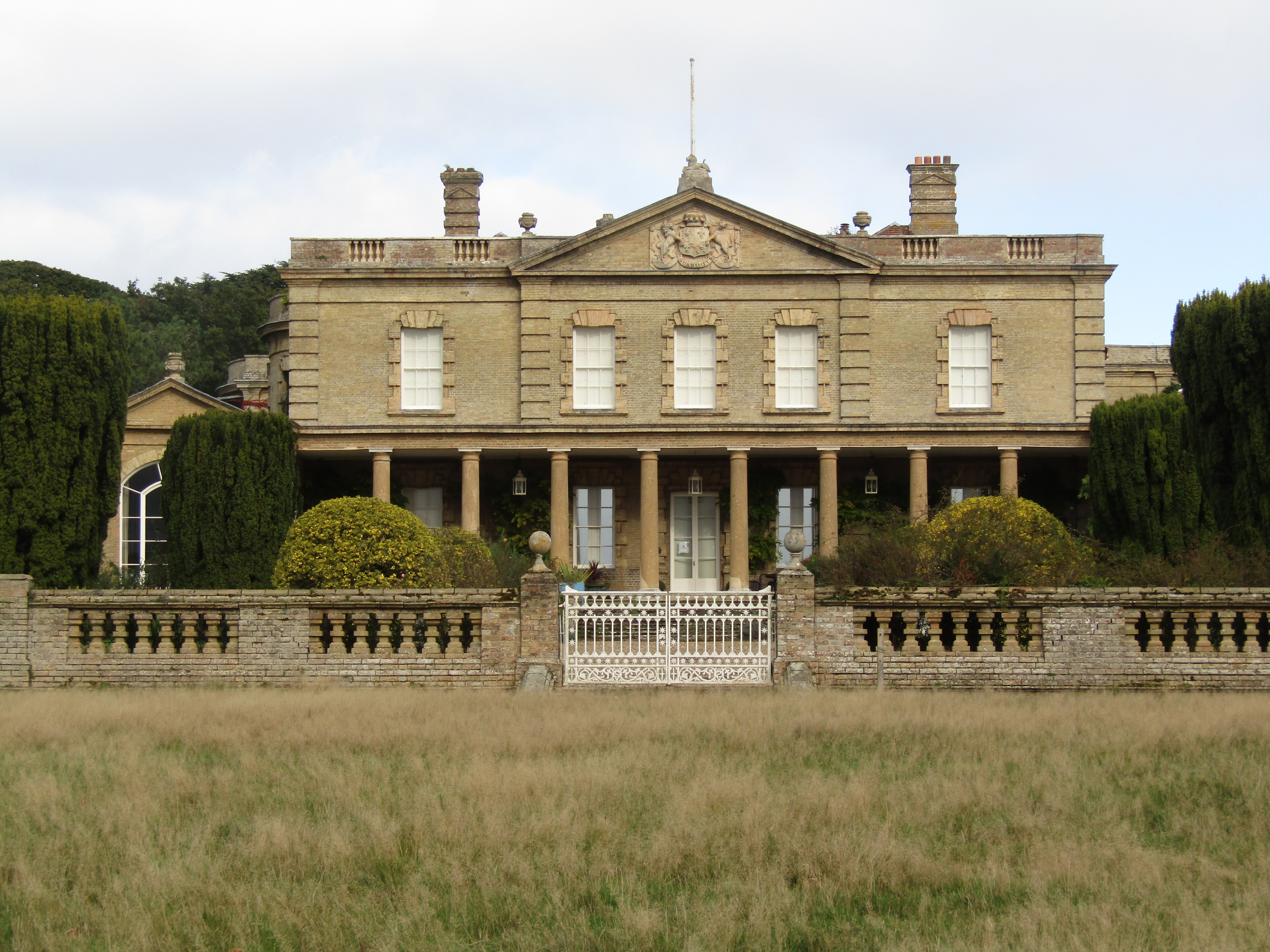
Gunton Hall

Gunton Hall, Gunton Park, is a large country house near Suffield in Norfolk. == History == The estate belonged to the Gunton family in the 12th century...

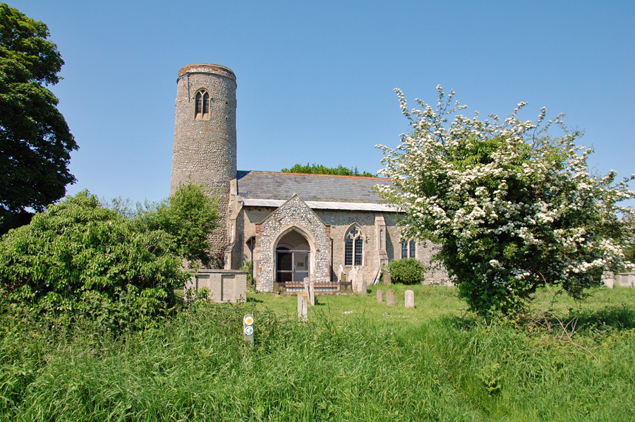
St Andrew's Church, Gunton

St Andrew's Church is a redundant Anglican church adjacent to Gunton Hall, in the parish of Hanworth, Norfolk, England. It is recorded in the National...

Suffield, Norfolk

Suffield is a village and a civil parish in the English county of Norfolk. The village is 7.1 miles (11.4 km) south of Cromer, 18.4 miles (29.6 km) north...

Colby, Norfolk

Colby is a village and a civil parish in the English county of Norfolk. The village is 8.6 miles (13.8 km) south of Cromer, 16.8 miles (27.0 km) north...

Hanworth, Norfolk

Hanworth is a village and a civil parish in the English county of Norfolk. It is 18.8 miles (30.3 km) north of Norwich, 5.4 miles (8.7 km) south-west of...

Nearby Amenities

Located within 500m of 52.855798,1.2912054
Deer's Glade Car. & Camp. Park
Phone: +44 1263768633
Source: ACSI
Tourism: camp_site
Lat/Long: 52.8545341/1.29173
Give Way
Lat/Long: 52.8574509/1.2894666
The data included in this document is from www.openstreetmap.org. The data is made available under ODbL.

Have you been to Heath Plantation?

Leave your review of Heath Plantation below (or comments, questions and feedback).