Frettenham

Settlement in Norfolk Broadland

England

Frettenham

OS Benchmark Recorded on Benchmark Database as 'Spixworth, St Peter's Church'.
OS Benchmark Credit: David Bremner

Frettenham is a small village located in the county of Norfolk, England. Situated about 8 miles to the northeast of Norwich, it falls within the administrative district of Broadland. With a population of just over 600 people, Frettenham offers a serene and close-knit community atmosphere.

The village is surrounded by picturesque countryside, characterized by rolling fields and charming farmland. Frettenham enjoys a peaceful and tranquil setting, making it an ideal place for those seeking a quieter lifestyle away from the bustling city.

Despite its small size, Frettenham boasts a range of amenities to cater to its residents' needs. The village is home to a locally run convenience store, which provides essential groceries and household supplies. Additionally, there is a village hall that hosts various community events and gatherings throughout the year, fostering a strong sense of community spirit.

For outdoor enthusiasts, Frettenham offers plenty of opportunities to explore the surrounding natural beauty. The village is situated near the Norfolk Broads, a renowned network of rivers, lakes, and wetlands, providing ample opportunities for boating, fishing, and bird-watching.

Frettenham's proximity to Norwich allows residents to easily access a wider range of amenities, including shopping centers, restaurants, and entertainment venues. The city also offers excellent transport links, with regular bus services connecting Frettenham to Norwich and other nearby towns.

Overall, Frettenham is a charming village that offers a peaceful countryside lifestyle while still providing access to essential amenities and nearby urban centers.

If you have any feedback on the listing, please let us know in the comments section below.
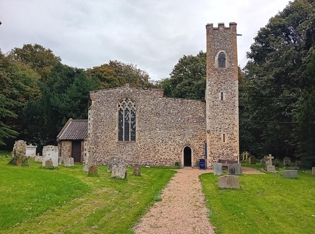
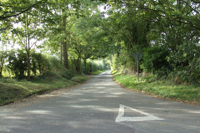
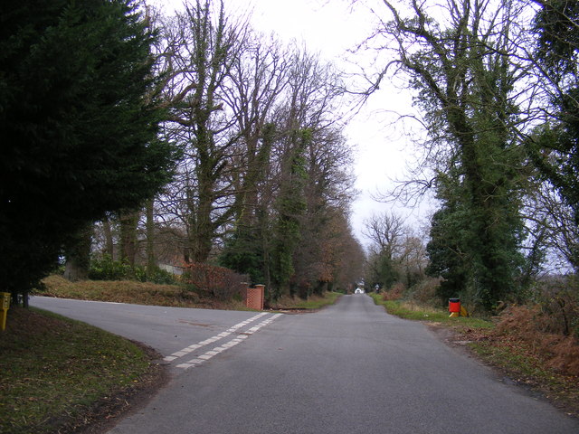
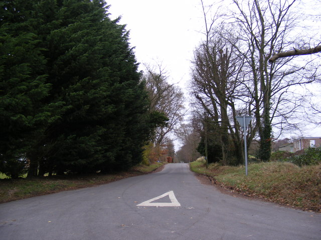
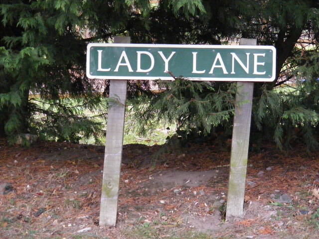
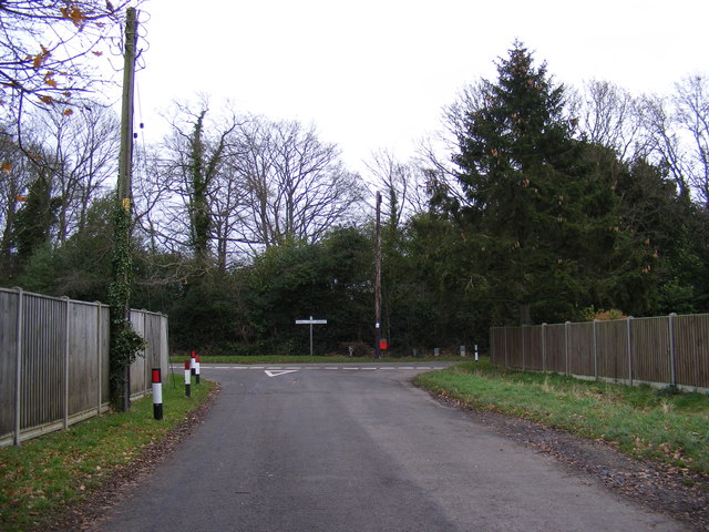
Frettenham Images

Images are sourced within 2km of 52.708452/1.319632 or Grid Reference TG2417. Thanks to Geograph Open Source API. All images are credited.

OS Benchmark Recorded on Benchmark Database as 'Spixworth, St Peter's Church'.
OS Benchmark
Recorded on Benchmark Database as 'Spixworth, St Peter's Church'.
St Peter's, Spixworth An attractive church which we were delighted to find open.
St Peter's, Spixworth
An attractive church which we were delighted to find open.
Flowers, St Peter's Church Attractive floral display at St Peter's Church, Spixworth.
Flowers, St Peter's Church
Attractive floral display at St Peter's Church, Spixworth.
Buxton Road, Hainford At the junction with Grange Road
Buxton Road, Hainford
At the junction with Grange Road
Grange Road, Hainford At the junction with Buxton Road
Grange Road, Hainford
At the junction with Buxton Road
Grange Road sign On Grange Road at the junction with Buxton Road
Grange Road sign
On Grange Road at the junction with Buxton Road
Buxton Road, Hainford Near Hainford Hall
Buxton Road, Hainford
Near Hainford Hall
Buxton Road, Frettingham Near Hainford Hall
Buxton Road, Frettingham
Near Hainford Hall
Newton Road, Hainford At the junction with Lady Lane
Newton Road, Hainford
At the junction with Lady Lane
Lady Lane, Hainford At the junction with Newton Road
Lady Lane, Hainford
At the junction with Newton Road
Lady Lane sign At the junction with Newton Road
Lady Lane sign
At the junction with Newton Road
Chapel Road & Hainford Post Office Postbox At the junction with Wells Close
Postbox No.NR20 1000
Chapel Road & Hainford Post Office Postbox
At the junction with Wells Close Postbox No.NR20 1000
Hainford Post Office Postbox Postbox No.NR20 1000
Hainford Post Office Postbox
Postbox No.NR20 1000
Hainford Post Office Postbox Postbox No.NR20 1000
Hainford Post Office Postbox
Postbox No.NR20 1000
Chapel Road Telephone Box <span class="nowrap"><a title="https://en.wikipedia.org/wiki/Hainford" rel="nofollow ugc noopener" href="https://en.wikipedia.org/wiki/Hainford">Link</a><img style="margin-left:2px;" alt="External link" title="External link - shift click to open in new window" src="https://s1.geograph.org.uk/img/external.png" width="10" height="10"/></span>
Chapel Road Telephone Box
Chapel Road, Hainford At the junction with Hall Road
Chapel Road, Hainford
At the junction with Hall Road
Roadsign on Hall Road At the junction with Chapel Road
Roadsign on Hall Road
At the junction with Chapel Road
Hall Road, Hainford Looking towards Lady Lane at the junction with Chapel Road
Hall Road, Hainford
Looking towards Lady Lane at the junction with Chapel Road
Show me another place!

Frettenham is located at Grid Ref: TG2417 (Lat: 52.708452, Lng: 1.319632)

Administrative County: Norfolk

District: Broadland

Police Authority: Norfolk

What 3 Words

///charities.headless.snap. Near Spixworth, Norfolk

Nearby Locations

Chisel Hill Frettenham

Related Wikis

Frettenham

Frettenham is a village and civil parish in the English county of Norfolk. It is located 3.2 miles (5.1 km) west of Wroxham, and 5.7 miles (9.2 km) north...

Frettenham Windmill

Frettenham Mill is a Grade II listed tower mill at Frettenham, Norfolk, England which has been converted to residential accommodation. == History == Frettenham...

Hillside Animal Sanctuary

Hillside Animal Sanctuary, based in Frettenham, Norwich, and with a site at West Runton, North Norfolk, is the United Kingdom's largest home for different...

Crostwick

Crostwick is a village in the English county of Norfolk. The village is part of the civil parish of Horstead with Stanninghall. Crostwick is located 2...

Nearby Amenities

Located within 500m of 52.708452,1.319632
Frettenham
Place: village
Lat/Long: 52.7085962/1.3247301
Post Office Road, adj
Naptan AtcoCode: 2900F211
Naptan Bearing: SW
Naptan BusStopType: CUS
Naptan CommonName: Post Office Road
Naptan Indicator: adj
Naptan Landmark: Post Office Road
Naptan Locality: Frettenham
Naptan NaptanCode: nfoaptwg
Naptan Street: Mill Road
Naptan Verified: no
Source: naptan_import
Lat/Long: 52.7087029/1.320727
Mill Road, opp
Naptan AtcoCode: 2900F2110
Naptan Bearing: N
Naptan BusStopType: CUS
Naptan CommonName: Mill Road
Naptan Indicator: opp
Naptan Locality: Frettenham
Naptan NaptanCode: nfoaptwj
Naptan ShortCommonName: Pound Hill
Naptan Street: Buxton Road
Naptan Verified: no
Source: naptan_import
Lat/Long: 52.7061256/1.3152279
school, adj
Naptan AtcoCode: 2900F214
Naptan Bearing: S
Naptan BusStopType: CUS
Naptan CommonName: school
Naptan Indicator: adj
Naptan Locality: Frettenham
Naptan NaptanCode: nfoaptwp
Naptan Street: School Road
Naptan Verified: no
Source: naptan_import
Lat/Long: 52.7087154/1.3255087
Post Office Road, opp
Naptan AtcoCode: 2900F217
Naptan Bearing: NE
Naptan BusStopType: CUS
Naptan CommonName: Post Office Road
Naptan Indicator: opp
Naptan Landmark: Post Office Road
Naptan Locality: Frettenham
Naptan NaptanCode: nfoapwag
Naptan Street: Mill Road
Naptan Verified: no
Source: naptan_import
Lat/Long: 52.7086674/1.3204482
Bus Stop
school, opp
Naptan AtcoCode: 2900F218
Naptan Bearing: N
Naptan CommonName: school
Naptan Indicator: opp
Naptan Landmark: school
Naptan Locality: Frettenham
Naptan NaptanCode: nfoapwaj
Naptan ShortCommonName: school
Naptan Street: School Road
Naptan Verified: no
Source: naptan_import
Lat/Long: 52.709052/1.3253714
Mill Road, adj
Naptan AtcoCode: 2900F219
Naptan Bearing: S
Naptan BusStopType: CUS
Naptan CommonName: Mill Road
Naptan Indicator: adj
Naptan Locality: Frettenham
Naptan NaptanCode: nfoapwam
Naptan ShortCommonName: Pound Hill
Naptan Street: Buxton Road
Naptan Verified: no
Source: naptan_import
Lat/Long: 52.7060509/1.3153259
Noexit: yes
Lat/Long: 52.7065548/1.3253385
Noexit: yes
Lat/Long: 52.7067042/1.3252525
Turning Circle
Lat/Long: 52.7069014/1.3260085
Give Way
Lat/Long: 52.7064311/1.3157208
Give Way
Lat/Long: 52.7065576/1.3159918
Give Way
Lat/Long: 52.706608/1.3158744
Give Way
Lat/Long: 52.7095763/1.3155983
Give Way
Lat/Long: 52.7096308/1.3157011
Give Way
Lat/Long: 52.7097923/1.3153084
Location Transition: yes
Power: pole
Lat/Long: 52.7104293/1.3241503
Power: pole
Transformer: distribution
Lat/Long: 52.7105268/1.3234395
Power: pole
Lat/Long: 52.7105772/1.3231122
Power: pole
Lat/Long: 52.7108957/1.3208565
Power: pole
Lat/Long: 52.7112256/1.3185579
Power: pole
Lat/Long: 52.7114791/1.3161868
Give Way
Lat/Long: 52.7114365/1.3248623
Give Way
Lat/Long: 52.711306/1.3248902
Give Way
Lat/Long: 52.7114286/1.3250071
Give Way
Lat/Long: 52.7084509/1.3196991
Give Way
Lat/Long: 52.7084173/1.3203968
Give Way
Lat/Long: 52.7085553/1.3202765
Frettenham
Man Made: village_sign
Material: metal
Lat/Long: 52.7085309/1.3204696
Bench
Backrest: yes
Inscription: yes
Material: wood
Seats: 2
Lat/Long: 52.7085382/1.320536
Waste Basket
Lat/Long: 52.7084838/1.3206225
Post Box
Post Box Type: pillar
Lat/Long: 52.7084927/1.3205514
Give Way
Lat/Long: 52.7084791/1.3200129
Give Way
Lat/Long: 52.708481/1.3203056
Power: pole
Lat/Long: 52.7092934/1.3228896
Power: pole
Lat/Long: 52.7088872/1.3218409
Power: pole
Lat/Long: 52.7080259/1.3199244
Power: pole
Transformer: distribution
Lat/Long: 52.7084614/1.3206808
The data included in this document is from www.openstreetmap.org. The data is made available under ODbL.

Have you been to Frettenham?

Leave your review of Frettenham below (or comments, questions and feedback).