The Grove

Wood, Forest in Norfolk South Norfolk

England

The Grove

Church of St Peter, Swainsthorpe <span class="nowrap"><a title="https://historicengland.org.uk/listing/the-list/list-entry/1169726?section=official-list-entry" rel="nofollow ugc noopener" href="https://historicengland.org.uk/listing/the-list/list-entry/1169726?section=official-list-entry">Link</a><img style="margin-left:2px;" alt="External link" title="External link - shift click to open in new window" src="https://s1.geograph.org.uk/img/external.png" width="10" height="10"/></span>
Church of St Peter, Swainsthorpe Credit: Sandy Gerrard

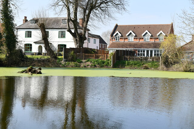
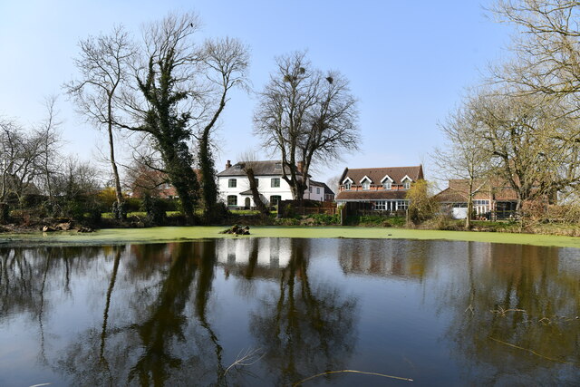
The Grove in Norfolk is a picturesque woodland area located in the eastern part of England. This forest is known for its lush greenery, towering trees, and diverse wildlife. It covers a vast area and is a popular destination for nature lovers, hikers, and bird watchers.

The Grove is home to a variety of tree species, including oak, beech, and pine, creating a rich and vibrant ecosystem. The forest floor is carpeted with ferns, mosses, and wildflowers, adding to its natural beauty.

Visitors to The Grove can enjoy peaceful walks along well-maintained trails, where they may encounter deer, squirrels, and various species of birds. The forest is also home to a number of historical sites, such as ancient ruins and burial mounds, adding an element of intrigue to the natural surroundings.

Overall, The Grove in Norfolk is a tranquil and enchanting destination for those seeking to escape the hustle and bustle of city life and immerse themselves in the beauty of nature.

If you have any feedback on the listing, please let us know in the comments section below.

The Grove Images

Images are sourced within 2km of 52.573454/1.262313 or Grid Reference TG2102. Thanks to Geograph Open Source API. All images are credited.

Church of St Peter, Swainsthorpe <span class="nowrap"><a title="https://historicengland.org.uk/listing/the-list/list-entry/1169726?section=official-list-entry" rel="nofollow ugc noopener" href="https://historicengland.org.uk/listing/the-list/list-entry/1169726?section=official-list-entry">Link</a><img style="margin-left:2px;" alt="External link" title="External link - shift click to open in new window" src="https://s1.geograph.org.uk/img/external.png" width="10" height="10"/></span>
Church of St Peter, Swainsthorpe
Swardeston: Village pond
Swardeston: Village pond and houses in Chestnut Close
Swardeston: The Cricket Pavilion
Swardeston: Houses in The Common (road name)
Keswick: A47 bridge over the Ipswich Road roundabout
Dunston, St Remigius
Church of St. Remigius, Stoke Holy Cross <span class="nowrap"><a title="https://historicengland.org.uk/listing/the-list/list-entry/1050433?section=official-list-entry" rel="nofollow ugc noopener" href="https://historicengland.org.uk/listing/the-list/list-entry/1050433?section=official-list-entry">Link</a><img style="margin-left:2px;" alt="External link" title="External link - shift click to open in new window" src="https://s1.geograph.org.uk/img/external.png" width="10" height="10"/></span>
Church of St. Remigius, Stoke Holy Cross
Driveway to Swardeston House
Paddocks by Swardeston House
Gate on the driveway to the Old Rectory The driveway is a public footpath.
Gate on the driveway to the Old Rectory
The driveway is a public footpath.
Footpath through the Old Rectory grounds
The Old Rectory at Swardeston A Grade II listed building. Excerpt from the listing text: Former parsonage, C16 and early C19; C16 range timberframed, rendered and colourwashed, black glazed pantiles; early C19 range of gault brick, hipped roof of black unglazed pantiles. C16 range to south erroneously and subsequently dated 1660 on left gable; 2½ cells, 2 storeys and attic; off centre axial stack with gault brick shaft to chimney bay to right; C19 bell turret forward to right of first cell. Half bay to left with doorway; rendered lean-to to left under pantiles, canted bay window across angle of half bay, lead polygonal roof, sashes with glazing bars. Cell 1 with 4-light casement having pintle hinges and leaded lights to both floors, gabled roof dormer with casements with pintle hinges. <span class="nowrap"><a title="http://www.britishlistedbuildings.co.uk/en-226989-the-old-rectory-and-attached-garden-wall#.VuR4rr9urOo" rel="nofollow ugc noopener" href="http://www.britishlistedbuildings.co.uk/en-226989-the-old-rectory-and-attached-garden-wall#.VuR4rr9urOo">Link</a><img style="margin-left:2px;" alt="External link" title="External link - shift click to open in new window" src="https://s1.geograph.org.uk/img/external.png" width="10" height="10"/></span>
The Old Rectory at Swardeston
A Grade II listed building. Excerpt from the listing text: Former parsonage, C16 and early C19; C16 range timberframed, rendered and colourwashed, black glazed pantiles; early C19 range of gault brick, hipped roof of black unglazed pantiles. C16 range to south erroneously and subsequently dated 1660 on left gable; 2½ cells, 2 storeys and attic; off centre axial stack with gault brick shaft to chimney bay to right; C19 bell turret forward to right of first cell. Half bay to left with doorway; rendered lean-to to left under pantiles, canted bay window across angle of half bay, lead polygonal roof, sashes with glazing bars. Cell 1 with 4-light casement having pintle hinges and leaded lights to both floors, gabled roof dormer with casements with pintle hinges. LinkExternal link
Old Rectory and St Mary's church in Swardeston A Grade II listed building. Excerpt from the listing text: Former parsonage, C16 and early C19; C16 range timberframed, rendered and colourwashed, black glazed pantiles; early C19 range of gault brick, hipped roof of black unglazed pantiles. C16 range to south erroneously and subsequently dated 1660 on left gable; 2½ cells, 2 storeys and attic; off centre axial stack with gault brick shaft to chimney bay to right; C19 bell turret forward to right of first cell. Half bay to left with doorway; rendered lean-to to left under pantiles, canted bay window across angle of half bay, lead polygonal roof, sashes with glazing bars. Cell 1 with 4-light casement having pintle hinges and leaded lights to both floors, gabled roof dormer with casements with pintle hinges. <span class="nowrap"><a title="http://www.britishlistedbuildings.co.uk/en-226989-the-old-rectory-and-attached-garden-wall#.VuR4rr9urOo" rel="nofollow ugc noopener" href="http://www.britishlistedbuildings.co.uk/en-226989-the-old-rectory-and-attached-garden-wall#.VuR4rr9urOo">Link</a><img style="margin-left:2px;" alt="External link" title="External link - shift click to open in new window" src="https://s1.geograph.org.uk/img/external.png" width="10" height="10"/></span>
Old Rectory and St Mary's church in Swardeston
A Grade II listed building. Excerpt from the listing text: Former parsonage, C16 and early C19; C16 range timberframed, rendered and colourwashed, black glazed pantiles; early C19 range of gault brick, hipped roof of black unglazed pantiles. C16 range to south erroneously and subsequently dated 1660 on left gable; 2½ cells, 2 storeys and attic; off centre axial stack with gault brick shaft to chimney bay to right; C19 bell turret forward to right of first cell. Half bay to left with doorway; rendered lean-to to left under pantiles, canted bay window across angle of half bay, lead polygonal roof, sashes with glazing bars. Cell 1 with 4-light casement having pintle hinges and leaded lights to both floors, gabled roof dormer with casements with pintle hinges. LinkExternal link
The Old Rectory in Swardeston A Grade II listed building. Excerpt from the listing text: Former parsonage, C16 and early C19; C16 range timberframed, rendered and colourwashed, black glazed pantiles; early C19 range of gault brick, hipped roof of black unglazed pantiles. C16 range to south erroneously and subsequently dated 1660 on left gable; 2½ cells, 2 storeys and attic; off centre axial stack with gault brick shaft to chimney bay to right; C19 bell turret forward to right of first cell. Half bay to left with doorway; rendered lean-to to left under pantiles, canted bay window across angle of half bay, lead polygonal roof, sashes with glazing bars. Cell 1 with 4-light casement having pintle hinges and leaded lights to both floors, gabled roof dormer with casements with pintle hinges. <span class="nowrap"><a title="http://www.britishlistedbuildings.co.uk/en-226989-the-old-rectory-and-attached-garden-wall#.VuR4rr9urOo" rel="nofollow ugc noopener" href="http://www.britishlistedbuildings.co.uk/en-226989-the-old-rectory-and-attached-garden-wall#.VuR4rr9urOo">Link</a><img style="margin-left:2px;" alt="External link" title="External link - shift click to open in new window" src="https://s1.geograph.org.uk/img/external.png" width="10" height="10"/></span>
The Old Rectory in Swardeston
A Grade II listed building. Excerpt from the listing text: Former parsonage, C16 and early C19; C16 range timberframed, rendered and colourwashed, black glazed pantiles; early C19 range of gault brick, hipped roof of black unglazed pantiles. C16 range to south erroneously and subsequently dated 1660 on left gable; 2½ cells, 2 storeys and attic; off centre axial stack with gault brick shaft to chimney bay to right; C19 bell turret forward to right of first cell. Half bay to left with doorway; rendered lean-to to left under pantiles, canted bay window across angle of half bay, lead polygonal roof, sashes with glazing bars. Cell 1 with 4-light casement having pintle hinges and leaded lights to both floors, gabled roof dormer with casements with pintle hinges. LinkExternal link
Old Rectory in Swardeston A Grade II listed building. Excerpt from the listing text: Former parsonage, C16 and early C19; C16 range timberframed, rendered and colourwashed, black glazed pantiles; early C19 range of gault brick, hipped roof of black unglazed pantiles. C16 range to south erroneously and subsequently dated 1660 on left gable; 2½ cells, 2 storeys and attic; off centre axial stack with gault brick shaft to chimney bay to right; C19 bell turret forward to right of first cell. Half bay to left with doorway; rendered lean-to to left under pantiles, canted bay window across angle of half bay, lead polygonal roof, sashes with glazing bars. Cell 1 with 4-light casement having pintle hinges and leaded lights to both floors, gabled roof dormer with casements with pintle hinges. <span class="nowrap"><a title="http://www.britishlistedbuildings.co.uk/en-226989-the-old-rectory-and-attached-garden-wall#.VuR4rr9urOo" rel="nofollow ugc noopener" href="http://www.britishlistedbuildings.co.uk/en-226989-the-old-rectory-and-attached-garden-wall#.VuR4rr9urOo">Link</a><img style="margin-left:2px;" alt="External link" title="External link - shift click to open in new window" src="https://s1.geograph.org.uk/img/external.png" width="10" height="10"/></span>
Old Rectory in Swardeston
A Grade II listed building. Excerpt from the listing text: Former parsonage, C16 and early C19; C16 range timberframed, rendered and colourwashed, black glazed pantiles; early C19 range of gault brick, hipped roof of black unglazed pantiles. C16 range to south erroneously and subsequently dated 1660 on left gable; 2½ cells, 2 storeys and attic; off centre axial stack with gault brick shaft to chimney bay to right; C19 bell turret forward to right of first cell. Half bay to left with doorway; rendered lean-to to left under pantiles, canted bay window across angle of half bay, lead polygonal roof, sashes with glazing bars. Cell 1 with 4-light casement having pintle hinges and leaded lights to both floors, gabled roof dormer with casements with pintle hinges. LinkExternal link
The Old Rectory as seen from across the pond A Grade II listed building. Excerpt from the listing text: Former parsonage, C16 and early C19; C16 range timberframed, rendered and colourwashed, black glazed pantiles; early C19 range of gault brick, hipped roof of black unglazed pantiles. C16 range to south erroneously and subsequently dated 1660 on left gable; 2½ cells, 2 storeys and attic; off centre axial stack with gault brick shaft to chimney bay to right; C19 bell turret forward to right of first cell. Half bay to left with doorway; rendered lean-to to left under pantiles, canted bay window across angle of half bay, lead polygonal roof, sashes with glazing bars. Cell 1 with 4-light casement having pintle hinges and leaded lights to both floors, gabled roof dormer with casements with pintle hinges. <span class="nowrap"><a title="http://www.britishlistedbuildings.co.uk/en-226989-the-old-rectory-and-attached-garden-wall#.VuR4rr9urOo" rel="nofollow ugc noopener" href="http://www.britishlistedbuildings.co.uk/en-226989-the-old-rectory-and-attached-garden-wall#.VuR4rr9urOo">Link</a><img style="margin-left:2px;" alt="External link" title="External link - shift click to open in new window" src="https://s1.geograph.org.uk/img/external.png" width="10" height="10"/></span>
The Old Rectory as seen from across the pond
A Grade II listed building. Excerpt from the listing text: Former parsonage, C16 and early C19; C16 range timberframed, rendered and colourwashed, black glazed pantiles; early C19 range of gault brick, hipped roof of black unglazed pantiles. C16 range to south erroneously and subsequently dated 1660 on left gable; 2½ cells, 2 storeys and attic; off centre axial stack with gault brick shaft to chimney bay to right; C19 bell turret forward to right of first cell. Half bay to left with doorway; rendered lean-to to left under pantiles, canted bay window across angle of half bay, lead polygonal roof, sashes with glazing bars. Cell 1 with 4-light casement having pintle hinges and leaded lights to both floors, gabled roof dormer with casements with pintle hinges. LinkExternal link
Footpath in Swardeston
Show me another place!

The Grove is located at Grid Ref: TG2102 (Lat: 52.573454, Lng: 1.262313)

Administrative County: Norfolk

District: South Norfolk

Police Authority: Norfolk

What 3 Words

///selects.sailed.scoping. Near Mulbarton, Norfolk
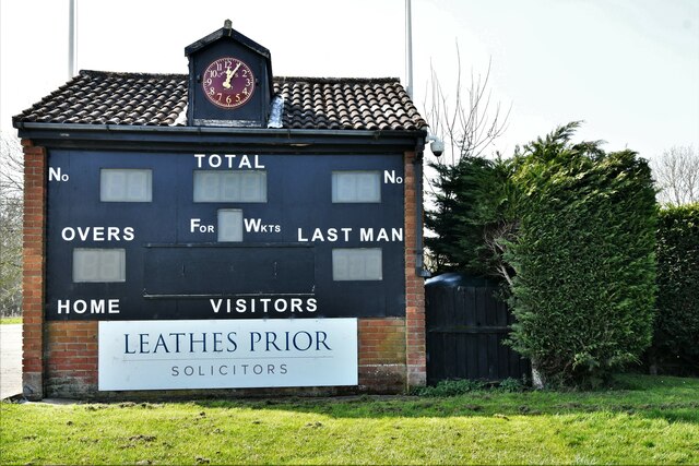
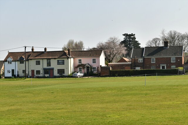
Nearby Locations

The Grove

Related Wikis

Swardeston

Swardeston is a village four miles (6 km) south of Norwich in Norfolk, England, on high ground above the Tas valley. It covers an area of 3.95 km2 (1.53...

Norwich CEYMS F.C.

Norwich Church of England Young Men's Society Football Club, commonly called Norwich CEYMS, is a football club based in Swardeston, near Norwich, in Norfolk...

Swainsthorpe railway station

Swainsthorpe was a railway station in Swainsthorpe, England, around five miles south of Norwich. It was opened in 1850 when the Great Eastern Railway constructed...

Dunston Common

Dunston Common is a 3.8-hectare (9.4-acre) Local Nature Reserve south of Norwich in Norfolk. It is owned and managed by South Norfolk District Council...

Nearby Amenities

Located within 500m of 52.573454,1.262313
Power: tower
Ref: 4VV 222
Lat/Long: 52.576983/1.2635666
Power: tower
Ref: PO14
Lat/Long: 52.5772601/1.2646456
Power: tower
Ref: 4VV 223
Lat/Long: 52.5755534/1.2687551
Location Transition: yes
Power: pole
Lat/Long: 52.5766394/1.2616212
Power: pole
Lat/Long: 52.576724/1.261454
Power: pole
Lat/Long: 52.574921/1.261137
Power: pole
Lat/Long: 52.575989/1.261427
Power: pole
Lat/Long: 52.572789/1.26015
Power: pole
Lat/Long: 52.573848/1.260654
Power: pole
Lat/Long: 52.571726/1.259635
Power: pole
Lat/Long: 52.5763729/1.2603459
Note: Path overgrown under pylon.
Lat/Long: 52.5772706/1.264644
Power: pole
Lat/Long: 52.5699245/1.2587345
Power: pole
Lat/Long: 52.5708806/1.2592696
Power: pole
Lat/Long: 52.5713097/1.2563869
Power: pole
Lat/Long: 52.5722283/1.2560745
Power: pole
Lat/Long: 52.5731477/1.2558062
Power: pole
Lat/Long: 52.5735193/1.2557338
Power: pole
Lat/Long: 52.5738947/1.2555923
Power: pole
Lat/Long: 52.5741771/1.2558652
Power: pole
Transformer: distribution
Lat/Long: 52.5741885/1.2555165
Power: pole
Lat/Long: 52.5742276/1.2555018
Power: pole
Lat/Long: 52.5754192/1.2579574
Power: pole
Lat/Long: 52.5760117/1.2592489
Note: Stile is now removed.
Lat/Long: 52.5769853/1.2633707
The data included in this document is from www.openstreetmap.org. The data is made available under ODbL.

Have you been to The Grove?

Leave your review of The Grove below (or comments, questions and feedback).