Frenchwood

Settlement in Lancashire Preston

England

Frenchwood

St Thomas' Church, Preston This grade II listed church was designed by John Latham and built between 1837 and 1839. It was declared redundant by the Church of England in 1983 and is used by City Church Preston, part of a Pentecostal denomination.
St Thomas' Church, Preston Credit: Stephen McKay

Frenchwood is a small residential suburb located in the city of Preston, Lancashire, England. Situated approximately one mile southeast of Preston's city center, it falls within the local government district of the City of Preston. The area is primarily residential, characterized by a mix of traditional terraced houses and modern housing estates.

Frenchwood is well-connected to the wider region, with easy access to major road networks such as the A6 and the M6 motorway. The area also benefits from regular bus services, providing convenient transportation options for residents.

A key feature of Frenchwood is its proximity to the scenic Ribble River, which flows nearby. This offers residents the opportunity to enjoy picturesque walks and recreational activities along the riverbank. Additionally, Frenchwood is within close reach of popular green spaces like Avenham Park and Miller Park, providing further opportunities for outdoor leisure and relaxation.

The suburb is home to a range of amenities, including local shops, supermarkets, and schools, catering to the daily needs of residents. For more extensive shopping and entertainment options, Preston city center is just a short distance away.

Frenchwood has a diverse community, with a mix of families, young professionals, and retirees. The area enjoys a relatively peaceful and quiet atmosphere, making it an attractive place to live for those seeking a suburban lifestyle within easy reach of urban amenities.

Overall, Frenchwood offers a pleasant residential environment with convenient access to transportation links, natural beauty spots, and a range of local amenities.

If you have any feedback on the listing, please let us know in the comments section below.
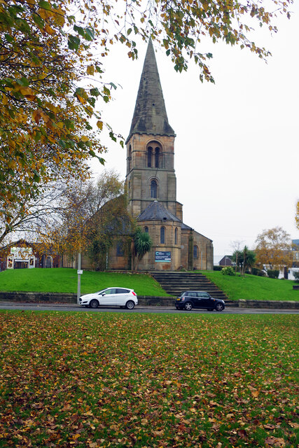
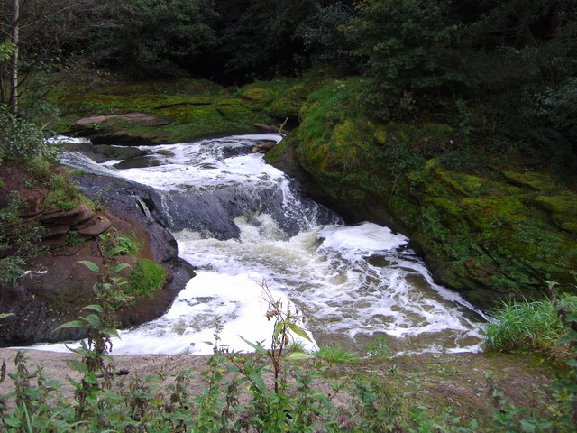
Frenchwood Images

Images are sourced within 2km of 53.75224/-2.687428 or Grid Reference SD5428. Thanks to Geograph Open Source API. All images are credited.

St Thomas' Church, Preston This grade II listed church was designed by John Latham and built between 1837 and 1839. It was declared redundant by the Church of England in 1983 and is used by City Church Preston, part of a Pentecostal denomination.
St Thomas' Church, Preston
This grade II listed church was designed by John Latham and built between 1837 and 1839. It was declared redundant by the Church of England in 1983 and is used by City Church Preston, part of a Pentecostal denomination.
Turf zone "NoWaterZone" Allotments off St Barnabas' Place, Preston.
Turf zone "NoWaterZone"
Allotments off St Barnabas' Place, Preston.
Turf zone "PigeonRoad" Park on Dove Street, Preston.
Turf zone "PigeonRoad"
Park on Dove Street, Preston.
Preston North End Football Ground, Deepdale With "The Splash" in the foreground (by Peter Hodgkinson) based on a photograph of Tom Finney at Stamford Bridge in 1956
Preston North End Football Ground, Deepdale
With "The Splash" in the foreground (by Peter Hodgkinson) based on a photograph of Tom Finney at Stamford Bridge in 1956
North Road, Preston
North Road, Preston
West View Leisure Centre West View sports a very good climbing wall
West View Leisure Centre
West View sports a very good climbing wall
Salvation Army Worship Hall - Harrington Street
Former Windmill off Moor Lane
Windmill Entrances - off Moor Lane
The Queen Vic - Moor Lane
St Thomas' Church - St Thomas' Place
St Thomas' Hall - St Thomas' Place
New flats near Harrington Street
Offices of the old Preston Corporation Bus Depot Still used for the buses for Preston
Offices of the old Preston Corporation Bus Depot
Still used for the buses for Preston
Holmrook  Road, Preston
Holmrook Road, Preston
Back street This back street runs parallel Holmrook Road
Back street
This back street runs parallel Holmrook Road
Guttridge Methodist Church, Deepdale Road, Preston
St Georges Road, Preston
Show me another place!

Frenchwood is located at Grid Ref: SD5428 (Lat: 53.75224, Lng: -2.687428)

Administrative County: Lancashire

District: Preston

Police Authority: Lancashire

What 3 Words

///gain.flat.dating. Near Preston, Lancashire

Related Wikis

Christ the King Catholic High School, Preston

Christ the King Catholic High School is a coeducational secondary school located in Preston in the English county of Lancashire. It is a voluntary aided...

River Darwen

The River Darwen runs through Darwen and Blackburn in Lancashire, England, eventually joining the River Ribble at Walton le Dale south of Preston on its...

Jamea Masjid, Preston

Jamea Masjid is the largest and longest established mosque (masjid) in Preston, Lancashire, England, UK. == History == The mosque was established in 1964...

Cardinal Newman College

Cardinal Newman College is a Catholic sixth form college close to the centre of Preston, Lancashire, England. The college was graded "outstanding" by Ofsted...

Nearby Amenities

Located within 500m of 53.75224,-2.687428
Source: PGS
Lat/Long: 53.7514672/-2.6940674
Source: PGS
Lat/Long: 53.7512515/-2.6936168
Source: PGS
Lat/Long: 53.7504014/-2.6923508
Source: PGS
Lat/Long: 53.7500462/-2.6917071
Source: PGS
Lat/Long: 53.7498812/-2.6913852
Source: PGS
Lat/Long: 53.749526/-2.6905269
Source: PGS
Lat/Long: 53.7492595/-2.6868147
Created By: almien_coastlines
Source: PGS
Lat/Long: 53.7494749/-2.6855848
Created By: almien_coastlines
Source: PGS
Lat/Long: 53.7498229/-2.6848455
Source: PGS
Lat/Long: 53.750135/-2.6843471
Source: PGS
Lat/Long: 53.7505537/-2.6836605
Source: PGS
Lat/Long: 53.7513911/-2.682609
Created By: almien_coastlines
Source: PGS
Lat/Long: 53.7520871/-2.6818534
Created By: almien_coastlines
Source: PGS
Lat/Long: 53.752466/-2.6813768
Created By: almien_coastlines
Source: PGS
Lat/Long: 53.752648/-2.6809216
Created By: almien_coastlines
Source: PGS
Lat/Long: 53.752767/-2.6805372
Source: PGS
Lat/Long: 53.7528882/-2.6802058
Source: PGS
Lat/Long: 53.7523508/-2.6798324
Source: PGS
Lat/Long: 53.752097/-2.6802615
Source: PGS
Lat/Long: 53.7518433/-2.6807121
Source: PGS
Lat/Long: 53.751285/-2.6814417
Source: PGS
Lat/Long: 53.7509932/-2.6818494
Created By: almien_coastlines
Source: PGS
Lat/Long: 53.750686/-2.682266
Source: PGS
Lat/Long: 53.7503081/-2.6827721
Source: PGS
Lat/Long: 53.750067/-2.6832656
Source: PGS
Lat/Long: 53.7497625/-2.6836733
Source: PGS
Lat/Long: 53.749496/-2.6841883
Source: PGS
Lat/Long: 53.7489504/-2.6850466
Source: PGS
Lat/Long: 53.7488489/-2.6854757
Source: PGS
Lat/Long: 53.7487347/-2.6868061
Created By: almien_coastlines
Source: PGS
Lat/Long: 53.748784/-2.689843
Source: PGS
Lat/Long: 53.7490692/-2.6910419
Created By: almien_coastlines
Source: PGS
Lat/Long: 53.74931/-2.6916593
Created By: almien_coastlines
Source: PGS
Lat/Long: 53.749559/-2.692431
Created By: almien_coastlines
Source: PGS
Lat/Long: 53.749817/-2.692861
Created By: almien_coastlines
Source: PGS
Lat/Long: 53.750074/-2.693292
Created By: almien_coastlines
Source: PGS
Lat/Long: 53.750718/-2.694368
Note: FIXME
Lat/Long: 53.7498536/-2.6901574
Frenchwood
Place: suburb
Source: local knowledge
Lat/Long: 53.7537778/-2.6868765
Pharmacy
Healthcare: pharmacy
Lat/Long: 53.7546502/-2.6872111
Post Box
Brand: Royal Mail
Brand Wikidata: Q638098
Check Date: 2021-06-04
Collection Times: Mo-Fr 09:00; Sa 07:00
Operator: Royal Mail
Operator Wikidata: Q638098
Post Box Design: type_k
Post Box Type: pillar
Ref: PR1 90
Royal Cypher: EIIR
Royal Cypher Wikidata: Q33102113
Source: survey
Lat/Long: 53.7553172/-2.6884065
Turning Circle
Lat/Long: 53.7542172/-2.688385
Addr City: Preston
Addr Housenumber: 190
Addr Street: Manchester Road
Shop: yes
Lat/Long: 53.7553653/-2.6886201
Crossing
Button Operated: yes
Crossing: traffic_signals
Crossing Island: no
Crossing Markings: dots
Crossing Ref: toucan
Tactile Paving: yes
Lat/Long: 53.7536621/-2.6803398
Crossing
Button Operated: yes
Crossing: traffic_signals
Crossing Island: no
Crossing Markings: dots
Crossing Ref: toucan
Tactile Paving: yes
Lat/Long: 53.7537731/-2.6802729
Telephone
Booth: KX100
Check Date: 2021-03-11
Covered: booth
Operator: BT
Operator Wikidata: Q593786
Lat/Long: 53.7548066/-2.68485
Bus Stop
Walton-le-Dale, Park and Ride
Naptan AtcoCode: 2500GCS10059
Naptan NaptanCode: landpadg
Park Ride: yes
Public Transport: platform
Shelter: yes
Lat/Long: 53.7495735/-2.682683
Bus Stop
Boulevard Opp Carleton Drive
Bench: no
Bus: yes
Departures Board: timetable
Naptan AtcoCode: 2500DCL3123
Naptan NaptanCode: landgpgw
Public Transport: platform
Ref: landgpgw
Shelter: no
Tactile Paving: no
Lat/Long: 53.7496182/-2.6861961
Post Box
Brand: Royal Mail
Brand Wikidata: Q638098
Brand Wikipedia: en:Royal Mail
Check Date: 2021-03-16
Collection Times: Mo-Fr 09:00; Sa 07:00
Operator: Royal Mail
Operator Wikidata: Q638098
Post Box Design: type_b
Post Box Type: pillar
Ref: PR1 328
Royal Cypher: GR
Royal Cypher Wikidata: Q33102273
Lat/Long: 53.7497531/-2.686313
Bus Stop
Manchester Road/Selborne Street
Bus: yes
Public Transport: platform
Lat/Long: 53.7551485/-2.688244
Post Box
Brand: Royal Mail
Brand Wikidata: Q638098
Check Date: 2021-06-04
Collection Times: Mo-Fr 09:00; Sa 07:00
Operator: Royal Mail
Operator Wikidata: Q638098
Post Box Type: lamp
Ref: PR1 293
Royal Cypher: EIIR
Royal Cypher Wikidata: Q33102113
Source: survey
Lat/Long: 53.7546937/-2.6934447
Speed Camera
Maxspeed: 30 mph
Lat/Long: 53.7543542/-2.6808327
Kindergarten
Oxford Gems Nursery
Addr City: Preston
Addr Postcode: PR1 3YN
Addr Street: Clarendon Street
Lat/Long: 53.754758/-2.6928306
Traffic Signals
Traffic Signals: crossing
Lat/Long: 53.7538258/-2.6803172
Traffic Signals
Traffic Signals: crossing
Lat/Long: 53.7536295/-2.6803097
The data included in this document is from www.openstreetmap.org. The data is made available under ODbL.

Have you been to Frenchwood?

Leave your review of Frenchwood below (or comments, questions and feedback).