Foxburrow Plantation

Wood, Forest in Norfolk South Norfolk

England

Foxburrow Plantation

Swardeston: Village pond
Swardeston: Village pond Credit: Michael Garlick

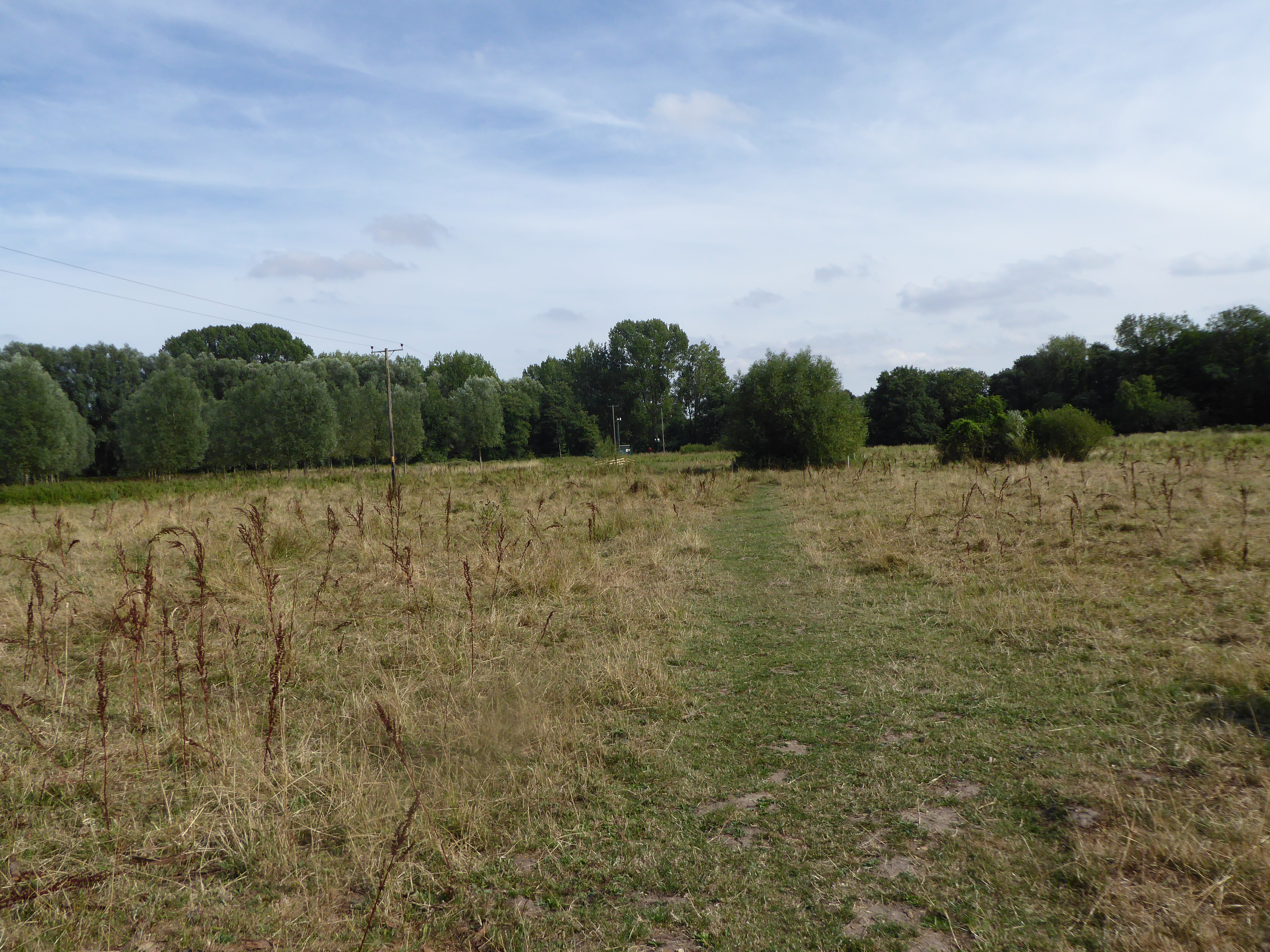
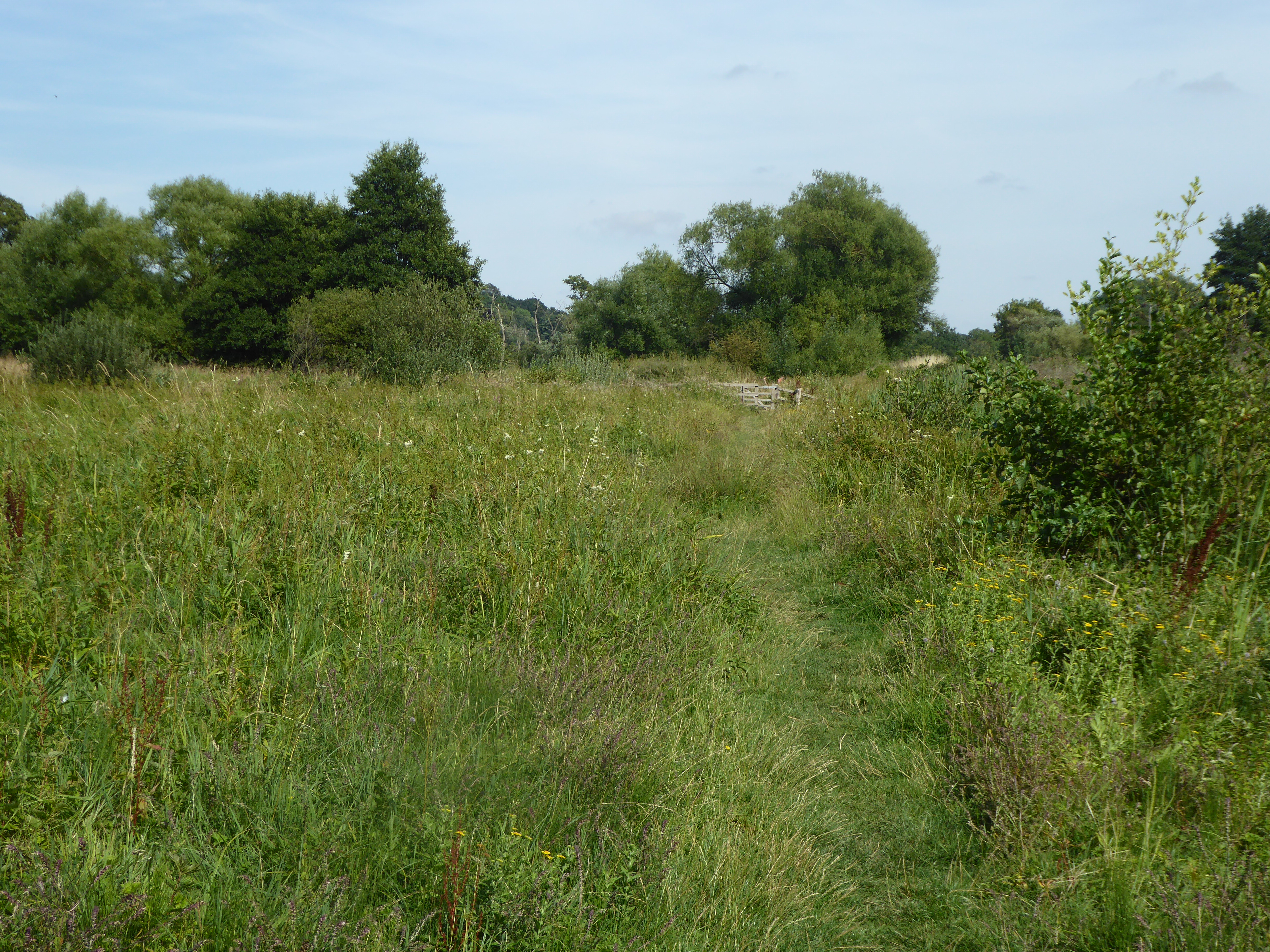
Foxburrow Plantation is a picturesque woodland located in Norfolk, England. Spanning over a vast area, it is known for its diverse flora and fauna, making it a popular destination for nature enthusiasts and hikers. The plantation is predominantly covered with a dense forest, creating a serene and tranquil environment.

The woodland is home to a variety of tree species, including oak, beech, and pine, which provide ample shade and shelter to the wildlife inhabiting the area. The forest floor is adorned with a rich carpet of vibrant wildflowers, adding to the beauty of the plantation.

Foxburrow Plantation boasts an impressive array of wildlife. Birdwatchers can spot a multitude of avian species, such as woodpeckers, robins, and thrushes, among others. Small mammals like rabbits, squirrels, and foxes are frequently sighted, while lucky visitors may even catch a glimpse of deer gracefully roaming through the trees.

The plantation offers well-maintained walking trails, allowing visitors to explore the woodland at their own pace. The paths wind through the forest, offering breathtaking views of the surrounding countryside. Numerous benches and picnic areas are strategically placed throughout the plantation, providing opportunities for visitors to relax and immerse themselves in the tranquility of nature.

Foxburrow Plantation is also home to a visitor center, where knowledgeable staff members offer information about the woodland and its inhabitants. Educational programs and guided tours are frequently organized, catering to both adults and children.

Overall, Foxburrow Plantation offers a wonderful opportunity to connect with nature, providing a haven of beauty and serenity for all who visit.

If you have any feedback on the listing, please let us know in the comments section below.

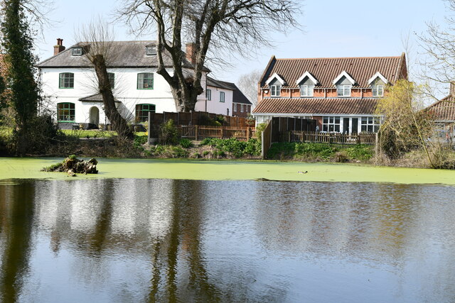
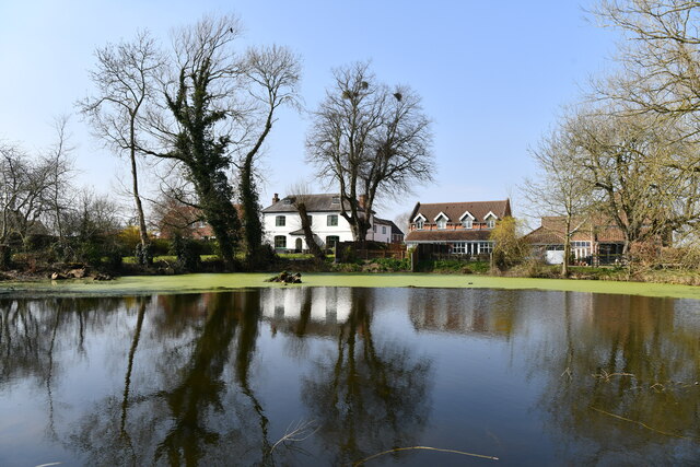
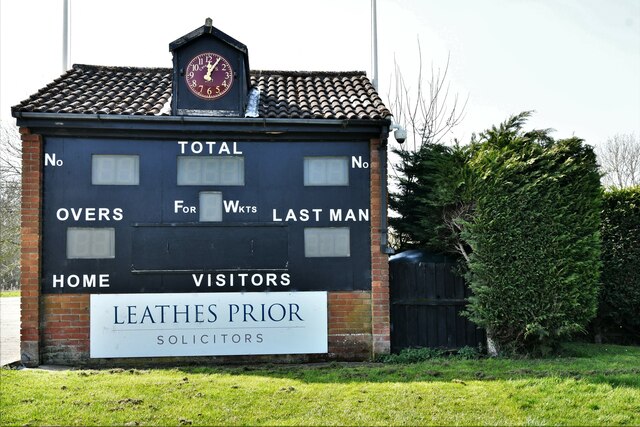
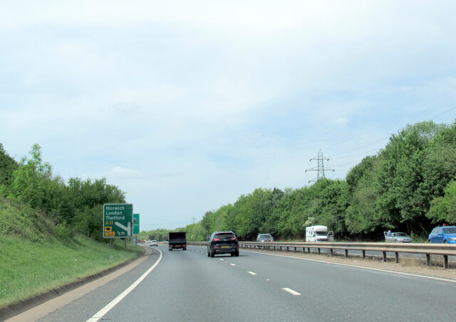
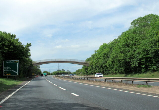
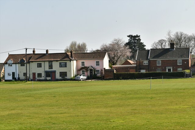
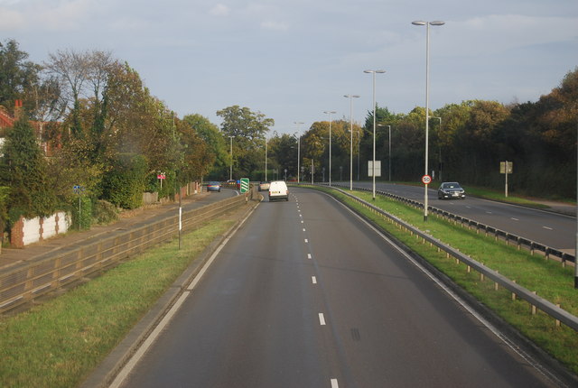
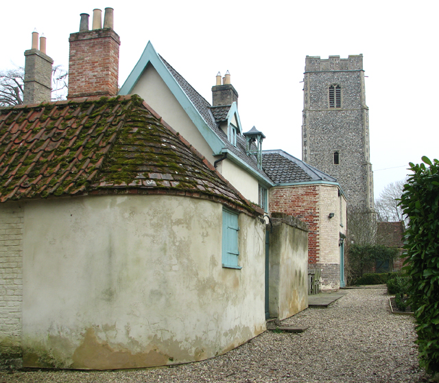
Foxburrow Plantation Images

Images are sourced within 2km of 52.586981/1.244964 or Grid Reference TG1903. Thanks to Geograph Open Source API. All images are credited.

Swardeston: Village pond
Swardeston: Village pond and houses in Chestnut Close
Swardeston: The Cricket Pavilion
The A47 west approaching junction with A11
Footbridge over the A47 west approaching junction with A11
Swardeston: Houses in The Common (road name)
Keswick: A47 bridge over the Ipswich Road roundabout
A11 The A11 is a major road in Eastern England. It runs roughly north east for 111 miles from London to Norwich, With the M11 opening in the 1970s and then the A12 extension in 1999, a lengthy section has been downgraded between the suburbs of east London and the north-west corner of the county of Essex. It also overlaps with the A14 on the Newmarket bypass.
<span class="nowrap"><a title="http://www.sabre-roads.org.uk/wiki/index.php?title=A11" rel="nofollow ugc noopener" href="http://www.sabre-roads.org.uk/wiki/index.php?title=A11">Link</a><img style="margin-left:2px;" alt="External link" title="External link - shift click to open in new window" src="https://s1.geograph.org.uk/img/external.png" width="10" height="10"/></span>
A11
The A11 is a major road in Eastern England. It runs roughly north east for 111 miles from London to Norwich, With the M11 opening in the 1970s and then the A12 extension in 1999, a lengthy section has been downgraded between the suburbs of east London and the north-west corner of the county of Essex. It also overlaps with the A14 on the Newmarket bypass. LinkExternal link
Driveway to Swardeston House
Paddocks by Swardeston House
Gate on the driveway to the Old Rectory The driveway is a public footpath.
Gate on the driveway to the Old Rectory
The driveway is a public footpath.
Footpath through the Old Rectory grounds
The Old Rectory at Swardeston A Grade II listed building. Excerpt from the listing text: Former parsonage, C16 and early C19; C16 range timberframed, rendered and colourwashed, black glazed pantiles; early C19 range of gault brick, hipped roof of black unglazed pantiles. C16 range to south erroneously and subsequently dated 1660 on left gable; 2½ cells, 2 storeys and attic; off centre axial stack with gault brick shaft to chimney bay to right; C19 bell turret forward to right of first cell. Half bay to left with doorway; rendered lean-to to left under pantiles, canted bay window across angle of half bay, lead polygonal roof, sashes with glazing bars. Cell 1 with 4-light casement having pintle hinges and leaded lights to both floors, gabled roof dormer with casements with pintle hinges. <span class="nowrap"><a title="http://www.britishlistedbuildings.co.uk/en-226989-the-old-rectory-and-attached-garden-wall#.VuR4rr9urOo" rel="nofollow ugc noopener" href="http://www.britishlistedbuildings.co.uk/en-226989-the-old-rectory-and-attached-garden-wall#.VuR4rr9urOo">Link</a><img style="margin-left:2px;" alt="External link" title="External link - shift click to open in new window" src="https://s1.geograph.org.uk/img/external.png" width="10" height="10"/></span>
The Old Rectory at Swardeston
A Grade II listed building. Excerpt from the listing text: Former parsonage, C16 and early C19; C16 range timberframed, rendered and colourwashed, black glazed pantiles; early C19 range of gault brick, hipped roof of black unglazed pantiles. C16 range to south erroneously and subsequently dated 1660 on left gable; 2½ cells, 2 storeys and attic; off centre axial stack with gault brick shaft to chimney bay to right; C19 bell turret forward to right of first cell. Half bay to left with doorway; rendered lean-to to left under pantiles, canted bay window across angle of half bay, lead polygonal roof, sashes with glazing bars. Cell 1 with 4-light casement having pintle hinges and leaded lights to both floors, gabled roof dormer with casements with pintle hinges. LinkExternal link
Old Rectory and St Mary's church in Swardeston A Grade II listed building. Excerpt from the listing text: Former parsonage, C16 and early C19; C16 range timberframed, rendered and colourwashed, black glazed pantiles; early C19 range of gault brick, hipped roof of black unglazed pantiles. C16 range to south erroneously and subsequently dated 1660 on left gable; 2½ cells, 2 storeys and attic; off centre axial stack with gault brick shaft to chimney bay to right; C19 bell turret forward to right of first cell. Half bay to left with doorway; rendered lean-to to left under pantiles, canted bay window across angle of half bay, lead polygonal roof, sashes with glazing bars. Cell 1 with 4-light casement having pintle hinges and leaded lights to both floors, gabled roof dormer with casements with pintle hinges. <span class="nowrap"><a title="http://www.britishlistedbuildings.co.uk/en-226989-the-old-rectory-and-attached-garden-wall#.VuR4rr9urOo" rel="nofollow ugc noopener" href="http://www.britishlistedbuildings.co.uk/en-226989-the-old-rectory-and-attached-garden-wall#.VuR4rr9urOo">Link</a><img style="margin-left:2px;" alt="External link" title="External link - shift click to open in new window" src="https://s1.geograph.org.uk/img/external.png" width="10" height="10"/></span>
Old Rectory and St Mary's church in Swardeston
A Grade II listed building. Excerpt from the listing text: Former parsonage, C16 and early C19; C16 range timberframed, rendered and colourwashed, black glazed pantiles; early C19 range of gault brick, hipped roof of black unglazed pantiles. C16 range to south erroneously and subsequently dated 1660 on left gable; 2½ cells, 2 storeys and attic; off centre axial stack with gault brick shaft to chimney bay to right; C19 bell turret forward to right of first cell. Half bay to left with doorway; rendered lean-to to left under pantiles, canted bay window across angle of half bay, lead polygonal roof, sashes with glazing bars. Cell 1 with 4-light casement having pintle hinges and leaded lights to both floors, gabled roof dormer with casements with pintle hinges. LinkExternal link
The Old Rectory in Swardeston A Grade II listed building. Excerpt from the listing text: Former parsonage, C16 and early C19; C16 range timberframed, rendered and colourwashed, black glazed pantiles; early C19 range of gault brick, hipped roof of black unglazed pantiles. C16 range to south erroneously and subsequently dated 1660 on left gable; 2½ cells, 2 storeys and attic; off centre axial stack with gault brick shaft to chimney bay to right; C19 bell turret forward to right of first cell. Half bay to left with doorway; rendered lean-to to left under pantiles, canted bay window across angle of half bay, lead polygonal roof, sashes with glazing bars. Cell 1 with 4-light casement having pintle hinges and leaded lights to both floors, gabled roof dormer with casements with pintle hinges. <span class="nowrap"><a title="http://www.britishlistedbuildings.co.uk/en-226989-the-old-rectory-and-attached-garden-wall#.VuR4rr9urOo" rel="nofollow ugc noopener" href="http://www.britishlistedbuildings.co.uk/en-226989-the-old-rectory-and-attached-garden-wall#.VuR4rr9urOo">Link</a><img style="margin-left:2px;" alt="External link" title="External link - shift click to open in new window" src="https://s1.geograph.org.uk/img/external.png" width="10" height="10"/></span>
The Old Rectory in Swardeston
A Grade II listed building. Excerpt from the listing text: Former parsonage, C16 and early C19; C16 range timberframed, rendered and colourwashed, black glazed pantiles; early C19 range of gault brick, hipped roof of black unglazed pantiles. C16 range to south erroneously and subsequently dated 1660 on left gable; 2½ cells, 2 storeys and attic; off centre axial stack with gault brick shaft to chimney bay to right; C19 bell turret forward to right of first cell. Half bay to left with doorway; rendered lean-to to left under pantiles, canted bay window across angle of half bay, lead polygonal roof, sashes with glazing bars. Cell 1 with 4-light casement having pintle hinges and leaded lights to both floors, gabled roof dormer with casements with pintle hinges. LinkExternal link
Old Rectory in Swardeston A Grade II listed building. Excerpt from the listing text: Former parsonage, C16 and early C19; C16 range timberframed, rendered and colourwashed, black glazed pantiles; early C19 range of gault brick, hipped roof of black unglazed pantiles. C16 range to south erroneously and subsequently dated 1660 on left gable; 2½ cells, 2 storeys and attic; off centre axial stack with gault brick shaft to chimney bay to right; C19 bell turret forward to right of first cell. Half bay to left with doorway; rendered lean-to to left under pantiles, canted bay window across angle of half bay, lead polygonal roof, sashes with glazing bars. Cell 1 with 4-light casement having pintle hinges and leaded lights to both floors, gabled roof dormer with casements with pintle hinges. <span class="nowrap"><a title="http://www.britishlistedbuildings.co.uk/en-226989-the-old-rectory-and-attached-garden-wall#.VuR4rr9urOo" rel="nofollow ugc noopener" href="http://www.britishlistedbuildings.co.uk/en-226989-the-old-rectory-and-attached-garden-wall#.VuR4rr9urOo">Link</a><img style="margin-left:2px;" alt="External link" title="External link - shift click to open in new window" src="https://s1.geograph.org.uk/img/external.png" width="10" height="10"/></span>
Old Rectory in Swardeston
A Grade II listed building. Excerpt from the listing text: Former parsonage, C16 and early C19; C16 range timberframed, rendered and colourwashed, black glazed pantiles; early C19 range of gault brick, hipped roof of black unglazed pantiles. C16 range to south erroneously and subsequently dated 1660 on left gable; 2½ cells, 2 storeys and attic; off centre axial stack with gault brick shaft to chimney bay to right; C19 bell turret forward to right of first cell. Half bay to left with doorway; rendered lean-to to left under pantiles, canted bay window across angle of half bay, lead polygonal roof, sashes with glazing bars. Cell 1 with 4-light casement having pintle hinges and leaded lights to both floors, gabled roof dormer with casements with pintle hinges. LinkExternal link
The Old Rectory as seen from across the pond A Grade II listed building. Excerpt from the listing text: Former parsonage, C16 and early C19; C16 range timberframed, rendered and colourwashed, black glazed pantiles; early C19 range of gault brick, hipped roof of black unglazed pantiles. C16 range to south erroneously and subsequently dated 1660 on left gable; 2½ cells, 2 storeys and attic; off centre axial stack with gault brick shaft to chimney bay to right; C19 bell turret forward to right of first cell. Half bay to left with doorway; rendered lean-to to left under pantiles, canted bay window across angle of half bay, lead polygonal roof, sashes with glazing bars. Cell 1 with 4-light casement having pintle hinges and leaded lights to both floors, gabled roof dormer with casements with pintle hinges. <span class="nowrap"><a title="http://www.britishlistedbuildings.co.uk/en-226989-the-old-rectory-and-attached-garden-wall#.VuR4rr9urOo" rel="nofollow ugc noopener" href="http://www.britishlistedbuildings.co.uk/en-226989-the-old-rectory-and-attached-garden-wall#.VuR4rr9urOo">Link</a><img style="margin-left:2px;" alt="External link" title="External link - shift click to open in new window" src="https://s1.geograph.org.uk/img/external.png" width="10" height="10"/></span>
The Old Rectory as seen from across the pond
A Grade II listed building. Excerpt from the listing text: Former parsonage, C16 and early C19; C16 range timberframed, rendered and colourwashed, black glazed pantiles; early C19 range of gault brick, hipped roof of black unglazed pantiles. C16 range to south erroneously and subsequently dated 1660 on left gable; 2½ cells, 2 storeys and attic; off centre axial stack with gault brick shaft to chimney bay to right; C19 bell turret forward to right of first cell. Half bay to left with doorway; rendered lean-to to left under pantiles, canted bay window across angle of half bay, lead polygonal roof, sashes with glazing bars. Cell 1 with 4-light casement having pintle hinges and leaded lights to both floors, gabled roof dormer with casements with pintle hinges. LinkExternal link
Footpath in Swardeston
Show me another place!

Foxburrow Plantation is located at Grid Ref: TG1903 (Lat: 52.586981, Lng: 1.244964)

Administrative County: Norfolk

District: South Norfolk

Police Authority: Norfolk

What 3 Words

///natively.scare.alive. Near Cringleford, Norfolk

Related Wikis

Intwood

Intwood is a village and former civil parish, now in the parish of Keswick and Intwood, in the South Norfolk district, in the county of Norfolk, England...

Norwich CEYMS F.C.

Norwich Church of England Young Men's Society Football Club, commonly called Norwich CEYMS, is a football club based in Swardeston, near Norwich, in Norfolk...

Swardeston

Swardeston is a village four miles (6 km) south of Norwich in Norfolk, England, on high ground above the Tas valley. It covers an area of 3.95 km2 (1.53...

Mulbarton, Norfolk

Mulbarton is a village and civil parish located south of Norwich in the English county of Norfolk. It covers an area of 5.34 km2 (2.06 sq mi).The place...

Eaton Common

Eaton Common is a 5.3-hectare (13-acre) Local Nature Reserve on the southern outskirts of Norwich in the county of Norfolk in England, United Kingdom...

Keswick, South Norfolk

Keswick is a village and former civil parish, now in the parish of Keswick and Intwood, in the South Norfolk district, in the county of Norfolk, England...

Cringleford

Cringleford is a civil parish and village in the English county of Norfolk. The village sits on the River Yare and forms part of the outskirts of Norwich...

Marston Marshes

Marston Marshes is a 25.9-hectare (64-acre) Local Nature Reserve on the southern outskirts of Norwich in Norfolk. It is owned and managed by Norwich City...

Nearby Amenities

Located within 500m of 52.586981,1.244964
Depth: 0.1
Description: Has a pedestrian bridge bypass.
Ford: yes
Seasonal: yes
Source: OS_OpenData_StreetView;survey
Lat/Long: 52.589966/1.2449662
Power: tower
Ref: 4VV 217
Lat/Long: 52.5895833/1.2493291
Power: tower
Ref: PO19
Lat/Long: 52.5895467/1.2503636
Power: pole
Lat/Long: 52.585307/1.251473
Power: pole
Lat/Long: 52.584751/1.239331
Power: pole
Lat/Long: 52.584724/1.241085
Power: pole
Lat/Long: 52.584681/1.243225
Power: pole
Lat/Long: 52.584847/1.245393
Power: pole
Lat/Long: 52.584991/1.247348
Power: pole
Lat/Long: 52.585147/1.249378
Give Way
Lat/Long: 52.5907551/1.2428083
Parking
Access: yes
Fee: no
Parking: layby
Lat/Long: 52.5886562/1.2511745
Intwood
Place: hamlet
Lat/Long: 52.5909628/1.2424023
Note: No access to A47
Lat/Long: 52.5897893/1.2488754
Phone
Check Date: 2021-08-14
Emergency: phone
Ref: 237B
Lat/Long: 52.588874/1.2506729
Board Type: notice
Information: board
Tourism: information
Lat/Long: 52.5910067/1.2423136
Location Transition: yes
Power: pole
Transformer: distribution
Lat/Long: 52.5893325/1.2454355
Intwood
Board Type: notice
Information: board
Tourism: information
Lat/Long: 52.5908532/1.2421679
Entrance: main
Lat/Long: 52.5909921/1.2418499
Give Way
Lat/Long: 52.5907567/1.2420169
The data included in this document is from www.openstreetmap.org. The data is made available under ODbL.

Have you been to Foxburrow Plantation?

Leave your review of Foxburrow Plantation below (or comments, questions and feedback).