Intwood Carr

Wood, Forest in Norfolk South Norfolk

England

Intwood Carr

Swardeston: Village pond
Swardeston: Village pond Credit: Michael Garlick

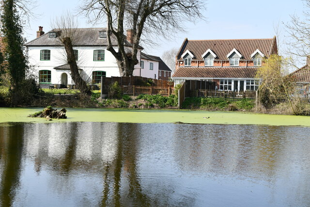
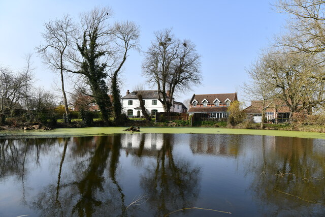
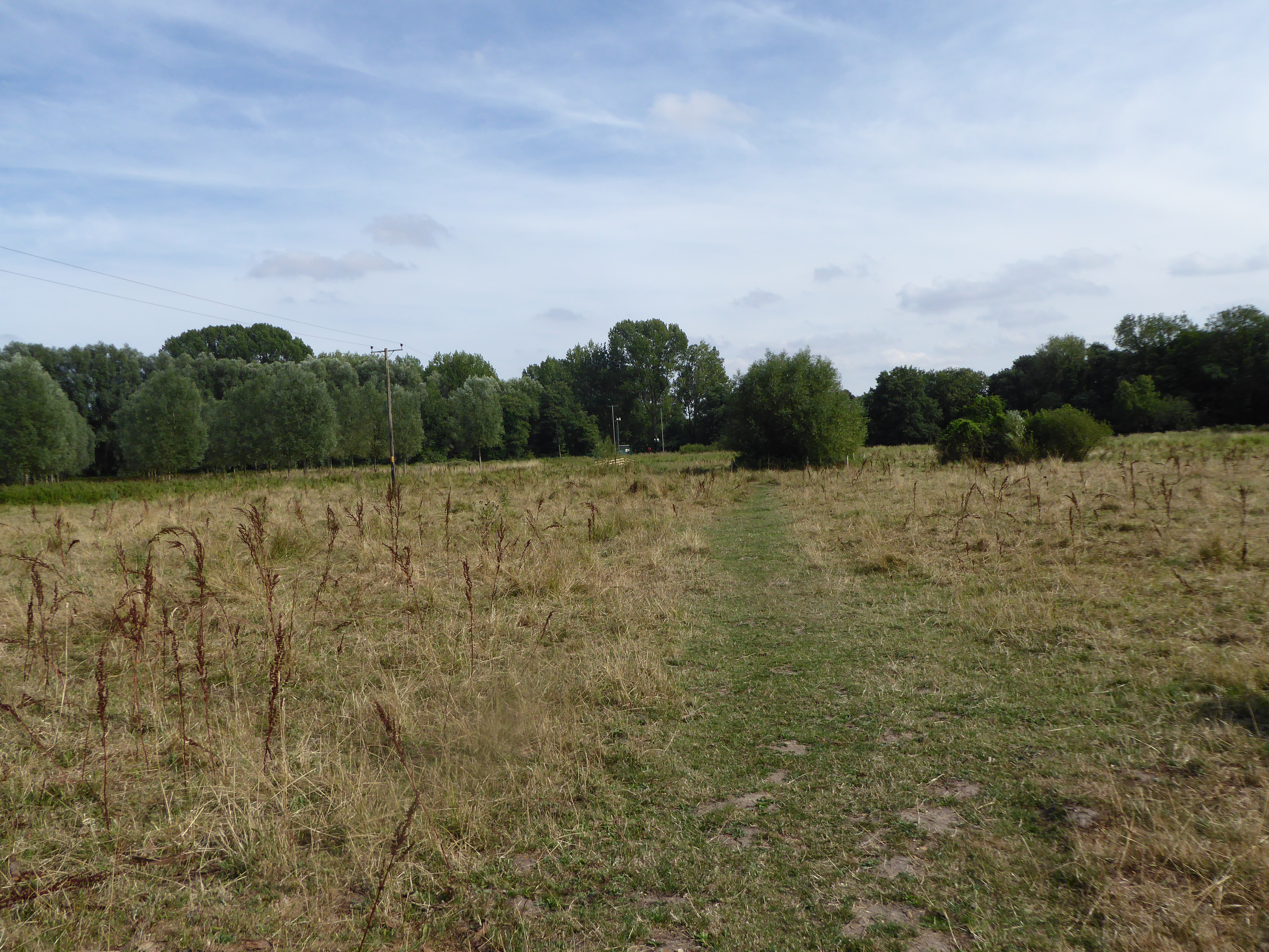
Intwood Carr is a picturesque woodland area located in Norfolk, England. Situated near the village of Intwood, it covers a vast expanse of land and is well-known for its natural beauty and diverse wildlife. The name "Carr" refers to a type of wetland forest, and Intwood Carr is characterized by its dense woodlands and marshy areas.

The woodland of Intwood Carr is home to a rich variety of flora and fauna. It is dominated by ancient oak trees, which create a dense canopy that provides shelter for numerous species of birds, mammals, and insects. The forest floor is adorned with a colorful array of wildflowers, such as bluebells and primroses, during springtime.

The wetland areas within Intwood Carr are particularly notable. Marshes and ponds are interspersed throughout the woodland, creating a diverse ecosystem that supports a range of water-dwelling plants and animals. These wetlands also attract a variety of waterfowl, including ducks and herons.

Intwood Carr is a popular destination for nature enthusiasts and offers several walking trails that allow visitors to explore the woodland. The tranquil atmosphere and the abundance of wildlife make it an ideal location for birdwatching, photography, and nature walks.

Overall, Intwood Carr is a stunning example of Norfolk's natural beauty. Its ancient woodlands, wetland habitats, and diverse wildlife make it a haven for nature lovers and a place of great ecological importance.

If you have any feedback on the listing, please let us know in the comments section below.
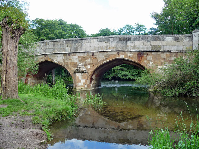
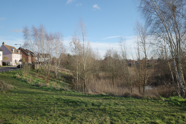
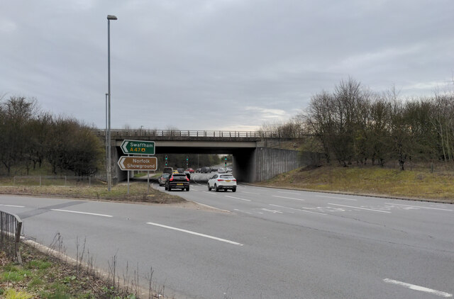
Intwood Carr Images

Images are sourced within 2km of 52.596362/1.2449488 or Grid Reference TG1904. Thanks to Geograph Open Source API. All images are credited.

Swardeston: Village pond
Swardeston: Village pond and houses in Chestnut Close
The A47 west approaching junction with A11
Footbridge over the A47 west approaching junction with A11
Slip road leaving the A47 to join the A11
Bridge, Cringleford Built in 1520, replacing a bridge washed away in 1519, and widened in 1780. The facings are in limestone, "a rarity in Norfolk other than for churches and bridges". Grade II* listed.
It carries Eaton Street over the River Yare.
Bridge, Cringleford
Built in 1520, replacing a bridge washed away in 1519, and widened in 1780. The facings are in limestone, "a rarity in Norfolk other than for churches and bridges". Grade II* listed. It carries Eaton Street over the River Yare.
The A11 eastbound approaching the Thickthorn Interchange
Dragonfly Lane, Cringleford
Newmarket Road, Cringleford
Round House Way, Cringleford
Bus shelter, Round House Way, Cringleford
Dragonfly Lane, Cringleford
Jasmine Walk, Cringleford
A balancing pond seen from Dragonfly Lane, Cringleford
The A11 going under the A47, Cringleford The A11 is a major road in Eastern England. It runs roughly north east for 111 miles from London to Norwich, With the M11 opening in the 1970s and then the A12 extension in 1999, a lengthy section has been downgraded between the suburbs of east London and the north-west corner of the county of Essex. It also overlaps with the A14 on the Newmarket bypass.
<span class="nowrap"><a title="http://www.sabre-roads.org.uk/wiki/index.php?title=A11" rel="nofollow ugc noopener" href="http://www.sabre-roads.org.uk/wiki/index.php?title=A11">Link</a><img style="margin-left:2px;" alt="External link" title="External link - shift click to open in new window" src="https://s1.geograph.org.uk/img/external.png" width="10" height="10"/></span>
The A11 going under the A47, Cringleford
The A11 is a major road in Eastern England. It runs roughly north east for 111 miles from London to Norwich, With the M11 opening in the 1970s and then the A12 extension in 1999, a lengthy section has been downgraded between the suburbs of east London and the north-west corner of the county of Essex. It also overlaps with the A14 on the Newmarket bypass. LinkExternal link
A sliproad to the A47 from the A11, Cringleford
Show me another place!

Intwood Carr is located at Grid Ref: TG1904 (Lat: 52.596362, Lng: 1.2449488)

Administrative County: Norfolk

District: South Norfolk

Police Authority: Norfolk

What 3 Words

///detail.cove.upset. Near Cringleford, Norfolk

Related Wikis

Intwood

Intwood is a village and former civil parish, now in the parish of Keswick and Intwood, in the South Norfolk district, in the county of Norfolk, England...

Eaton Common

Eaton Common is a 5.3-hectare (13-acre) Local Nature Reserve on the southern outskirts of Norwich in the county of Norfolk in England, United Kingdom...

Cringleford

Cringleford is a civil parish and village in the English county of Norfolk. The village sits on the River Yare and forms part of the outskirts of Norwich...

Keswick, South Norfolk

Keswick is a village and former civil parish, now in the parish of Keswick and Intwood, in the South Norfolk district, in the county of Norfolk, England...

Nearby Amenities

Located within 500m of 52.596362,1.2449488
Railway: level_crossing
Lat/Long: 52.5978351/1.2410152
Parking
Access: yes
Fee: no
Parking: layby
Lat/Long: 52.5953942/1.2389887
Power: tower
Ref: 4VV 215
Lat/Long: 52.5938871/1.2409709
Power: tower
Ref: 4VV 216
Lat/Long: 52.5919254/1.2450024
Power: tower
Ref: PO22
Lat/Long: 52.5949299/1.2408435
Power: tower
Ref: PO21
Lat/Long: 52.5930114/1.2442409
Power: pole
Lat/Long: 52.597428/1.251953
Power: pole
Lat/Long: 52.597579/1.251079
Power: pole
Lat/Long: 52.597707/1.249566
Power: pole
Lat/Long: 52.597821/1.248029
Power: pole
Lat/Long: 52.597518/1.246597
Power: pole
Lat/Long: 52.597127/1.245053
Power: pole
Lat/Long: 52.596825/1.243627
Power: pole
Lat/Long: 52.596388/1.242492
Location Transition: yes
Material: wood
Power: pole
Lat/Long: 52.595979/1.241401
Bus Stop
Kewsick Road / Keswick Close
Naptan AtcoCode: 2900C3534
Naptan Bearing: W
Naptan CommonName: Keswick Close
Naptan Indicator: opp
Naptan Locality: Cringleford
Naptan NaptanCode: nfogpamw
Naptan PlusbusZoneRef: NRCH
Naptan Street: Keswick Road
Operator: Anglian Coaches Ltd.
Ref: NFOGPAMW
Shelter: no
Source: naptan_import;survey
Lat/Long: 52.6007314/1.2455559
Bus Stop
Keswick Close, adj
Naptan AtcoCode: 2900C3535
Naptan Bearing: E
Naptan BusStopType: CUS
Naptan CommonName: Keswick Close
Naptan Indicator: adj
Naptan Locality: Cringleford
Naptan NaptanCode: nfogpaga
Naptan PlusbusZoneRef: NRCH
Naptan Street: Keswick Road
Naptan Verified: no
Operator: Anglian Coaches Ltd.
Physically Present: no
Shelter: no
Source: naptan_import
Lat/Long: 52.6007898/1.2457682
Bus Stop
Mark Lemon Close
Naptan AtcoCode: 2900C3536
Naptan Bearing: SE
Naptan BusStopType: CUS
Naptan CommonName: Mark Lemon Close
Naptan Indicator: adj
Naptan Locality: Cringleford
Naptan NaptanCode: nfogpagd
Naptan PlusbusZoneRef: NRCH
Naptan Street: Keswick Road
Operator: Anglian Coaches Ltd.
Physically Present: no
Shelter: no
Source: naptan_import;survey
Lat/Long: 52.600622/1.246967
Phone
Check Date: 2021-08-14
Emergency: phone
Ref: 236A
Lat/Long: 52.5953462/1.2392845
Railway: level_crossing
Lat/Long: 52.5978742/1.2410105
Note: 9 new houses here.
Lat/Long: 52.5968291/1.251851
Generator Method: photovoltaic
Generator Output Electricity: yes
Generator Source: solar
Generator Type: solar_photovoltaic_panel
Location: roof
Power: generator
Lat/Long: 52.5979941/1.2495983
Generator Method: photovoltaic
Generator Output Electricity: yes
Generator Solar Modules: 16
Generator Source: solar
Generator Type: solar_photovoltaic_panel
Location: roof
Power: generator
Lat/Long: 52.6007278/1.2438476
Generator Method: photovoltaic
Generator Output Electricity: yes
Generator Source: solar
Generator Type: solar_photovoltaic_panel
Location: roof
Power: generator
Lat/Long: 52.5987036/1.2393817
Generator Method: photovoltaic
Generator Output Electricity: yes
Generator Source: solar
Generator Type: solar_photovoltaic_panel
Location: roof
Power: generator
Lat/Long: 52.5987989/1.2390411
Generator Method: photovoltaic
Generator Output Electricity: yes
Generator Source: solar
Generator Type: solar_photovoltaic_panel
Location: roof
Power: generator
Lat/Long: 52.6000045/1.2448454
Description: Bench
Lat/Long: 52.5961552/1.2490005
The data included in this document is from www.openstreetmap.org. The data is made available under ODbL.

Have you been to Intwood Carr?

Leave your review of Intwood Carr below (or comments, questions and feedback).