Freiston Shore

Settlement in Lincolnshire Boston

England

Freiston Shore

Freiston Shore Lincolnshire The picture is taken from the top of a sea wall. The reclaimed field covers what 150 years ago was a golden sandy beach at Lincolnshire's first seaside resort, Freiston Shore. The white house in the distance is part of the Plummer's Hotel, which was built to serve the resort.
Freiston Shore Lincolnshire Credit: Robin Jones

Freiston Shore is a small village located in Lincolnshire, England. Situated on the eastern coast of the country, it lies approximately 7 miles southeast of the town of Boston. The village is bordered by the North Sea to the east and the River Witham to the west.

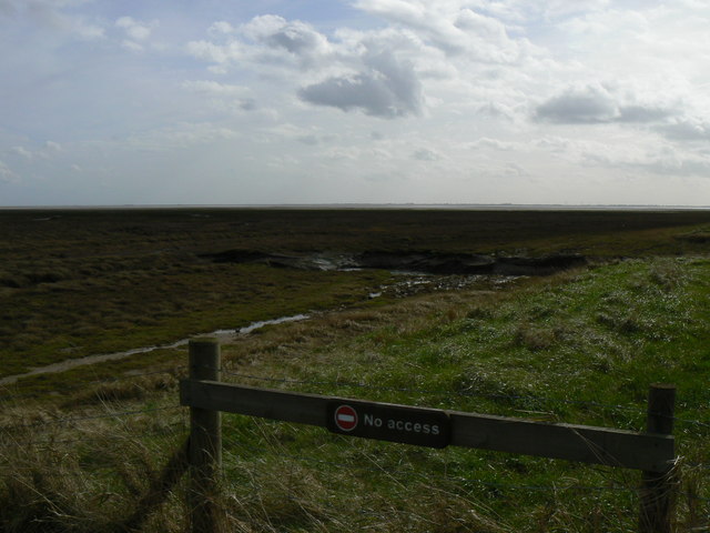
Known for its scenic beauty, Freiston Shore is a haven for nature enthusiasts and bird watchers. The area is home to the Freiston Shore Nature Reserve, managed by the Royal Society for the Protection of Birds (RSPB). The reserve covers around 3.5 square kilometers and offers a diverse range of habitats, including salt marshes, mudflats, and freshwater lagoons. These habitats attract a wide variety of bird species throughout the year, making it a popular destination for birdwatching.

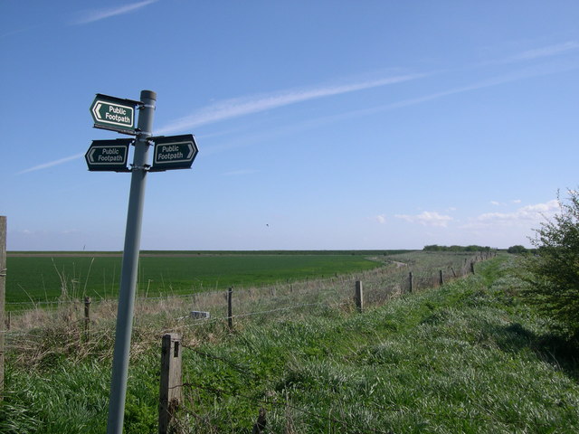
The village itself is relatively small, with a population of around 300 people. It has a quaint charm, with traditional cottages and a few local amenities, including a pub and a church. The nearby coastline offers stunning views, and visitors can enjoy long walks along the sandy beach, taking in the fresh sea air.

Freiston Shore is well-connected to other parts of Lincolnshire, with regular bus services linking it to nearby towns and villages. It is also easily accessible by road, as it is located just off the A52. Overall, Freiston Shore is a peaceful and picturesque village that offers a unique blend of natural beauty and tranquility.

If you have any feedback on the listing, please let us know in the comments section below.

Freiston Shore Images

Images are sourced within 2km of 52.961939/0.078601 or Grid Reference TF3942. Thanks to Geograph Open Source API. All images are credited.

Freiston Shore Lincolnshire The picture is taken from the top of a sea wall. The reclaimed field covers what 150 years ago was a golden sandy beach at Lincolnshire's first seaside resort, Freiston Shore. The white house in the distance is part of the Plummer's Hotel, which was built to serve the resort.
Freiston Shore Lincolnshire
The picture is taken from the top of a sea wall. The reclaimed field covers what 150 years ago was a golden sandy beach at Lincolnshire's first seaside resort, Freiston Shore. The white house in the distance is part of the Plummer's Hotel, which was built to serve the resort.
Freiston Shore managed realignment site A view of the managed realignment site at Freiston Shore, taken from the North car park shortly after high tide.
Freiston Shore managed realignment site
A view of the managed realignment site at Freiston Shore, taken from the North car park shortly after high tide.
Saltmarsh at Freiston Shore A view of the natural saltmarsh, taken from the seawall of the Freiston Shore managed realignment site.
Saltmarsh at Freiston Shore
A view of the natural saltmarsh, taken from the seawall of the Freiston Shore managed realignment site.
Lane leading to north carpark, Freiston Shore Access to the north carpark of the Freiston Shore managed realignment site, including public footpath access. This photo was taken on the Victorian sea wall, and shows the 1970s wall in the distance.
Lane leading to north carpark, Freiston Shore
Access to the north carpark of the Freiston Shore managed realignment site, including public footpath access. This photo was taken on the Victorian sea wall, and shows the 1970s wall in the distance.
Breaches at the Freiston Shore managed realignment site A view looking back across the saltmarsh to the sea wall and central breach of the Freiston Shore managed realignment site. The marsh is starting to revegetate with annual pioneer species, and saltpans can also be observed.
Breaches at the Freiston Shore managed realignment site
A view looking back across the saltmarsh to the sea wall and central breach of the Freiston Shore managed realignment site. The marsh is starting to revegetate with annual pioneer species, and saltpans can also be observed.
Freiston Shore managed realignment site at high tide This image shows the managed realignment site and the outer saltmarsh both under water during a high spring tide. This illustrates the amount of tidal exchange that occurs between a mature marsh, and new areas of marsh creation by managed realignment. This view also highlights public access to the site.
Freiston Shore managed realignment site at high tide
This image shows the managed realignment site and the outer saltmarsh both under water during a high spring tide. This illustrates the amount of tidal exchange that occurs between a mature marsh, and new areas of marsh creation by managed realignment. This view also highlights public access to the site.
Creek, Freiston Low A creek 3 hours after high tide. This is an area of complex saltmarsh communities.
Creek, Freiston Low
A creek 3 hours after high tide. This is an area of complex saltmarsh communities.
Managed Realignment Site at Low Tide Low tide at the Freiston Shore managed realignment trial, showing a good coverage of vegetation 5 years after breaching. Vegetation monitoring is ongoing.
Managed Realignment Site at Low Tide
Low tide at the Freiston Shore managed realignment trial, showing a good coverage of vegetation 5 years after breaching. Vegetation monitoring is ongoing.
Flood defences at Freiston Shore The image doesn't quite give you an impression of the scale, but these sea defences are quite sizeable. Looking out towards The Wash.
Flood defences at Freiston Shore
The image doesn't quite give you an impression of the scale, but these sea defences are quite sizeable. Looking out towards The Wash.
Inner Marshes near Cold Harbour The outer marshes can just be seen over the defences. The inner marshes are a nature reserve.
Inner Marshes near Cold Harbour
The outer marshes can just be seen over the defences. The inner marshes are a nature reserve.
Gated footpath near Cold Harbour Looking towards The Wash.
Gated footpath near Cold Harbour
Looking towards The Wash.
Saltmarsh creek near Cold Harbour The first sign of the turn of the tide will be these creeks filling with sea water.
Saltmarsh creek near Cold Harbour
The first sign of the turn of the tide will be these creeks filling with sea water.
Saltmarsh creek near Cold Harbour The water was gently running off into The Wash.
Saltmarsh creek near Cold Harbour
The water was gently running off into The Wash.
Saltmarsh near Cold Harbour Could this be an observation platform? Nearby there were several rotted off poles about as though there had been some sort of fence leading up to this platform. Maybe something to hang onto as you walked through the mud.
Saltmarsh near Cold Harbour
Could this be an observation platform? Nearby there were several rotted off poles about as though there had been some sort of fence leading up to this platform. Maybe something to hang onto as you walked through the mud.
Saltmarsh near Cold Harbour Footpath from the outer marshes.
Saltmarsh near Cold Harbour
Footpath from the outer marshes.
Inner Marshes near Cold Harbour Looking back towards the car park.
Inner Marshes near Cold Harbour
Looking back towards the car park.
Footpath near Cold Harbour The footpath leads to a pumping station, which can just be seen.
Footpath near Cold Harbour
The footpath leads to a pumping station, which can just be seen.
Inner Marshes near Cold Harbour A reserve for wading birds.
Inner Marshes near Cold Harbour
A reserve for wading birds.
Show me another place!

Freiston Shore is located at Grid Ref: TF3942 (Lat: 52.961939, Lng: 0.078601)

Division: Parts of Holland

Administrative County: Lincolnshire

District: Boston

Police Authority: Lincolnshire

What 3 Words

///hubcaps.animated.resolved. Near Butterwick, Lincolnshire

Nearby Locations

Freiston Shore

Related Wikis

Freiston Shore

Freiston Shore is a settlement in the Borough of Boston, in Lincolnshire, England. It is in the civil parish of Freiston, and approximately 4 miles (6...

Freiston Priory

Freiston Priory was a Benedictine cell of Crowland Abbey founded in 1114, and became a priory soon afterwards. It was Dissolved in 1539 and was located...

Butterwick, Lincolnshire

Butterwick is a village and civil parish in the Borough of Boston, Lincolnshire, England, It is situated approximately 3 miles (5 km) east from the market...

HM Prison North Sea Camp

HM Prison North Sea Camp is a men's open prison (Category D), located on the edge of the parish of Freiston (near Boston) in Lincolnshire, England. North...

Nearby Amenities

Located within 500m of 52.961939,0.078601
Bus Stop
Nature Reserve
Naptan AtcoCode: 270000009272
Naptan Bearing: N
Naptan CommonName: Nature Reserve
Naptan Indicator: opp
Naptan Landmark: Nature Reserve
Naptan NaptanCode: linjajwt
Naptan Street: Shore Road
Naptan Verified: no
Source: naptan_import
Lat/Long: 52.9619659/0.0785409
Bus Stop
Nature Reserve
Naptan AtcoCode: 2700LFS06162
Naptan Bearing: S
Naptan CommonName: Nature Reserve
Naptan Indicator: adj
Naptan Landmark: Nature Reserve
Naptan NaptanCode: lingapdg
Naptan Street: Shore Road
Naptan Verified: no
Source: naptan_import
Lat/Long: 52.961692/0.0787809
Tourism: viewpoint
Lat/Long: 52.9592912/0.0828645
Post Box
Ref: PE22 153
Lat/Long: 52.9611884/0.0787028
Bicycle Parking
Capacity: 4
Covered: no
Source: Bing
Supervised: no
Lat/Long: 52.9605331/0.0788302
Bench
Source: Bing
Lat/Long: 52.960776/0.0791318
Bench
Source: Bing
Lat/Long: 52.9609552/0.0792354
Freiston Shore
Is In: Lincolnshire, England, UK
Is In District: Boston
Is In Ward: Freiston
Place: hamlet
Source: Bing, survey, local knowledge
Wikidata: Q5501432
Wikipedia: en:Freiston Shore
Lat/Long: 52.9614646/0.078632
Vending Machine
Currency GBP: yes
Operator: RSPB
Payment Cash: yes
Payment Visa: yes
Vending: parking_tickets
Lat/Long: 52.9606805/0.0789641
Entrance: yes
Lat/Long: 52.958514/0.0746291
Royal Artillery plinth
Historic: memorial
Lat/Long: 52.9584125/0.0748989
The data included in this document is from www.openstreetmap.org. The data is made available under ODbL.

Have you been to Freiston Shore?

Leave your review of Freiston Shore below (or comments, questions and feedback).