Drayton Wood

Wood, Forest in Norfolk Broadland

England

Drayton Wood

Old Milestone, Drayton On the South side of the A1067, 20yds W of junction with Taverham Road, in the parish of Drayton. Alternative views are <a href="https://www.geograph.org.uk/photo/1391707">TG1713 : Drayton Milestone</a> & <a href="https://www.geograph.org.uk/photo/1558894">TG1713 : Old Milepost</a>.

Inscription: To / Norwich / 4 / Miles // Fakenham / 20 // Drayton

Milestone Society National ID: NO_NF04
Old Milestone, Drayton Credit: Alan Lake

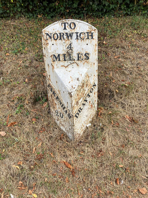
Drayton Wood is a small forest located in the county of Norfolk, England. Covering an area of approximately 150 acres, it is a popular destination for nature enthusiasts and outdoor lovers. The wood is situated near the village of Drayton, just a few miles west of Norwich, the county's capital.

The woodland is predominantly made up of native broadleaf trees, including oak, beech, birch, and sycamore. These trees provide a lush canopy that offers shade and shelter to a diverse range of wildlife. Drayton Wood is home to a variety of bird species, such as woodpeckers, owls, and thrushes, making it a haven for birdwatchers. In addition to the avian population, the forest also houses mammals like deer, foxes, and squirrels.

The wood features a network of well-maintained walking trails, allowing visitors to explore its beauty at their own pace. These paths take visitors through enchanting glades, across babbling brooks, and past serene ponds. The tranquility of the surroundings makes it an ideal spot for individuals seeking peace and solitude.

Drayton Wood is open to the public throughout the year, free of charge, and provides ample parking facilities for visitors. The forest is managed by the local council, ensuring the preservation of its natural beauty and the protection of its inhabitants. It also hosts educational programs and events, aiming to raise awareness about the importance of woodland conservation and sustainable forestry practices.

Overall, Drayton Wood offers a peaceful escape from the hustle and bustle of everyday life, providing a haven for both nature enthusiasts and those seeking a moment of serenity in the heart of Norfolk.

If you have any feedback on the listing, please let us know in the comments section below.

Drayton Wood Images

Images are sourced within 2km of 52.669529/1.2460666 or Grid Reference TG1912. Thanks to Geograph Open Source API. All images are credited.

Old Milestone, Drayton On the South side of the A1067, 20yds W of junction with Taverham Road, in the parish of Drayton. Alternative views are <a href="https://www.geograph.org.uk/photo/1391707">TG1713 : Drayton Milestone</a> & <a href="https://www.geograph.org.uk/photo/1558894">TG1713 : Old Milepost</a>.

Inscription: To / Norwich / 4 / Miles // Fakenham / 20 // Drayton

Milestone Society National ID: NO_NF04
Old Milestone, Drayton
On the South side of the A1067, 20yds W of junction with Taverham Road, in the parish of Drayton. Alternative views are TG1713 : Drayton Milestone & TG1713 : Old Milepost. Inscription: To / Norwich / 4 / Miles // Fakenham / 20 // Drayton Milestone Society National ID: NO_NF04
Bridge Cottage, River Wensum, Costessey Nestling close to the river and the site of an old Toll Bridge, this cottage would have been the toll keeper's residence. The bridge looks to have been collecting tolls as late as 1905, run by a private company. It was not part of the turnpike system and would originally obviated some turnpike miles to Norwich.

Milestone Society National ID: NO.COS
Bridge Cottage, River Wensum, Costessey
Nestling close to the river and the site of an old Toll Bridge, this cottage would have been the toll keeper's residence. The bridge looks to have been collecting tolls as late as 1905, run by a private company. It was not part of the turnpike system and would originally obviated some turnpike miles to Norwich. Milestone Society National ID: NO.COS
Barber, baker and beautician, Drayton On Taverham Road.
Barber, baker and beautician, Drayton
On Taverham Road.
Oops a Daisy, Drayton Florist on Fakenham Road.
Oops a Daisy, Drayton
Florist on Fakenham Road.
Village sign, Drayton Commemorating 50 years since the founding of Drayton 'afternoon W I'.
Village sign, Drayton
Commemorating 50 years since the founding of Drayton 'afternoon W I'.
The Red Lion public house, Drayton The building dates from 1678, becoming an inn in the mid 1700s. Damaged by enemy action in 1942.
The Red Lion public house, Drayton
The building dates from 1678, becoming an inn in the mid 1700s. Damaged by enemy action in 1942.
The Cock Inn, Drayton The present building replaced an 18th century inn in 1956. It was renovated  in 1998-1999. One of the Marston chain of brewers.
The Cock Inn, Drayton
The present building replaced an 18th century inn in 1956. It was renovated in 1998-1999. One of the Marston chain of brewers.
Children's play area, Drayton Playground on School Road, next to St. Margaret's church which can be seen in the background.
Children's play area, Drayton
Playground on School Road, next to St. Margaret's church which can be seen in the background.
St. Margaret's church, Drayton The church dates from 1198 with some medieval fabric but mainly rebuilt in the 19th century. Inside is a fragment of the 15th century rood screen stair by the pulpit.  Grade II* listed.
St. Margaret's church, Drayton
The church dates from 1198 with some medieval fabric but mainly rebuilt in the 19th century. Inside is a fragment of the 15th century rood screen stair by the pulpit. Grade II* listed.
Inside St. Margaret's church, Drayton Looking eastwards along the nave. The church dates from 1198 with some medieval fabric but mainly rebuilt in the 19th century. A fragment of the 15th century rood screen stair can be seen by the pulpit. A Grade II* listed building.
Inside St. Margaret's church, Drayton
Looking eastwards along the nave. The church dates from 1198 with some medieval fabric but mainly rebuilt in the 19th century. A fragment of the 15th century rood screen stair can be seen by the pulpit. A Grade II* listed building.
A poppyhead in St. Margaret's church, Drayton A poppyhead is a form of carving on the top of the end of a bench or a choir stall. Its name is unrelated to the poppy flower but derived by way of Old French, from the Latin word puppis, which means the poop or the figurehead of a ship.
A poppyhead in St. Margaret's church, Drayton
A poppyhead is a form of carving on the top of the end of a bench or a choir stall. Its name is unrelated to the poppy flower but derived by way of Old French, from the Latin word puppis, which means the poop or the figurehead of a ship.
East window, St. Margaret's church, Drayton The church dates from 1198 with some medieval fabric but mainly rebuilt in the 19th century.  A Grade II* listed building.
East window, St. Margaret's church, Drayton
The church dates from 1198 with some medieval fabric but mainly rebuilt in the 19th century. A Grade II* listed building.
18th century gravestone, St. Margaret's church, Drayton A child's grave, John, son of John and Elizabeth Cannell, who died in 1781 in the 6th year of his age.
18th century gravestone, St. Margaret's church, Drayton
A child's grave, John, son of John and Elizabeth Cannell, who died in 1781 in the 6th year of his age.
18th century gravestone, St. Margaret's church, Drayton A detail on a child's grave, John, son of John and Elizabeth Cannell, who died in 1781 in the 6th year of his age.
18th century gravestone, St. Margaret's church, Drayton
A detail on a child's grave, John, son of John and Elizabeth Cannell, who died in 1781 in the 6th year of his age.
Old Milepost by the A1067, Drayton High Road, Drayton Cast iron post by the A1067, in parish of DRAYTON (BROADLAND District), 150yds East of junction with Hurn Road. Just East of entrance to former David Rice Hospital, on the verge, near lamppost, on South side of road. Fakenham ci l-top, erected by the Norwich & Fakenham turnpike trust in the 19th century. An earlier photograph can be found here <a title="https://www.geograph.org.uk/photo/6617195" href="https://www.geograph.org.uk/photo/6617195">Link</a>.

Inscription reads:- : TO / FAKENHAM / 21 : : TO / NORWICH / 3 : : DRAYTON :

Listed.

Milestone Society National ID: NO_NF03.
Old Milepost by the A1067, Drayton High Road, Drayton
Cast iron post by the A1067, in parish of DRAYTON (BROADLAND District), 150yds East of junction with Hurn Road. Just East of entrance to former David Rice Hospital, on the verge, near lamppost, on South side of road. Fakenham ci l-top, erected by the Norwich & Fakenham turnpike trust in the 19th century. An earlier photograph can be found here Link. Inscription reads:- : TO / FAKENHAM / 21 : : TO / NORWICH / 3 : : DRAYTON : Listed. Milestone Society National ID: NO_NF03.
Hellesdon Hospital Hellesdon Hospital - Norwich. Originally the 'Lunatic Asylum' - see OS map dated 1899.
Hellesdon Hospital
Hellesdon Hospital - Norwich. Originally the 'Lunatic Asylum' - see OS map dated 1899.
McDonald's Bin I didn't really want to be seen taking pictures of the carpark so just pressed the shutter and this was the result!
McDonald's Bin
I didn't really want to be seen taking pictures of the carpark so just pressed the shutter and this was the result!
McDonald's Carpark I didn't really want to be seen taking pictures of the carpark so just pressed the shutter and this was the result!
McDonald's Carpark
I didn't really want to be seen taking pictures of the carpark so just pressed the shutter and this was the result!
Show me another place!

Drayton Wood is located at Grid Ref: TG1912 (Lat: 52.669529, Lng: 1.2460666)

Administrative County: Norfolk

District: Broadland

Police Authority: Norfolk

What 3 Words

///courier.stems.joyously. Near Costessey, Norfolk

Nearby Locations

Drayton Wood

Related Wikis

Dussindale & Hellesdon Rovers F.C.

Dussindale & Hellesdon Rovers Football Club is a football club based in Norwich, England. They are currently members of the Eastern Counties League Division...

Hellesdon Hospital

Hellesdon Hospital is a mental health facility in Hellesdon, Norfolk, England. It is managed by Norfolk and Suffolk NHS Foundation Trust. == History... ==

Hellesdon High School

Hellesdon High School is a secondary school and sixth form with academy status in Hellesdon, Norfolk, England. The school is part of the Wensum Trust....

Marriott's Way

The Marriott's Way is a footpath, cycle-path and bridleway in north Norfolk, England, between Norwich and Aylsham via Themelthorpe. It forms part of the...

Related Videos

Saving For Disney World From Uk

Saving For Disney World From Uk. Looking at disney world holiday from the UK can seem super expensive. Try my savings hack, ...

Fundraising for the Multiple Sclerosis Therapy Centre, Norfolk, with Mr Richard Leigh

Richard Leigh is walking one mile a day for the Multiple Sclerosis Therapy Centre, Norfolk. He has been on TV several times ...

Nearby Amenities

Located within 500m of 52.669529,1.2460666
Post Box
Collection Times: Mo-Fr 18:15; Sa 11:00
Operator: Royal Mail
Postal Code: NR6
Ref: NR6 603
Lat/Long: 52.6661871/1.2478554
Bus Stop
No 237, opp
Bench: no
Bin: no
Lit: no
Naptan AtcoCode: 2900D1125
Naptan Bearing: NW
Naptan CommonName: No 237
Naptan Indicator: opp
Naptan Locality: Drayton
Naptan NaptanCode: nfogpwdp
Naptan PlusbusZoneRef: NRCH
Naptan Street: High Road
Naptan Verified: no
Shelter: no
Source: naptan_import
Tactile Paving: yes
Lat/Long: 52.6665099/1.2450189
Bus Stop
No 233, adj
Bench: no
Bin: no
Lit: no
Naptan AtcoCode: 2900D1126
Naptan Bearing: SE
Naptan CommonName: No 233
Naptan Indicator: adj
Naptan Locality: Drayton
Naptan NaptanCode: nfogpwdt
Naptan PlusbusZoneRef: NRCH
Naptan Street: High Road
Naptan Verified: no
Shelter: no
Source: naptan_import
Tactile Paving: yes
Lat/Long: 52.666346/1.245421
Bus Stop
Hurn Road, adj
Bench: yes
Naptan AtcoCode: 2900D117
Naptan Bearing: SE
Naptan CommonName: Hurn Road
Naptan Indicator: adj
Naptan Landmark: Hurn Road
Naptan Locality: Drayton
Naptan NaptanCode: nfoamjpj
Naptan PlusbusZoneRef: NRCH
Naptan Street: Drayton High Road
Naptan Verified: no
Shelter: yes
Source: naptan_import
Lat/Long: 52.6696399/1.2400878
Bus Stop
Hurn Road, opp
Bench: no
Bin: no
Naptan AtcoCode: 2900D118
Naptan Bearing: NW
Naptan CommonName: Hurn Road
Naptan Indicator: opp
Naptan Landmark: Hurn Road
Naptan Locality: Drayton
Naptan NaptanCode: nfoamjpm
Naptan PlusbusZoneRef: NRCH
Naptan Street: Drayton High Road
Naptan Verified: no
Shelter: no
Source: naptan_import
Lat/Long: 52.6690135/1.2409586
Turning Circle
Lat/Long: 52.6693269/1.2432072
Crossing
Crossing: unmarked
Crossing Island: yes
Tactile Paving: yes
Lat/Long: 52.6695795/1.2401225
Barrier: cycle_barrier
Lat/Long: 52.6720489/1.243483
Barrier: cycle_barrier
Lat/Long: 52.6723697/1.2440094
Post Box
Collection Times: Mo-Fr 15:50; Sa 09:40
Operator: Royal Mail
Post Box Type: wall
Ref: NR8 809
Royal Cypher: GVIR
Royal Cypher Wikidata: Q33102169
Lat/Long: 52.6706631/1.2410921
Fixme: check for oil pipeline marker posts around here
Lat/Long: 52.6664566/1.2449862
Generator Method: photovoltaic
Generator Output Electricity: yes
Generator Source: solar
Generator Type: solar_photovoltaic_panel
Location: roof
Power: generator
Lat/Long: 52.6657515/1.2473801
Generator Method: photovoltaic
Generator Output Electricity: yes
Generator Source: solar
Generator Type: solar_photovoltaic_panel
Location: roof
Power: generator
Lat/Long: 52.6660931/1.2470931
Generator Method: photovoltaic
Generator Output Electricity: yes
Generator Source: solar
Generator Type: solar_photovoltaic_panel
Location: roof
Power: generator
Lat/Long: 52.6660622/1.247144
Generator Method: photovoltaic
Generator Output Electricity: yes
Generator Source: solar
Generator Type: solar_photovoltaic_panel
Location: roof
Power: generator
Lat/Long: 52.6658507/1.2474337
Generator Method: photovoltaic
Generator Output Electricity: yes
Generator Source: solar
Generator Type: solar_photovoltaic_panel
Location: roof
Power: generator
Lat/Long: 52.6658263/1.2475249
Generator Method: photovoltaic
Generator Output Electricity: yes
Generator Source: solar
Generator Type: solar_photovoltaic_panel
Location: roof
Power: generator
Lat/Long: 52.6714152/1.2429035
Generator Method: photovoltaic
Generator Output Electricity: yes
Generator Source: solar
Generator Type: solar_photovoltaic_panel
Location: roof
Power: generator
Lat/Long: 52.671477/1.2430054
Generator Method: photovoltaic
Generator Output Electricity: yes
Generator Source: solar
Generator Type: solar_photovoltaic_panel
Location: roof
Power: generator
Lat/Long: 52.6696651/1.2407577
Generator Method: photovoltaic
Generator Output Electricity: yes
Generator Source: solar
Generator Type: solar_photovoltaic_panel
Location: roof
Power: generator
Lat/Long: 52.6704621/1.2429571
Generator Method: photovoltaic
Generator Output Electricity: yes
Generator Source: solar
Generator Type: solar_photovoltaic_panel
Location: roof
Power: generator
Lat/Long: 52.6692926/1.2427439
Generator Method: photovoltaic
Generator Output Electricity: yes
Generator Source: solar
Generator Type: solar_photovoltaic_panel
Location: roof
Power: generator
Lat/Long: 52.6693072/1.242815
Generator Method: photovoltaic
Generator Output Electricity: yes
Generator Source: solar
Generator Type: solar_photovoltaic_panel
Location: roof
Power: generator
Lat/Long: 52.6691747/1.2429169
Generator Method: photovoltaic
Generator Output Electricity: yes
Generator Source: solar
Generator Type: solar_photovoltaic_panel
Location: roof
Power: generator
Lat/Long: 52.669169/1.2435392
Generator Method: photovoltaic
Generator Output Electricity: yes
Generator Source: solar
Generator Type: solar_photovoltaic_panel
Location: roof
Power: generator
Lat/Long: 52.6690267/1.2433621
Generator Method: photovoltaic
Generator Output Electricity: yes
Generator Source: solar
Generator Type: solar_photovoltaic_panel
Location: roof
Power: generator
Lat/Long: 52.6689893/1.2433863
Colour: yellow
Marker: post
Material: concrete
Utility: gas
Lat/Long: 52.6697219/1.2397583
Colour: yellow
Marker: post
Material: plastic
Utility: gas
Lat/Long: 52.6698996/1.2400801
Colour: yellow
Marker: post
Material: concrete
Utility: gas
Lat/Long: 52.6720963/1.2433656
The data included in this document is from www.openstreetmap.org. The data is made available under ODbL.

Have you been to Drayton Wood?

Leave your review of Drayton Wood below (or comments, questions and feedback).