Carr's Hills

Wood, Forest in Norfolk South Norfolk

England

Carr's Hills

The Village Shop, Grove Avenue, Costessey See <a href="https://www.geograph.org.uk/photo/1972424">TG1810 : Your shop Village Store, Grove Avenue, Costessey</a> for an earlier view.
The Village Shop, Grove Avenue, Costessey Credit: Hugh Venables

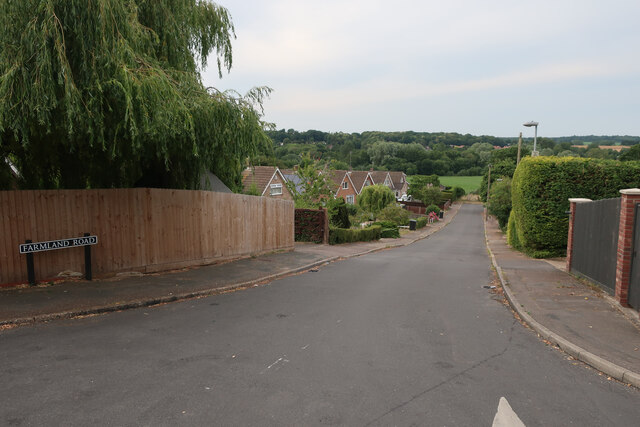
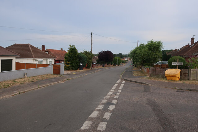
Carr's Hills is a picturesque woodland area located in Norfolk, England. Covering an expansive area, this natural haven is renowned for its breathtaking beauty and diverse range of flora and fauna. The hills are nestled within the larger expanse of Carr's Forest, which stretches across several square miles.

The woodland is predominantly made up of deciduous trees, including oak, beech, and birch, which create a vibrant and ever-changing landscape throughout the seasons. The dense canopy above provides ample shade, making it an ideal spot for leisurely walks, picnics, and outdoor activities.

Carr's Hills is also home to a variety of wildlife species, making it a popular destination for nature enthusiasts and birdwatchers. Visitors may spot a plethora of bird species, such as woodpeckers, blue tits, and pheasants, as well as small mammals like squirrels and rabbits.

Trails and footpaths crisscross the hills, offering visitors the opportunity to explore the area at their own pace. These paths lead to stunning viewpoints, offering panoramic vistas of the surrounding countryside. The hills also feature a small lake, adding to the tranquility and charm of the area.

Carr's Hills is easily accessible, with ample parking available for visitors. It attracts a diverse range of visitors, from families seeking a peaceful day out to nature lovers looking to immerse themselves in the beauty of the Norfolk countryside. With its idyllic setting and abundant natural wonders, Carr's Hills is truly a gem within the Norfolk woodlands.

If you have any feedback on the listing, please let us know in the comments section below.

Carr's Hills Images

Images are sourced within 2km of 52.658163/1.2259374 or Grid Reference TG1811. Thanks to Geograph Open Source API. All images are credited.

The Village Shop, Grove Avenue, Costessey See <a href="https://www.geograph.org.uk/photo/1972424">TG1810 : Your shop Village Store, Grove Avenue, Costessey</a> for an earlier view.
The Village Shop, Grove Avenue, Costessey
Richmond Road
Richmond Road
Middleton Crescent
Middleton Crescent
Farmland Road, New Costessey
Olive Road
Olive Road
Bridge Cottage, River Wensum, Costessey Nestling close to the river and the site of an old Toll Bridge, this cottage would have been the toll keeper's residence. The bridge looks to have been collecting tolls as late as 1905, run by a private company. It was not part of the turnpike system and would originally obviated some turnpike miles to Norwich.

Milestone Society National ID: NO.COS
Bridge Cottage, River Wensum, Costessey
Nestling close to the river and the site of an old Toll Bridge, this cottage would have been the toll keeper's residence. The bridge looks to have been collecting tolls as late as 1905, run by a private company. It was not part of the turnpike system and would originally obviated some turnpike miles to Norwich. Milestone Society National ID: NO.COS
Village sign, Drayton Commemorating 50 years since the founding of Drayton 'afternoon W I'.
Village sign, Drayton
Commemorating 50 years since the founding of Drayton 'afternoon W I'.
The Cock Inn, Drayton The present building replaced an 18th century inn in 1956. It was renovated  in 1998-1999. One of the Marston chain of brewers.
The Cock Inn, Drayton
The present building replaced an 18th century inn in 1956. It was renovated in 1998-1999. One of the Marston chain of brewers.
Old Milepost by the A1067, Drayton High Road, Drayton Cast iron post by the A1067, in parish of DRAYTON (BROADLAND District), 150yds East of junction with Hurn Road. Just East of entrance to former David Rice Hospital, on the verge, near lamppost, on South side of road. Fakenham ci l-top, erected by the Norwich & Fakenham turnpike trust in the 19th century. An earlier photograph can be found here <a title="https://www.geograph.org.uk/photo/6617195" href="https://www.geograph.org.uk/photo/6617195">Link</a>.

Inscription reads:- : TO / FAKENHAM / 21 : : TO / NORWICH / 3 : : DRAYTON :

Listed.

Milestone Society National ID: NO_NF03.
Old Milepost by the A1067, Drayton High Road, Drayton
Cast iron post by the A1067, in parish of DRAYTON (BROADLAND District), 150yds East of junction with Hurn Road. Just East of entrance to former David Rice Hospital, on the verge, near lamppost, on South side of road. Fakenham ci l-top, erected by the Norwich & Fakenham turnpike trust in the 19th century. An earlier photograph can be found here Link. Inscription reads:- : TO / FAKENHAM / 21 : : TO / NORWICH / 3 : : DRAYTON : Listed. Milestone Society National ID: NO_NF03.
Royal Mail depot and Screwfix, Bowthorpe Industrial Area
Sinclair International, Jarrold Way Producing labels for fresh produce.
Sinclair International, Jarrold Way
Producing labels for fresh produce.
Fox Joinery, Bowthorpe Industrial Area
Bowthorpe Park Industrial Estate
Bowthorpe water tower
Holworthy Road
Holworthy Road
Hellesdon Hospital Hellesdon Hospital - Norwich. Originally the 'Lunatic Asylum' - see OS map dated 1899.
Hellesdon Hospital
Hellesdon Hospital - Norwich. Originally the 'Lunatic Asylum' - see OS map dated 1899.
Show me another place!

Carr's Hills is located at Grid Ref: TG1811 (Lat: 52.658163, Lng: 1.2259374)

Administrative County: Norfolk

District: South Norfolk

Police Authority: Norfolk

What 3 Words

///proud.blocks.chain. Near Costessey, Norfolk

Related Wikis

Marriott's Way

The Marriott's Way is a footpath, cycle-path and bridleway in north Norfolk, England, between Norwich and Aylsham via Themelthorpe. It forms part of the...
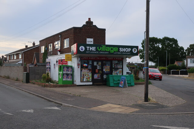
Costessey

Costessey ( KOSS-ee) is a town and civil parish in the South Norfolk district of Norfolk, England, and is 4 miles (6.4 km) north west of Norwich. The...

Ormiston Victory Academy

Ormiston Victory Academy (formerly Costessey High School) is a secondary school and sixth form located in Costessey, Norfolk, England. The academy has...

Norwich CBS F.C.

Norwich CBS Football Club is a football club based in Norwich, England. They are currently members of the Eastern Counties League Division One North and...

Hellesdon Hospital

Hellesdon Hospital is a mental health facility in Hellesdon, Norfolk, England. It is managed by Norfolk and Suffolk NHS Foundation Trust. == History... ==

Drayton, Norfolk

Drayton, Norfolk, is a suburban village in the English county of Norfolk. The village is located in the district of Broadland, 4.3 miles (6.9 km) north...

Drayton railway station

Drayton railway station is a former station in Norfolk, England. Constructed by the Midland and Great Northern Joint Railway in the 1880s, on the line...

Costessey Hall

Costessey Hall (pronounced and sometimes spelt Cossey Hall, also written as Cotesby Hall) was a manor house in Costessey, Norfolk, England, four miles...

Nearby Amenities

Located within 500m of 52.658163,1.2259374
Bus Stop
Myrtle Avenue, opp
Naptan AtcoCode: 2900C2739
Naptan Bearing: E
Naptan CommonName: Myrtle Avenue
Naptan Indicator: opp
Naptan Locality: Costessey
Naptan NaptanCode: nfoajtgj
Naptan PlusbusZoneRef: NRCH
Naptan Street: Town House Road
Naptan Verified: no
Note: Road name is 'Townhouse Road'
Source: naptan_import
Lat/Long: 52.6575061/1.220687
Bus Stop
Myrtle Avenue, adj
Naptan AtcoCode: 2900C2740
Naptan Bearing: NW
Naptan CommonName: Myrtle Avenue
Naptan Indicator: adj
Naptan Landmark: Myrtle Avenue
Naptan Locality: Costessey
Naptan NaptanCode: nfoajtgm
Naptan PlusbusZoneRef: NRCH
Naptan ShortCommonName: Myrtle Avenue
Naptan Street: Town House Road
Naptan Verified: no
Note: Road name is 'Townhouse Road'
Source: naptan_import
Lat/Long: 52.6574347/1.2206669
Bus Stop
Folgate Lane, adj
Naptan AtcoCode: 2900C2741
Naptan Bearing: SE
Naptan CommonName: Folgate Lane
Naptan Indicator: adj
Naptan Landmark: Folgate Lane
Naptan Locality: Costessey
Naptan NaptanCode: nfoajtgp
Naptan PlusbusZoneRef: NRCH
Naptan Street: Town House Road
Naptan Verified: no
Source: naptan_import
Lat/Long: 52.656567/1.2247886
Bus Stop
Folgate Lane, opp
Naptan AtcoCode: 2900C2742
Naptan Bearing: NW
Naptan CommonName: Folgate Lane
Naptan Indicator: opp
Naptan Landmark: Folgate Lane
Naptan Locality: Costessey
Naptan NaptanCode: nfoajtgt
Naptan PlusbusZoneRef: NRCH
Naptan ShortCommonName: Folgate Lane
Naptan Street: Town House Road
Naptan Verified: no
Source: naptan_import
Lat/Long: 52.6567734/1.2238129
Turning Circle
Lat/Long: 52.6615792/1.2227018
Turning Circle
Lat/Long: 52.6583669/1.224531
Marker: yes
Pipeline: marker
Substance: gas
Utility: gas
Lat/Long: 52.6602576/1.231861
Pipeline: marker
Type: oil
Lat/Long: 52.6601287/1.2320506
Fixme: check for oil pipeline marker posts around here
Lat/Long: 52.6588091/1.2310486
Pipeline: marker
Pipeline Ref: H/CO
Type: oil
Lat/Long: 52.6601974/1.2321051
Crossing
Crossing: uncontrolled
Lat/Long: 52.6594706/1.2222177
Entrance: main
Lat/Long: 52.6596159/1.2228131
Entrance: main
Lat/Long: 52.6596937/1.2226501
Post Box
Collection Times: Mo-Fr 16:45; Sa 11:00
Operator: Royal Mail
Post Box Type: lamp
Ref: NR8 803
Royal Cypher: EIIR
Royal Cypher Wikidata: Q33102113
Lat/Long: 52.6567017/1.2239361
Grit Bin
Lat/Long: 52.6567179/1.2239209
Barrier: cattle_grid
Bicycle: yes
Foot: yes
Lat/Long: 52.6554914/1.2288144
Power: pole
Lat/Long: 52.6614332/1.2256236
Power: pole
Lat/Long: 52.6621573/1.2247931
Give Way
Lat/Long: 52.6600894/1.2217188
Costessey
Man Made: village_sign
Material: metal
Lat/Long: 52.6573811/1.2206794
Generator Method: photovoltaic
Generator Output Electricity: yes
Generator Solar Modules: 6
Generator Source: solar
Generator Type: solar_photovoltaic_panel
Location: roof
Power: generator
Lat/Long: 52.6538658/1.2281212
Generator Method: photovoltaic
Generator Output Electricity: yes
Generator Source: solar
Generator Type: solar_photovoltaic_panel
Location: roof
Power: generator
Lat/Long: 52.6538748/1.2280344
Generator Method: photovoltaic
Generator Output Electricity: yes
Generator Solar Modules: 5
Generator Source: solar
Generator Type: solar_photovoltaic_panel
Location: roof
Power: generator
Lat/Long: 52.6538912/1.2279631
Generator Method: photovoltaic
Generator Output Electricity: yes
Generator Solar Modules: 5
Generator Source: solar
Generator Type: solar_photovoltaic_panel
Location: roof
Power: generator
Lat/Long: 52.6539056/1.227884
Generator Method: photovoltaic
Generator Output Electricity: yes
Generator Solar Modules: 8
Generator Source: solar
Generator Type: solar_photovoltaic_panel
Location: roof
Power: generator
Lat/Long: 52.6539622/1.2285775
Generator Method: photovoltaic
Generator Output Electricity: yes
Generator Solar Modules: 8
Generator Source: solar
Generator Type: solar_photovoltaic_panel
Location: roof
Power: generator
Lat/Long: 52.6540027/1.2283787
Generator Method: photovoltaic
Generator Output Electricity: yes
Generator Solar Modules: 8
Generator Source: solar
Generator Type: solar_photovoltaic_panel
Location: roof
Power: generator
Lat/Long: 52.6540441/1.2281838
Generator Method: photovoltaic
Generator Output Electricity: yes
Generator Solar Modules: 8
Generator Source: solar
Generator Type: solar_photovoltaic_panel
Location: roof
Power: generator
Lat/Long: 52.654082/1.2279966
Generator Method: photovoltaic
Generator Output Electricity: yes
Generator Solar Modules: 6
Generator Source: solar
Generator Type: solar_photovoltaic_panel
Location: roof
Power: generator
Lat/Long: 52.6541445/1.2278015
Generator Method: photovoltaic
Generator Output Electricity: yes
Generator Solar Modules: 12
Generator Source: solar
Generator Type: solar_photovoltaic_panel
Location: roof
Power: generator
Lat/Long: 52.6541014/1.2276283
Generator Method: photovoltaic
Generator Output Electricity: yes
Generator Source: solar
Generator Type: solar_photovoltaic_panel
Location: roof
Power: generator
Lat/Long: 52.6539922/1.2276152
Generator Method: photovoltaic
Generator Output Electricity: yes
Generator Solar Modules: 8
Generator Source: solar
Generator Type: solar_photovoltaic_panel
Location: roof
Power: generator
Lat/Long: 52.6538697/1.227561
Generator Method: photovoltaic
Generator Output Electricity: yes
Generator Source: solar
Generator Type: solar_photovoltaic_panel
Location: roof
Power: generator
Lat/Long: 52.659791/1.2216657
Generator Method: photovoltaic
Generator Output Electricity: yes
Generator Source: solar
Generator Type: solar_photovoltaic_panel
Location: roof
Power: generator
Lat/Long: 52.6586457/1.2205955
Generator Method: photovoltaic
Generator Output Electricity: yes
Generator Source: solar
Generator Type: solar_photovoltaic_panel
Location: roof
Power: generator
Lat/Long: 52.6586994/1.2211615
Generator Method: photovoltaic
Generator Output Electricity: yes
Generator Source: solar
Generator Type: solar_photovoltaic_panel
Location: roof
Power: generator
Lat/Long: 52.6569536/1.2216443
Generator Method: photovoltaic
Generator Output Electricity: yes
Generator Source: solar
Generator Type: solar_photovoltaic_panel
Location: roof
Power: generator
Lat/Long: 52.6569341/1.221891
Generator Method: photovoltaic
Generator Output Electricity: yes
Generator Source: solar
Generator Type: solar_photovoltaic_panel
Location: roof
Power: generator
Lat/Long: 52.6559725/1.2201852
Generator Method: photovoltaic
Generator Output Electricity: yes
Generator Source: solar
Generator Type: solar_photovoltaic_panel
Location: roof
Power: generator
Lat/Long: 52.6604629/1.220904
Generator Method: photovoltaic
Generator Output Electricity: yes
Generator Source: solar
Generator Type: solar_photovoltaic_panel
Location: roof
Power: generator
Lat/Long: 52.6605207/1.2210394
Generator Method: photovoltaic
Generator Output Electricity: yes
Generator Source: solar
Generator Type: solar_photovoltaic_panel
Location: roof
Power: generator
Lat/Long: 52.6604906/1.2209684
Generator Method: photovoltaic
Generator Output Electricity: yes
Generator Source: solar
Generator Type: solar_photovoltaic_panel
Location: roof
Power: generator
Lat/Long: 52.6602823/1.2212044
Generator Method: photovoltaic
Generator Output Electricity: yes
Generator Source: solar
Generator Type: solar_photovoltaic_panel
Location: roof
Power: generator
Lat/Long: 52.6607867/1.2217087
Generator Method: photovoltaic
Generator Output Electricity: yes
Generator Source: solar
Generator Type: solar_photovoltaic_panel
Location: roof
Power: generator
Lat/Long: 52.6608159/1.2217596
Generator Method: photovoltaic
Generator Output Electricity: yes
Generator Source: solar
Generator Type: solar_photovoltaic_panel
Location: roof
Power: generator
Lat/Long: 52.6600822/1.2242326
Generator Method: photovoltaic
Generator Output Electricity: yes
Generator Source: solar
Generator Type: solar_photovoltaic_panel
Location: roof
Power: generator
Lat/Long: 52.6593208/1.2256166
Generator Method: photovoltaic
Generator Output Electricity: yes
Generator Source: solar
Generator Type: solar_photovoltaic_panel
Location: roof
Power: generator
Lat/Long: 52.656311/1.2241548
Generator Method: photovoltaic
Generator Output Electricity: yes
Generator Source: solar
Generator Type: solar_photovoltaic_panel
Location: roof
Power: generator
Lat/Long: 52.6558619/1.2243935
Generator Method: photovoltaic
Generator Output Electricity: yes
Generator Source: solar
Generator Type: solar_photovoltaic_panel
Location: roof
Power: generator
Lat/Long: 52.6558505/1.224525
Generator Method: photovoltaic
Generator Output Electricity: yes
Generator Source: solar
Generator Type: solar_photovoltaic_panel
Location: roof
Power: generator
Lat/Long: 52.6564167/1.2276176
Generator Method: photovoltaic
Generator Output Electricity: yes
Generator Solar Modules: 8
Generator Source: solar
Generator Type: solar_photovoltaic_panel
Location: roof
Power: generator
Lat/Long: 52.6540932/1.2279449
Generator Method: photovoltaic
Generator Output Electricity: yes
Generator Solar Modules: 8
Generator Source: solar
Generator Type: solar_photovoltaic_panel
Location: roof
Power: generator
Lat/Long: 52.6540558/1.228118
Generator Method: photovoltaic
Generator Output Electricity: yes
Generator Solar Modules: 8
Generator Source: solar
Generator Type: solar_photovoltaic_panel
Location: roof
Power: generator
Lat/Long: 52.6540162/1.2283174
Generator Method: photovoltaic
Generator Output Electricity: yes
Generator Solar Modules: 8
Generator Source: solar
Generator Type: solar_photovoltaic_panel
Location: roof
Power: generator
Lat/Long: 52.653975/1.2285124
Colour: yellow
Marker: post
Material: plastic
Pipeline: marker
Substance: gas
Utility: gas
Lat/Long: 52.6552031/1.2284862
Description: GPSS
Marker: yes
Utility: oil
Lat/Long: 52.6557001/1.2278891
Description: GPSS
Marker: yes
Utility: oil
Lat/Long: 52.6556202/1.227795
Crossing
Crossing: unmarked
Crossing Island: no
Tactile Paving: yes
Lat/Long: 52.6541337/1.2287528
Leisure: fishing
Lat/Long: 52.6550714/1.2268288
Leisure: fishing
Lat/Long: 52.6550929/1.226952
Leisure: fishing
Lat/Long: 52.6551134/1.2270676
Leisure: fishing
Lat/Long: 52.6551368/1.2272016
Leisure: fishing
Lat/Long: 52.655162/1.2273264
Leisure: fishing
Lat/Long: 52.6551854/1.2274358
Leisure: fishing
Lat/Long: 52.6552069/1.2275636
Leisure: fishing
Lat/Long: 52.6552302/1.2276915
Leisure: fishing
Lat/Long: 52.6552134/1.227824
Leisure: fishing
Lat/Long: 52.6551368/1.2278702
Leisure: fishing
Lat/Long: 52.6550798/1.2277962
Leisure: fishing
Lat/Long: 52.655034/1.2277054
Leisure: fishing
Lat/Long: 52.6549976/1.2276037
Leisure: fishing
Lat/Long: 52.6549648/1.2275005
Leisure: fishing
Lat/Long: 52.6549508/1.2273772
Leisure: fishing
Lat/Long: 52.6549555/1.2272571
The data included in this document is from www.openstreetmap.org. The data is made available under ODbL.

Have you been to Carr's Hills?

Leave your review of Carr's Hills below (or comments, questions and feedback).