Freetown

Settlement in Lancashire

England

Freetown

Tram at Bury Interchange Metrolink tram number 3022 arrives at Bury interchange on the service from Altrincham
Tram at Bury Interchange Credit: David Dixon

Freetown is a small village located in the county of Lancashire in North West England. Situated on the outskirts of Burnley, it is part of the larger civil parish of Briercliffe. Freetown is known for its picturesque rural setting and charming atmosphere.

The village is characterized by its traditional stone houses and quaint cottages, giving it a timeless appeal. It is surrounded by rolling hills and lush green fields, offering stunning views of the Lancashire countryside. The nearby picturesque Briercliffe Valley provides ample opportunities for outdoor activities such as hiking, cycling, and birdwatching.

Despite its small size, Freetown boasts a close-knit community that takes pride in its heritage and history. The village has a local pub, The Freetown Inn, which serves as a social hub for residents and visitors alike. The pub is known for its warm and friendly atmosphere, where locals often gather to catch up and enjoy a pint.

Freetown also benefits from its proximity to larger towns and cities. Burnley, with its vibrant shopping centers, cultural attractions, and leisure facilities, is just a short drive away. The village is also well-connected to the wider region, with good transport links to Manchester, Leeds, and other major cities.

Overall, Freetown offers a peaceful and idyllic setting for those seeking a tranquil countryside retreat while still having access to urban amenities. Its natural beauty, community spirit, and convenient location make it an appealing place to live or visit in Lancashire.

If you have any feedback on the listing, please let us know in the comments section below.
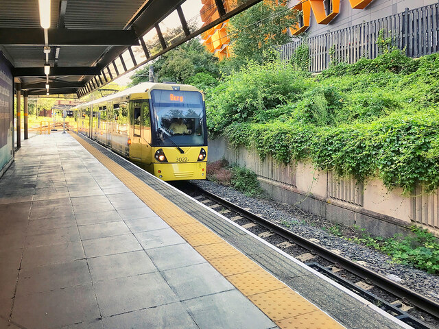
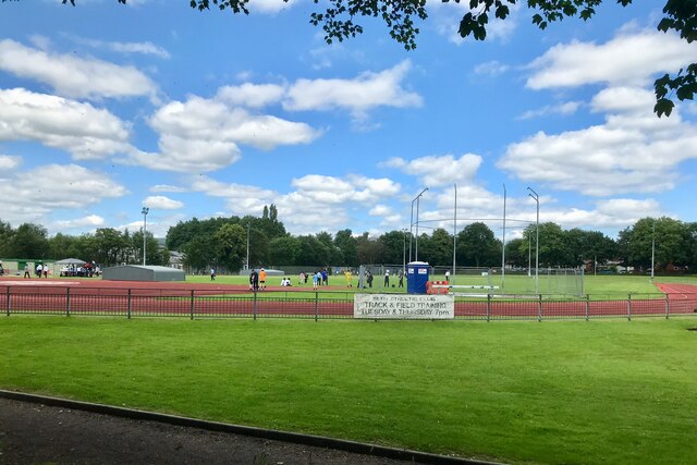
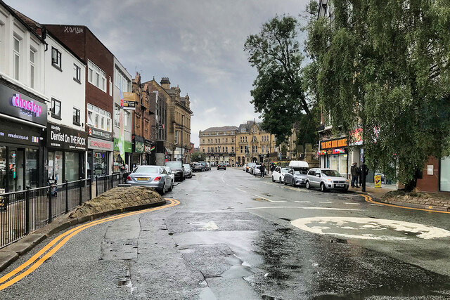
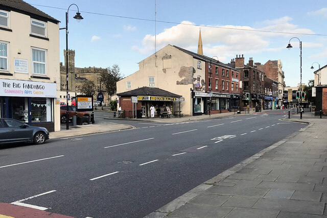
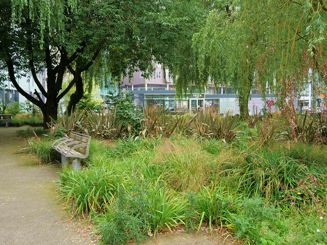
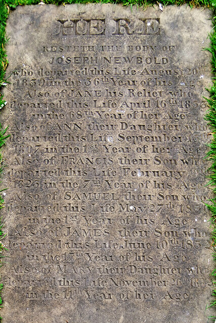
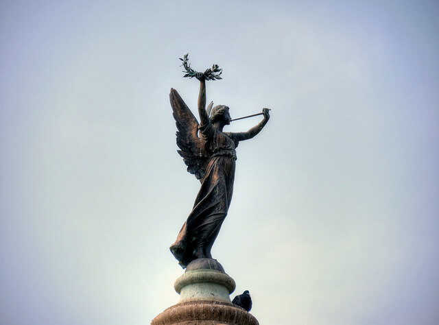
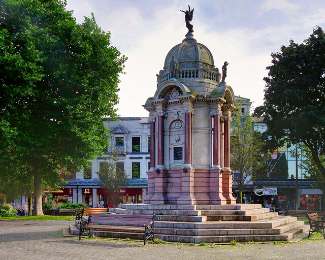
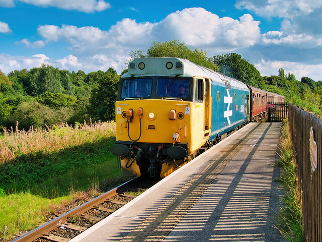
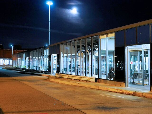
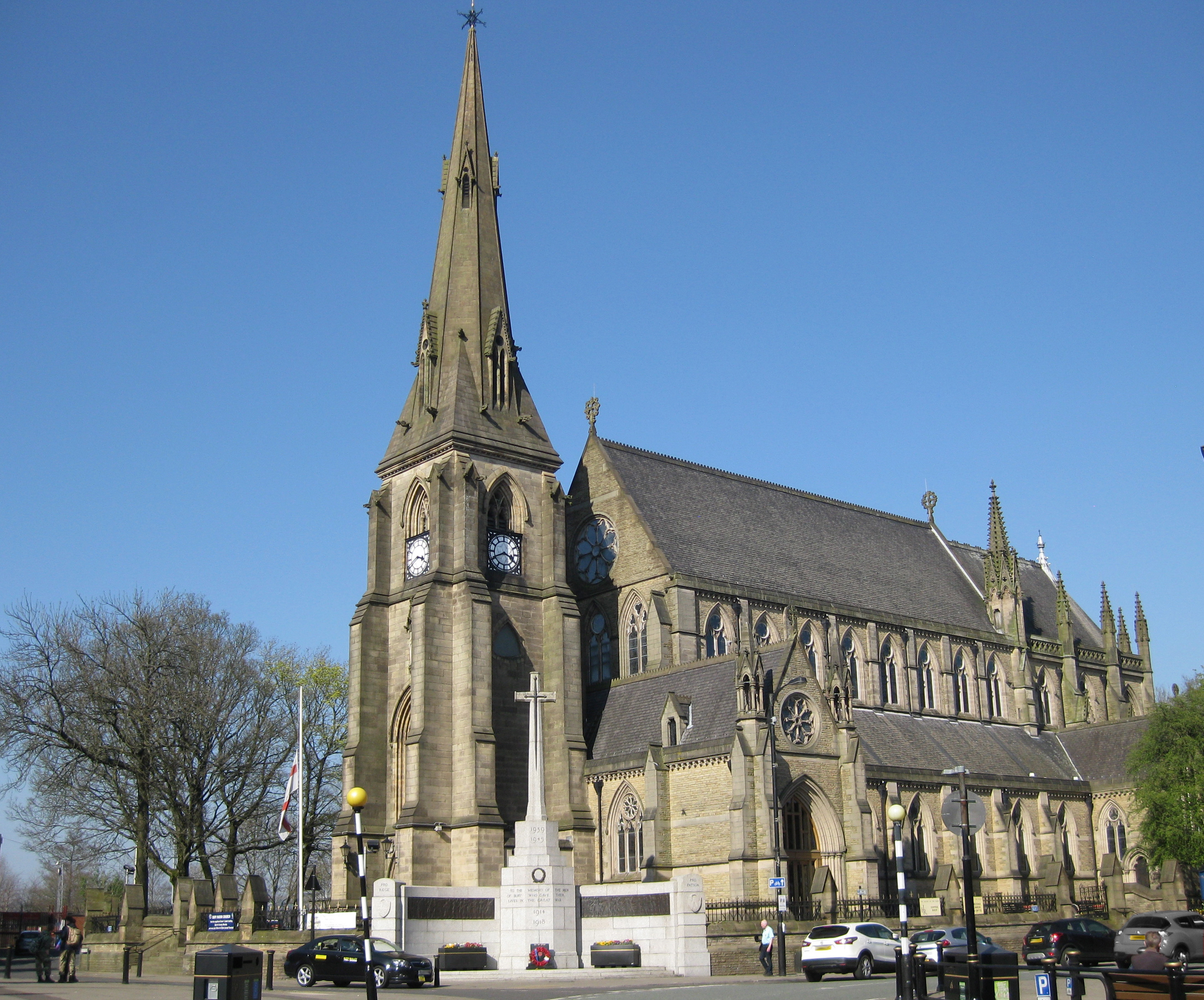
Freetown Images

Images are sourced within 2km of 53.599728/-2.282541 or Grid Reference SD8111. Thanks to Geograph Open Source API. All images are credited.

Tram at Bury Interchange Metrolink tram number 3022 arrives at Bury interchange on the service from Altrincham
Tram at Bury Interchange
Metrolink tram number 3022 arrives at Bury interchange on the service from Altrincham
Bury Athletic Club, Track and Field
The Rock, Bury
The Rock, Bury
Bolton Street, Bury
Bolton Street, Bury
WWII Lancashire: Ghost Signs of the Home Front  (8) -
Emergency Rendezvous Point, Lord Street, Bury (opposite junction with Parker Street)

"ERP 166"

Emergency Rendezvous Points (ERP) were designated places in the locality for the coordination of ARP and emergency services during civil emergencies, particularly for those services arriving from outside the area. The signs appear in a variety of designs, but most are diamond shapes framing the ERP locality number.

<a href="https://www.geograph.org.uk/photo/6945055">SD8110 : WWII Lancashire: Ghost Signs of the Home Front  (9)</a>
WWII Lancashire: Ghost Signs of the Home Front (8)
- Emergency Rendezvous Point, Lord Street, Bury (opposite junction with Parker Street) "ERP 166" Emergency Rendezvous Points (ERP) were designated places in the locality for the coordination of ARP and emergency services during civil emergencies, particularly for those services arriving from outside the area. The signs appear in a variety of designs, but most are diamond shapes framing the ERP locality number. SD8110 : WWII Lancashire: Ghost Signs of the Home Front (9)
WWII Lancashire: Ghost Signs of the Home Front  (9) -
Emergency Rendezvous Point, Lord Street, Bury (opposite junction with Parker Street)

"ERP 166" 

Emergency Rendezvous Points (ERP) were designated places in the locality for the coordination of ARP and emergency services during civil emergencies, particularly for those services arriving from outside the area. The signs appear in a variety of designs, but most are diamond shapes framing the ERP locality number.

<a href="https://www.geograph.org.uk/photo/6945061">SD8210 : WWII Lancashire: Ghost Signs of the Home Front  (10)</a>
WWII Lancashire: Ghost Signs of the Home Front (9)
- Emergency Rendezvous Point, Lord Street, Bury (opposite junction with Parker Street) "ERP 166" Emergency Rendezvous Points (ERP) were designated places in the locality for the coordination of ARP and emergency services during civil emergencies, particularly for those services arriving from outside the area. The signs appear in a variety of designs, but most are diamond shapes framing the ERP locality number. SD8210 : WWII Lancashire: Ghost Signs of the Home Front (10)
WWII Lancashire: Ghost Signs of the Home Front  (10) -
(Emergency Rendezvous Point), Junction of Waterfold Lane and Bury New Road, Heywood, Bury

"ERP ---?"

Emergency Rendezvous Points (ERP) were designated places in the locality for the coordination of ARP and emergency services during civil emergencies, particularly for those services arriving from outside the area. The signs appear in a variety of designs, but most are diamond shapes framing the ERP locality number.

<a href="https://www.geograph.org.uk/photo/6945065">SD8210 : WWII Lancashire: Ghost Signs of the Home Front  (11)</a>
WWII Lancashire: Ghost Signs of the Home Front (10)
- (Emergency Rendezvous Point), Junction of Waterfold Lane and Bury New Road, Heywood, Bury "ERP ---?" Emergency Rendezvous Points (ERP) were designated places in the locality for the coordination of ARP and emergency services during civil emergencies, particularly for those services arriving from outside the area. The signs appear in a variety of designs, but most are diamond shapes framing the ERP locality number. SD8210 : WWII Lancashire: Ghost Signs of the Home Front (11)
WWII Lancashire: Ghost Signs of the Home Front  (11) -
Emergency Rendezvous Point, Junction of Waterfold Lane and Bury New Road, Heywood, Bury

"ERP ---?"

Emergency Rendezvous Points (ERP) were designated places in the locality for the coordination of ARP and emergency services during civil emergencies, particularly for those services arriving from outside the area. The signs appear in a variety of designs, but most are diamond shapes framing the ERP locality number.

<a href="https://www.geograph.org.uk/photo/6945270">SD8410 : WWII Lancashire: Ghost Signs of the Home Front  (12)</a>
WWII Lancashire: Ghost Signs of the Home Front (11)
- Emergency Rendezvous Point, Junction of Waterfold Lane and Bury New Road, Heywood, Bury "ERP ---?" Emergency Rendezvous Points (ERP) were designated places in the locality for the coordination of ARP and emergency services during civil emergencies, particularly for those services arriving from outside the area. The signs appear in a variety of designs, but most are diamond shapes framing the ERP locality number. SD8410 : WWII Lancashire: Ghost Signs of the Home Front (12)
WWII Lancashire: Ghost Signs of the Home Front  (16) -
Emergency Rendezvous Point, Walmersley Road, Bury, at junction with Mather Road

"ERP ---?"

Emergency Rendezvous Points (ERP) were designated places in the locality for the coordination of ARP and emergency services during civil emergencies, particularly for those services arriving from outside the area. The signs appear in a variety of designs, but most are diamond shapes framing the ERP locality number.

<a href="https://www.geograph.org.uk/photo/6945297">SD8013 : WWII Lancashire: Ghost Signs of the Home Front  (17)</a>
WWII Lancashire: Ghost Signs of the Home Front (16)
- Emergency Rendezvous Point, Walmersley Road, Bury, at junction with Mather Road "ERP ---?" Emergency Rendezvous Points (ERP) were designated places in the locality for the coordination of ARP and emergency services during civil emergencies, particularly for those services arriving from outside the area. The signs appear in a variety of designs, but most are diamond shapes framing the ERP locality number. SD8013 : WWII Lancashire: Ghost Signs of the Home Front (17)
WWII Lancashire: Ghost Signs of the Home Front  (17) -
Emergency Rendezvous Point, Walmersley Road, Bury, at junction with Mather Road

"ERP ---?"

Emergency Rendezvous Points (ERP) were designated places in the locality for the coordination of ARP and emergency services during civil emergencies, particularly for those services arriving from outside the area. The signs appear in a variety of designs, but most are diamond shapes framing the ERP locality number.

<a href="https://www.geograph.org.uk/photo/6945304">SD7712 : WWII Lancashire: Ghost Signs of the Home Front  (18)</a>
WWII Lancashire: Ghost Signs of the Home Front (17)
- Emergency Rendezvous Point, Walmersley Road, Bury, at junction with Mather Road "ERP ---?" Emergency Rendezvous Points (ERP) were designated places in the locality for the coordination of ARP and emergency services during civil emergencies, particularly for those services arriving from outside the area. The signs appear in a variety of designs, but most are diamond shapes framing the ERP locality number. SD7712 : WWII Lancashire: Ghost Signs of the Home Front (18)
The Garsdale, Woodhill Road, Bury Built in 1925 as a manager's house for the Star Bleaching Company by 1933 and the Great Depression it saw closure of the bleaching and dye works and former Burrs Mill. Formerly a Wilsons Brewery Ltd house the Garsdale first opened its doors in 1980.
The Garsdale, Woodhill Road, Bury
Built in 1925 as a manager's house for the Star Bleaching Company by 1933 and the Great Depression it saw closure of the bleaching and dye works and former Burrs Mill. Formerly a Wilsons Brewery Ltd house the Garsdale first opened its doors in 1980.
Preserved Locomotive Leaving Bury Preserved former British Railways Bulleid 7P5FA 4-6-2 ‘West Country’ class locomotive number 34092 ‘City of Wells’ leaves Bolton Street Station with an East Lancashire Railway passenger train on the journey from Bury to Rawtenstall. 

One of the 4-6-2 Light Pacific steam locomotives designed for the Southern Railway by its Chief Mechanical Engineer Oliver Bulleid, 34092 was built at the Brighton Works in 1949, after the nationalisation of the railways in Britain; it was originally named “Wells” but was renamed “City of Wells” a year later.

The engine was withdrawn in November 1964 and sold to the Woodham Bros scrapyard in South Wales, remaining there until being purchased by a group of individuals in 1971 who brought it to the Keighley & Worth Valley Railway in November of that year. It returned to service with KWVR in 1979 and worked on special charters all over the country. The locomotive was withdrawn in 1989 to begin, what turned out to be, a 25-year restoration back to running order and as-built appearance. It finally returned to service again in August 2014.

<span class="nowrap"><a title="https://en.wikipedia.org/wiki/SR_West_Country_and_Battle_of_Britain_classes" rel="nofollow ugc noopener" href="https://en.wikipedia.org/wiki/SR_West_Country_and_Battle_of_Britain_classes">Link</a><img style="margin-left:2px;" alt="External link" title="External link - shift click to open in new window" src="https://s1.geograph.org.uk/img/external.png" width="10" height="10"/></span>  SR West Country and Battle of Britain (Light Pacific) classes (Wikipedia)
<span class="nowrap"><a title="http://kwvr.co.uk/steam-train/british-railways-bullied-west-country-pacific-4-6-2-no-34092-city-of-wells/" rel="nofollow ugc noopener" href="http://kwvr.co.uk/steam-train/british-railways-bullied-west-country-pacific-4-6-2-no-34092-city-of-wells/">Link</a><img style="margin-left:2px;" alt="External link" title="External link - shift click to open in new window" src="https://s1.geograph.org.uk/img/external.png" width="10" height="10"/></span>  British Railways, Bulleid West Country Pacific 4-6-2 No. 34092 ‘City of Wells’ (KWVR)
Preserved Locomotive Leaving Bury
Preserved former British Railways Bulleid 7P5FA 4-6-2 ‘West Country’ class locomotive number 34092 ‘City of Wells’ leaves Bolton Street Station with an East Lancashire Railway passenger train on the journey from Bury to Rawtenstall. One of the 4-6-2 Light Pacific steam locomotives designed for the Southern Railway by its Chief Mechanical Engineer Oliver Bulleid, 34092 was built at the Brighton Works in 1949, after the nationalisation of the railways in Britain; it was originally named “Wells” but was renamed “City of Wells” a year later. The engine was withdrawn in November 1964 and sold to the Woodham Bros scrapyard in South Wales, remaining there until being purchased by a group of individuals in 1971 who brought it to the Keighley & Worth Valley Railway in November of that year. It returned to service with KWVR in 1979 and worked on special charters all over the country. The locomotive was withdrawn in 1989 to begin, what turned out to be, a 25-year restoration back to running order and as-built appearance. It finally returned to service again in August 2014. LinkExternal link SR West Country and Battle of Britain (Light Pacific) classes (Wikipedia) LinkExternal link British Railways, Bulleid West Country Pacific 4-6-2 No. 34092 ‘City of Wells’ (KWVR)
St John's Gardens The former St John's Church was located off The Rock, then named Stanley Street. The church closed in 1964 but the former graveyard remained. Now, this land forms a garden adjacent to the new Rock Triangle retail and entertainment development which opened in 2010. Several of the gravestones have been retained in the design of the garden alongside the paths.
St John's Gardens
The former St John's Church was located off The Rock, then named Stanley Street. The church closed in 1964 but the former graveyard remained. Now, this land forms a garden adjacent to the new Rock Triangle retail and entertainment development which opened in 2010. Several of the gravestones have been retained in the design of the garden alongside the paths.
Joseph Newbold's Gravestone, St John's Gardens The former St John's Church was located off The Rock, then named Stanley Street. The church closed in 1964 but the former graveyard remained. Now, this land forms a garden (<a href="https://www.geograph.org.uk/photo/6959084">SD8011 : St John's Gardens</a>) adjacent to the new Rock Triangle retail and entertainment development which opened in 2010. 

Several of the gravestones have been retained in the design of the garden and lie flat alongside the paths. Most are worn to the point of being illegible but I was able to make out the wording on this one which relates the tragic story of Joseph and Jane Newbold who had 5 children, none of whom survived them. Two died in infancy (not uncommon at that time) and three died between 1830 and 1833 when a cholera pandemic caused 60,000 deaths amongst the population of 14 million in England.

HERE
Resteth the body of 
JOSEPH NEWBOLD
Who departed this life August 20th 1839 in the 56th year of his Age.
Also of JANE his Relict * who departed this life April 16th 1853 in the 68th year of her Age.
Also of ANN their Daughter who departed this life September 1?th 1807 in the first year of her Age.
Also of FRANCIS their Son who departed this life February 1826 in the 7th year of his Age.
Also of SAMUEL their Son who departed this life May 27th 1830 in the 1st year of his Age.
Also of JAMES their son who departed this life June 10th 1833 in the 17th year of his Age
Also of MARY their Daughter who departed this life November 26th 1833 in the 11th year of her Age

* I was unfamiliar with the term relict in this context. On looking it up, I found that it was a term from the 17th and 18th centuries that meant a woman who was the surviving spouse of the marriage and had not remarried (as today we would use the word widow).
Joseph Newbold's Gravestone, St John's Gardens
The former St John's Church was located off The Rock, then named Stanley Street. The church closed in 1964 but the former graveyard remained. Now, this land forms a garden (SD8011 : St John's Gardens) adjacent to the new Rock Triangle retail and entertainment development which opened in 2010. Several of the gravestones have been retained in the design of the garden and lie flat alongside the paths. Most are worn to the point of being illegible but I was able to make out the wording on this one which relates the tragic story of Joseph and Jane Newbold who had 5 children, none of whom survived them. Two died in infancy (not uncommon at that time) and three died between 1830 and 1833 when a cholera pandemic caused 60,000 deaths amongst the population of 14 million in England. HERE Resteth the body of JOSEPH NEWBOLD Who departed this life August 20th 1839 in the 56th year of his Age. Also of JANE his Relict * who departed this life April 16th 1853 in the 68th year of her Age. Also of ANN their Daughter who departed this life September 1?th 1807 in the first year of her Age. Also of FRANCIS their Son who departed this life February 1826 in the 7th year of his Age. Also of SAMUEL their Son who departed this life May 27th 1830 in the 1st year of his Age. Also of JAMES their son who departed this life June 10th 1833 in the 17th year of his Age Also of MARY their Daughter who departed this life November 26th 1833 in the 11th year of her Age * I was unfamiliar with the term relict in this context. On looking it up, I found that it was a term from the 17th and 18th centuries that meant a woman who was the surviving spouse of the marriage and had not remarried (as today we would use the word widow).
Fame on the Kay Monument The Portland stone dome of the Kay monument (<a href="https://www.geograph.org.uk/photo/2752602">SD8010 : Kay Monument, Bury</a>) is surmounted by the bronze figure of Fame.
Fame on the Kay Monument
The Portland stone dome of the Kay monument (SD8010 : Kay Monument, Bury) is surmounted by the bronze figure of Fame.
Bury, The Kay Monument This imposing structure, an ornate, Italianate domed octagon standing more than ten metres in height, is a memorial to John Kay. It stands in the centre of Kay Gardens, an open space created from the former market place when a new market hall was built in 1901. The gardens and this memorial were commissioned and paid for by Henry Whitehead, a local mill owner.

John Kay was born in Bury in 1704. He was a prolific inventor, most famous in Lancashire as the 'Inventor of the flying shuttle' - a mechanism for speeding up the production of cloth on a hand-operated loom. Although he left Bury, emigrating to France in 1747, he has long been regarded as a celebrated son of the town and one of the men responsible for Lancashire's success in the cotton industry. An inscription on one side of the monument reads:

THE GIFT OF HENRY WHITEHEAD OF HASLEM HEY TO HIS NATIVE TOWN
TO PERPETUATE THE NAME AND FAME OF  
JOHN KAY 
OF  
BURY. 
WHOSE INVENTION IN THE YEAR 1733 OF THE FLY SHUTTLE
QUADRUPLED HUMAN POWER IN WEAVING & PLACED ENGLAND IN THE FRONT RANK 
AS THE BEST MARKET IN THE WORLD FOR TEXTILE MANUFACTURES. 
HE WAS BORN IN BURY IN 1704, AND DIED IN EXILE AND POVERTY IN FRANCE, 
WHERE HE LIES IN AN UNKNOWN GRAVE.

Kay Gardens and the Kay Monument were opened in April 1908. Mrs Henry Whitehead opened the gardens and the Earl of Derby unveiled the monument. The monument, which was cleaned and refurbished in 2011, is a Grade II listed structure (List Entry Number: 1163636 <span class="nowrap"><a title="https://historicengland.org.uk/listing/the-list/list-entry/1163636" rel="nofollow ugc noopener" href="https://historicengland.org.uk/listing/the-list/list-entry/1163636">Link</a><img style="margin-left:2px;" alt="External link" title="External link - shift click to open in new window" src="https://s1.geograph.org.uk/img/external.png" width="10" height="10"/></span> Historic England).
 .

(see also <a href="https://www.geograph.org.uk/photo/2752605">SD8010 : Kay Monument  - Relief Portrait</a>, <a href="https://www.geograph.org.uk/photo/2752607">SD8010 : Kay Monument, Inscription</a>,  <a href="https://www.geograph.org.uk/photo/2752612">SD8010 : Kay Monument (detail)</a>  and <a href="https://www.geograph.org.uk/photo/6959132">SD8010 : Fame on the Kay Monument</a>).

<span class="nowrap"><a title="http://www.johncassidy.org.uk/kay.html" rel="nofollow ugc noopener" href="http://www.johncassidy.org.uk/kay.html">Link</a><img style="margin-left:2px;" alt="External link" title="External link - shift click to open in new window" src="https://s1.geograph.org.uk/img/external.png" width="10" height="10"/></span> - John Cassidy, Manchester Sculpture
<span class="nowrap"><a title="http://www.cottontimes.co.uk/JohnKayo.htm" rel="nofollow ugc noopener" href="http://www.cottontimes.co.uk/JohnKayo.htm">Link</a><img style="margin-left:2px;" alt="External link" title="External link - shift click to open in new window" src="https://s1.geograph.org.uk/img/external.png" width="10" height="10"/></span> - Cotton Times, The Life of John Kay

<a href="https://www.geograph.org.uk/photo/1139632">SD8010 : Monument to John Kay Kay Gardens, Bury Town Centre</a> and <a href="https://www.geograph.org.uk/photo/1338262">SD8010 : The John Kay Memorial</a> show the monument before it was cleaned and refurbished).
Bury, The Kay Monument
This imposing structure, an ornate, Italianate domed octagon standing more than ten metres in height, is a memorial to John Kay. It stands in the centre of Kay Gardens, an open space created from the former market place when a new market hall was built in 1901. The gardens and this memorial were commissioned and paid for by Henry Whitehead, a local mill owner. John Kay was born in Bury in 1704. He was a prolific inventor, most famous in Lancashire as the 'Inventor of the flying shuttle' - a mechanism for speeding up the production of cloth on a hand-operated loom. Although he left Bury, emigrating to France in 1747, he has long been regarded as a celebrated son of the town and one of the men responsible for Lancashire's success in the cotton industry. An inscription on one side of the monument reads: THE GIFT OF HENRY WHITEHEAD OF HASLEM HEY TO HIS NATIVE TOWN TO PERPETUATE THE NAME AND FAME OF JOHN KAY OF BURY. WHOSE INVENTION IN THE YEAR 1733 OF THE FLY SHUTTLE QUADRUPLED HUMAN POWER IN WEAVING & PLACED ENGLAND IN THE FRONT RANK AS THE BEST MARKET IN THE WORLD FOR TEXTILE MANUFACTURES. HE WAS BORN IN BURY IN 1704, AND DIED IN EXILE AND POVERTY IN FRANCE, WHERE HE LIES IN AN UNKNOWN GRAVE. Kay Gardens and the Kay Monument were opened in April 1908. Mrs Henry Whitehead opened the gardens and the Earl of Derby unveiled the monument. The monument, which was cleaned and refurbished in 2011, is a Grade II listed structure (List Entry Number: 1163636 LinkExternal link Historic England). . (see also SD8010 : Kay Monument - Relief Portrait, SD8010 : Kay Monument, Inscription, SD8010 : Kay Monument (detail) and SD8010 : Fame on the Kay Monument). LinkExternal link - John Cassidy, Manchester Sculpture LinkExternal link - Cotton Times, The Life of John Kay SD8010 : Monument to John Kay Kay Gardens, Bury Town Centre and SD8010 : The John Kay Memorial show the monument before it was cleaned and refurbished).
East Lancashire Railway, Valiant at Burrs An East Lancashire Railway train hauled by 50015, ex-British Rail Co-Co Class 50 ‘Valiant' diesel locomotive, arrives at Burrs Country Park Halt.

One of 18 preserved Class 50 locomotives, Valiant was built by English Electric at the Vulcan Foundry. It entered service with British Rail in 1968. It was withdrawn from service in 1992 (<span class="nowrap"><a title="http://www.elrdiesel.info/fleet-50015.php#start" rel="nofollow ugc noopener" href="http://www.elrdiesel.info/fleet-50015.php#start">Link</a><img style="margin-left:2px;" alt="External link" title="External link - shift click to open in new window" src="https://s1.geograph.org.uk/img/external.png" width="10" height="10"/></span>  East Lancashire Railway Diesel Group).
East Lancashire Railway, Valiant at Burrs
An East Lancashire Railway train hauled by 50015, ex-British Rail Co-Co Class 50 ‘Valiant' diesel locomotive, arrives at Burrs Country Park Halt. One of 18 preserved Class 50 locomotives, Valiant was built by English Electric at the Vulcan Foundry. It entered service with British Rail in 1968. It was withdrawn from service in 1992 (LinkExternal link East Lancashire Railway Diesel Group).
Bury Interchange 9pm on a Sunday evening, the bus station is almost deserted; only a few all-night services are running at this time.
Bury Interchange
9pm on a Sunday evening, the bus station is almost deserted; only a few all-night services are running at this time.
Show me another place!

Freetown is located at Grid Ref: SD8111 (Lat: 53.599728, Lng: -2.282541)

Unitary Authority: Bury

Police Authority: Greater Manchester

Also known as: Free town

What 3 Words

///trial.vine.bits. Near Bury, Manchester

Nearby Locations

Free Town Freetown

Related Wikis

St Paul's Church, Bury

St Paul's Church is in Church Street, Bury, Greater Manchester, England. A former Anglican parish church, it is now redundant and, following fire damage...
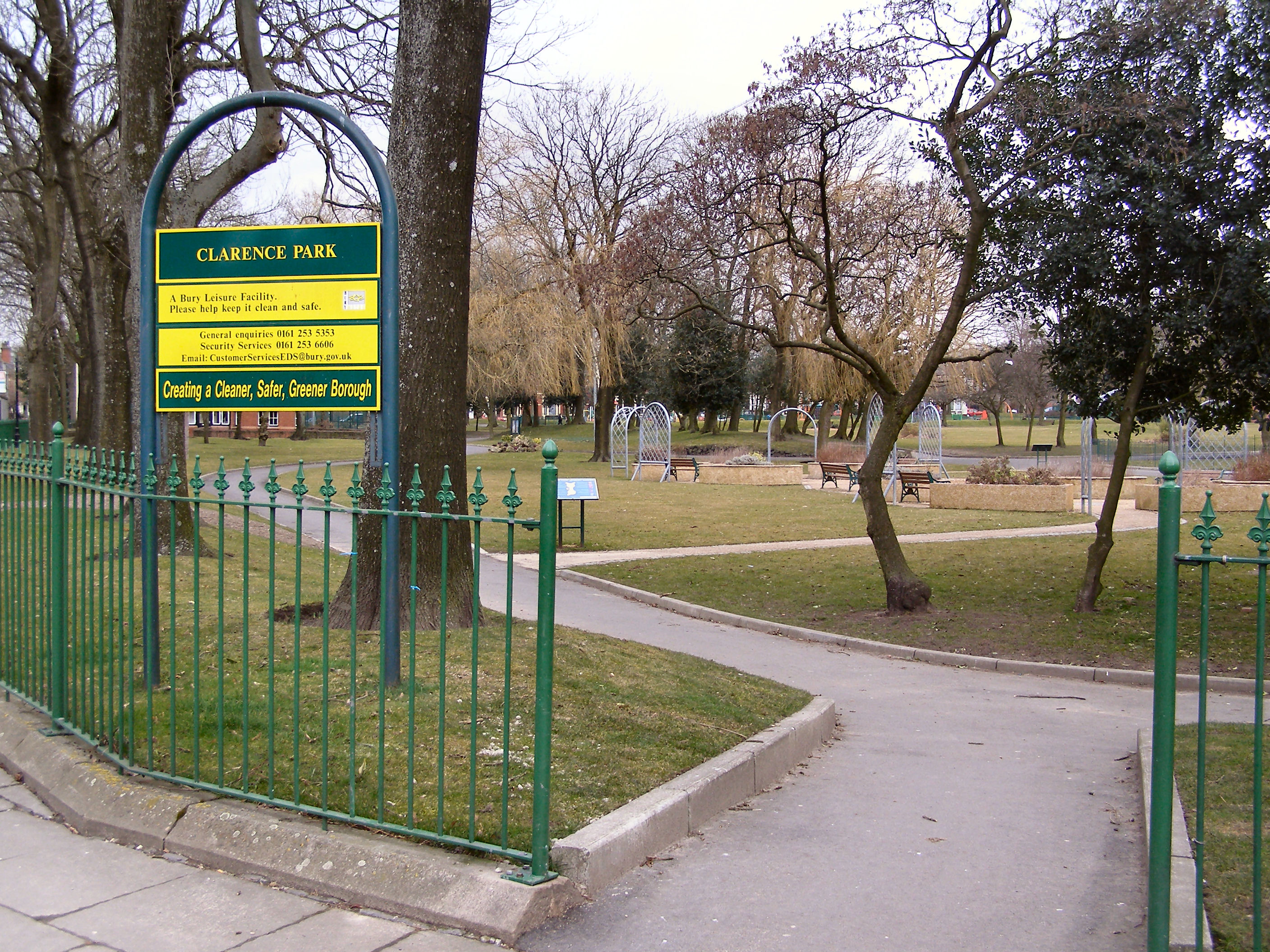
Clarence Park, Bury

Clarence Park is a Green Flag awarded public park located in Bury, Greater Manchester. It is the largest urban park in the borough, and was opened to the...

Hazel Wood High School

Hazel Wood High School, formerly known as Broad Oak Sports College, is a coeducational 11-16 secondary school located on Hazel Avenue about a mile to the...

Chamber Hall Power Station

Chamber Hall Power Station was a coal-fired power station situated in Bury, Greater Manchester. It was opened in 1912 by the Bury Corporation Electricity...

Bury power station

Bury power stations are two generating stations that supplied electricity to the town of Bury, Lancashire and the surrounding area from 1896 to 1970. They...

Ramsbottom Urban District

Ramsbottom Urban District was, from 1894 to 1974, a local government district of the administrative county of Lancashire, England. Its area was coterminate...

Church of St Mary the Virgin, Bury

The Parish Church of St Mary the Virgin is located at the highest point in the town centre of Bury, Greater Manchester, England. The church is located...

County Borough of Bury

Bury was a local government district centred on Bury in the northwest of England from 1846 to 1974. Under the Bury Improvement Act 1846 a board of twenty...

Nearby Amenities

Located within 500m of 53.599728,-2.282541
Mini Roundabout
Direction: clockwise
Lat/Long: 53.5973068/-2.2815597
Mini Roundabout
Lat/Long: 53.6008906/-2.2782882
Mini Roundabout
Direction: clockwise
Lat/Long: 53.5998806/-2.2884607
Crossing
Crossing: marked
Crossing Island: no
Tactile Paving: yes
Lat/Long: 53.5961447/-2.2818968
Traffic Signals
Bicycle: yes
Foot: yes
Traffic Signals: signal
Traffic Signals Direction: backward
Lat/Long: 53.5977851/-2.276148
Bus Stop
Moorgate/Old Blue Bell
Bus: yes
Naptan AtcoCode: 1800NC20471
Naptan Bearing: W
Naptan CommonName: Moorgate/Old Blue Bell
Naptan Indicator: Nr taxi hire
Naptan Landmark: PROPERTY 56A
Naptan NaptanCode: mandpgwp
Naptan Notes: INDICATOR AMENDED
Naptan PlusbusZoneRef: MNCRPIC
Naptan ShortCommonName: Old Blue Bell
Naptan Street: BELL LANE
Naptan Verified: no
Network: TfGM
Public Transport: platform
Source: naptan_import
Lat/Long: 53.5969509/-2.2877257
Bus Stop
Bell Lane/Old Blue Bell
Bus: yes
Naptan AtcoCode: 1800NC20481
Naptan Bearing: E
Naptan CommonName: Bell Lane/Old Blue Bell
Naptan Indicator: Opp House 10
Naptan Landmark: OPP HOUSE 10
Naptan NaptanCode: mandpgwt
Naptan PlusbusZoneRef: MNCRPIC
Naptan ShortCommonName: Old Blue Bell
Naptan Street: BELL LANE
Naptan Verified: no
Network: TfGM
Public Transport: platform
Source: naptan_import
Lat/Long: 53.5970892/-2.2862609
Bus Stop
Walmersley Road/Cateaton Street
Bus: yes
Naptan AtcoCode: 1800NC21271
Naptan Bearing: N
Naptan CommonName: Walmersley Road/Cateaton Street
Naptan Indicator: House 89
Naptan Landmark: HOUSE 89
Naptan NaptanCode: mandpmdt
Naptan PlusbusZoneRef: MNCRPIC
Naptan ShortCommonName: Cateaton Street
Naptan Street: WALMERSLEY ROAD
Naptan Verified: no
Network: TfGM
Public Transport: platform
Source: naptan_import
Lat/Long: 53.59966/-2.2899503
Bus Stop
Walmersley Road/Cateaton Street
Bus: yes
Naptan AtcoCode: 1800NC21281
Naptan Bearing: S
Naptan CommonName: Walmersley Road/Cateaton Street
Naptan Indicator: Surgery
Naptan Landmark: SURGERY
Naptan NaptanCode: mandpmdw
Naptan PlusbusZoneRef: MNCRPIC
Naptan ShortCommonName: Cateaton Street
Naptan Street: WALMERSLEY ROAD
Naptan Verified: no
Network: TfGM
Public Transport: platform
Source: naptan_import
Lat/Long: 53.5997954/-2.2897246
Bus Stop
Chesham Road/Brookshaw Street
Bus: yes
Naptan AtcoCode: 1800NC21311
Naptan Bearing: NE
Naptan CommonName: Chesham Road/Brookshaw Street
Naptan Indicator: J h smith
Naptan Landmark: HAIRDRESSERS
Naptan NaptanCode: mandpmgj
Naptan Notes: INDICATOR AMENDED
Naptan PlusbusZoneRef: MNCRPIC
Naptan ShortCommonName: Brookshaw Street
Naptan Street: CHESHAM ROAD
Naptan Verified: no
Network: TfGM
Public Transport: platform
Source: naptan_import
Lat/Long: 53.6026407/-2.2877039
Bus Stop
Chesham Road/Brookshaw Street
Bus: yes
Naptan AtcoCode: 1800NC21321
Naptan Bearing: SW
Naptan CommonName: Chesham Road/Brookshaw Street
Naptan Indicator: Laundrette
Naptan Landmark: HOUSE 30
Naptan NaptanCode: mandpmgm
Naptan PlusbusZoneRef: MNCRPIC
Naptan ShortCommonName: Brookshaw Street
Naptan Street: CHESHAM ROAD
Naptan Verified: no
Network: TfGM
Public Transport: platform
Source: naptan_import
Lat/Long: 53.6026775/-2.2873415
Bus Stop
Chester Street/Chesham Road
Bus: yes
Naptan AtcoCode: 1800NC21351
Naptan Bearing: N
Naptan CommonName: Chester Street/Chesham Road
Naptan Indicator: Os House 146
Naptan Landmark: HOUSE 146
Naptan NaptanCode: mandpmgw
Naptan Notes: INDICATOR AMENDED
Naptan PlusbusZoneRef: MNCRPIC
Naptan ShortCommonName: Chesham Road
Naptan Street: CHESTER STREET
Naptan Verified: no
Network: TfGM
Public Transport: platform
Source: naptan_import
Lat/Long: 53.603982/-2.2830583
Bus Stop
Salford Street/Haslam Street
Bus: yes
Naptan AtcoCode: 1800NC21361
Naptan Bearing: E
Naptan CommonName: Salford Street/Haslam Street
Naptan Indicator: Warehouse Opp
Naptan Landmark: WAREHOUSE OPP
Naptan NaptanCode: mandpmja
Naptan PlusbusZoneRef: MNCRPIC
Naptan ShortCommonName: Haslam Street
Naptan Street: SALFORD STREET
Naptan Verified: no
Network: TfGM
Public Transport: platform
Source: naptan_import
Lat/Long: 53.6026133/-2.2840919
Bus Stop
Huntley Mount Road/Percy Street
Bus: yes
Naptan AtcoCode: 1800NC21631
Naptan Bearing: N
Naptan CommonName: Huntley Mount Road/Percy Street
Naptan Indicator: Boiler Plant
Naptan Landmark: WORKS UNIT
Naptan NaptanCode: mandpmwt
Naptan PlusbusZoneRef: MNCRPIC
Naptan ShortCommonName: Percy Street
Naptan Street: HUNTLEY MOUNT R
Naptan Verified: no
Network: TfGM
Public Transport: platform
Source: naptan_import
Lat/Long: 53.5988604/-2.2784455
Bus Stop
Huntley Mount Road/Percy Street
Bus: yes
Naptan AtcoCode: 1800NC21641
Naptan Bearing: S
Naptan CommonName: Huntley Mount Road/Percy Street
Naptan Indicator: Bowling Green
Naptan Landmark: BOWLING GREEN
Naptan NaptanCode: mandptad
Naptan PlusbusZoneRef: MNCRPIC
Naptan ShortCommonName: Percy Street
Naptan Street: HUNTLEY MOUNT R
Naptan Verified: no
Network: TfGM
Public Transport: platform
Source: naptan_import
Lat/Long: 53.5992175/-2.2783192
Bus Stop
Thrush Drive/Kestrel Drive
Bus: yes
Naptan AtcoCode: 1800NC21651
Naptan Bearing: W
Naptan CommonName: Thrush Drive/Kestrel Drive
Naptan Indicator: Playing Field
Naptan Landmark: PLAYING FIELD
Naptan NaptanCode: mandptag
Naptan PlusbusZoneRef: MNCRPIC
Naptan ShortCommonName: Kestrel Drive
Naptan Street: THRUSH DRIVE
Naptan Verified: no
Network: TfGM
Public Transport: platform
Source: naptan_import
Lat/Long: 53.6010194/-2.2777042
Bus Stop
Thrush Drive/Kestrel Drive
Bus: yes
Naptan AtcoCode: 1800NC21661
Naptan Bearing: E
Naptan CommonName: Thrush Drive/Kestrel Drive
Naptan Indicator: Bungalow
Naptan Landmark: HOUSE 27
Naptan NaptanCode: mandptaj
Naptan PlusbusZoneRef: MNCRPIC
Naptan ShortCommonName: Kestrel Drive
Naptan Street: THRUSH DRIVE
Naptan Verified: no
Network: TfGM
Public Transport: platform
Source: naptan_import
Lat/Long: 53.6011095/-2.2776141
Bus Stop
Kingfisher Drive/Swallow Drive
Bus: yes
Naptan AtcoCode: 1800NC21691
Naptan Bearing: N
Naptan CommonName: Kingfisher Drive/Swallow Drive
Naptan Indicator: O/s House 11
Naptan Landmark: HOUSE 11
Naptan NaptanCode: mandptat
Naptan PlusbusZoneRef: MNCRPIC
Naptan ShortCommonName: Swallow Drive
Naptan Street: Kingfisher Drive
Naptan Verified: no
Network: TfGM
Public Transport: platform
Source: naptan_import
Lat/Long: 53.602191/-2.2763518
Bus Stop
Bell Lane/Chesham Fold Road
Bus: yes
Naptan AtcoCode: 1800NC21701
Naptan Bearing: W
Naptan CommonName: Bell Lane/Chesham Fold Road
Naptan Indicator: O/s House 234
Naptan Landmark: HOUSE 234
Naptan NaptanCode: mandptaw
Naptan Notes: LOCATION AMENDED
Naptan PlusbusZoneRef: MNCRPIC
Naptan ShortCommonName: Chesham Fold Road
Naptan Street: BELL LANE
Naptan Verified: no
Network: TfGM
Public Transport: platform
Source: naptan_import
Lat/Long: 53.5978235/-2.2759606
Bus Stop
Bell Lane/Chesham Fold Road
Bus: yes
Naptan AtcoCode: 1800NC21711
Naptan Bearing: E
Naptan CommonName: Bell Lane/Chesham Fold Road
Naptan Indicator: Grass Area
Naptan Landmark: GRASS AREA
Naptan NaptanCode: mandptda
Naptan PlusbusZoneRef: MNCRPIC
Naptan ShortCommonName: Chesham Fold Road
Naptan Street: Rochdale Old Road
Naptan Verified: no
Network: TfGM
Public Transport: platform
Source: naptan_import
Lat/Long: 53.5979315/-2.2758858
Bus Stop
Bell Lane/Aldi
Bus: yes
Naptan AtcoCode: 1800NC21721
Naptan Bearing: E
Naptan CommonName: Bell Lane/Aldi
Naptan Indicator: Aldi Stores
Naptan Landmark: ALDI STORE
Naptan NaptanCode: mandptdg
Naptan PlusbusZoneRef: MNCRPIC
Naptan ShortCommonName: Aldi
Naptan Street: BELL LANE
Naptan Verified: no
Network: TfGM
Public Transport: platform
Source: naptan_import
Lat/Long: 53.5977007/-2.2785437
Bus Stop
Bell Lane/Aldi
Bus: yes
Naptan AtcoCode: 1800NC21731
Naptan Bearing: W
Naptan CommonName: Bell Lane/Aldi
Naptan Indicator: Spotted Cow Pub
Naptan Landmark: SPOTTED COW PUB
Naptan NaptanCode: mandptdj
Naptan PlusbusZoneRef: MNCRPIC
Naptan ShortCommonName: Aldi
Naptan Street: BELL LANE
Naptan Verified: no
Network: TfGM
Public Transport: platform
Source: naptan_import
Lat/Long: 53.5974366/-2.2799774
Bus Stop
Parsonage Street/Bell Lane
Bus: yes
Naptan AtcoCode: 1800NC33611
Naptan Bearing: N
Naptan CommonName: Parsonage Street/Bell Lane
Naptan Indicator: Chip Shop
Naptan Landmark: CHIP SHOP
Naptan NaptanCode: mandtdtj
Naptan PlusbusZoneRef: MNCRPIC
Naptan ShortCommonName: Bell Lane
Naptan Street: Parsonage Street
Naptan Verified: no
Network: TfGM
Public Transport: platform
Source: naptan_import
Lat/Long: 53.5970284/-2.2815915
Bus Stop
Parsonage Street/Bell Lane
Bus: yes
Naptan AtcoCode: 1800NC33621
Naptan Bearing: S
Naptan CommonName: Parsonage Street/Bell Lane
Naptan Indicator: O/s House 9
Naptan Landmark: HOUSE 9
Naptan NaptanCode: mandtdtm
Naptan PlusbusZoneRef: MNCRPIC
Naptan ShortCommonName: Bell Lane
Naptan Street: Parsonage Street
Naptan Verified: no
Network: TfGM
Public Transport: platform
Source: naptan_import
Lat/Long: 53.5967318/-2.2815744
Bus Stop
Bell Lane/Sanderson Street
Bus: yes
Naptan AtcoCode: 1800NC33631
Naptan Bearing: E
Naptan CommonName: Bell Lane/Sanderson Street
Naptan Indicator: Op Public House
Naptan Landmark: 155
Naptan NaptanCode: mandtdtp
Naptan PlusbusZoneRef: MNCRPIC
Naptan ShortCommonName: Sanderson Street
Naptan Street: BELL LANE
Naptan Verified: no
Network: TfGM
Public Transport: platform
Source: naptan_import
Lat/Long: 53.5973227/-2.2825454
Bus Stop
Bell Lane/Sanderson Street
Bus: yes
Naptan AtcoCode: 1800NC33641
Naptan Bearing: W
Naptan CommonName: Bell Lane/Sanderson Street
Naptan Indicator: Grapes Hotel
Naptan Landmark: GRAPES HOTEL
Naptan NaptanCode: mandtdtw
Naptan PlusbusZoneRef: MNCRPIC
Naptan ShortCommonName: Sanderson Street
Naptan Street: BELL LANE
Naptan Verified: no
Network: TfGM
Public Transport: platform
Source: naptan_import
Lat/Long: 53.5972052/-2.2828468
Turning Circle
Lat/Long: 53.6010733/-2.2811951
Traffic Signals
Traffic Signals: signal
Traffic Signals Direction: forward
Lat/Long: 53.5970205/-2.2883612
Clifton Trade Bathrooms
Addr City: Bury
Addr Housenumber: 2
Addr Postcode: BL9 6ED
Addr Street: Canon Street
Phone: +44 161 761 2888
Website: https://ctb.co.uk/
Wheelchair: yes
Lat/Long: 53.6005036/-2.2869127
School
Cambian Chesham House School
Addr City: Bury
Addr Postcode: BL9 6JD
Addr Street: Thrush Drive
Capacity: 20
Isced Level: 2
Max Age: 18
Min Age: 10
Note: only 6 pupils: needs survey
Phone: +44 161 7637072
Ref GB Uprn: 100012436000
Ref Edubase: 140205
Religion: none
School Boarding: no
School Gender: mixed
School Selective: no
School Trust: no
School Type: special
Website: https://www.cambiangroup.com/specialist-education/our-schools/semh-schools/cambian-chesham-house-school/
Lat/Long: 53.6015494/-2.2756619
Noexit: yes
Lat/Long: 53.5976803/-2.2792944
Give Way
Lat/Long: 53.59695/-2.2883981
Total Site Safety Ltd
Addr City: Bury
Addr Housename: Bury Business Centre
Addr Housenumber: Unit 29
Addr Postcode: BL9 6BU
Addr Street: Kay Street
Email: info@totalsitesafety.co.uk
Lat/Long: 53.6000601/-2.2829429
Barrier: bollard
Lat/Long: 53.5995617/-2.2750181
Give Way
Lat/Long: 53.5968745/-2.2869415
Barrier: kissing_gate
Lat/Long: 53.6042072/-2.2832063
ALDI
Addr City: Bury
Addr Postcode: BL9 6HS
Addr Street: Bell Lane
Brand: ALDI
Brand Wikidata: Q41171672
Brand Wikipedia: en:Aldi
Contact Website: https://stores.aldi.co.uk/bury/201-bell-lane
Fhrs Id: 936709
Operator: Aldi Stores Limited
Shop: supermarket
Lat/Long: 53.5979362/-2.2784883
Traffic Signals
Traffic Signals: signal
Traffic Signals Direction: backward
Lat/Long: 53.6005815/-2.2899191
Cycleway: asl
Direction: backward
Lat/Long: 53.6006334/-2.2899239
Cycleway: asl
Direction: backward
Lat/Long: 53.6007716/-2.2896682
Traffic Signals
Traffic Signals: signal
Traffic Signals Direction: backward
Lat/Long: 53.600771/-2.2895851
Traffic Signals
Traffic Signals: signal
Traffic Signals Direction: forward
Lat/Long: 53.5970221/-2.2876626
Traffic Signals
Traffic Signals: signal
Traffic Signals Direction: backward
Lat/Long: 53.5969963/-2.2868881
Traffic Signals
Traffic Signals: signal
Traffic Signals Direction: forward
Lat/Long: 53.5972321/-2.2873269
Give Way
Direction: forward
Lat/Long: 53.5958483/-2.2863433
Cycleway: asl
Direction: backward
Lat/Long: 53.5968611/-2.2870357
Cycleway: asl
Direction: forward
Lat/Long: 53.597182/-2.2873409
Cycleway: asl
Direction: forward
Lat/Long: 53.5970203/-2.2875878
Traffic Signals
Traffic Signals: signal
Traffic Signals Direction: backward
Lat/Long: 53.5968357/-2.286977
Cycleway: asl
Direction: backward
Lat/Long: 53.5969934/-2.286963
Traffic Signals
Traffic Signals: signal
Traffic Signals Direction: backward
Lat/Long: 53.5970357/-2.2880556
Traffic Signals
Traffic Signals: signal
Traffic Signals Direction: backward
Lat/Long: 53.5971934/-2.2881709
Traffic Signals
Traffic Signals: signal
Lat/Long: 53.5969162/-2.2882113
Traffic Signals
Traffic Signals: signal
Lat/Long: 53.5968972/-2.2883203
Crossing
Crossing: traffic_signals
Crossing Ref: pegasus;toucan
Lat/Long: 53.5978427/-2.2761679
Barrier: bollard
Bicycle: yes
Foot: yes
Lat/Long: 53.5983007/-2.2816935
Barrier: bollard
Bicycle: yes
Foot: yes
Lat/Long: 53.5977532/-2.2814092
Barrier: bollard
Bicycle: yes
Foot: yes
Lat/Long: 53.5978152/-2.2815889
Traffic Signals
Traffic Signals: signal
Traffic Signals Direction: forward
Lat/Long: 53.5978774/-2.2761774
Traffic Signals
Traffic Signals: signal
Traffic Signals Direction: backward
Lat/Long: 53.5978488/-2.2761073
Traffic Signals
Traffic Signals: signal
Traffic Signals Direction: forward
Lat/Long: 53.5978363/-2.2762399
Barrier: kerb
Lat/Long: 53.5971103/-2.2815534
Post Box
Lat/Long: 53.5974646/-2.2811208
GSF Car Parts
Addr City: Bury
Addr Postcode: BL9 6AQ
Addr Street: Kay Street
Addr Unit: 10
Branch: Bury
Brand: GSF Car Parts
Brand Wikidata: Q80963064
Contact Website: https://www.gsfcarparts.com/bury
Opening Hours: Mo-Fr 08:00-17:30; Sa 08:00-14:00
Phone: 0161 7614012
Shop: car_parts
Website: https://www.gsfcarparts.com
Lat/Long: 53.599338/-2.2838388
Place Of Worship
The Salvation Army - Bury
Addr City: Bury
Addr Country: GB
Addr Housenumber: 18
Addr Postcode: BL9 6EB
Addr Street: Brookshaw Street
Denomination: salvation_army
Email: bury@salvationarmy.org.uk
Phone: 0161 763 5142
Religion: christian
Website: https://www.salvationarmy.org.uk/bury
Lat/Long: 53.6009222/-2.2883669
Barrier: bollard
Foot: yes
Lat/Long: 53.5975659/-2.2798083
The data included in this document is from www.openstreetmap.org. The data is made available under ODbL.

Have you been to Freetown?

Leave your review of Freetown below (or comments, questions and feedback).