Cantley Wood

Wood, Forest in Norfolk South Norfolk

England

Cantley Wood

The A47 west approaching junction with A11
The A47 west approaching junction with A11 Credit: Roy Hughes

Cantley Wood is a picturesque woodland located in Norfolk, England. Situated just outside the village of Cantley, this woodland covers an area of approximately 60 hectares. It is a designated Site of Special Scientific Interest (SSSI) due to its diverse and unique flora and fauna.

The woodland is predominantly made up of broadleaf trees, including oak, birch, and beech, which create a dense and vibrant canopy. Underneath the trees, a rich undergrowth of wildflowers, ferns, and mosses thrives, adding to the woodland's natural beauty.

Cantley Wood is home to a variety of wildlife species. Bird enthusiasts can spot numerous species, including woodpeckers, owls, and various songbirds. Mammals such as deer, foxes, and rabbits are also frequently seen within the wood. Additionally, the woodland is known for its abundance of butterflies and insects, making it a popular spot for nature enthusiasts and photographers.

The woodland offers several walking trails, allowing visitors to explore its serene surroundings. The trails wind through the trees and offer glimpses of the wildlife and plant life that call Cantley Wood their home. It is an ideal location for nature walks, family outings, and picnics.

Cantley Wood provides a tranquil escape from the bustling city life. Its natural beauty, diverse ecosystem, and peaceful atmosphere make it a must-visit destination for anyone seeking a connection with nature in Norfolk.

If you have any feedback on the listing, please let us know in the comments section below.
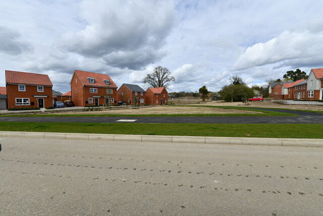
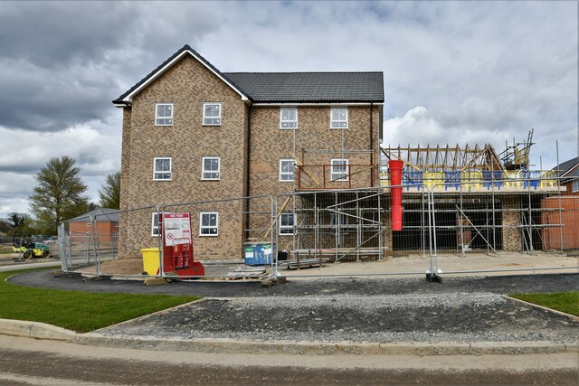
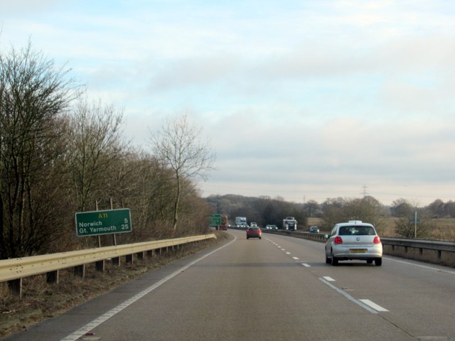
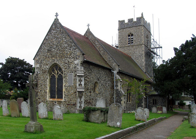
Cantley Wood Images

Images are sourced within 2km of 52.598476/1.2198781 or Grid Reference TG1804. Thanks to Geograph Open Source API. All images are credited.

The A47 west approaching junction with A11
Footbridge over the A47 west approaching junction with A11
Slip road leaving the A47 to join the A11
The A11 west approaching junction for Ketteringham
The A11 west . 22 miles to Thetford
Cringleford: 79, Woolhouse Way
Cringleford: Work in progress on a huge housing estate
Cringleford: Davies Drive
Cringleford: Housing street to be named though numbered
Cringleford: House under construction
Cringleford: Haldane Drive
Cringleford: Barratt Homes 'Cringleford Heights' site and sales office
Little Melton: Field used for grazing
The A11 eastbound, Norwich 5 miles
The A11 eastbound approaching the Thickthorn Interchange
Dragonfly Lane, Cringleford
Newmarket Road, Cringleford
Round House Way, Cringleford
Show me another place!

Cantley Wood is located at Grid Ref: TG1804 (Lat: 52.598476, Lng: 1.2198781)

Administrative County: Norfolk

District: South Norfolk

Police Authority: Norfolk

What 3 Words

///hurray.stiff.apron. Near Cringleford, Norfolk

Nearby Locations

Cantley Wood Cantley Wood

Related Wikis

Mulbarton, Norfolk

Mulbarton is a village and civil parish located south of Norwich in the English county of Norfolk. It covers an area of 5.34 km2 (2.06 sq mi).The place...

Hethersett railway station

Hethersett was a railway station near Hethersett, Norfolk. == History == The Bill for the Norwich & Brandon Railway (N&BR) received Royal Assent on 10...

Intwood

Intwood is a village and former civil parish, now in the parish of Keswick and Intwood, in the South Norfolk district, in the county of Norfolk, England...

Cringleford

Cringleford is a civil parish and village in the English county of Norfolk. The village sits on the River Yare and forms part of the outskirts of Norwich...

Nearby Amenities

Located within 500m of 52.598476,1.2198781
Traffic Calming: hump
Lat/Long: 52.6012491/1.2207255
Traffic Signals
Traffic Signals: signal
Lat/Long: 52.6025648/1.2228882
Power: tower
Ref: 4VV 211
Lat/Long: 52.5993329/1.2232804
Power: tower
Ref: 4VV 210
Lat/Long: 52.6021121/1.2218884
Crossing
Crossing: uncontrolled
Traffic Calming: table
Lat/Long: 52.6029123/1.2195629
Crossing
Crossing: uncontrolled
Traffic Calming: table
Lat/Long: 52.6025734/1.2198013
Crossing
Crossing: uncontrolled
Traffic Calming: table
Lat/Long: 52.6024488/1.2198889
Crossing
Crossing: uncontrolled
Traffic Calming: table
Lat/Long: 52.6023264/1.219975
Crossing
Crossing: uncontrolled
Traffic Calming: table
Lat/Long: 52.6022012/1.2200631
Crossing
Crossing: uncontrolled
Traffic Calming: table
Lat/Long: 52.602078/1.2201498
Crossing
Crossing: uncontrolled
Traffic Calming: table
Lat/Long: 52.6018587/1.220304
Crossing
Crossing: uncontrolled
Traffic Calming: table
Lat/Long: 52.6017344/1.2203914
Crossing
Crossing: uncontrolled
Traffic Calming: table
Lat/Long: 52.6016112/1.2204781
Crossing
Crossing: uncontrolled
Traffic Calming: table
Lat/Long: 52.6014889/1.2205624
Crossing
Crossing: uncontrolled
Traffic Calming: table
Lat/Long: 52.6013698/1.2206408
Power: pole
Ref: 89
Lat/Long: 52.59982/1.224785
Power: pole
Lat/Long: 52.5997752/1.2249032
Location Transition: yes
Power: pole
Lat/Long: 52.5992271/1.225156
Location Transition: yes
Power: pole
Lat/Long: 52.598538/1.22489
Power: pole
Ref: 91
Lat/Long: 52.601685/1.223444
Power: pole
Ref: 90
Lat/Long: 52.60075/1.224093
Power: pole
Lat/Long: 52.594753/1.222371
Material: wood
Power: pole
Lat/Long: 52.59664/1.224396
Material: steel
Power: pole
Lat/Long: 52.597697/1.225212
Power: pole
Lat/Long: 52.59549/1.223219
Power: pole
Lat/Long: 52.596373/1.224195
Bus Stop
Thickthorn / Park Ride
Naptan AtcoCode: 2900H2258
Naptan Bearing: NE
Naptan CommonName: Park & Ride
Naptan Indicator: adj
Naptan Locality: Thickthorn
Naptan NaptanCode: nfogmwtd
Naptan PlusbusZoneRef: NRCH
Naptan Street: Norwich Road
Operator: Norfolk County Council
Shelter: yes
Source: naptan_import;survey
Lat/Long: 52.602798/1.2198535
Grit Bin
Colour: yellow
Lat/Long: 52.6028654/1.220029
Waste Basket
Waste: trash
Lat/Long: 52.6028801/1.220021
Bicycle Parking
Bicycle Parking: stands
Capacity: 12
Covered: yes
Operator: Norfolk County Council
Lat/Long: 52.6029205/1.2199662
Bicycle Parking
Bicycle Parking: stands
Capacity: 12
Covered: yes
Operator: Norfolk County Council
Lat/Long: 52.6028524/1.2199486
Street Lamp
Operator: Norfolk County Council
Ref: 262
Lat/Long: 52.602269/1.219471
Street Lamp
Operator: Norfolk County Council
Ref: 253
Lat/Long: 52.602525/1.219311
Street Lamp
Operator: Norfolk County Council
Ref: 280
Lat/Long: 52.601311/1.220147
Street Lamp
Operator: Norfolk County Council
Ref: 272
Lat/Long: 52.601793/1.219853
Street Lamp
Operator: Norfolk County Council
Ref: 273
Lat/Long: 52.601558/1.219972
Street Lamp
Operator: Norfolk County Council
Ref: 282
Lat/Long: 52.601256/1.220595
Street Lamp
Operator: Norfolk County Council
Ref: 281
Lat/Long: 52.601175/1.220284
Street Lamp
Operator: Norfolk County Council
Ref: 279
Lat/Long: 52.601382/1.220416
Street Lamp
Operator: Norfolk County Council
Ref: 278
Lat/Long: 52.601452/1.220687
Street Lamp
Operator: Norfolk County Council
Ref: 274
Lat/Long: 52.601628/1.220243
Street Lamp
Operator: Norfolk County Council
Ref: 275
Lat/Long: 52.6017/1.220514
Street Lamp
Operator: Norfolk County Council
Ref: 276
Lat/Long: 52.601771/1.220785
Street Lamp
Operator: Norfolk County Council
Ref: 263
Lat/Long: 52.602021/1.219649
Street Lamp
Operator: Norfolk County Council
Ref: 264
Lat/Long: 52.602082/1.219885
Street Lamp
Operator: Norfolk County Council
Ref: 271
Lat/Long: 52.601853/1.220111
Street Lamp
Operator: Norfolk County Council
Ref: 265
Lat/Long: 52.602153/1.220155
Street Lamp
Operator: Norfolk County Council
Ref: 261
Lat/Long: 52.602337/1.219743
Street Lamp
Operator: Norfolk County Council
Ref: 260
Lat/Long: 52.602409/1.220016
Street Lamp
Operator: Norfolk County Council
Ref: 270
Lat/Long: 52.601935/1.220394
Street Lamp
Operator: Norfolk County Council
Ref: 269
Lat/Long: 52.602008/1.22067
Street Lamp
Lit: 24/7
Operator: Norfolk County Council
Ref: 259
Lat/Long: 52.602479/1.220287
Street Lamp
Operator: Norfolk County Council
Ref: 267
Lat/Long: 52.602283/1.220676
Street Lamp
Operator: Norfolk County Council
Ref: 266
Lat/Long: 52.602223/1.220425
Street Lamp
Operator: Norfolk County Council
Ref: 277
Lat/Long: 52.601515/1.22095
Street Lamp
Operator: Norfolk County Council
Ref: 283
Lat/Long: 52.601349/1.220924
Street Lamp
Lat/Long: 52.6025066/1.2221366
Street Lamp
Lat/Long: 52.602375/1.222225
Street Lamp
Lat/Long: 52.602512/1.221811
Street Lamp
Lit: no
Operator: National Highways
Operator Wikidata: Q5760006
Ref: 118
Lat/Long: 52.602505/1.222713
Street Lamp
Operator: National Highways
Operator Wikidata: Q5760006
Ref: 116
Lat/Long: 52.60233/1.22323
Street Lamp
Operator: Norfolk County Council
Ref: 252
Lat/Long: 52.602739/1.219181
Street Lamp
Operator: Norfolk County Council
Ref: 251
Lat/Long: 52.602806/1.219459
Street Lamp
Operator: Norfolk County Council
Ref: 256
Lat/Long: 52.602731/1.220106
Street Lamp
Operator: Norfolk County Council
Ref: 250
Lat/Long: 52.602873/1.219722
Street Lamp
Operator: Norfolk County Council
Ref: 255
Lat/Long: 52.602665/1.219839
Street Lamp
Operator: Norfolk County Council
Ref: 249
Lat/Long: 52.6029366/1.2199753
Street Lamp
Operator: Norfolk County Council
Ref: 258
Lat/Long: 52.602549/1.220558
Street Lamp
Operator: Norfolk County Council
Ref: 257
Lat/Long: 52.60281/1.220389
Street Lamp
Lat/Long: 52.602694/1.22149
Street Lamp
Operator: Norfolk County Council
Ref: 268
Lat/Long: 52.60202/1.220906
Street Lamp
Operator: Norfolk County Council
Ref: 254
Lat/Long: 52.60259/1.219565
Bus Stop
Thickthorn
Operator: National Express
Public Transport: platform
Shelter: yes
Lat/Long: 52.6018826/1.2200495
Grit Bin
Lat/Long: 52.6019085/1.2203037
Camera Mount: pole
Man Made: surveillance
Surveillance: public
Surveillance Type: camera
Surveillance Zone: parking
Lat/Long: 52.601418/1.220639
Camera Mount: pole
Man Made: surveillance
Surveillance: public
Surveillance Type: camera
Surveillance Zone: parking
Lat/Long: 52.601826/1.220353
Man Made: surveillance
Surveillance: public
Lat/Long: 52.602126/1.219548
Grit Bin
Lat/Long: 52.602385/1.21996
Camera Mount: pole
Man Made: surveillance
Surveillance: public
Surveillance Type: camera
Surveillance Zone: parking
Lat/Long: 52.602537/1.219849
Camera Mount: pole
Man Made: surveillance
Surveillance: public
Surveillance Type: camera
Surveillance Zone: parking
Lat/Long: 52.602047/1.220199
Camera Mount: pole
Camera Type: dome
Man Made: surveillance
Surveillance: public
Surveillance Type: camera
Surveillance Zone: parking
Lat/Long: 52.60279/1.219404
Camera Mount: pole
Camera Type: dome
Man Made: surveillance
Surveillance: public
Surveillance Type: camera
Surveillance Zone: parking
Lat/Long: 52.602924/1.219925
Entrance: main
Lat/Long: 52.6023291/1.2213885
Traffic Calming: hump
Lat/Long: 52.6017575/1.2197428
Traffic Calming: hump
Lat/Long: 52.6020675/1.2208185
Traffic Calming: hump
Lat/Long: 52.6028424/1.2189817
deli2go
Shop: deli
Website: http://www.deli2go.co.uk/
Lat/Long: 52.6026166/1.2224656
Street Lamp
Operator: National Highways
Operator Wikidata: Q5760006
Ref: 141
Lat/Long: 52.6019712/1.2225032
Street Lamp
Operator: National Highways
Operator Wikidata: Q5760006
Ref: 140
Lat/Long: 52.6022056/1.2227488
Parking
Access: yes
Fee: no
Operator: National Highways
Operator Wikidata: Q5760006
Parking: surface
Lat/Long: 52.5998874/1.2195359
Location Transition: yes
Power: pole
Lat/Long: 52.5969523/1.2221257
Power: pole
Lat/Long: 52.597314/1.2223188
Location Transition: yes
Power: pole
Lat/Long: 52.5975128/1.2221686
Power: pole
Lat/Long: 52.5975568/1.2229545
Power: pole
Lat/Long: 52.5975828/1.2242688
Power: pole
Lat/Long: 52.5977669/1.2233112
Location Transition: yes
Lat/Long: 52.5977702/1.2235526
Power: pole
Lat/Long: 52.5979331/1.2236036
Power: pole
Lat/Long: 52.5980353/1.2239207
Power: pole
Lat/Long: 52.5981437/1.2239154
Location Transition: yes
Power: pole
Lat/Long: 52.5983734/1.2242694
Power: pole
Lat/Long: 52.5999329/1.2254302
Power: pole
Lat/Long: 52.594688/1.2185223
Power: pole
Lat/Long: 52.5948305/1.2233153
Power: pole
Lat/Long: 52.5952128/1.219787
Power: pole
Transformer: distribution
Lat/Long: 52.5954654/1.2223753
Power: pole
Lat/Long: 52.5957668/1.2210825
Vacuum Cleaner
Lat/Long: 52.6025787/1.2220944
Compressed Air
Charge: £0.50 GBP/5 minute
Fee: yes
Lat/Long: 52.6025848/1.2220843
Priority: equal
Lat/Long: 52.6027519/1.2219889
Give Way
Lat/Long: 52.6026191/1.220562
Give Way
Lat/Long: 52.6023531/1.2206648
Give Way
Lat/Long: 52.6014521/1.2209592
Give Way
Lat/Long: 52.6017204/1.2208849
Give Way
Lat/Long: 52.6019901/1.2208043
Give Way
Lat/Long: 52.6016084/1.2198919
Give Way
Lat/Long: 52.6013604/1.2200601
Give Way
Lat/Long: 52.6019559/1.2196679
Give Way
Lat/Long: 52.602203/1.2194925
Give Way
Lat/Long: 52.6024533/1.2193237
Give Way
Lat/Long: 52.6029039/1.2189855
Entrance: main
Lat/Long: 52.6018416/1.2216577
Generator Method: photovoltaic
Generator Orientation: 155
Generator Solar Modules: 15
Generator Source: solar
Generator Type: solar_photovoltaic_panel
Power: generator
Lat/Long: 52.602804/1.219756
Bench
Backrest: yes
Colour: yellow
Lat/Long: 52.6028899/1.2198881
Grit Bin
Colour: yellow
Lat/Long: 52.6028284/1.2196621
Bench
Backrest: yes
Colour: yellow
Lat/Long: 52.6028561/1.2197681
Motorcycle Parking
Access: customers
Covered: no
Fee: no
Lit: yes
Parking: surface
Lat/Long: 52.6026558/1.2192571
Barrier: bollard
Lat/Long: 52.601341/1.220661
Barrier: bollard
Lat/Long: 52.6013925/1.2206259
Barrier: bollard
Lat/Long: 52.6014667/1.220577
Barrier: bollard
Lat/Long: 52.6015184/1.220542
Barrier: bollard
Lat/Long: 52.6015913/1.2204919
Barrier: bollard
Lat/Long: 52.6016415/1.2204568
Barrier: bollard
Lat/Long: 52.6017153/1.2204048
Barrier: bollard
Lat/Long: 52.6017678/1.2203679
Barrier: bollard
Lat/Long: 52.6018372/1.2203191
Barrier: bollard
Lat/Long: 52.6018904/1.2202817
Barrier: bollard
Lat/Long: 52.6020508/1.2201689
Barrier: bollard
Lat/Long: 52.6021055/1.2201305
Barrier: bollard
Lat/Long: 52.6021762/1.2200807
Barrier: bollard
Lat/Long: 52.6022296/1.2200431
Barrier: bollard
Lat/Long: 52.6023008/1.219993
Barrier: bollard
Lat/Long: 52.6023517/1.2199572
Barrier: bollard
Lat/Long: 52.602422/1.2199078
Barrier: bollard
Lat/Long: 52.6024762/1.2198696
Barrier: bollard
Lat/Long: 52.6025491/1.2198184
Barrier: bollard
Lat/Long: 52.6026004/1.2197823
Barrier: bollard
Lat/Long: 52.6028849/1.2195822
Barrier: bollard
Lat/Long: 52.6029403/1.2195432
Street Lamp
Lat/Long: 52.6026867/1.22183
Note: Ground location for potential new
Ref: GB*ION*E411202
Lat/Long: 52.6027254/1.2217707
Note: Ground location for potential new
Ref: GB*ION*E411201
Lat/Long: 52.6026967/1.2218069
Charging Station
Ionity Cringleford 3
Amperage: 500
Brand: Ionity
Capacity: 1
Charge: £0.69 GBP/kWh
Fee: yes
Height: 2.60
Motorcar: yes
Opening Hours: 24/7
Operator: ABB
Phone: +44 20 3885 0100
Ref: GB*ION*E411203
Socket Type2 Combo: 1
Voltage: 920
Website: https://payment.ionity.eu/
Lat/Long: 52.6027918/1.2217221
Charging Station
Ionity Cringleford 4
Amperage: 500
Brand: Ionity
Capacity: 1
Charge: £0.69 GBP/kWh
Fee: yes
Height: 2.60
Motorcar: yes
Opening Hours: 24/7
Operator: ABB
Phone: +44 20 3885 0100
Ref: GB*ION*E411204
Socket Type2 Combo: 1
Voltage: 920
Website: https://payment.ionity.eu/
Lat/Long: 52.6027769/1.221719
Charging Station
Ionity Cringleford 5
Amperage: 500
Brand: Ionity
Capacity: 1
Charge: £0.69 GBP/kWh
Fee: yes
Height: 2.60
Motorcar: yes
Opening Hours: 24/7
Operator: ABB
Phone: +44 20 3885 0100
Ref: GB*ION*E411205
Socket Type2 Combo: 1
Voltage: 920
Website: https://payment.ionity.eu/
Lat/Long: 52.6028307/1.2216418
Give Way
Lat/Long: 52.6010913/1.2252876
Generator Method: photovoltaic
Generator Output Electricity: yes
Generator Source: solar
Generator Type: solar_photovoltaic_panel
Location: roof
Power: generator
Lat/Long: 52.5983786/1.2237632
Parcel Locker
Brand: Amazon
Collection Times: 24/7
Colour: blue
Parcel Mail In: returns_only
Parcel Pickup: yes
Ref: saddle
Wheelchair: yes
Lat/Long: 52.6025332/1.2223108
The data included in this document is from www.openstreetmap.org. The data is made available under ODbL.

Have you been to Cantley Wood?

Leave your review of Cantley Wood below (or comments, questions and feedback).