Ward's Wood

Wood, Forest in Norfolk South Norfolk

England

Ward's Wood

The A47 west approaching junction with A11
The A47 west approaching junction with A11 Credit: Roy Hughes

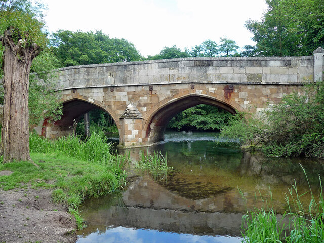
Ward's Wood is a picturesque woodland area located in Norfolk, England. Nestled in the heart of the county, this forested area covers approximately 200 acres of land. Known for its natural beauty and diverse ecosystems, Ward's Wood offers a peaceful retreat for nature enthusiasts and outdoor adventurers alike.

The wood is characterized by its dense canopy of mature trees, predominantly consisting of oak, beech, and ash. These towering trees not only provide a stunning visual backdrop but also create a haven for a wide variety of wildlife. Visitors to Ward's Wood may spot deer, foxes, badgers, and an array of bird species, making it a popular spot for birdwatchers.

Traversing through the woodland, visitors will find well-maintained footpaths that wind their way through the forest, allowing for leisurely walks and peaceful contemplation. These trails provide an opportunity to explore the diverse flora and fauna that inhabit the wood, with wildflowers, ferns, and mosses adding splashes of color to the forest floor.

Beyond its natural beauty, Ward's Wood also holds historical significance. The wood has been present for centuries and is believed to have been used as a source of timber during the medieval period. Today, remnants of this past can still be seen in the form of ancient tree stumps and the occasional hidden artifact.

Overall, Ward's Wood in Norfolk offers a serene escape from the hustle and bustle of modern life. Whether it's a leisurely stroll, birdwatching, or simply immersing oneself in the tranquility of nature, this forested area provides a delightful experience for all who venture within its boundaries.

If you have any feedback on the listing, please let us know in the comments section below.

Ward's Wood Images

Images are sourced within 2km of 52.601909/1.2193324 or Grid Reference TG1805. Thanks to Geograph Open Source API. All images are credited.

The A47 west approaching junction with A11
Footbridge over the A47 west approaching junction with A11
Slip road leaving the A47 to join the A11
The A11 west approaching junction for Ketteringham
The A11 west . 22 miles to Thetford
Bridge, Cringleford Built in 1520, replacing a bridge washed away in 1519, and widened in 1780. The facings are in limestone, "a rarity in Norfolk other than for churches and bridges". Grade II* listed.
It carries Eaton Street over the River Yare.
Bridge, Cringleford
Built in 1520, replacing a bridge washed away in 1519, and widened in 1780. The facings are in limestone, "a rarity in Norfolk other than for churches and bridges". Grade II* listed. It carries Eaton Street over the River Yare.
Cringleford: 79, Woolhouse Way
Cringleford: Work in progress on a huge housing estate
Cringleford: Davies Drive
Cringleford: Housing street to be named though numbered
Cringleford: House under construction
Cringleford: Haldane Drive
Cringleford: Barratt Homes 'Cringleford Heights' site and sales office
Little Melton: Field used for grazing
To Norwich 4 Old milestone near to Cringleford, Norfolk. For close up view see <a title="https://www.geograph.org.uk/photo/4665289" href="https://www.geograph.org.uk/photo/4665289">Link</a>
To Norwich 4
Old milestone near to Cringleford, Norfolk. For close up view see Link
Old Milestone Old milestone near to Cringleford, Norfolk. For overall view see <a title="https://www.geograph.org.uk/photo/4665286" href="https://www.geograph.org.uk/photo/4665286">Link</a>
Old Milestone
Old milestone near to Cringleford, Norfolk. For overall view see Link
To Norwich 5 Old milestone at Hethersett, Norfolk now a good distance from the road due to realignment and hidden the hedge can be seen centre left. For close up view see <a title="https://www.geograph.org.uk/photo/4665298" href="https://www.geograph.org.uk/photo/4665298">Link</a>
To Norwich 5
Old milestone at Hethersett, Norfolk now a good distance from the road due to realignment and hidden the hedge can be seen centre left. For close up view see Link
Old Milestone Old milestone at Hethersett, Norfolk. For overall view see <a title="https://www.geograph.org.uk/photo/4665295" href="https://www.geograph.org.uk/photo/4665295">Link</a>
Old Milestone
Old milestone at Hethersett, Norfolk. For overall view see Link
Show me another place!

Ward's Wood is located at Grid Ref: TG1805 (Lat: 52.601909, Lng: 1.2193324)

Administrative County: Norfolk

District: South Norfolk

Police Authority: Norfolk

What 3 Words

///arena.laws.faster. Near Cringleford, Norfolk

Nearby Locations

Ward's Wood

Related Wikis

Norwich City F.C. Under-23s and Academy

Norwich City Under-21s and Academy is the youth organisation run by Norwich City F.C. The team is made up of under-21 and academy players and is effectively...

Hethersett railway station

Hethersett was a railway station near Hethersett, Norfolk. == History == The Bill for the Norwich & Brandon Railway (N&BR) received Royal Assent on 10...

Cringleford

Cringleford is a civil parish and village in the English county of Norfolk. The village sits on the River Yare and forms part of the outskirts of Norwich...

Norfolk and Norwich University Hospital

The Norfolk and Norwich University Hospital (NNUH) is a large National Health Service academic teaching hospital in the Norwich Research Park on the western...

Nearby Amenities

Located within 500m of 52.601909,1.2193324
Traffic Signals
Traffic Signals: signal
Lat/Long: 52.6034668/1.2252795
Traffic Signals
Traffic Signals: signal
Lat/Long: 52.6038319/1.2241424
Traffic Signals
Traffic Signals: signal
Lat/Long: 52.6026757/1.2240976
Traffic Signals
Traffic Signals: signal
Lat/Long: 52.6026619/1.2231508
Traffic Signals
Traffic Signals: signal
Lat/Long: 52.6024809/1.2241522
Traffic Calming: hump
Lat/Long: 52.6035341/1.2191256
Traffic Calming: hump
Lat/Long: 52.6012491/1.2207255
Proposed
Proposed: traffic_signals
Lat/Long: 52.6031789/1.2226855
Traffic Signals
Traffic Signals: signal
Lat/Long: 52.6025648/1.2228882
Traffic Signals
Traffic Signals: signal
Lat/Long: 52.6040245/1.2241204
Traffic Signals
Traffic Signals: signal
Lat/Long: 52.6033721/1.2254923
Crossing
Bicycle: designated
Button Operated: yes
Crossing: traffic_signals
Crossing Ref: toucan
Tactile Paving: yes
Traffic Signals Sound: walk
Traffic Signals Vibration: yes
Lat/Long: 52.603988/1.2241791
Crossing
Bicycle: designated
Crossing: traffic_signals
Crossing Ref: toucan
Tactile Paving: yes
Traffic Signals Sound: walk
Lat/Long: 52.6037267/1.2230372
Power: tower
Ref: 4VV 209
Lat/Long: 52.6050864/1.2204321
Power: tower
Ref: PO27
Lat/Long: 52.6023088/1.226215
Power: tower
Ref: 4VV 211
Lat/Long: 52.5993329/1.2232804
Power: tower
Ref: 4VV 210
Lat/Long: 52.6021121/1.2218884
Note: Thickthorn Park & Ride
Operator: UK Power Networks
Power: substation
Ref: TG1816 0552
Lat/Long: 52.6037305/1.2203879
Crossing
Crossing: uncontrolled
Traffic Calming: table
Lat/Long: 52.6034089/1.2192136
Crossing
Crossing: uncontrolled
Traffic Calming: table
Lat/Long: 52.6032841/1.2193014
Crossing
Crossing: uncontrolled
Traffic Calming: table
Lat/Long: 52.6031582/1.2193899
Crossing
Crossing: uncontrolled
Traffic Calming: table
Lat/Long: 52.6030334/1.2194777
Crossing
Crossing: uncontrolled
Traffic Calming: table
Lat/Long: 52.6029123/1.2195629
Crossing
Crossing: uncontrolled
Traffic Calming: table
Lat/Long: 52.6025734/1.2198013
Crossing
Crossing: uncontrolled
Traffic Calming: table
Lat/Long: 52.6024488/1.2198889
Crossing
Crossing: uncontrolled
Traffic Calming: table
Lat/Long: 52.6023264/1.219975
Crossing
Crossing: uncontrolled
Traffic Calming: table
Lat/Long: 52.6022012/1.2200631
Crossing
Crossing: uncontrolled
Traffic Calming: table
Lat/Long: 52.602078/1.2201498
Crossing
Crossing: uncontrolled
Traffic Calming: table
Lat/Long: 52.6018587/1.220304
Crossing
Crossing: uncontrolled
Traffic Calming: table
Lat/Long: 52.6017344/1.2203914
Crossing
Crossing: uncontrolled
Traffic Calming: table
Lat/Long: 52.6016112/1.2204781
Crossing
Crossing: uncontrolled
Traffic Calming: table
Lat/Long: 52.6014889/1.2205624
Crossing
Crossing: uncontrolled
Traffic Calming: table
Lat/Long: 52.6013698/1.2206408
Material: wood
Power: pole
Ref: 95
Lat/Long: 52.605109/1.221824
Power: pole
Ref: 94
Lat/Long: 52.6043564/1.2214658
Power: pole
Ref: 93
Lat/Long: 52.6035882/1.2220408
Power: pole
Ref: 92
Lat/Long: 52.602739/1.222669
Material: wood
Power: pole
Ref: 96
Lat/Long: 52.605831/1.22217
Power: pole
Ref: 89
Lat/Long: 52.59982/1.224785
Power: pole
Lat/Long: 52.5997752/1.2249032
Location Transition: yes
Power: pole
Lat/Long: 52.5992271/1.225156
Power: pole
Ref: 91
Lat/Long: 52.601685/1.223444
Location Transition: yes
Material: wood
Power: pole
Lat/Long: 52.604315/1.222472
Location Transition: yes
Power: pole
Lat/Long: 52.604234/1.224324
Power: pole
Ref: 90
Lat/Long: 52.60075/1.224093
A11/Thickthorn Roundabout CCTV Camera
Man Made: surveillance
Note: Demountable CCTV camera. Mounted to a street light. Forward Vision MIC1-400 aluminium range.
Surveillance: traffic
Url: http://sites.google.com/site/norwichpolicecctv/
Lat/Long: 52.603504/1.225386
A11/Thickthorn Roundabout CCTV Camera
Man Made: surveillance
Note: Demountable CCTV camera. Mounted to a street light. Forward Vision MIC1-400 aluminium range.
Surveillance: traffic
Url: http://sites.google.com/site/norwichpolicecctv/
Lat/Long: 52.602543/1.223145
Crossing
Crossing: unmarked
Tactile Paving: yes
Lat/Long: 52.6042343/1.2202937
Bus Stop
Thickthorn / Norwich Road
Naptan AtcoCode: 2900H2214
Naptan Bearing: E
Naptan CommonName: Cottages
Naptan Indicator: adj
Naptan Latitude: 52.6043355
Naptan Locality: Thickthorn
Naptan Longitude: 1.218362
Naptan NaptanCode: nfoawgmt
Naptan PlusbusZoneRef: NRCH
Naptan Street: Norwich Road
Physically Present: no
Shelter: no
Source: naptan_import;survey
Lat/Long: 52.6042547/1.2184371
Bus Stop
Thickthorn / Norwich Road
Naptan AtcoCode: 2900H2215
Naptan Bearing: W
Naptan CommonName: Cottages
Naptan Indicator: opp
Naptan Locality: Thickthorn
Naptan NaptanCode: nfoawgmw
Naptan PlusbusZoneRef: NRCH
Naptan Street: Norwich Road
Operator: Norfolk County Council
Ref: NFOAWGMW
Shelter: no
Source: naptan_import;survey
Lat/Long: 52.604131/1.2184358
Bus Stop
Thickthorn / Park Ride
Naptan AtcoCode: 2900H2258
Naptan Bearing: NE
Naptan CommonName: Park & Ride
Naptan Indicator: adj
Naptan Locality: Thickthorn
Naptan NaptanCode: nfogmwtd
Naptan PlusbusZoneRef: NRCH
Naptan Street: Norwich Road
Operator: Norfolk County Council
Shelter: yes
Source: naptan_import;survey
Lat/Long: 52.602798/1.2198535
Bus Stop
Thickthorn
Naptan AtcoCode: 2900H2259
Naptan Bearing: SE
Naptan CommonName: Park & Ride
Naptan Indicator: opp
Naptan Locality: Thickthorn
Naptan NaptanCode: nfogmwaj
Naptan PlusbusZoneRef: NRCH
Naptan Street: Norwich Road
Operator: Norfolk County Council
Source: naptan_import;survey
Lat/Long: 52.6035602/1.2217154
Bus Stop
Thickthorn
Note: Used by coaches when P&R site is closed
Operator: Norfolk County Council
Public Transport: platform
Shelter: no
Lat/Long: 52.6035443/1.2204425
Grit Bin
Colour: yellow
Lat/Long: 52.6028654/1.220029
Waste Basket
Waste: trash
Lat/Long: 52.6028801/1.220021
Bicycle Parking
Bicycle Parking: stands
Capacity: 12
Covered: yes
Operator: Norfolk County Council
Lat/Long: 52.6029205/1.2199662
Bicycle Parking
Bicycle Parking: stands
Capacity: 12
Covered: yes
Operator: Norfolk County Council
Lat/Long: 52.6028524/1.2199486
Crossing
Button Operated: yes
Check Date Crossing: 2021-06-06
Crossing: traffic_signals
Crossing Ref: pegasus
Horse: yes
Tactile Paving: yes
Lat/Long: 52.6025163/1.2240835
Crossing
Check Date Crossing: 2021-06-06
Crossing: traffic_signals
Crossing Ref: pegasus
Horse: yes
Tactile Paving: yes
Lat/Long: 52.6028613/1.2253175
Street Lamp
Operator: Norfolk County Council
Ref: 262
Lat/Long: 52.602269/1.219471
Street Lamp
Operator: Norfolk County Council
Ref: 253
Lat/Long: 52.602525/1.219311
Street Lamp
Operator: Norfolk County Council
Ref: 280
Lat/Long: 52.601311/1.220147
Street Lamp
Operator: Norfolk County Council
Ref: 272
Lat/Long: 52.601793/1.219853
Street Lamp
Operator: Norfolk County Council
Ref: 273
Lat/Long: 52.601558/1.219972
Street Lamp
Operator: Norfolk County Council
Ref: 282
Lat/Long: 52.601256/1.220595
Street Lamp
Operator: Norfolk County Council
Ref: 281
Lat/Long: 52.601175/1.220284
Street Lamp
Operator: Norfolk County Council
Ref: 279
Lat/Long: 52.601382/1.220416
Street Lamp
Operator: Norfolk County Council
Ref: 278
Lat/Long: 52.601452/1.220687
Street Lamp
Operator: Norfolk County Council
Ref: 274
Lat/Long: 52.601628/1.220243
Street Lamp
Operator: Norfolk County Council
Ref: 275
Lat/Long: 52.6017/1.220514
Street Lamp
Operator: Norfolk County Council
Ref: 276
Lat/Long: 52.601771/1.220785
Street Lamp
Operator: Norfolk County Council
Ref: 263
Lat/Long: 52.602021/1.219649
Street Lamp
Operator: Norfolk County Council
Ref: 264
Lat/Long: 52.602082/1.219885
Street Lamp
Operator: Norfolk County Council
Ref: 271
Lat/Long: 52.601853/1.220111
Street Lamp
Operator: Norfolk County Council
Ref: 265
Lat/Long: 52.602153/1.220155
Street Lamp
Operator: Norfolk County Council
Ref: 261
Lat/Long: 52.602337/1.219743
Street Lamp
Operator: Norfolk County Council
Ref: 260
Lat/Long: 52.602409/1.220016
Street Lamp
Operator: Norfolk County Council
Ref: 270
Lat/Long: 52.601935/1.220394
Street Lamp
Operator: Norfolk County Council
Ref: 269
Lat/Long: 52.602008/1.22067
Street Lamp
Lit: 24/7
Operator: Norfolk County Council
Ref: 259
Lat/Long: 52.602479/1.220287
Street Lamp
Operator: Norfolk County Council
Ref: 267
Lat/Long: 52.602283/1.220676
Street Lamp
Operator: Norfolk County Council
Ref: 266
Lat/Long: 52.602223/1.220425
Street Lamp
Operator: Norfolk County Council
Ref: 277
Lat/Long: 52.601515/1.22095
Street Lamp
Operator: Norfolk County Council
Ref: 283
Lat/Long: 52.601349/1.220924
Street Lamp
Lat/Long: 52.6025066/1.2221366
Street Lamp
Lat/Long: 52.602375/1.222225
Street Lamp
Lat/Long: 52.602512/1.221811
Street Lamp
Lit: no
Operator: National Highways
Operator Wikidata: Q5760006
Ref: 118
Lat/Long: 52.602505/1.222713
Street Lamp
Operator: National Highways
Operator Wikidata: Q5760006
Ref: 117
Lat/Long: 52.602536/1.223143
Street Lamp
Operator: National Highways
Operator Wikidata: Q5760006
Ref: 116
Lat/Long: 52.60233/1.22323
Street Lamp
Operator: National Highways
Operator Wikidata: Q5760006
Ref: 136
Lat/Long: 52.602405/1.224104
Street Lamp
Operator: National Highways
Operator Wikidata: Q5760006
Ref: 115
Lat/Long: 52.602493/1.223636
Street Lamp
Operator: Norfolk County Council
Ref: 245
Lat/Long: 52.603055/1.219279
Street Lamp
Operator: Norfolk County Council
Ref: 246
Lat/Long: 52.602985/1.219006
Street Lamp
Operator: Norfolk County Council
Ref: 252
Lat/Long: 52.602739/1.219181
Street Lamp
Operator: Norfolk County Council
Ref: 251
Lat/Long: 52.602806/1.219459
Street Lamp
Operator: Norfolk County Council
Ref: 239
Lat/Long: 52.603232/1.218835
Street Lamp
Operator: Norfolk County Council
Ref: 240
Lat/Long: 52.603301/1.219104
Street Lamp
Operator: Norfolk County Council
Ref: 241
Lat/Long: 52.60338/1.219409
Street Lamp
Operator: Norfolk County Council
Ref: 237
Lat/Long: 52.603492/1.218828
Street Lamp
Operator: Norfolk County Council
Ref: 236
Lat/Long: 52.603576/1.219153
Street Lamp
Operator: Norfolk County Council
Ref: 235
Lat/Long: 52.603659/1.219482
Street Lamp
Operator: Norfolk County Council
Ref: 256
Lat/Long: 52.602731/1.220106
Street Lamp
Operator: Norfolk County Council
Ref: 250
Lat/Long: 52.602873/1.219722
Street Lamp
Operator: Norfolk County Council
Ref: 255
Lat/Long: 52.602665/1.219839
Street Lamp
Operator: Norfolk County Council
Ref: 243
Lat/Long: 52.603194/1.219821
Street Lamp
Operator: Norfolk County Council
Ref: 244
Lat/Long: 52.603133/1.219581
Street Lamp
Operator: Norfolk County Council
Ref: 249
Lat/Long: 52.6029366/1.2199753
Street Lamp
Operator: Norfolk County Council
Ref: 258
Lat/Long: 52.602549/1.220558
Street Lamp
Operator: Norfolk County Council
Ref: 257
Lat/Long: 52.60281/1.220389
Street Lamp
Operator: Norfolk County Council
Ref: 242
Lat/Long: 52.603442/1.219645
Street Lamp
Operator: Norfolk County Council
Ref: 213
Lat/Long: 52.603569/1.220659
Street Lamp
Operator: Norfolk County Council
Lat/Long: 52.603698/1.220644
Street Lamp
Lat/Long: 52.602694/1.22149
Street Lamp
Lat/Long: 52.6029355/1.2213749
Street Lamp
Lat/Long: 52.6029545/1.2210826
Street Lamp
Lat/Long: 52.6030183/1.2214049
Street Lamp
Lat/Long: 52.6028661/1.2215776
Street Lamp
Lat/Long: 52.6030145/1.2220468
Street Lamp
Lat/Long: 52.6030958/1.221859
Street Lamp
Lat/Long: 52.6028446/1.2223316
Street Lamp
Operator: National Highways
Operator Wikidata: Q5760006
Ref: 119
Lat/Long: 52.602723/1.222737
Street Lamp
Operator: National Highways
Operator Wikidata: Q5760006
Ref: 120
Lat/Long: 52.603059/1.222639
Street Lamp
Operator: National Highways
Operator Wikidata: Q5760006
Ref: 122
Lat/Long: 52.603329/1.222735
Street Lamp
Operator: National Highways
Operator Wikidata: Q5760006
Ref: 145
Lat/Long: 52.603651/1.222913
Street Lamp
Operator: National Highways
Operator Wikidata: Q5760006
Ref: 123
Lat/Long: 52.603555/1.223133
Street Lamp
Operator: National Highways
Operator Wikidata: Q5760006
Ref: 124
Lat/Long: 52.6037254/1.2233825
Street Lamp
Operator: National Highways
Operator Wikidata: Q5760006
Ref: 146
Lat/Long: 52.603895/1.223003
Street Lamp
Operator: National Highways
Operator Wikidata: Q5760006
Ref: 113
Lat/Long: 52.602624/1.224377
Street Lamp
Operator: National Highways
Operator Wikidata: Q5760006
Ref: 129
Lat/Long: 52.6038844/1.2238705
Street Lamp
Operator: National Highways
Operator Wikidata: Q5760006
Ref: 148
Lat/Long: 52.604405/1.22353
Street Lamp
Operator: National Highways
Operator Wikidata: Q5760006
Ref: 149
Lat/Long: 52.604141/1.223842
Street Lamp
Operator: National Highways
Operator Wikidata: Q5760006
Ref: 130
Lat/Long: 52.60395/1.224603
Street Lamp
Operator: National Highways
Operator Wikidata: Q5760006
Ref: 150
Lat/Long: 52.604058/1.224248
Street Lamp
Operator: National Highways
Operator Wikidata: Q5760006
Ref: 133
Lat/Long: 52.602888/1.225406
Street Lamp
Operator: National Highways
Operator Wikidata: Q5760006
Ref: 108
Lat/Long: 52.602826/1.224984
Street Lamp
Operator: National Highways
Operator Wikidata: Q5760006
Ref: 106
Lat/Long: 52.603143/1.225434
Street Lamp
Operator: National Highways
Operator Wikidata: Q5760006
Ref: 131
Lat/Long: 52.603806/1.225136
Street Lamp
Lit: no
Operator: National Highways
Operator Wikidata: Q5760006
Ref: 132
Lat/Long: 52.603657/1.225552
Street Lamp
Lit: no
Operator: National Highways
Operator Wikidata: Q5760006
Ref: 105
Lat/Long: 52.603315/1.225746
Street Lamp
Operator: Norfolk County Council
Ref: 268
Lat/Long: 52.60202/1.220906
Street Lamp
Operator: Norfolk County Council
Ref: 238
Lat/Long: 52.603323/1.218585
Street Lamp
Operator: Norfolk County Council
Ref: 254
Lat/Long: 52.60259/1.219565
Street Lamp
Operator: Norfolk County Council
Ref: 247
Lat/Long: 52.603194/1.220075
Street Lamp
Operator: Norfolk County Council
Ref: 248
Lat/Long: 52.603115/1.220271
Street Lamp
Operator: Norfolk County Council
Ref: 233
Lat/Long: 52.603319/1.220133
Street Lamp
Operator: Norfolk County Council
Ref: 234
Lat/Long: 52.603591/1.219894
Bus Stop
Thickthorn
Operator: National Express
Public Transport: platform
Shelter: yes
Lat/Long: 52.6018826/1.2200495
Grit Bin
Lat/Long: 52.6019085/1.2203037
Camera Mount: pole
Man Made: surveillance
Surveillance: public
Surveillance Type: camera
Surveillance Zone: parking
Lat/Long: 52.601418/1.220639
Camera Mount: pole
Man Made: surveillance
Surveillance: public
Surveillance Type: camera
Surveillance Zone: parking
Lat/Long: 52.601826/1.220353
Man Made: surveillance
Surveillance: public
Lat/Long: 52.602126/1.219548
Grit Bin
Lat/Long: 52.602385/1.21996
Camera Mount: pole
Man Made: surveillance
Surveillance: public
Surveillance Type: camera
Surveillance Zone: parking
Lat/Long: 52.602537/1.219849
Camera Mount: pole
Man Made: surveillance
Surveillance: public
Surveillance Type: camera
Surveillance Zone: parking
Lat/Long: 52.602047/1.220199
Camera Mount: pole
Camera Type: dome
Man Made: surveillance
Surveillance: public
Surveillance Type: camera
Surveillance Zone: parking
Lat/Long: 52.60279/1.219404
Grit Bin
Lat/Long: 52.603216/1.219371
Camera Mount: pole
Man Made: surveillance
Surveillance: public
Surveillance Type: camera
Surveillance Zone: parking
Lat/Long: 52.603491/1.219177
Camera Mount: pole
Camera Type: fixed
Man Made: surveillance
Surveillance: public
Surveillance Type: camera
Surveillance Zone: parking
Lat/Long: 52.603075/1.220112
Camera Mount: pole
Camera Type: dome
Man Made: surveillance
Surveillance: public
Surveillance Type: camera
Surveillance Zone: parking
Lat/Long: 52.602924/1.219925
Milestone
Distance Norwich: 4 mi
Distance Thetford: 25 mi
Marker: stone
Lat/Long: 52.604128/1.2181479
Street Lamp
Lit: no
Note: Just used for CCTV pole
Lat/Long: 52.6034996/1.2253788
Street Lamp
Operator: Norfolk County Council
Ref: 187
Lat/Long: 52.6035389/1.225886
Entrance: main
Lat/Long: 52.6023291/1.2213885
Crossing
Crossing: uncontrolled
Traffic Calming: table
Lat/Long: 52.6033158/1.2200275
Traffic Calming: hump
Lat/Long: 52.6017575/1.2197428
Crossing
Crossing: unmarked
Tactile Paving: yes
Lat/Long: 52.6031532/1.2204336
Traffic Calming: hump
Lat/Long: 52.6020675/1.2208185
Traffic Calming: hump
Lat/Long: 52.6028424/1.2189817
Crossing
Crossing: unmarked
Tactile Paving: yes
Lat/Long: 52.6032371/1.2203689
Street Lamp
Operator: Norfolk County Council
Ref: 231
Source: survey
Lat/Long: 52.603457/1.220591
Street Lamp
Operator: Norfolk County Council
Ref: 227
Source: survey
Lat/Long: 52.603394/1.221457
Street Lamp
Operator: Norfolk County Council
Ref: 209
Source: survey
Lat/Long: 52.603847/1.220862
Street Lamp
Operator: Norfolk County Council
Ref: 215
Source: survey
Lat/Long: 52.603822/1.221182
Street Lamp
Operator: Norfolk County Council
Ref: 232
Source: survey
Lat/Long: 52.603424/1.220785
Crossing
Crossing Island: yes
Tactile Paving: yes
Lat/Long: 52.6044043/1.2206848
Street Lamp
Operator: Norfolk County Council
Ref: 203
Source: survey
Lat/Long: 52.6043468/1.2204839
Street Lamp
Operator: Norfolk County Council
Ref: 219
Source: survey
Lat/Long: 52.603235/1.222135
Street Lamp
Operator: Norfolk County Council
Ref: 220
Source: survey
Lat/Long: 52.603136/1.222478
Street Lamp
Operator: Norfolk County Council
Ref: 207
Source: survey
Lat/Long: 52.604082/1.221242
Street Lamp
Operator: Norfolk County Council
Ref: 213
Source: survey
Lat/Long: 52.60348/1.220861
Street Lamp
Operator: Norfolk County Council
Ref: 230
Source: survey
Lat/Long: 52.603234/1.220436
Street Lamp
Operator: Norfolk County Council
Ref: 217
Source: survey
Lat/Long: 52.603492/1.22157
Street Lamp
Operator: Norfolk County Council
Ref: 218
Source: survey
Lat/Long: 52.603338/1.221871
Street Lamp
Operator: Norfolk County Council
Ref: 205
Source: survey
Lat/Long: 52.6043581/1.2210133
Street Lamp
Operator: Norfolk County Council
Ref: 201
Source: survey
Lat/Long: 52.603978/1.220354
Street Lamp
Operator: Norfolk County Council
Ref: 228
Source: survey
Lat/Long: 52.603457/1.221128
Street Lamp
Operator: Norfolk County Council
Ref: 224
Source: survey
Lat/Long: 52.603439/1.221965
Street Lamp
Operator: Norfolk County Council
Ref: 206
Source: survey
Lat/Long: 52.6041717/1.221205
Street Lamp
Operator: Norfolk County Council
Ref: 212
Source: survey
Lat/Long: 52.603596/1.220403
Street Lamp
Operator: Norfolk County Council
Ref: 225
Source: survey
Lat/Long: 52.603334/1.222229
Street Lamp
Operator: Norfolk County Council
Ref: 216
Source: survey
Lat/Long: 52.603656/1.221344
Street Lamp
Operator: Norfolk County Council
Ref: 222
Source: survey
Lat/Long: 52.603717/1.22151
Street Lamp
Operator: Norfolk County Council
Ref: 204
Source: survey
Lat/Long: 52.6043831/1.2207328
Crossing
Crossing: unmarked
Tactile Paving: yes
Lat/Long: 52.6041547/1.220253
Street Lamp
Operator: Norfolk County Council
Ref: 210
Source: survey
Lat/Long: 52.603852/1.220599
Street Lamp
Operator: Norfolk County Council
Ref: 226
Source: survey
Lat/Long: 52.603257/1.222563
Street Lamp
Operator: Norfolk County Council
Ref: 223
Source: survey
Lat/Long: 52.603575/1.221703
Street Lamp
Operator: Norfolk County Council
Ref: 214
Source: survey
Lat/Long: 52.603555/1.221188
Street Lamp
Operator: Norfolk County Council
Ref: 211
Source: survey
Lat/Long: 52.603767/1.220409
Crossing
Crossing: uncontrolled
Tactile Paving: yes
Lat/Long: 52.6042227/1.2212319
Street Lamp
Operator: Norfolk County Council
Ref: 202
Source: survey
Lat/Long: 52.60419/1.220323
Street Lamp
Operator: Norfolk County Council
Ref: 229
Source: survey
Lat/Long: 52.603198/1.220811
Street Lamp
Operator: Norfolk County Council
Ref: 221
Source: survey
Lat/Long: 52.603882/1.221354
Street Lamp
Operator: Norfolk County Council
Ref: 208
Source: survey
Lat/Long: 52.603917/1.22109
Crossing
Crossing: uncontrolled
Tactile Paving: yes
Lat/Long: 52.6041635/1.221263
deli2go
Shop: deli
Website: http://www.deli2go.co.uk/
Lat/Long: 52.6026166/1.2224656
Street Lamp
Operator: National Highways
Operator Wikidata: Q5760006
Ref: 141
Lat/Long: 52.6019712/1.2225032
Street Lamp
Operator: National Highways
Operator Wikidata: Q5760006
Ref: 138
Lat/Long: 52.6020574/1.2249215
Street Lamp
Operator: National Highways
Operator Wikidata: Q5760006
Ref: 140
Lat/Long: 52.6022056/1.2227488
Street Lamp
Operator: National Highways
Operator Wikidata: Q5760006
Ref: 135
Lat/Long: 52.6022592/1.2255857
Street Lamp
Operator: National Highways
Operator Wikidata: Q5760006
Ref: 137
Lat/Long: 52.60231/1.2245602
Street Lamp
Operator: National Highways
Operator Wikidata: Q5760006
Ref: 134
Lat/Long: 52.6025497/1.2253739
Street Lamp
Covered: yes
Operator: National Highways
Operator Wikidata: Q5760006
Ref: 111
Lat/Long: 52.602725/1.224623
Street Lamp
Covered: yes
Operator: National Highways
Operator Wikidata: Q5760006
Ref: 109
Lat/Long: 52.6027637/1.2247335
Street Lamp
Covered: yes
Operator: National Highways
Operator Wikidata: Q5760006
Ref: 112
Lat/Long: 52.6028671/1.2244905
Street Lamp
Covered: yes
Operator: National Highways
Operator Wikidata: Q5760006
Ref: 110
Lat/Long: 52.6029042/1.2246009
Street Lamp
Covered: yes
Operator: National Highways
Operator Wikidata: Q5760006
Ref: 126
Lat/Long: 52.6036288/1.2237456
Street Lamp
Covered: yes
Lit: no
Operator: National Highways
Operator Wikidata: Q5760006
Ref: 128
Lat/Long: 52.6036667/1.2238522
Street Lamp
Covered: yes
Operator: National Highways
Operator Wikidata: Q5760006
Ref: 125
Lat/Long: 52.6037795/1.2235923
Street Lamp
Covered: yes
Operator: National Highways
Operator Wikidata: Q5760006
Ref: 127
Lat/Long: 52.6038198/1.2237066
Street Lamp
Operator: Norfolk County Council
Ref: 151
Lat/Long: 52.6040284/1.2249528
Street Lamp
Operator: National Highways
Operator Wikidata: Q5760006
Ref: 147
Lat/Long: 52.604189/1.2228067
Post Box
Collection Times: Mo-Fr 16:45; Sa 09:15
Operator: Royal Mail
Operator Wikidata: Q638098
Post Box Type: lamp
Ref: NR9 903
Royal Cypher: EIIR
Royal Cypher Wikidata: Q33102113
Lat/Long: 52.603795/1.2131666
Parking
Access: yes
Fee: no
Operator: National Highways
Operator Wikidata: Q5760006
Parking: surface
Lat/Long: 52.5998874/1.2195359
Power: pole
Lat/Long: 52.5999329/1.2254302
Vacuum Cleaner
Lat/Long: 52.6025787/1.2220944
Compressed Air
Charge: £0.50 GBP/5 minute
Fee: yes
Lat/Long: 52.6025848/1.2220843
Entrance: main
Lat/Long: 52.6037065/1.2224068
Leisure: playground
Lat/Long: 52.6034792/1.2225335
Bicycle Parking
Bicycle Parking: stands
Capacity: 14
Covered: yes
Lat/Long: 52.6036127/1.2221874
Give Way
Lat/Long: 52.6041304/1.221207
Give Way
Lat/Long: 52.6036431/1.2221188
Give Way
Lat/Long: 52.6041474/1.2220999
Crossing
Crossing: uncontrolled
Crossing Ref: zebra
Lat/Long: 52.60368/1.2221952
Crossing
Crossing: uncontrolled
Crossing Island: no
Crossing Ref: zebra
Tactile Paving: yes
Lat/Long: 52.604082/1.2222438
Crossing
Crossing: uncontrolled
Crossing Island: no
Crossing Ref: zebra
Tactile Paving: yes
Lat/Long: 52.6040893/1.2219956
Crossing
Crossing Island: yes
Tactile Paving: yes
Lat/Long: 52.6044033/1.2207758
Crossing
Bicycle: yes
Crossing: unmarked
Tactile Paving: no
Lat/Long: 52.6038192/1.2137104
Priority: equal
Lat/Long: 52.6027519/1.2219889
Priority: equal
Lat/Long: 52.6027983/1.222056
Traffic Signals
Crossing: no
Traffic Signals: crossing
Lat/Long: 52.6028978/1.225303
Give Way
Lat/Long: 52.6026191/1.220562
Give Way
Lat/Long: 52.6023531/1.2206648
Give Way
Lat/Long: 52.6014521/1.2209592
Give Way
Lat/Long: 52.6017204/1.2208849
Give Way
Lat/Long: 52.6019901/1.2208043
Give Way
Lat/Long: 52.6016084/1.2198919
Give Way
Lat/Long: 52.6013604/1.2200601
Give Way
Lat/Long: 52.6019559/1.2196679
Give Way
Lat/Long: 52.602203/1.2194925
Give Way
Lat/Long: 52.6024533/1.2193237
Give Way
Lat/Long: 52.6036493/1.2195623
Give Way
Lat/Long: 52.6035232/1.2196548
Give Way
Lat/Long: 52.6032731/1.2198317
Give Way
Lat/Long: 52.603154/1.2188078
Give Way
Lat/Long: 52.6029039/1.2189855
Entrance: main
Lat/Long: 52.6018416/1.2216577
Priority: equal
Lat/Long: 52.6028926/1.2221824
Generator Method: photovoltaic
Generator Orientation: 155
Generator Solar Modules: 15
Generator Source: solar
Generator Type: solar_photovoltaic_panel
Power: generator
Lat/Long: 52.602804/1.219756
Bench
Backrest: yes
Colour: yellow
Lat/Long: 52.6028899/1.2198881
Grit Bin
Colour: yellow
Lat/Long: 52.6028284/1.2196621
Bench
Backrest: yes
Colour: yellow
Lat/Long: 52.6028561/1.2197681
Motorcycle Parking
Access: customers
Covered: no
Fee: no
Lit: yes
Parking: surface
Lat/Long: 52.6026558/1.2192571
Barrier: bollard
Lat/Long: 52.601341/1.220661
Barrier: bollard
Lat/Long: 52.6013925/1.2206259
Barrier: bollard
Lat/Long: 52.6014667/1.220577
Barrier: bollard
Lat/Long: 52.6015184/1.220542
Barrier: bollard
Lat/Long: 52.6015913/1.2204919
Barrier: bollard
Lat/Long: 52.6016415/1.2204568
Barrier: bollard
Lat/Long: 52.6017153/1.2204048
Barrier: bollard
Lat/Long: 52.6017678/1.2203679
Barrier: bollard
Lat/Long: 52.6018372/1.2203191
Barrier: bollard
Lat/Long: 52.6018904/1.2202817
Barrier: bollard
Lat/Long: 52.6020508/1.2201689
Barrier: bollard
Lat/Long: 52.6021055/1.2201305
Barrier: bollard
Lat/Long: 52.6021762/1.2200807
Barrier: bollard
Lat/Long: 52.6022296/1.2200431
Barrier: bollard
Lat/Long: 52.6023008/1.219993
Barrier: bollard
Lat/Long: 52.6023517/1.2199572
Barrier: bollard
Lat/Long: 52.602422/1.2199078
Barrier: bollard
Lat/Long: 52.6024762/1.2198696
Barrier: bollard
Lat/Long: 52.6025491/1.2198184
Barrier: bollard
Lat/Long: 52.6026004/1.2197823
Barrier: bollard
Lat/Long: 52.6028849/1.2195822
Barrier: bollard
Lat/Long: 52.6029403/1.2195432
Barrier: bollard
Lat/Long: 52.6030083/1.2194954
Barrier: bollard
Lat/Long: 52.603065/1.2194555
Barrier: bollard
Lat/Long: 52.6031349/1.2194063
Barrier: bollard
Lat/Long: 52.6031896/1.2193678
Barrier: bollard
Lat/Long: 52.6032579/1.2193198
Barrier: bollard
Lat/Long: 52.6033115/1.2192821
Barrier: bollard
Lat/Long: 52.6033833/1.2192316
Barrier: bollard
Lat/Long: 52.6034342/1.2191958
Recycling
Recycling Bags: yes
Recycling Cardboard: yes
Recycling Clothes: yes
Recycling Glass Bottles: yes
Recycling Paper: yes
Recycling Shoes: yes
Recycling Type: container
Website: https://www.south-norfolk.gov.uk/residents/rubbish-and-recycling/recycling/where-can-i-recycle-more
Lat/Long: 52.6035778/1.2195931
John Kemp Ltd
Description: 4x4 specialists
Opening Hours: Mo-Fr 08:30-17:30; Sa 09:00-16:30; Su,PH appointment
Phone: +44 1603 508333
Second Hand: only
Shop: car
Website: https://www.kemp4x4s.co.uk/
Lat/Long: 52.6043931/1.2134823
Entrance: main
Lat/Long: 52.6041554/1.2139498
Street Lamp
Lat/Long: 52.6026867/1.22183
Note: Ground location for potential new
Ref: GB*ION*E411202
Lat/Long: 52.6027254/1.2217707
Note: Ground location for potential new
Ref: GB*ION*E411201
Lat/Long: 52.6026967/1.2218069
Charging Station
Ionity Cringleford 3
Amperage: 500
Brand: Ionity
Capacity: 1
Charge: £0.69 GBP/kWh
Fee: yes
Height: 2.60
Motorcar: yes
Opening Hours: 24/7
Operator: ABB
Phone: +44 20 3885 0100
Ref: GB*ION*E411203
Socket Type2 Combo: 1
Voltage: 920
Website: https://payment.ionity.eu/
Lat/Long: 52.6027918/1.2217221
Charging Station
Ionity Cringleford 4
Amperage: 500
Brand: Ionity
Capacity: 1
Charge: £0.69 GBP/kWh
Fee: yes
Height: 2.60
Motorcar: yes
Opening Hours: 24/7
Operator: ABB
Phone: +44 20 3885 0100
Ref: GB*ION*E411204
Socket Type2 Combo: 1
Voltage: 920
Website: https://payment.ionity.eu/
Lat/Long: 52.6027769/1.221719
Note: Ground location for potential new
Ref: GB*ION*E411206
Lat/Long: 52.602849/1.221646
Charging Station
Ionity Cringleford 5
Amperage: 500
Brand: Ionity
Capacity: 1
Charge: £0.69 GBP/kWh
Fee: yes
Height: 2.60
Motorcar: yes
Opening Hours: 24/7
Operator: ABB
Phone: +44 20 3885 0100
Ref: GB*ION*E411205
Socket Type2 Combo: 1
Voltage: 920
Website: https://payment.ionity.eu/
Lat/Long: 52.6028307/1.2216418
Give Way
Lat/Long: 52.6010913/1.2252876
Give Way
Lat/Long: 52.6013867/1.2255905
Generator Method: photovoltaic
Generator Output Electricity: yes
Generator Source: solar
Generator Type: solar_photovoltaic_panel
Location: roof
Power: generator
Lat/Long: 52.6035924/1.2224704
Generator Method: photovoltaic
Generator Output Electricity: yes
Generator Source: solar
Generator Type: solar_photovoltaic_panel
Location: roof
Power: generator
Lat/Long: 52.5983786/1.2237632
Parcel Locker
Brand: Amazon
Collection Times: 24/7
Colour: blue
Parcel Mail In: returns_only
Parcel Pickup: yes
Ref: saddle
Wheelchair: yes
Lat/Long: 52.6025332/1.2223108
Traffic Signals
Traffic Signals: crossing
Lat/Long: 52.6036889/1.2230382
The data included in this document is from www.openstreetmap.org. The data is made available under ODbL.

Have you been to Ward's Wood?

Leave your review of Ward's Wood below (or comments, questions and feedback).