Grove Plantation
Wood, Forest in Norfolk South Norfolk
England
Grove Plantation

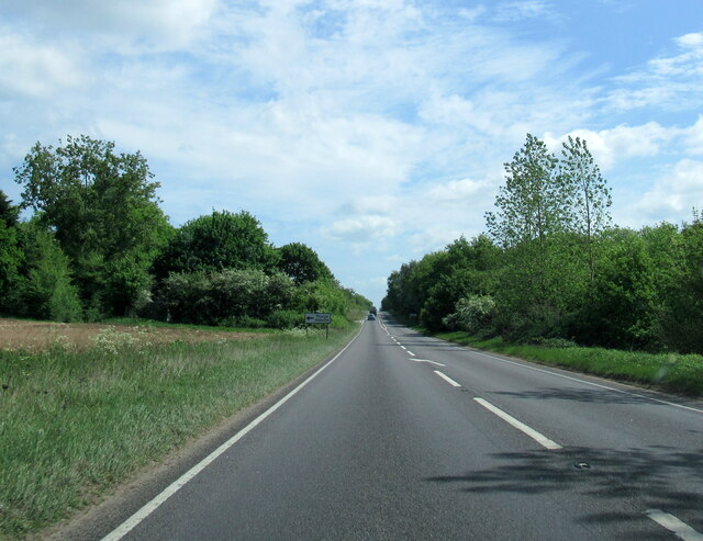
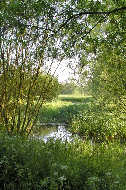
Grove Plantation is a stunning woodland area located in Norfolk, England. Stretching across a vast expanse, this plantation is a testament to the natural beauty and rich biodiversity of the region. The plantation is nestled within a dense forest, providing visitors with a tranquil escape from the hustle and bustle of everyday life.
Woodland enthusiasts and nature lovers are drawn to Grove Plantation for its diverse range of flora and fauna. The plantation is home to a variety of tree species, including oak, beech, and birch, creating a breathtaking tapestry of colors during the changing seasons. The forest floor is adorned with an array of wildflowers, adding to the plantation's charm and natural splendor.
Grove Plantation offers numerous walking trails, allowing visitors to explore the depths of the forest and soak in the picturesque surroundings. These trails cater to all levels of fitness, ensuring that everyone, from casual strollers to avid hikers, can enjoy the plantation's beauty at their own pace.
The plantation also serves as a habitat for a diverse range of wildlife. Birdwatchers can spot a plethora of avian species, including woodpeckers, owls, and various songbirds. Small mammals like foxes, rabbits, and squirrels can also be glimpsed darting through the undergrowth.
Grove Plantation is not only a haven for nature enthusiasts but also a valuable educational resource. It offers guided tours and educational programs, providing visitors with insights into the importance of conservation and the plantation's role in preserving local ecosystems.
Overall, Grove Plantation is a haven for those seeking solace in nature, offering an enchanting experience filled with beauty, tranquility, and a rich tapestry of flora and fauna.
If you have any feedback on the listing, please let us know in the comments section below.
Grove Plantation Images
Images are sourced within 2km of 52.368988/1.1986393 or Grid Reference TM1779. Thanks to Geograph Open Source API. All images are credited.


Grove Plantation is located at Grid Ref: TM1779 (Lat: 52.368988, Lng: 1.1986393)
Administrative County: Norfolk
District: South Norfolk
Police Authority: Norfolk
What 3 Words
///voice.starlight.weaved. Near Scole, Norfolk
Nearby Locations
Related Wikis
River Dove, Suffolk
The River Dove is a river in the county of Suffolk. It is a tributary of the River Waveney starting near Bacton going through Eye to the Waveney. ��2...

Dickleburgh and Rushall
Dickleburgh and Rushall is a civil parish in South Norfolk. It covers an area of 14.90 km2 (5.75 sq mi) and had a population of 1356 in 565 households...
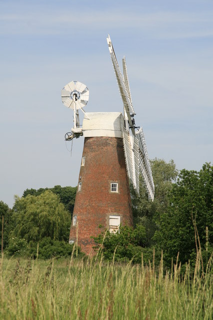
Billingford Windmill
Billingford Windmill is a grade II* listed brick tower mill at Billingford near Diss, Norfolk, England which has been preserved and restored to working...
Billingford, South Norfolk
Billingford or Pirleston is a village and former civil parish, 19 miles (31 km) south of Norwich, now in the parish of Scole, in the South Norfolk district...
Thorpe Abbotts
Thorpe Abbotts is a village and (as Thorpe Abbots) a former civil parish, now in the parish of Brockdish, in the South Norfolk district, in the county...
Oakley, Suffolk
Oakley is a village and former civil parish in the Mid Suffolk district, in the north of the English county of Suffolk. It lies immediately to the south...

Hoxne
Hoxne ( HOK-sən) is a village in the Mid Suffolk district of Suffolk, England, about five miles (8 km) east-southeast of Diss, Norfolk and 1⁄2 mile (800...

100th Bomb Group Memorial Museum
The 100th Bomb Group Memorial Museum, located in the original control tower and other remaining buildings of the RAF Thorpe Abbotts airfield east of Diss...
Related Videos


Thorpe Abbots USAF /RAF Disused Airfield
Exploring the huge USAF base. Then a night in the woods, BBQ, beer and bonfire.

Kayaking the Waveney, Scole to Billingford.
Lovely little paddle from Scole to Billingford bridge. Low river level and vegetation growth made it hard work but well worth it.

Riding Solo 56 - 100th Bomb Squad Memorial Museum
Catching up with Andy's friend and meeting others at an a War Museum dedicated to the aircrew of the #bloodiest #100? #riding ...
Nearby Amenities
Located within 500m of 52.368988,1.1986393Have you been to Grove Plantation?
Leave your review of Grove Plantation below (or comments, questions and feedback).