Freckenham

Settlement in Suffolk West Suffolk

England

Freckenham

Fordham Road at the end of Chippenham Road
Fordham Road at the end of Chippenham Road Credit: David Howard

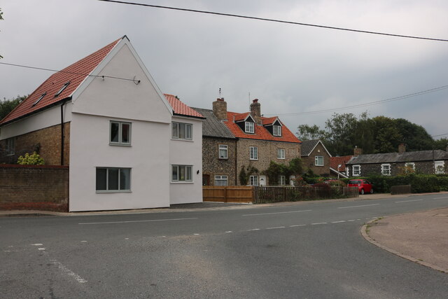
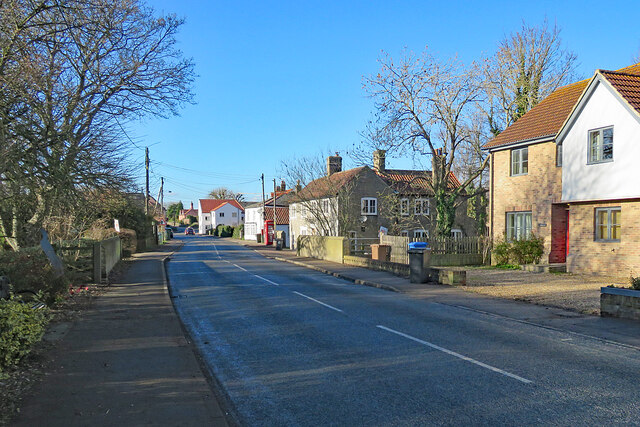
Freckenham is a small village located in the county of Suffolk, England. Situated approximately 8 miles northeast of the town of Newmarket, it falls within the larger district of Forest Heath. With a population of around 400 residents, Freckenham is an idyllic rural settlement known for its peaceful and picturesque surroundings.

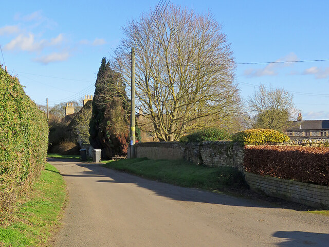
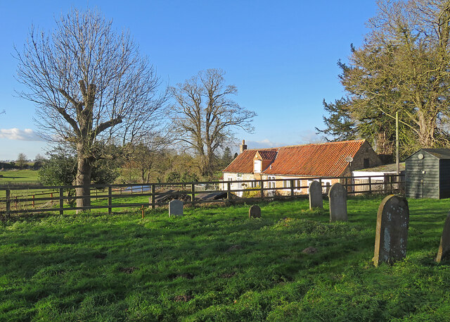
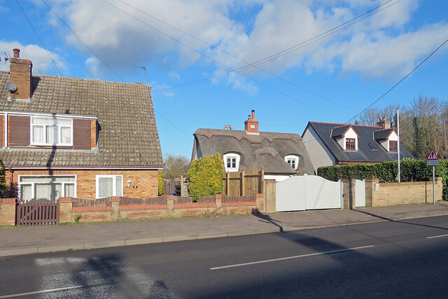
The village is characterized by its charming thatched cottages and historic buildings, reflecting its long history that stretches back to the Saxon era. One of the village's notable landmarks is the St. Andrew's Church, a Grade II* listed building that dates back to the 14th century. The church features stunning stained glass windows and intricate stone carvings, attracting visitors interested in architectural heritage.

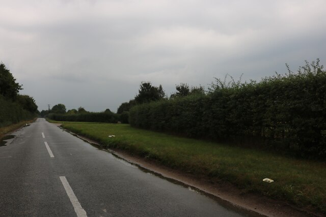
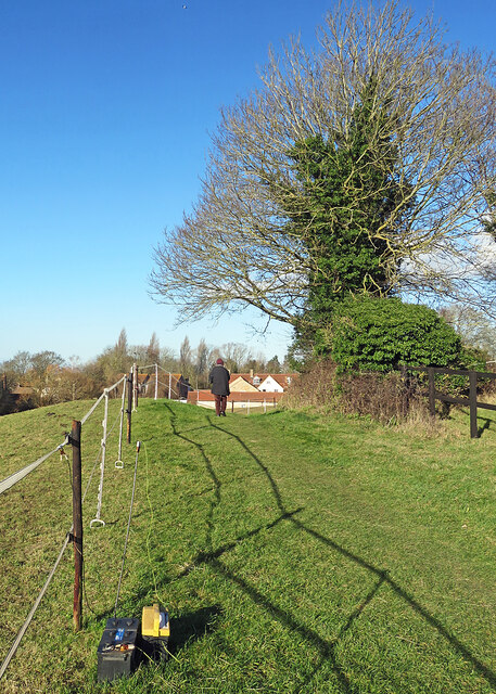
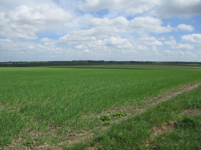
Freckenham is surrounded by stunning natural landscapes, with the nearby River Lark offering opportunities for boating, fishing, and leisurely walks along its banks. The village is also a haven for birdwatchers, with its proximity to the Breckland area, renowned for its diverse bird species.

Despite its small size, Freckenham boasts a strong sense of community. The village has a vibrant social scene, with a local pub serving as a popular gathering spot for residents and visitors alike. The village also organizes various events throughout the year, including fetes, festivals, and sporting competitions, fostering a strong community spirit.

Transport links to Freckenham are well-established, with the A14 road running nearby, connecting the village to larger towns and cities in the region. Additionally, the village is served by several bus routes, providing easy access to neighboring areas.

In summary, Freckenham is a tranquil village in Suffolk, offering a slice of rural charm and a friendly community spirit. With its rich history, natural beauty, and convenient location, it is an attractive destination for those seeking a peaceful getaway.

If you have any feedback on the listing, please let us know in the comments section below.

Freckenham Images

Images are sourced within 2km of 52.320883/0.443983 or Grid Reference TL6672. Thanks to Geograph Open Source API. All images are credited.

Fordham Road at the end of Chippenham Road
Freckenham Road, Worlington
Freckenham Road, Chippenham
Freckenham: on the footpath from the church The sun is low in the sky early on a bright January afternoon.
Freckenham: on the footpath from the church
The sun is low in the sky early on a bright January afternoon.
Freckenham: Church Lane Early on a bright January afternoon.
Freckenham: Church Lane
Early on a bright January afternoon.
Freckenham: St Andrew "Over-restored or rather rebuilt (by [G E] Street, 1867). W tower rebuilt 1884. Two-light Perp windows used as a kind of dormer" (Nikolaus Pevsner). A plane from Mildenhall or Lakenheath, nearby US air bases, shows above the nave.
Freckenham: St Andrew
"Over-restored or rather rebuilt (by [G E] Street, 1867). W tower rebuilt 1884. Two-light Perp windows used as a kind of dormer" (Nikolaus Pevsner). A plane from Mildenhall or Lakenheath, nearby US air bases, shows above the nave.
Freckenham: west of the churchyard A bright afternoon at the end of January.
Freckenham: west of the churchyard
A bright afternoon at the end of January.
Freckenham church and war memorial "E window of three stepped lancet lights under one arch, shafted inside, ie c 1300 [in style]" (Nikolaus Pevsner). In the Shell Guide Norman Scarfe thought the church "ruined by Victorians". The majority of the rebuilding was by G E Street in 1867. The War Memorial lists seventeen who died in The Great War and two from the Second World War.
Freckenham church and war memorial
"E window of three stepped lancet lights under one arch, shafted inside, ie c 1300 [in style]" (Nikolaus Pevsner). In the Shell Guide Norman Scarfe thought the church "ruined by Victorians". The majority of the rebuilding was by G E Street in 1867. The War Memorial lists seventeen who died in The Great War and two from the Second World War.
Freckenham: The Street On the left, lost in the deep shadows of a bright January afternoon, are the  silhouette of a soldier and a steel bench - supplied by David Ogilvie Engineering of Kilmarnock - commemorating the centenary of the end of The Great War.

(Other Ogilvie benches: <a href="https://www.geograph.org.uk/photo/4496202">TL2352 : Gamlingay: War Memorial Bench</a>, <a href="https://www.geograph.org.uk/photo/6023195">TL4762 : Milton: war memorial and benches</a> and <a href="https://www.geograph.org.uk/photo/6673079">TL4765 : Landbeach: War Memorial benches and bin</a>.)
Freckenham: The Street
On the left, lost in the deep shadows of a bright January afternoon, are the silhouette of a soldier and a steel bench - supplied by David Ogilvie Engineering of Kilmarnock - commemorating the centenary of the end of The Great War. (Other Ogilvie benches: TL2352 : Gamlingay: War Memorial Bench, TL4762 : Milton: war memorial and benches and TL4765 : Landbeach: War Memorial benches and bin.)
Freckenham: houses on The Street These houses are opposite The Golden Boar public house on the main street through the village. The thatched house has the date 1646 on its modern chimney. It is called Forget-me-not Cottage and has - ho, ho - an elephant on the roof ridge....
Freckenham: houses on The Street
These houses are opposite The Golden Boar public house on the main street through the village. The thatched house has the date 1646 on its modern chimney. It is called Forget-me-not Cottage and has - ho, ho - an elephant on the roof ridge....
Barley field near Isleham
Farm track near Freckenham
Patterned ground on field NE of Chippenham: aerial 2022 (1)
Patterned ground on field NE of Chippenham: aerial 2022
Gauging station, Lee Brook
Beck Road towards West Row
Farmland near Freckenham
Road towards West Row
Show me another place!

Freckenham is located at Grid Ref: TL6672 (Lat: 52.320883, Lng: 0.443983)

Administrative County: Suffolk

District: West Suffolk

Police Authority: Suffolk

What 3 Words

///remarks.trips.dwarf. Near Isleham, Cambridgeshire

Nearby Locations

Home Plantation Freckenham

Related Wikis

Freckenham

Freckenham is a small rural village and civil parish in the West Suffolk district of Suffolk in East Anglia, in the country of England. Geographically...

River Kennett

The River Kennett is a river that runs through Suffolk and Cambridgeshire in eastern England. == Course == The River Kennett rises in the hills just west...

Isleham railway station

Isleham railway station is a disused railway station on the Cambridge to Mildenhall railway in England. The station was on the outskirts of the village...

Chippenham Preceptory

Chippenham Preceptory was a preceptory in Cambridgeshire, England. It was established in 1184 and was dissolved in 1540. == References ==

Nearby Amenities

Located within 500m of 52.320883,0.443983
Bus Stop
Golden Boar
Naptan AtcoCode: 390020152
Naptan Bearing: E
Naptan CommonName: Golden Boar
Naptan Indicator: adj
Naptan Landmark: Golden Boar
Naptan NaptanCode: sufajgjw
Naptan Street: B1102
Shelter: yes
Source: naptan_import;survey
Lat/Long: 52.3211327/0.4419264
Bus Stop
Golden Boar
Naptan AtcoCode: 390020153
Naptan Bearing: W
Naptan BusStopType: CUS
Naptan CommonName: Golden Boar
Naptan Indicator: opp
Naptan Landmark: Golden Boar
Naptan NaptanCode: sufajgma
Naptan Street: B1102
Naptan Verified: no
Source: naptan_import
Lat/Long: 52.3211995/0.4420279
Bus Stop
Elms Road
Naptan AtcoCode: 390020154
Naptan Bearing: S
Naptan CommonName: Elms Road
Naptan Indicator: adj
Naptan Landmark: Elms Road
Naptan NaptanCode: sufajgmd
Naptan Street: Mildenhall Road
Naptan Verified: no
Source: naptan_import
Lat/Long: 52.3209947/0.4443713
Bus Stop
Elms Road
Naptan AtcoCode: 390020155
Naptan Bearing: N
Naptan BusStopType: CUS
Naptan CommonName: Elms Road
Naptan Indicator: opp
Naptan Landmark: Elms Road
Naptan NaptanCode: sufajgmg
Naptan Street: Mildenhall Road
Naptan Verified: no
Source: naptan_import
Lat/Long: 52.3210562/0.4440079
Bus Stop
East View
Naptan AtcoCode: 390020156
Naptan Bearing: E
Naptan BusStopType: CUS
Naptan CommonName: East View
Naptan Indicator: adj
Naptan Landmark: East View
Naptan NaptanCode: sufajgmj
Naptan Street: Mildenhall Road
Naptan Verified: no
Source: naptan_import
Lat/Long: 52.3233079/0.4499357
Bus Stop
East View
Naptan AtcoCode: 390020157
Naptan Bearing: W
Naptan CommonName: East View
Naptan Indicator: opp
Naptan Landmark: East View
Naptan NaptanCode: sufajgmp
Naptan Street: Mildenhall Road
Naptan Verified: no
Source: naptan_import
Lat/Long: 52.3232188/0.4499443
Freckenham
Place: village
Source: NPE
Wikidata: Q5494335
Lat/Long: 52.3203349/0.4417751
Defibrillator
Defibrillator Location: On back wall inside bus shelter - opposite red phone box in Freckenham
Emergency: defibrillator
Ref: CHT-14-1164
Lat/Long: 52.321107/0.4419257
Recycling
Recycling Glass: yes
Lat/Long: 52.321146/0.4418271
Public Bookcase
Freckenham Library
Booth: K6
Disused Amenity: telephone
Man Made: telephone_box
Public Bookcase Type: phone_box
Lat/Long: 52.3212049/0.4420041
Post Box
Collection Times: Mo-Fr 16:00; Sa 08:30
Post Box Mounting: pier
Post Box Type: lamp
Ref: IP28 2179
Royal Cypher: EIIR
Royal Cypher Wikidata: Q33102113
Lat/Long: 52.3212147/0.4419612
Fixme: incomplete
Lat/Long: 52.3207862/0.4439458
The data included in this document is from www.openstreetmap.org. The data is made available under ODbL.

Have you been to Freckenham?

Leave your review of Freckenham below (or comments, questions and feedback).