Oak Plantation

Wood, Forest in Suffolk Mid Suffolk

England

Oak Plantation

The old watermill at Oakley The mill which stands on the River Dove, a tributary of the Waveney, had an undershot wheel roughly six feet wide and probably ceased to operate in the early 1800s. In the early 1830s the wheel was removed and part of the building was converted into a laundry. The river which is to the right of the building, is not fast flowing and has much vegetation in places upstream. The tail-race and millpond are however relatively clear with a small weir a short distance downstream. Access was granted by the kind permission of the owner.
<a href="https://www.geograph.org.uk/photo/6942267">TM1776 : The mill-race at Oakley old mill</a>
<a href="https://www.geograph.org.uk/photo/6942273">TM1776 : Oakley old watermill tail-race and millpond</a>
The old watermill at Oakley Credit: Adrian S Pye

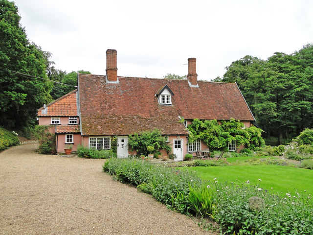
Oak Plantation is a picturesque wooded area located in Suffolk, England. Spanning across a vast expanse, it is known for its dense population of oak trees, which gives it its distinctive name. This enchanting forest is a haven for nature enthusiasts and provides a serene escape from the bustling city life.

The woodland boasts a rich biodiversity, attracting a wide range of flora and fauna. The towering oak trees dominate the landscape, with their gnarled trunks and sprawling branches creating a majestic canopy overhead. The forest floor is covered in a thick layer of fallen leaves, providing a natural carpet and adding to the ethereal beauty of the surroundings.

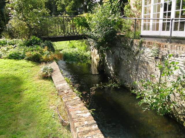
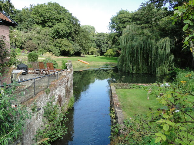
Visitors can explore the network of well-maintained footpaths that wind through the forest, offering opportunities for leisurely walks and hikes. The trails lead to hidden gems such as tranquil ponds, babbling brooks, and open clearings where one can rest and immerse themselves in the tranquil atmosphere.

Oak Plantation also serves as a habitat for various wildlife species. Birdwatchers can spot a variety of birds, including woodpeckers, owls, and songbirds. The forest is also home to small mammals like squirrels, foxes, and deer, which can occasionally be spotted by lucky observers.

The management of Oak Plantation ensures the preservation of its natural beauty and the protection of its inhabitants. Regular conservation efforts are carried out to maintain the delicate balance of the ecosystem.

Overall, Oak Plantation in Suffolk is a captivating woodland that offers a sanctuary for both nature lovers and those seeking solace in the embrace of nature's wonders.

If you have any feedback on the listing, please let us know in the comments section below.

Oak Plantation Images

Images are sourced within 2km of 52.331855/1.1829358 or Grid Reference TM1675. Thanks to Geograph Open Source API. All images are credited.

The old watermill at Oakley The mill which stands on the River Dove, a tributary of the Waveney, had an undershot wheel roughly six feet wide and probably ceased to operate in the early 1800s. In the early 1830s the wheel was removed and part of the building was converted into a laundry. The river which is to the right of the building, is not fast flowing and has much vegetation in places upstream. The tail-race and millpond are however relatively clear with a small weir a short distance downstream. Access was granted by the kind permission of the owner.
<a href="https://www.geograph.org.uk/photo/6942267">TM1776 : The mill-race at Oakley old mill</a>
<a href="https://www.geograph.org.uk/photo/6942273">TM1776 : Oakley old watermill tail-race and millpond</a>
The old watermill at Oakley
The mill which stands on the River Dove, a tributary of the Waveney, had an undershot wheel roughly six feet wide and probably ceased to operate in the early 1800s. In the early 1830s the wheel was removed and part of the building was converted into a laundry. The river which is to the right of the building, is not fast flowing and has much vegetation in places upstream. The tail-race and millpond are however relatively clear with a small weir a short distance downstream. Access was granted by the kind permission of the owner. TM1776 : The mill-race at Oakley old mill TM1776 : Oakley old watermill tail-race and millpond
The mill-race at Oakley old mill The mill which stands on the River Dove, a tributary of the Waveney, had an undershot wheel roughly six feet wide and probably ceased to operate in the early 1800s. In the early 1830s the wheel was removed and part of the building was converted into a laundry. The river which is to the right of the building, is not fast flowing and has much vegetation in places upstream. The tail-race and millpond are however relatively clear with a small weir a short distance downstream. Access was granted by the kind permission of the owner.
<a href="https://www.geograph.org.uk/photo/6942263">TM1776 : The old watermill at Oakley</a>
The mill-race at Oakley old mill
The mill which stands on the River Dove, a tributary of the Waveney, had an undershot wheel roughly six feet wide and probably ceased to operate in the early 1800s. In the early 1830s the wheel was removed and part of the building was converted into a laundry. The river which is to the right of the building, is not fast flowing and has much vegetation in places upstream. The tail-race and millpond are however relatively clear with a small weir a short distance downstream. Access was granted by the kind permission of the owner. TM1776 : The old watermill at Oakley
Oakley old watermill tail-race and millpond Taken from the bridge over the former location of the undershot water-wheel showing the tail-race and millpond.
The mill which stands on the River Dove, a tributary of the Waveney, had an undershot wheel roughly six feet wide and probably ceased to operate in the early 1800s. In the early 1830s the wheel was removed and part of the building was converted into a laundry. The river which is to the right of the building, is not fast flowing and has much vegetation in places upstream. The tail-race and millpond are however relatively clear with a small weir a short distance downstream. Access was granted by the kind permission of the owner.
<a href="https://www.geograph.org.uk/photo/6942263">TM1776 : The old watermill at Oakley</a>
Oakley old watermill tail-race and millpond
Taken from the bridge over the former location of the undershot water-wheel showing the tail-race and millpond. The mill which stands on the River Dove, a tributary of the Waveney, had an undershot wheel roughly six feet wide and probably ceased to operate in the early 1800s. In the early 1830s the wheel was removed and part of the building was converted into a laundry. The river which is to the right of the building, is not fast flowing and has much vegetation in places upstream. The tail-race and millpond are however relatively clear with a small weir a short distance downstream. Access was granted by the kind permission of the owner. TM1776 : The old watermill at Oakley
Fishpond at Hoxne Priory <span class="nowrap"><a title="https://historicengland.org.uk/listing/the-list/list-entry/1020447?section=comments-and-photos" rel="nofollow ugc noopener" href="https://historicengland.org.uk/listing/the-list/list-entry/1020447?section=comments-and-photos">Link</a><img style="margin-left:2px;" alt="External link" title="External link - shift click to open in new window" src="https://s1.geograph.org.uk/img/external.png" width="10" height="10"/></span>
Fishpond at Hoxne Priory
River Dove at White Bridge, Hoxne
Kiln and Chimney at Hoxne Brickworks
Cattle Grid This stands at the approach to Eye Sewage Treatment Works.
Cattle Grid
This stands at the approach to Eye Sewage Treatment Works.
A view of Burnt House Farm
A view of Bungalow Farm from Nuttery Vale
Footpath to Cross Street, just south of Hoxne
Brome Street Village Hall
Farmhouse at Abbey Farm This farm lies just south of Hoxne village and stands on, or near, the site of a Benedictine priory first founded at Hoxne in 950 to commemorate the site of the martyrdom of King Edmund. Nothing survives of the priory.
Farmhouse at Abbey Farm
This farm lies just south of Hoxne village and stands on, or near, the site of a Benedictine priory first founded at Hoxne in 950 to commemorate the site of the martyrdom of King Edmund. Nothing survives of the priory.
Footpath, close to Hoxne This is the start of a footpath from Clink Hill.
Footpath, close to Hoxne
This is the start of a footpath from Clink Hill.
Footpath to Denham church
Road to Denham Hall Farm
Denham church interior
Cultivating behind Capon's Farm, Oakley The ploughed earth in the foreground is being broken up by the cultivator behind the red tractor.
Cultivating behind Capon's Farm, Oakley
The ploughed earth in the foreground is being broken up by the cultivator behind the red tractor.
Capon's Farm, Oakley Whether this is a farmhouse or an ex-farmhouse is difficult to say - but it seems that the latter is likely: altogether too clean and tidy for the former.
Capon's Farm, Oakley
Whether this is a farmhouse or an ex-farmhouse is difficult to say - but it seems that the latter is likely: altogether too clean and tidy for the former.
Show me another place!

Oak Plantation is located at Grid Ref: TM1675 (Lat: 52.331855, Lng: 1.1829358)

Administrative County: Suffolk

District: Mid Suffolk

Police Authority: Suffolk

What 3 Words

///timed.skylights.free. Near Scole, Norfolk

Related Wikis

Hoxne Hoard

The Hoxne Hoard ( HOK-sən) is the largest hoard of late Roman silver and gold discovered in Britain, and the largest collection of gold and silver coins...

Hoxne Brick Pit

Hoxne Brick Pit is a 1.3-hectare (3.2-acre) geological Site of Special Scientific Interest in Hoxne in Suffolk, England. It is a Geological Conservation...

Hoxne Priory

Hoxne Priory was a Benedictine priory at Hoxne in Suffolk, England. It was founded as a religious house around the year 950, with a chapel at the supposed...

St Edmund's Memorial, Hoxne

St Edmund's Memorial, Hoxne is a memorial which claims to mark the spot where St Edmund was killed by the Vikings in the Suffolk village of Hoxne. The...

Nearby Amenities

Located within 500m of 52.331855,1.1829358
Gissing Farm
Naptan AtcoCode: 390040145
Naptan Bearing: N
Naptan BusStopType: CUS
Naptan CommonName: Gissing Farm
Naptan Indicator: opp
Naptan Landmark: Gissing Farm
Naptan NaptanCode: sufawdgt
Naptan Street: Eye Road
Naptan Verified: no
Source: naptan_import
Lat/Long: 52.332449/1.1839196
Gissing Farm
Local Ref: NR
Naptan AtcoCode: 390040146
Naptan Bearing: S
Naptan BusStopType: CUS
Naptan CommonName: Gissing Farm
Naptan Indicator: nr
Naptan Landmark: Gissing Farm
Naptan NaptanCode: sufawdgw
Naptan Street: Eye Road
Naptan Verified: no
Source: naptan_import
Lat/Long: 52.3323304/1.1839844
Barrier: stile
Bicycle: no
Foot: yes
Material: wood
Stile: stepover
Lat/Long: 52.3328037/1.1888196
Barrier: stile
Bicycle: no
Foot: yes
Material: wood
Stile: stepover
Lat/Long: 52.332314/1.1891508
Power: pole
Lat/Long: 52.3277348/1.183416
Power: pole
Lat/Long: 52.32835/1.1843014
Post Box
Collection Times: Mo-Fr 11:00; Sa 10:00
Operator: Royal Mail
Post Box Mounting: wooden_post
Post Box Type: lamp
Ref: IP23 7113
Royal Cypher: EIIR
Royal Cypher Wikidata: Q33102113
Source: survey
Lat/Long: 52.3320056/1.1868485
The data included in this document is from www.openstreetmap.org. The data is made available under ODbL.

Have you been to Oak Plantation?

Leave your review of Oak Plantation below (or comments, questions and feedback).