Cannell's Plantation
Wood, Forest in Norfolk South Norfolk
England
Cannell's Plantation
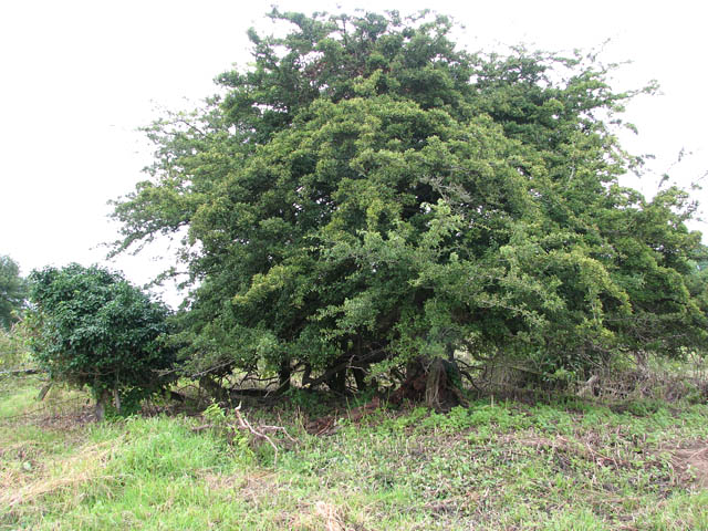
Cannell's Plantation, located in Norfolk, England, is a picturesque woodland area known for its rich biodiversity and serene environment. Spanning over a vast expanse, the plantation is nestled within the larger Norfolk Forest, offering visitors a unique opportunity to immerse themselves in nature.
The plantation boasts a diverse range of tree species, including oak, beech, and birch, creating a varied and vibrant canopy that stretches as far as the eye can see. The lush undergrowth is home to numerous plant species, such as bluebells, ferns, and wild garlic, adding to the plantation's natural beauty.
Cannell's Plantation provides a habitat for a plethora of wildlife, making it a haven for nature enthusiasts and photographers. Birdwatchers can spot a variety of species, including woodpeckers, owls, and wrens, while small mammals like squirrels, foxes, and rabbits can be observed going about their daily routines. The plantation also supports a diverse range of insects and butterflies, further enriching its ecological significance.
Visitors to Cannell's Plantation can explore the numerous walking trails that wind their way through the woodland, allowing them to fully appreciate the tranquility and charm of the surroundings. The plantation is also a popular destination for picnics and family outings, offering visitors the opportunity to relax and enjoy the idyllic setting.
Cannell's Plantation, with its lush vegetation, diverse wildlife, and peaceful ambiance, is a true gem within the Norfolk Forest. It provides a much-needed escape from the hustle and bustle of everyday life, offering a chance to reconnect with nature and appreciate the beauty of the natural world.
If you have any feedback on the listing, please let us know in the comments section below.
Cannell's Plantation Images
Images are sourced within 2km of 52.581231/1.198165 or Grid Reference TG1602. Thanks to Geograph Open Source API. All images are credited.


Cannell's Plantation is located at Grid Ref: TG1602 (Lat: 52.581231, Lng: 1.198165)
Administrative County: Norfolk
District: South Norfolk
Police Authority: Norfolk
What 3 Words
///junction.community.clockwork. Near Hethel, Norfolk
Nearby Locations
Related Wikis

Ketteringham
Ketteringham is a village and civil parish in the English county of Norfolk. The parish covers an area of 6.50 km2 (2.51 sq mi) and had a population of...

Hethersett railway station
Hethersett was a railway station near Hethersett, Norfolk. == History == The Bill for the Norwich & Brandon Railway (N&BR) received Royal Assent on 10...

East Carleton
East Carleton is a village and civil parish in the English county of Norfolk. The village is located 6.3 kilometres (3.9 mi) east of nearby Wymondham and...

Forehoe and Henstead Rural District
Forehoe and Henstead Rural Districts were adjacent rural districts in Norfolk, England from 1894 to 1935.They were formed under the Local Government Act...

Mulbarton, Norfolk
Mulbarton is a village and civil parish located south of Norwich in the English county of Norfolk. It covers an area of 5.34 km2 (2.06 sq mi).The place...

Hethersett Old Hall School
Hethersett Old Hall School was an independent school located in Hethersett, Norfolk, England that educated around 180 boys and girls. It was a day school...
Hethersett Academy
Hethersett Academy, previously known as Hethersett High School and Science College, is a coeducational secondary school, part of the Inspiration Trust...
Hethel Old Thorn
Hethel Old Thorn is a 0.025-hectare (0.062-acre) nature reserve south-west of Norwich in Norfolk. It is managed by the Norfolk Wildlife Trust.This is...
Nearby Amenities
Located within 500m of 52.581231,1.198165Have you been to Cannell's Plantation?
Leave your review of Cannell's Plantation below (or comments, questions and feedback).