Victoria Plantation

Wood, Forest in Norfolk Broadland

England

Victoria Plantation

Old Milestone, Drayton On the South side of the A1067, 20yds W of junction with Taverham Road, in the parish of Drayton. Alternative views are <a href="https://www.geograph.org.uk/photo/1391707">TG1713 : Drayton Milestone</a> & <a href="https://www.geograph.org.uk/photo/1558894">TG1713 : Old Milepost</a>.

Inscription: To / Norwich / 4 / Miles // Fakenham / 20 // Drayton

Milestone Society National ID: NO_NF04
Old Milestone, Drayton Credit: Alan Lake

Victoria Plantation is a sprawling estate located in Norfolk, England. Situated amidst lush woodlands and pristine forests, it is renowned for its picturesque beauty and rich history. Covering an expansive area of land, the plantation offers a serene and peaceful retreat for nature enthusiasts and history lovers alike.

The plantation is named after Queen Victoria, who visited the estate during her reign in the 19th century. It boasts a wide variety of flora and fauna, with towering trees, colorful flowers, and an abundance of wildlife. The woodlands are carefully maintained, with well-maintained walking trails that allow visitors to explore the natural beauty of the area.

In addition to its natural attractions, Victoria Plantation also holds historical significance. It was once a thriving center of agricultural activity, with fields that produced various crops and livestock. The estate's original manor house, a grand and stately building, still stands as a testament to its past glory.

Today, the plantation has been transformed into a popular destination for tourists and locals alike. Visitors can enjoy leisurely walks through the woodlands, picnics in the open air, and even horseback riding along designated trails. The estate also hosts various events throughout the year, such as garden parties and outdoor concerts, adding to its charm and appeal.

Overall, Victoria Plantation in Norfolk is a captivating blend of natural beauty and historical significance. With its idyllic woodlands, well-preserved manor house, and array of recreational activities, it offers a truly enchanting experience for all who visit.

If you have any feedback on the listing, please let us know in the comments section below.

Victoria Plantation Images

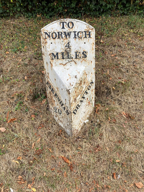
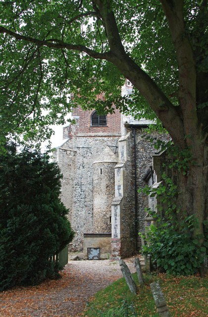
Images are sourced within 2km of 52.679728/1.1991462 or Grid Reference TG1613. Thanks to Geograph Open Source API. All images are credited.

Old Milestone, Drayton On the South side of the A1067, 20yds W of junction with Taverham Road, in the parish of Drayton. Alternative views are <a href="https://www.geograph.org.uk/photo/1391707">TG1713 : Drayton Milestone</a> & <a href="https://www.geograph.org.uk/photo/1558894">TG1713 : Old Milepost</a>.

Inscription: To / Norwich / 4 / Miles // Fakenham / 20 // Drayton

Milestone Society National ID: NO_NF04
Old Milestone, Drayton
On the South side of the A1067, 20yds W of junction with Taverham Road, in the parish of Drayton. Alternative views are TG1713 : Drayton Milestone & TG1713 : Old Milepost. Inscription: To / Norwich / 4 / Miles // Fakenham / 20 // Drayton Milestone Society National ID: NO_NF04
Barber, baker and beautician, Drayton On Taverham Road.
Barber, baker and beautician, Drayton
On Taverham Road.
Oops a Daisy, Drayton Florist on Fakenham Road.
Oops a Daisy, Drayton
Florist on Fakenham Road.
Village sign, Drayton Commemorating 50 years since the founding of Drayton 'afternoon W I'.
Village sign, Drayton
Commemorating 50 years since the founding of Drayton 'afternoon W I'.
The Red Lion public house, Drayton The building dates from 1678, becoming an inn in the mid 1700s. Damaged by enemy action in 1942.
The Red Lion public house, Drayton
The building dates from 1678, becoming an inn in the mid 1700s. Damaged by enemy action in 1942.
The Cock Inn, Drayton The present building replaced an 18th century inn in 1956. It was renovated  in 1998-1999. One of the Marston chain of brewers.
The Cock Inn, Drayton
The present building replaced an 18th century inn in 1956. It was renovated in 1998-1999. One of the Marston chain of brewers.
Children's play area, Drayton Playground on School Road, next to St. Margaret's church which can be seen in the background.
Children's play area, Drayton
Playground on School Road, next to St. Margaret's church which can be seen in the background.
St. Margaret's church, Drayton The church dates from 1198 with some medieval fabric but mainly rebuilt in the 19th century. Inside is a fragment of the 15th century rood screen stair by the pulpit.  Grade II* listed.
St. Margaret's church, Drayton
The church dates from 1198 with some medieval fabric but mainly rebuilt in the 19th century. Inside is a fragment of the 15th century rood screen stair by the pulpit. Grade II* listed.
Inside St. Margaret's church, Drayton Looking eastwards along the nave. The church dates from 1198 with some medieval fabric but mainly rebuilt in the 19th century. A fragment of the 15th century rood screen stair can be seen by the pulpit. A Grade II* listed building.
Inside St. Margaret's church, Drayton
Looking eastwards along the nave. The church dates from 1198 with some medieval fabric but mainly rebuilt in the 19th century. A fragment of the 15th century rood screen stair can be seen by the pulpit. A Grade II* listed building.
A poppyhead in St. Margaret's church, Drayton A poppyhead is a form of carving on the top of the end of a bench or a choir stall. Its name is unrelated to the poppy flower but derived by way of Old French, from the Latin word puppis, which means the poop or the figurehead of a ship.
A poppyhead in St. Margaret's church, Drayton
A poppyhead is a form of carving on the top of the end of a bench or a choir stall. Its name is unrelated to the poppy flower but derived by way of Old French, from the Latin word puppis, which means the poop or the figurehead of a ship.
East window, St. Margaret's church, Drayton The church dates from 1198 with some medieval fabric but mainly rebuilt in the 19th century.  A Grade II* listed building.
East window, St. Margaret's church, Drayton
The church dates from 1198 with some medieval fabric but mainly rebuilt in the 19th century. A Grade II* listed building.
18th century gravestone, St. Margaret's church, Drayton A child's grave, John, son of John and Elizabeth Cannell, who died in 1781 in the 6th year of his age.
18th century gravestone, St. Margaret's church, Drayton
A child's grave, John, son of John and Elizabeth Cannell, who died in 1781 in the 6th year of his age.
18th century gravestone, St. Margaret's church, Drayton A detail on a child's grave, John, son of John and Elizabeth Cannell, who died in 1781 in the 6th year of his age.
18th century gravestone, St. Margaret's church, Drayton
A detail on a child's grave, John, son of John and Elizabeth Cannell, who died in 1781 in the 6th year of his age.
Old Milepost by the A1067, Fakenham Road, Taverham Cast iron post by the A1067, in parish of Taverham (Broadland District), Fakenham Road, opposite No. 230, on the verge at rear of footpath against hedge, on West side of road. Fakenham ci n-top, erected by the Norwich & Fakenham turnpike trust in the 19th century. 

Inscription reads:-
: FAKENHAM / 19 : : TO NORWICH / 5 / MILES : : TAVERHAM / 5 :

Norfolk HER.
NHER Number: 56411 <span class="nowrap"><a title="https://www.heritagegateway.org.uk/Gateway/Results_Single.aspx?uid=MNF62817&resourceID=1002" rel="nofollow ugc noopener" href="https://www.heritagegateway.org.uk/Gateway/Results_Single.aspx?uid=MNF62817&resourceID=1002">Link</a><img style="margin-left:2px;" alt="External link" title="External link - shift click to open in new window" src="https://s1.geograph.org.uk/img/external.png" width="10" height="10"/></span>

Milestone Society National ID: NO_NF05
Old Milepost by the A1067, Fakenham Road, Taverham
Cast iron post by the A1067, in parish of Taverham (Broadland District), Fakenham Road, opposite No. 230, on the verge at rear of footpath against hedge, on West side of road. Fakenham ci n-top, erected by the Norwich & Fakenham turnpike trust in the 19th century. Inscription reads:- : FAKENHAM / 19 : : TO NORWICH / 5 / MILES : : TAVERHAM / 5 : Norfolk HER. NHER Number: 56411 LinkExternal link Milestone Society National ID: NO_NF05
Spider web, Thorpe Marriott Covered in water droplets on a misty morning.
Spider web, Thorpe Marriott
Covered in water droplets on a misty morning.
A1067 Fakenham Road At the junction with Beech Avenue
A1067 Fakenham Road
At the junction with Beech Avenue
St Edmund, Costessey
Show me another place!

Victoria Plantation is located at Grid Ref: TG1613 (Lat: 52.679728, Lng: 1.1991462)

Administrative County: Norfolk

District: Broadland

Police Authority: Norfolk

What 3 Words

///houseboat.gifted.pressing. Near Costessey, Norfolk

Related Wikis

Taverham

Taverham is a village and civil parish in Norfolk, in England. It is approximately 5 miles (8 km) north-west of Norwich. Taverham sits on the River Wensum...

Thorpe Marriott

Thorpe Marriott is a residential area in Norfolk, England covering part of Taverham and Drayton parishes. Much of the housing was built in the latter part...

Taverham High School

Taverham High School is a secondary school and sixth form with academy status, located in Taverham in the English county of Norfolk. As well as serving...

Taverham Hall School

Taverham Hall School was a private co-educational day and boarding preparatory school. Situated in Taverham, Norfolk, it was founded in 1920. The school...

Nearby Amenities

Located within 500m of 52.679728,1.1991462
Mini Roundabout
Direction: clockwise
Lat/Long: 52.6796212/1.1946371
Traffic Calming: cushion
Lat/Long: 52.6814547/1.1957162
Taverham
Place: village
Source: NPE
Lat/Long: 52.6811508/1.1942478
Bus Stop
Church, opp
Naptan AtcoCode: 2900T0416
Naptan Bearing: SW
Naptan CommonName: Church
Naptan Indicator: opp
Naptan Landmark: Taverham Road Church
Naptan Locality: Taverham
Naptan NaptanCode: nfodwmga
Naptan PlusbusZoneRef: NRCH
Naptan Street: Sandy Lane
Naptan Verified: no
Source: naptan_import
Lat/Long: 52.6806683/1.1953265
Bus Stop
Penn Road, adj
Naptan AtcoCode: 2900T0418
Naptan Bearing: SE
Naptan CommonName: Penn Road
Naptan Indicator: adj
Naptan Landmark: Penn Road
Naptan Locality: Taverham
Naptan NaptanCode: nfodwmgj
Naptan PlusbusZoneRef: NRCH
Naptan Street: Victoria Road
Naptan Verified: no
Source: naptan_import
Lat/Long: 52.6780932/1.2020931
Bus Stop
Byron Road, adj
Naptan AtcoCode: 2900T0456
Naptan Bearing: SE
Naptan CommonName: Byron Road
Naptan Indicator: adj
Naptan Landmark: Keats Road
Naptan Locality: Taverham
Naptan NaptanCode: nfodwpda
Naptan PlusbusZoneRef: NRCH
Naptan ShortCommonName: Byron Road
Naptan Street: Byron Road
Naptan Verified: no
Source: naptan_import
Lat/Long: 52.6775679/1.2045553
Bus Stop
St. Edmunds Road, adj
Naptan AtcoCode: 2900T0470
Naptan Bearing: SE
Naptan CommonName: St. Edmunds Road
Naptan Indicator: adj
Naptan Landmark: Roeditch Drive
Naptan Locality: Taverham
Naptan NaptanCode: nfodwpjd
Naptan PlusbusZoneRef: NRCH
Naptan ShortCommonName: St. Edmunds Road
Naptan Street: St. Edmunds Road
Naptan Verified: no
Source: naptan_import
Lat/Long: 52.6807706/1.201194
Turning Circle
Lat/Long: 52.6821237/1.20186
Traffic Calming: hump
Lat/Long: 52.6803995/1.2047975
Barrier: cycle_barrier
Lat/Long: 52.6806306/1.201172
Bus Stop
Church, adj
Naptan AtcoCode: 2900T04161
Naptan Bearing: N
Naptan BusStopType: CUS
Naptan CommonName: Church
Naptan Indicator: adj
Naptan Locality: Taverham
Naptan NaptanCode: nfogtgaw
Naptan Street: Sandy Lane
Naptan Verified: no
Source: naptan_import
Lat/Long: 52.6817366/1.1957302
Entrance: main
Lat/Long: 52.6812479/1.195323
Entrance: main
Lat/Long: 52.6814824/1.1954451
Barrier: cycle_barrier
Bicycle: yes
Foot: yes
Lat/Long: 52.681742/1.1957694
Post Box
Collection Times: Mo-Fr 17:15; Sa 10:30
Operator: Royal Mail
Post Box Type: pillar
Ref: NR8 810
Royal Cypher: EIIR
Royal Cypher Wikidata: Q33102113
Lat/Long: 52.6809776/1.2015814
Crossing
Crossing: unmarked
Lat/Long: 52.6816309/1.1957556
Give Way
Lat/Long: 52.679572/1.1945862
Crossing
Crossing: unmarked
Lat/Long: 52.6806955/1.1951311
Give Way
Lat/Long: 52.6796703/1.1946883
Crossing
Crossing: unmarked
Lat/Long: 52.6795343/1.1948932
Crossing
Crossing: unmarked
Tactile Paving: yes
Lat/Long: 52.6797911/1.1947885
Give Way
Lat/Long: 52.6796625/1.1945745
Give Way
Lat/Long: 52.6795924/1.1947245
Crossing
Crossing: unmarked
Tactile Paving: yes
Lat/Long: 52.6797219/1.1944078
Crossing
Crossing: uncontrolled
Traffic Calming: table
Lat/Long: 52.6789668/1.2063968
Crossing
Crossing: unmarked
Lat/Long: 52.6806698/1.2039351
Crossing
Crossing: unmarked
Lat/Long: 52.6811747/1.2025356
Crossing
Crossing: unmarked
Lat/Long: 52.6801745/1.2056554
Crossing
Crossing: unmarked
Lat/Long: 52.6791376/1.2055147
Crossing
Crossing: unmarked
Lat/Long: 52.6774322/1.2048625
Crossing
Crossing: unmarked
Lat/Long: 52.6804973/1.2041592
Crossing
Crossing: unmarked
Lat/Long: 52.6788435/1.205088
Crossing
Crossing: unmarked
Lat/Long: 52.680239/1.2051388
Crossing
Crossing: unmarked
Lat/Long: 52.6778631/1.2040625
Crossing
Crossing: unmarked
Lat/Long: 52.6782686/1.2045451
Traffic Calming: hump
Lat/Long: 52.6825182/1.1939417
Bench
Backrest: yes
Colour: brown
Material: wood
Lat/Long: 52.6797987/1.1945982
Taverham
Colour: white
Inscription: Please drive slowly
Material: metal
Operator: Norfolk C. C.
Traffic Sign: city_limit
Lat/Long: 52.679767/1.1946358
Traffic Calming: cushion
Lat/Long: 52.6808546/1.1953877
Post Box
Collection Times: Mo-Fr 16:15; Sa 10:15
Operator: Royal Mail
Post Box Mounting: pier
Post Box Type: lamp
Ref: NR8 818
Royal Cypher: EIIR
Royal Cypher Wikidata: Q33102113
Lat/Long: 52.680636/1.1951434
Entrance: yes
Lat/Long: 52.6790043/1.1948984
Entrance: main
Lat/Long: 52.6788893/1.1948678
Colour: green
Man Made: street_cabinet
Note: PCP (Primary Connection Point)
Operator: BT
Ref: 4
Lat/Long: 52.6795979/1.1949415
Colour: green
Man Made: street_cabinet
Note: FTTC (Fibre to the Cabinet)
Operator: BT
Lat/Long: 52.6795727/1.1949576
Generator Method: photovoltaic
Generator Output Electricity: yes
Generator Source: solar
Generator Type: solar_photovoltaic_panel
Location: roof
Power: generator
Lat/Long: 52.6811484/1.1921668
Generator Method: photovoltaic
Generator Output Electricity: yes
Generator Source: solar
Generator Type: solar_photovoltaic_panel
Location: roof
Power: generator
Lat/Long: 52.680337/1.2004682
Generator Method: photovoltaic
Generator Output Electricity: yes
Generator Source: solar
Generator Type: solar_photovoltaic_panel
Location: roof
Power: generator
Lat/Long: 52.6808899/1.2009215
Generator Method: photovoltaic
Generator Output Electricity: yes
Generator Source: solar
Generator Type: solar_photovoltaic_panel
Location: roof
Power: generator
Lat/Long: 52.6807663/1.200892
Generator Method: photovoltaic
Generator Output Electricity: yes
Generator Source: solar
Generator Type: solar_photovoltaic_panel
Location: roof
Power: generator
Lat/Long: 52.6797727/1.205036
Generator Method: photovoltaic
Generator Output Electricity: yes
Generator Source: solar
Generator Type: solar_photovoltaic_panel
Location: roof
Power: generator
Lat/Long: 52.6798735/1.2051594
Generator Method: photovoltaic
Generator Output Electricity: yes
Generator Solar Modules: 16
Generator Source: solar
Generator Type: solar_photovoltaic_panel
Location: roof
Power: generator
Lat/Long: 52.6802703/1.2061733
Generator Method: photovoltaic
Generator Output Electricity: yes
Generator Source: solar
Generator Type: solar_photovoltaic_panel
Location: roof
Power: generator
Lat/Long: 52.6800199/1.2063664
Generator Method: photovoltaic
Generator Output Electricity: yes
Generator Source: solar
Generator Type: solar_photovoltaic_panel
Location: roof
Power: generator
Lat/Long: 52.6786214/1.2053364
Generator Method: photovoltaic
Generator Output Electricity: yes
Generator Source: solar
Generator Type: solar_photovoltaic_panel
Location: roof
Power: generator
Lat/Long: 52.6791336/1.2050709
Generator Method: photovoltaic
Generator Output Electricity: yes
Generator Source: solar
Generator Type: solar_photovoltaic_panel
Location: roof
Power: generator
Lat/Long: 52.6793076/1.2028742
Generator Method: photovoltaic
Generator Output Electricity: yes
Generator Source: solar
Generator Type: solar_photovoltaic_panel
Location: roof
Power: generator
Lat/Long: 52.6797418/1.2026516
Generator Method: photovoltaic
Generator Output Electricity: yes
Generator Source: solar
Generator Type: solar_photovoltaic_panel
Location: roof
Power: generator
Lat/Long: 52.679802/1.2026355
Generator Method: photovoltaic
Generator Output Electricity: yes
Generator Source: solar
Generator Type: solar_photovoltaic_panel
Location: roof
Power: generator
Lat/Long: 52.6798784/1.2020561
Generator Method: photovoltaic
Generator Output Electricity: yes
Generator Source: solar
Generator Type: solar_photovoltaic_panel
Location: roof
Power: generator
Lat/Long: 52.6795369/1.2008062
Generator Method: photovoltaic
Generator Output Electricity: yes
Generator Source: solar
Generator Type: solar_photovoltaic_panel
Location: roof
Power: generator
Lat/Long: 52.6793304/1.2014902
Generator Method: photovoltaic
Generator Output Electricity: yes
Generator Source: solar
Generator Type: solar_photovoltaic_panel
Location: roof
Power: generator
Lat/Long: 52.6781075/1.2031665
Generator Method: photovoltaic
Generator Output Electricity: yes
Generator Source: solar
Generator Type: solar_photovoltaic_panel
Location: roof
Power: generator
Lat/Long: 52.6774066/1.2033865
Generator Method: photovoltaic
Generator Output Electricity: yes
Generator Source: solar
Generator Type: solar_photovoltaic_panel
Location: roof
Power: generator
Lat/Long: 52.6776668/1.2038693
Generator Method: photovoltaic
Generator Output Electricity: yes
Generator Source: solar
Generator Type: solar_photovoltaic_panel
Location: roof
Power: generator
Lat/Long: 52.677605/1.2039685
Generator Method: photovoltaic
Generator Output Electricity: yes
Generator Source: solar
Generator Type: solar_photovoltaic_panel
Location: roof
Power: generator
Lat/Long: 52.678075/1.2047544
Generator Method: photovoltaic
Generator Output Electricity: yes
Generator Source: solar
Generator Type: solar_photovoltaic_panel
Location: roof
Power: generator
Lat/Long: 52.6776912/1.2049556
Generator Method: photovoltaic
Generator Output Electricity: yes
Generator Source: solar
Generator Type: solar_photovoltaic_panel
Location: roof
Power: generator
Lat/Long: 52.6777758/1.2050682
Generator Method: photovoltaic
Generator Output Electricity: yes
Generator Source: solar
Generator Type: solar_photovoltaic_panel
Location: roof
Power: generator
Lat/Long: 52.6775676/1.2055591
Generator Method: photovoltaic
Generator Output Electricity: yes
Generator Source: solar
Generator Type: solar_photovoltaic_panel
Location: roof
Power: generator
Lat/Long: 52.6769529/1.2040731
Generator Method: photovoltaic
Generator Output Electricity: yes
Generator Source: solar
Generator Type: solar_photovoltaic_panel
Location: roof
Power: generator
Lat/Long: 52.6769952/1.2031156
Generator Method: photovoltaic
Generator Output Electricity: yes
Generator Source: solar
Generator Type: solar_photovoltaic_panel
Location: roof
Power: generator
Lat/Long: 52.6775757/1.2013319
Give Way
Lat/Long: 52.6809466/1.201252
Give Way
Lat/Long: 52.6811613/1.2025229
Give Way
Lat/Long: 52.6805255/1.2041788
Give Way
Lat/Long: 52.6806629/1.2039292
Give Way
Lat/Long: 52.6801656/1.205644
Give Way
Lat/Long: 52.6802759/1.2051676
Give Way
Lat/Long: 52.6788272/1.2051408
Give Way
Lat/Long: 52.6791435/1.2054947
Give Way
Lat/Long: 52.6782493/1.2045925
Give Way
Lat/Long: 52.6778903/1.2040392
Give Way
Lat/Long: 52.6774176/1.2048409
Post Office
Taverham Post Office
Addr City: Norwich
Addr Housename: One Stop
Addr Housenumber: 5-7
Addr Postcode: NR8 6NU
Addr Street: Victoria Road
Brand: Post Office
Brand Wikidata: Q1783168
Opening Hours: Mo-Su 06:00-22:00
Ref Pol Id: 9390
Source Post Office: pol_branch_list_2018-01
Website: https://www.postoffice.co.uk/branch-finder/2411369/taverham
Lat/Long: 52.6808939/1.2017584
Give Way
Lat/Long: 52.6808439/1.2059949
Give Way
Lat/Long: 52.6807159/1.2060767
The data included in this document is from www.openstreetmap.org. The data is made available under ODbL.

Have you been to Victoria Plantation?

Leave your review of Victoria Plantation below (or comments, questions and feedback).