Black Acre Plantation

Wood, Forest in Norfolk North Norfolk

England

Black Acre Plantation

All Saints' church, Gresham See <span class="nowrap"><a title="http://www.norfolkchurches.co.uk/gresham/gresham.htm" rel="nofollow ugc noopener" href="http://www.norfolkchurches.co.uk/gresham/gresham.htm">Link</a><img style="margin-left:2px;" alt="External link" title="External link - shift click to open in new window" src="https://s1.geograph.org.uk/img/external.png" width="10" height="10"/></span>.
All Saints' church, Gresham Credit: Bikeboy

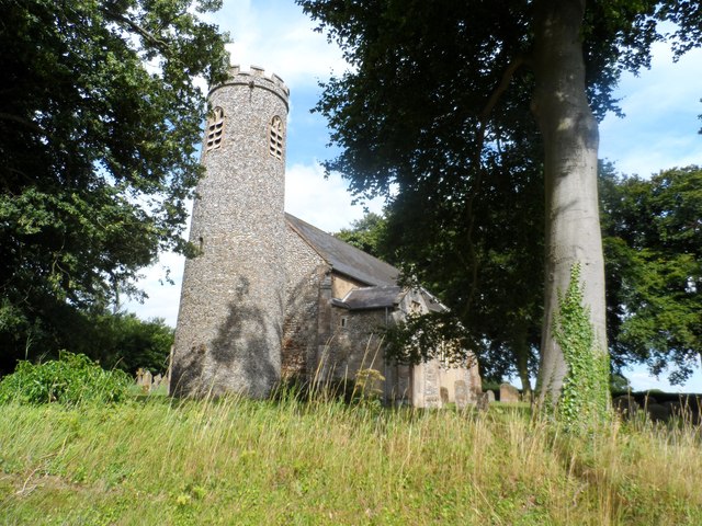
Black Acre Plantation is a picturesque wooded area located in Norfolk, England. Covering an expansive area of land, the plantation is renowned for its dense and lush forest, making it a haven for nature enthusiasts and outdoor adventurers.

The woodland of Black Acre Plantation is characterized by its rich biodiversity and stunning natural beauty. Towering oak and beech trees dominate the landscape, providing shade and creating a serene atmosphere. The forest floor is adorned with a vibrant carpet of ferns, wildflowers, and moss, creating a picturesque setting throughout the year.

Wildlife thrives within the plantation, with an abundance of species calling it home. Birdwatchers can spot a variety of native and migratory birds, including woodpeckers, owls, and warblers. Squirrels and rabbits can be observed darting through the undergrowth, while deer graze peacefully in clearings.

The plantation offers a range of recreational activities for visitors. Hiking and walking trails crisscross the area, allowing visitors to explore the forest and enjoy its natural splendor. Cyclists can traverse the plantation on designated bike paths, while families can enjoy picnics in the designated areas.

Black Acre Plantation is open to the public throughout the year, encouraging visitors to connect with nature and experience the tranquility of the forest. Whether it's a leisurely stroll, an adrenaline-filled bike ride, or simply a moment of solitude amidst the trees, Black Acre Plantation offers a unique and enriching experience for all who venture into its depths.

If you have any feedback on the listing, please let us know in the comments section below.

Black Acre Plantation Images

Images are sourced within 2km of 52.905941/1.2142387 or Grid Reference TG1639. Thanks to Geograph Open Source API. All images are credited.

All Saints' church, Gresham See <span class="nowrap"><a title="http://www.norfolkchurches.co.uk/gresham/gresham.htm" rel="nofollow ugc noopener" href="http://www.norfolkchurches.co.uk/gresham/gresham.htm">Link</a><img style="margin-left:2px;" alt="External link" title="External link - shift click to open in new window" src="https://s1.geograph.org.uk/img/external.png" width="10" height="10"/></span>.
All Saints' church, Gresham
See LinkExternal link.
Aylmerton Cross Restored ancient cross situated one mile south of the village of Aylmerton at a crossroads (3 roads and a track).
Aylmerton Cross
Restored ancient cross situated one mile south of the village of Aylmerton at a crossroads (3 roads and a track).
RAF West Beckham radar station (A Site) Entrance into the transmitter block. This structure currently forms part of a farm and was accessed by kind permisison of the owner.
RAF West Beckham radar station (A Site)
Entrance into the transmitter block. This structure currently forms part of a farm and was accessed by kind permisison of the owner.
RAF West Beckham radar station (A Site) Interior of the transmitter block > <a title="https://www.geograph.org.uk/photo/3962674" href="https://www.geograph.org.uk/photo/3962674">Link</a>.
RAF West Beckham radar station (A Site)
Interior of the transmitter block > Link.
Aylmerton Stone Cross before restoration
Aylmerton Cross One mile south of the village on Church Road, at a small junction of the Lower Gresham to Metton road, is this ancient cross which has been recently restored. Aylmerton cross is on the parish boundary with Gresham. It is said to have been one of a number of guides to Walsingham where pilgrims could rest and do whatever else pilgrims used to do on their journeys. This seems most unlikely as it is nowhere near to being on the route heading to Walsingham being 15 miles the east of the shrine and there being nothing resembling a direct route betwixt the two.
Aylmerton Cross
One mile south of the village on Church Road, at a small junction of the Lower Gresham to Metton road, is this ancient cross which has been recently restored. Aylmerton cross is on the parish boundary with Gresham. It is said to have been one of a number of guides to Walsingham where pilgrims could rest and do whatever else pilgrims used to do on their journeys. This seems most unlikely as it is nowhere near to being on the route heading to Walsingham being 15 miles the east of the shrine and there being nothing resembling a direct route betwixt the two.
Gresham village sign Village signs are typically placed along the principal road or in a prominent location such as a village green or close by the church. The design often depicts a particularly feature of the village or a scene from its history, heritage, or culture. They are typically made of wood or metal or a combination of both, the designs are often made by the local community.
Although they do appear in villages and towns all over the country they are more prominent in East Anglia than elsewhere in the country.
Gresham village sign
Village signs are typically placed along the principal road or in a prominent location such as a village green or close by the church. The design often depicts a particularly feature of the village or a scene from its history, heritage, or culture. They are typically made of wood or metal or a combination of both, the designs are often made by the local community. Although they do appear in villages and towns all over the country they are more prominent in East Anglia than elsewhere in the country.
Gresham village sign The grasshopper on top of the sign is an heraldic device used by the Gresham family. It is used by Gresham College, which was founded by Sir Thomas Gresham and can also be seen as the weathervane on the Royal Exchange in the City of London, which he also founded in 1565. The windmill, watermill and castle are also featured
Gresham village sign
The grasshopper on top of the sign is an heraldic device used by the Gresham family. It is used by Gresham College, which was founded by Sir Thomas Gresham and can also be seen as the weathervane on the Royal Exchange in the City of London, which he also founded in 1565. The windmill, watermill and castle are also featured
East and West Beckham War Memorial The Memorial bears nine names of the men lost in WW1. They are repeated on the Roll of Honour which stands outside the church and is in a very poor condition with the surface of the stone flaking badly. <a title="https://www.geograph.org.uk/photo/2113136" href="https://www.geograph.org.uk/photo/2113136">Link</a>
East and West Beckham War Memorial
The Memorial bears nine names of the men lost in WW1. They are repeated on the Roll of Honour which stands outside the church and is in a very poor condition with the surface of the stone flaking badly. Link
Gresham War Memorial The Memorial has twelve names of men lost in WW1 and on another face are the names of six men lost in WW2.
Gresham War Memorial
The Memorial has twelve names of men lost in WW1 and on another face are the names of six men lost in WW2.
All Saints, Gresham, East end
All Saints, Gresham - Sanctuary
All Saints, Gresham - West end
All Saints, Gresham - War Memorial WWII
All Saints, Gresham - Wall monument
All Saints, Gresham
All Saints, Gresham
All Saints, Gresham - War Memorial
Show me another place!

Black Acre Plantation is located at Grid Ref: TG1639 (Lat: 52.905941, Lng: 1.2142387)

Administrative County: Norfolk

District: North Norfolk

Police Authority: Norfolk

What 3 Words

///below.dunk.lengthen. Near Sheringham, Norfolk

Related Wikis

East Beckham

East Beckham is a village and a civil parish in the English county of Norfolk. The village is 23.4 miles (37.7 km) north of Norwich, 5 miles (8 km) south...

Gresham, Norfolk

Gresham is a village and civil parish in North Norfolk, England, five miles (8 km) south-west of Cromer. A predominantly rural parish, Gresham centres...

Gresham Castle

Gresham Castle is located south of the village of Gresham in the north of the English county of Norfolk. The medieval castle was actually a fortified manor...

Wood-Dene School

Wood-Dene School was a private school for the creative arts in the English county of Norfolk in Great Britain, closing during March 2010. The school was...

Aylmerton

Aylmerton is a village in the county of Norfolk, England. It is in the area of North Norfolk and lies 2.2 miles (3.5 km) south of the North Sea, 3.2 miles...

Bessingham

Bessingham is a village and former civil parish, now in the parish of Sustead, in the North Norfolk district of the English county of Norfolk. It lies...

RAF West Beckham

Royal Air Force Station West Beckham, commonly known as RAF West Beckham, is a former Chain Home radar station controlled by the Royal Air Force (RAF)...

Briton's Lane Gravel Pit

Briton's Lane Gravel Pit is a 21.5-hectare (53-acre) geological Site of Special Scientific Interest east of Sheringham in Norfolk. It is a Geological...

Have you been to Black Acre Plantation?

Leave your review of Black Acre Plantation below (or comments, questions and feedback).