School Wood

Wood, Forest in Norfolk South Norfolk

England

School Wood

St Remigius Church, Hethersett
St Remigius Church, Hethersett Credit: Helen Steed

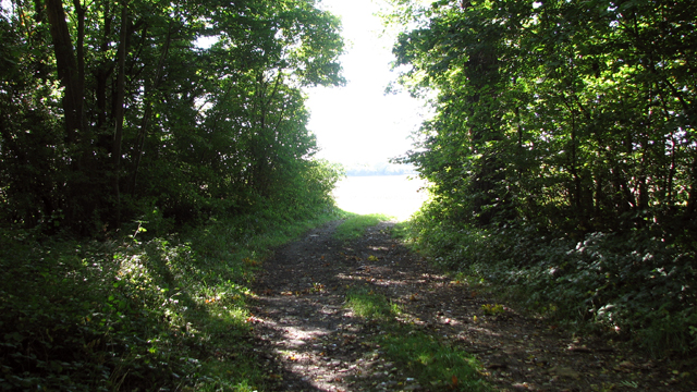
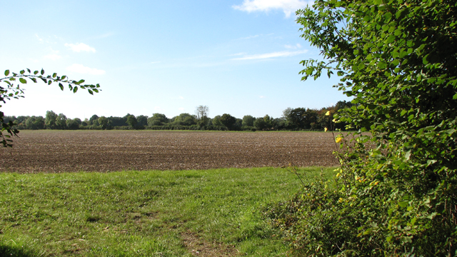
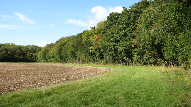
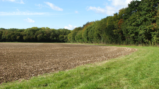
School Wood is a picturesque forest located in Norfolk, England. Covering an area of approximately 50 acres, this woodland is renowned for its natural beauty and tranquil environment. It is situated in close proximity to the village of Wood, making it easily accessible for nature enthusiasts and locals alike.

The wood is predominantly composed of a variety of native tree species, including oak, beech, birch, and ash. These towering trees create a dense canopy, providing shelter and habitat for a diverse range of wildlife. Birdwatchers can delight in the presence of woodpeckers, owls, and various songbirds, while nature lovers may spot squirrels, foxes, and even deer roaming freely through the woodland.

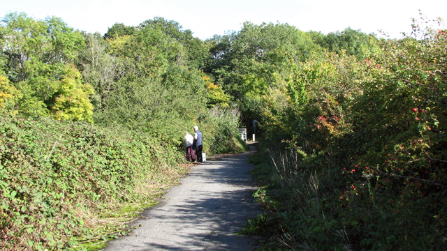
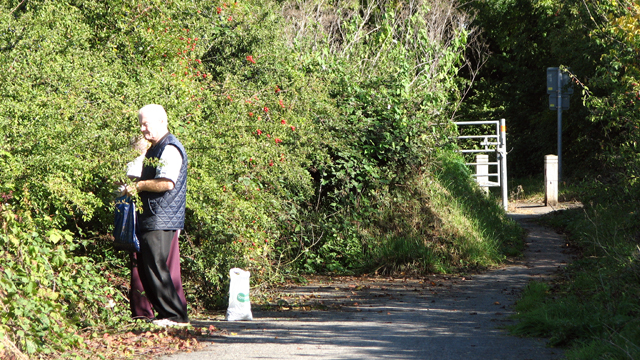
Several well-maintained footpaths wind their way through School Wood, allowing visitors to explore its unspoiled beauty. The paths are suitable for leisurely walks, jogging, and dog walking, and there are also designated picnic areas for those wishing to enjoy a peaceful outdoor meal.

In addition to its natural allure, School Wood holds historical significance. The wood was once part of the estate of a nearby school, hence its name. Remnants of an old stone wall and the foundations of a building can still be found within its boundaries, adding an air of mystery and intrigue to the forest.

Overall, School Wood is a cherished destination for nature enthusiasts, hikers, and history buffs alike. Its idyllic setting, diverse wildlife, and rich history make it an ideal place to escape the hustle and bustle of everyday life and immerse oneself in the beauty of the Norfolk countryside.

If you have any feedback on the listing, please let us know in the comments section below.
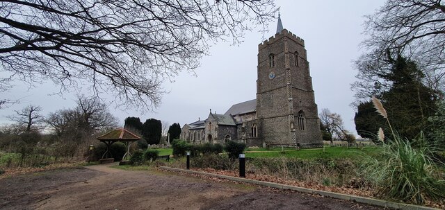
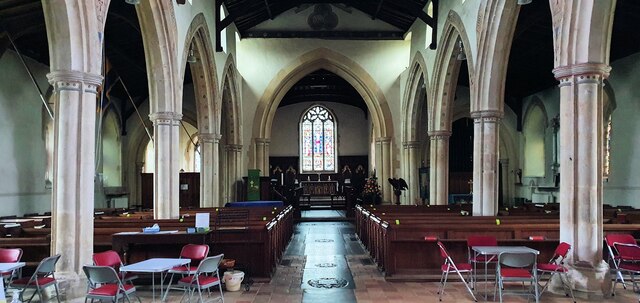
School Wood Images

Images are sourced within 2km of 52.58279/1.1867327 or Grid Reference TG1503. Thanks to Geograph Open Source API. All images are credited.

St Remigius Church, Hethersett
Interior of St Remigius Church, Hethersett
War memorial in the grounds of St Remigius Church, Hethersett
Names on the Hethersett war memorial - 1
Names on the Hethersett war memorial - 2
Names on the Hethersett war memorial - 3
Names on the Hethersett war memorial - 4
Names on the Hethersett war memorial - 5
War memorial inside St Remigius Church, Hethersett
The A11 west approaching junction for Ketteringham
The A11 west . 22 miles to Thetford
Track in Park Plantation East
Fields by Park Plantation East
Park Plantation East
Field south of Park Plantation East
View along Potash Lane
Picking sloes on Potash Lane For a close-up view of sloes see > <a title="https://www.geograph.org.uk/photo/4691135" href="https://www.geograph.org.uk/photo/4691135">Link</a>.
Picking sloes on Potash Lane
For a close-up view of sloes see > Link.
Sloes ready for picking Sloes are the fruit of the blackthorn tree. These berries will sustain birds during the winter. Blackthorn in bloom is considered an emblem of life and death together because the flowers appear when the tree has no leaves. In Irish folklore it was believed that the "little people" lived in Blackthorn bushes. Fairy tribes, called Lunantishees, are said to guard Blackthorn trees and to cut branches off it on 11 November or 11 May is considered to be unlucky. The blackthorn flowers provide food for bumblebees and early-flying Small Tortoiseshell butterflies and its leaves feed the larvae of Black and Brown Hairstreak butterflies. The dried juice of the berries is used for making gum acacia. The flowers and fruit are considered a good tonic for diarrhoea and other bowel problems and sloe syrup has anti-rheumatic properties and can help fight flu. The berries are used in wine, gin and vodka as flavouring and they can be made into a paste for whitening teeth and removing tartar. The berries taste better and not so bitter if harvested after a few frosts. Ancient folk used to bury the sloes in straw-lined pits for a few months to ripen them and make them sweeter - one such pit was found at a neolithic lake village in Glastonbury. The sharp thorns of the plant were used for centuries as awls and blackthorn is the traditional wood used in wands and to make the traditional Irish shillelagh (cudgel) used in fighting sports. For a wider view of this location see > <a title="https://www.geograph.org.uk/photo/4691133" href="https://www.geograph.org.uk/photo/4691133">Link</a>.
Sloes ready for picking
Sloes are the fruit of the blackthorn tree. These berries will sustain birds during the winter. Blackthorn in bloom is considered an emblem of life and death together because the flowers appear when the tree has no leaves. In Irish folklore it was believed that the "little people" lived in Blackthorn bushes. Fairy tribes, called Lunantishees, are said to guard Blackthorn trees and to cut branches off it on 11 November or 11 May is considered to be unlucky. The blackthorn flowers provide food for bumblebees and early-flying Small Tortoiseshell butterflies and its leaves feed the larvae of Black and Brown Hairstreak butterflies. The dried juice of the berries is used for making gum acacia. The flowers and fruit are considered a good tonic for diarrhoea and other bowel problems and sloe syrup has anti-rheumatic properties and can help fight flu. The berries are used in wine, gin and vodka as flavouring and they can be made into a paste for whitening teeth and removing tartar. The berries taste better and not so bitter if harvested after a few frosts. Ancient folk used to bury the sloes in straw-lined pits for a few months to ripen them and make them sweeter - one such pit was found at a neolithic lake village in Glastonbury. The sharp thorns of the plant were used for centuries as awls and blackthorn is the traditional wood used in wands and to make the traditional Irish shillelagh (cudgel) used in fighting sports. For a wider view of this location see > Link.
Show me another place!

School Wood is located at Grid Ref: TG1503 (Lat: 52.58279, Lng: 1.1867327)

Administrative County: Norfolk

District: South Norfolk

Police Authority: Norfolk

What 3 Words

///appealing.dignity.silent. Near Hethersett, Norfolk

Nearby Locations

Ketteringham School Wood

Related Wikis

Ketteringham

Ketteringham is a village and civil parish in the English county of Norfolk. The parish covers an area of 6.50 km2 (2.51 sq mi) and had a population of...

Hethersett Old Hall School

Hethersett Old Hall School was an independent school located in Hethersett, Norfolk, England that educated around 180 boys and girls. It was a day school...

Forehoe and Henstead Rural District

Forehoe and Henstead Rural Districts were adjacent rural districts in Norfolk, England from 1894 to 1935.They were formed under the Local Government Act...

Hethersett railway station

Hethersett was a railway station near Hethersett, Norfolk. == History == The Bill for the Norwich & Brandon Railway (N&BR) received Royal Assent on 10...

Hethersett Academy

Hethersett Academy, previously known as Hethersett High School and Science College, is a coeducational secondary school, part of the Inspiration Trust...

East Carleton

East Carleton is a village and civil parish in the English county of Norfolk. The village is located 6.3 kilometres (3.9 mi) east of nearby Wymondham and...

Hethersett

Hethersett is a large village and electoral ward in the county of Norfolk, England, about 6 miles (10 km) south-west of Norwich. It covers an area of 4...

Kett's Oak

Kett's Oak is one of the 50 Great British Trees. The ancient oak tree (Quercus robur) is located at the side of the B1172 road between Wymondham and Hethersett...

Nearby Amenities

Located within 500m of 52.58279,1.1867327
Passing Place
Lat/Long: 52.5828135/1.1841558
Ketteringham
Place: village
Lat/Long: 52.5839645/1.1871456
Phone
Check Date: 2021-06-06
Emergency: phone
Ref: 167B
Lat/Long: 52.5866336/1.1869684
Marker: yes
Pipeline: marker
Substance: oil
Utility: oil
Lat/Long: 52.5787067/1.1845947
Post Box
Collection Times: Mo-Fr 16:00; Sa 10:30
Post Box Mounting: wooden_post
Post Box Type: lamp
Ref: NR18 1851
Royal Cypher: EIIR
Royal Cypher Wikidata: Q33102113
Lat/Long: 52.5849428/1.1899652
Phone: +44 1603 810687
Removed Amenity: telephone
Lat/Long: 52.5849292/1.1899644
Marker: yes
Pipeline: marker
Substance: oil
Utility: oil
Lat/Long: 52.5787975/1.1847457
Parking
Access: yes
Fee: no
Operator: National Highways
Operator Wikidata: Q5760006
Parking: surface
Lat/Long: 52.586832/1.1874405
Ketteringham
Inscription: WI / 1979
Man Made: village_sign
Material: wood
Start Date: 1979
Lat/Long: 52.584354/1.1869527
War Memorial
Description: Large stone cross on pedestal set in grass small grass square by the side of the road.
Historic: memorial
Inscription: To the Glory of God and a Memorial of the Part Taken by Ketteringham in the Great War 191 - 1919. (These are the dates engraved 191 - 1919)
Lat/Long: 52.5849953/1.1895537
Description: Small brick built structure over the well with protruding handle.
Disused Man Made: village_well
Material: brick
Lat/Long: 52.5835672/1.1833464
Bench
Backrest: yes
Colour: brown
Material: wood
Seats: 3
Lat/Long: 52.5843821/1.1870093
Waste Basket
Lat/Long: 52.5844062/1.1870575
Power: pole
Lat/Long: 52.581119/1.1924042
Power: pole
Lat/Long: 52.5820912/1.1919308
Location Transition: yes
Power: pole
Lat/Long: 52.5830234/1.1914654
Location Transition: yes
Power: pole
Lat/Long: 52.5830414/1.1914775
Power: pole
Lat/Long: 52.58323/1.1927938
Give Way
Lat/Long: 52.5836472/1.1834664
Give Way
Lat/Long: 52.5836023/1.183143
Give Way
Lat/Long: 52.5834521/1.1834238
Power: pole
Transformer: distribution
Lat/Long: 52.5833681/1.1845306
Power: pole
Lat/Long: 52.5836941/1.1861895
Power: pole
Lat/Long: 52.5839972/1.187607
Power: pole
Lat/Long: 52.5836663/1.1902678
Power: pole
Lat/Long: 52.5842987/1.1891037
Waste Basket
Lat/Long: 52.5844779/1.1873871
Give Way
Lat/Long: 52.5844062/1.1867836
Description: Small brick built structure over the well with protruding handle.
Disused Man Made: well
Material: brick
Lat/Long: 52.5841817/1.1851562
The data included in this document is from www.openstreetmap.org. The data is made available under ODbL.

Have you been to School Wood?

Leave your review of School Wood below (or comments, questions and feedback).