Eastwood

Wood, Forest in Norfolk North Norfolk

England

Eastwood

Beeston Regis Common Part of a SSSI covering 61 acres of grassland, heath, marsh, fen and secondary woodland.
Beeston Regis Common Credit: Hugh Venables

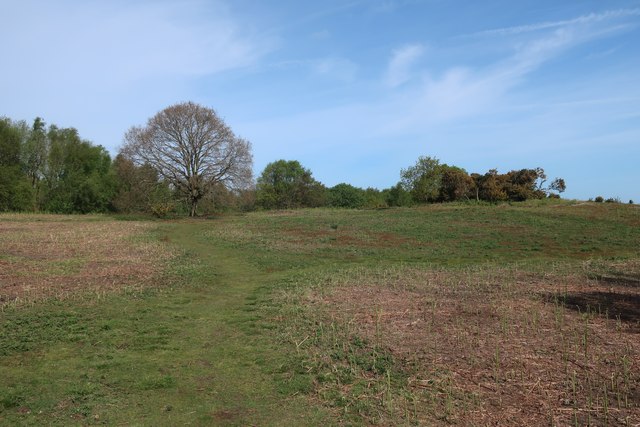
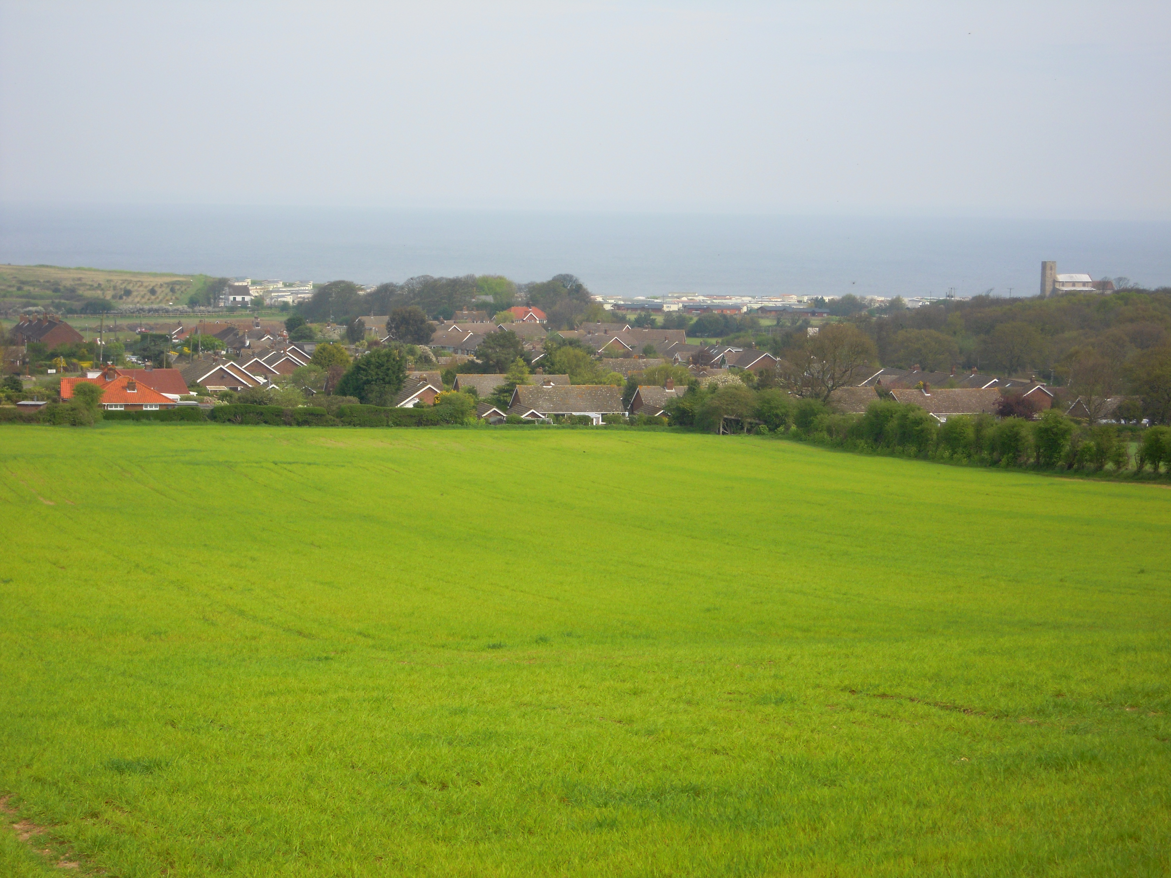
Eastwood is a small village located in the county of Norfolk, England. Situated near the town of Aylsham, it lies within the beautiful rural landscape of East Anglia. The village is predominantly known for its picturesque woodlands and lush forests, which surround the area and give it a serene and natural charm.

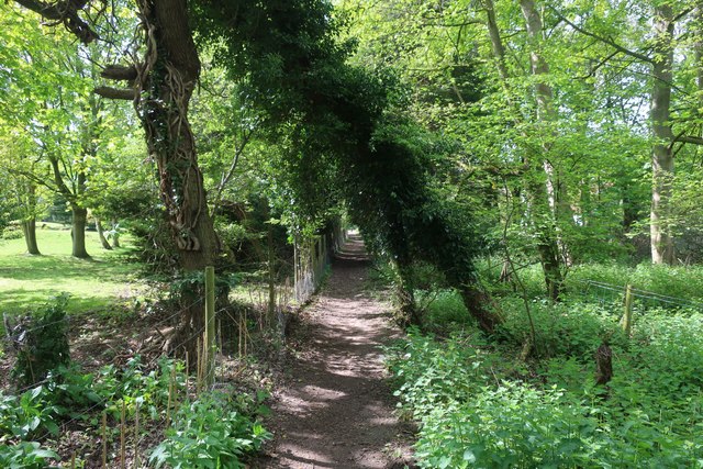
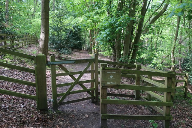
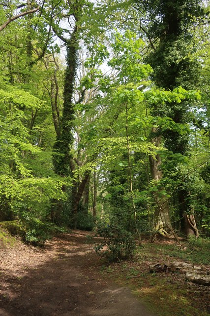
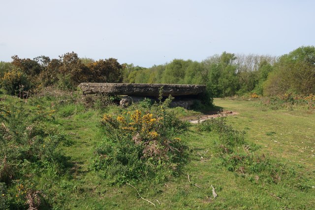
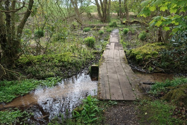
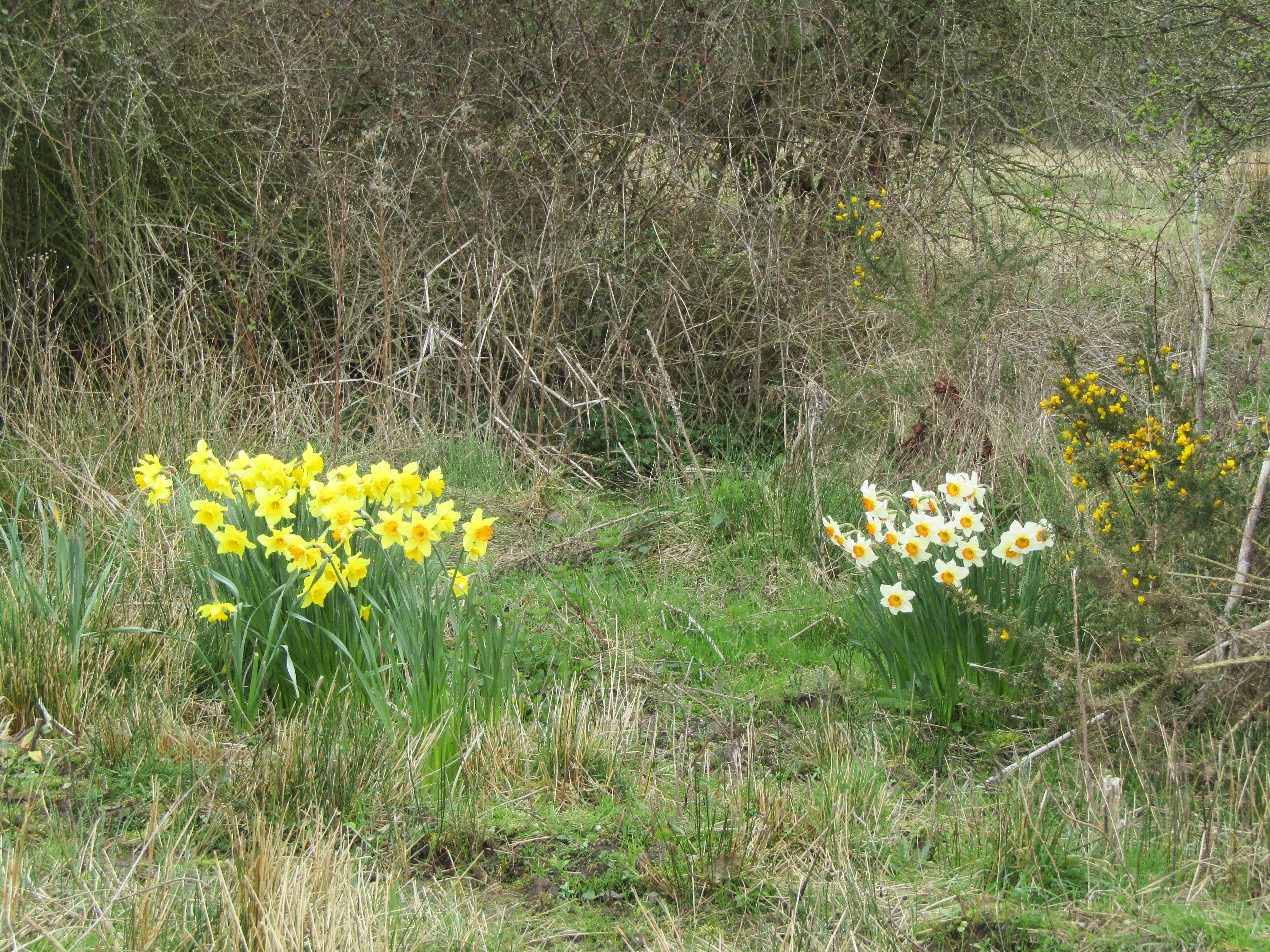
The woodlands in Eastwood are home to a diverse range of flora and fauna, making it a popular destination for nature enthusiasts and outdoor lovers. Visitors can enjoy peaceful walks along the well-maintained trails, taking in the sights and sounds of the tranquil surroundings. The forest is particularly famous for its majestic oak trees, many of which have been standing for centuries.

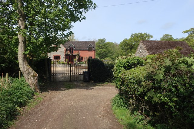
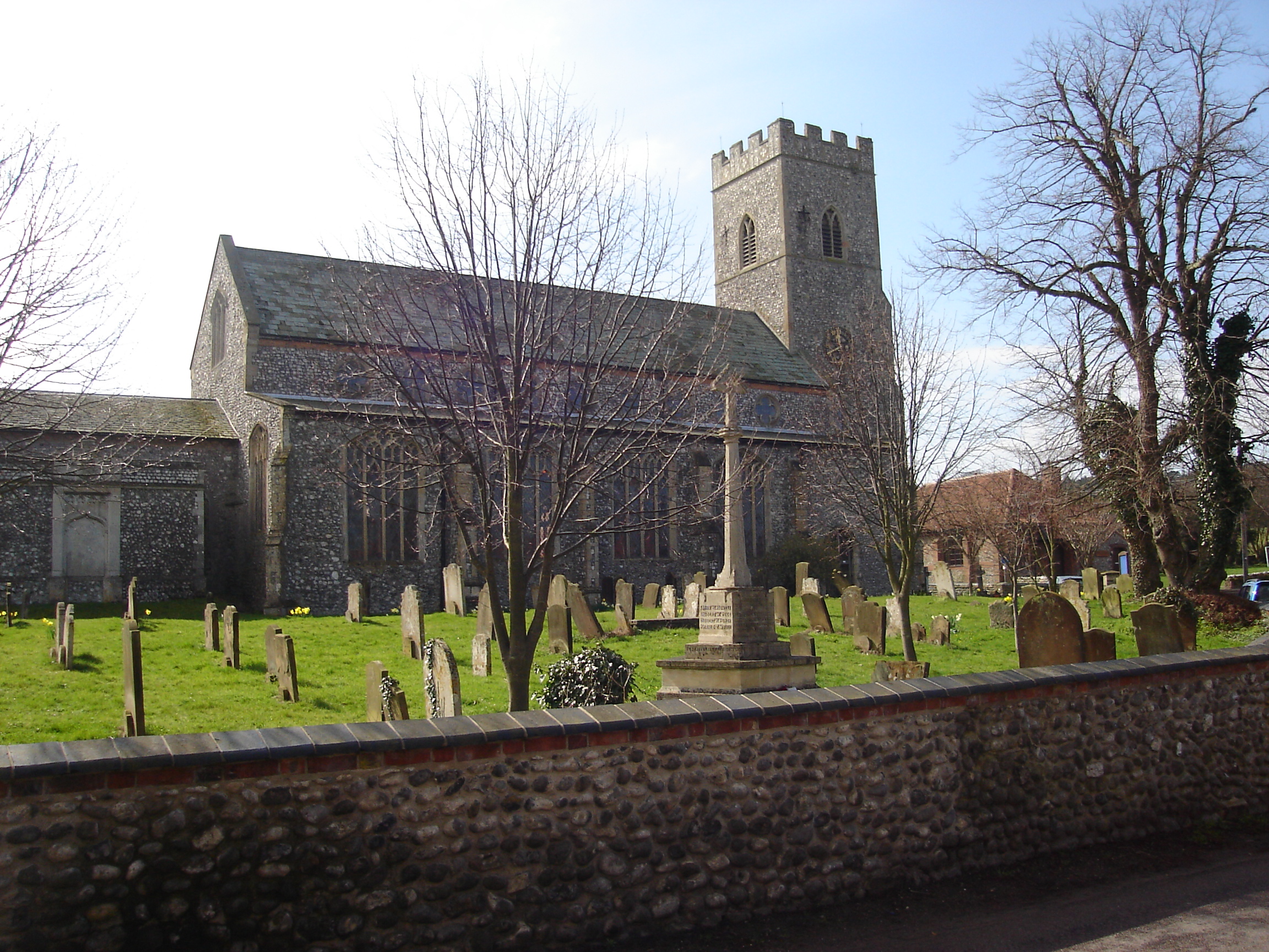
The village itself is a tight-knit community, with a small but friendly population. It boasts a few quaint cottages and houses, adding to its idyllic charm. Although it is a relatively quiet and secluded location, Eastwood is well-connected to nearby towns and villages, providing residents with easy access to amenities and services.

Eastwood offers a sense of escapism from the hustle and bustle of modern life, allowing individuals to immerse themselves in the beauty of nature. It is a haven for those seeking a peaceful retreat or a place for outdoor activities such as hiking, birdwatching, or simply enjoying a picnic amidst the tranquil surroundings.

Overall, Eastwood, Norfolk (Wood, Forest) is a hidden gem for nature lovers, offering a serene and picturesque environment that is sure to captivate anyone seeking a peaceful getaway.

If you have any feedback on the listing, please let us know in the comments section below.

Eastwood Images

Images are sourced within 2km of 52.9294/1.1980742 or Grid Reference TG1541. Thanks to Geograph Open Source API. All images are credited.

Beeston Regis Common Part of a SSSI covering 61 acres of grassland, heath, marsh, fen and secondary woodland.
Beeston Regis Common
Part of a SSSI covering 61 acres of grassland, heath, marsh, fen and secondary woodland.
Footpath into Sheringwood
Overgrown barn in Sheringwood
Footpath through Sheringwood
Gate into Old Wood
Gate into Old Wood
Woodland south of Sheringham
Footpath through Sheringham Wood
Sheringham Wood
Sheringham Wood
Footpath on Beeston Regis Common
Depth gauge on Beeton Regis Common Part of a SSSI covering 61 acres of grassland, heath, marsh, fen and secondary woodland.
Depth gauge on Beeton Regis Common
Part of a SSSI covering 61 acres of grassland, heath, marsh, fen and secondary woodland.
Pillbox on Beeston Regis Common
Beeston Regis Common An SSSI covering 61 acres of grassland, heath, marsh, fen and secondary woodland.
Beeston Regis Common
An SSSI covering 61 acres of grassland, heath, marsh, fen and secondary woodland.
Woodland Rise West, Sheringham
Path on Sheringham Common Part of a SSSI covering 61 acres of grassland, heath, marsh, fen and secondary woodland.
Path on Sheringham Common
Part of a SSSI covering 61 acres of grassland, heath, marsh, fen and secondary woodland.
Boardwalk on Sheringham Common Part of a SSSI covering 61 acres of grassland, heath, marsh, fen and secondary woodland.
Boardwalk on Sheringham Common
Part of a SSSI covering 61 acres of grassland, heath, marsh, fen and secondary woodland.
Path on Beeston Regis Common
Pond on Beeston Regis Common Part of a SSSI covering 61 acres of grassland, heath, marsh, fen and secondary woodland.
Pond on Beeston Regis Common
Part of a SSSI covering 61 acres of grassland, heath, marsh, fen and secondary woodland.
Show me another place!

Eastwood is located at Grid Ref: TG1541 (Lat: 52.9294, Lng: 1.1980742)

Administrative County: Norfolk

District: North Norfolk

Police Authority: Norfolk

What 3 Words

///escalated.suspect.liked. Near Sheringham, Norfolk

Related Wikis

Sheringham Woodfields School

Sheringham Woodfields School is a co-educational special school located in Sheringham in the English county of Norfolk.It is a Learning and Cognition Specialist...

Upper Sheringham

Upper Sheringham is a village and a civil parish in the English county of Norfolk. The village is 26.8 miles (43.1 km) north-north-west of Norwich, 6...

A1082 road

The A1082 is an English A road entirely in the county of Norfolk. It runs from a junction with the A148 King's Lynn to Cromer Road to a roundabout on the...

Sheringham High School

Sheringham High School is a secondary school and sixth form located in the town of Sheringham in the English county of Norfolk. The school has around 700...

Sheringham F.C.

Sheringham Football Club is a football club based in Sheringham, England and was established in 1897. They are currently members of the Eastern Counties...

Masonic Hall, Sheringham

The Masonic Hall, Sheringham was built in 1914 to house the Electric Picture Palace. == Location == The hall is located on the landward side of the coast...

Sheringham and Beeston Regis Commons

Sheringham and Beeston Regis Commons is a 24.9-hectare (62-acre) biological Site of Special Scientific Interest in Sheringham in Norfolk. It is a Nature...

Beeston Regis

Beeston Regis is a village and civil parish in the North Norfolk district of Norfolk, England. It is about a mile (2 km) east of Sheringham, Norfolk and...

Nearby Amenities

Located within 500m of 52.9294,1.1980742
Parking
Parking: layby
Lat/Long: 52.9274342/1.201322
Heath Farm
Place: farm
Lat/Long: 52.9302818/1.1925919
Ivy Farm
Place: farm
Lat/Long: 52.9311992/1.1914652
Pretty Corner
Place: locality
Lat/Long: 52.9255994/1.1997749
Pretty Corner Woods
Board Type: nature
Information: board
Tourism: information
Lat/Long: 52.9295851/1.2038256
Waste Basket
Colour: black
Material: plastic
Waste: trash
Lat/Long: 52.9295904/1.2038185
Access: yes
Barrier: swing_gate
Colour: pink
Material: metal
Swing Gate Type: single
Lat/Long: 52.9296502/1.2036193
Bench
Backrest: yes
Colour: grey
Inscription: In loving memory of Margaret Baxter / 1924 ~ 2006 / She and her Family have long loved Sheringham
Material: wood
Lat/Long: 52.9301874/1.2050175
Give Way
Lat/Long: 52.9311811/1.204222
Power: pole
Lat/Long: 52.932831/1.1975192
Power: pole
Lat/Long: 52.9324818/1.1958978
Power: pole
Lat/Long: 52.9324738/1.1942173
Power: pole
Lat/Long: 52.9312572/1.1923948
Power: pole
Lat/Long: 52.9295066/1.1932792
Power: pole
Lat/Long: 52.9272546/1.1945889
Power: pole
Lat/Long: 52.9260501/1.1949422
Power: pole
Lat/Long: 52.9255609/1.1945781
Give Way
Lat/Long: 52.9312224/1.2045108
Bench
Backrest: yes
Lat/Long: 52.9301985/1.2053072
Bench
Backrest: no
Inscription: no
Material: wood
Lat/Long: 52.9296246/1.2040872
Waste Basket
Colour: red
Material: plastic
Waste: dog_excrement
Lat/Long: 52.9296783/1.2041026
Hiking: yes
Information: route_marker
Tourism: information
Lat/Long: 52.9296694/1.2041737
Bench
Backrest: no
Inscription: no
Material: wood
Seats: 3
Lat/Long: 52.929357/1.2052352
Power: pole
Lat/Long: 52.9280225/1.1941031
Power: pole
Lat/Long: 52.928103/1.1940777
Power: pole
Lat/Long: 52.9303841/1.1928226
Sheringham
Colour: black
Colour Back: white
Direction: N
Inscription: North Norfolk’s Premier Seaside Town / Twinned with Otterndorf, Germany
Material: metal
Traffic Sign: city_limit
Lat/Long: 52.9309217/1.20399
Location Transition: yes
Power: pole
Transformer: distribution
Lat/Long: 52.9306387/1.203648
Welcome to Pretty Corner Woods
Boundary: marker
Inscription: Woodland Trust / North Norfolk District Council
Material: wood
Lat/Long: 52.9296885/1.2036505
The data included in this document is from www.openstreetmap.org. The data is made available under ODbL.

Have you been to Eastwood?

Leave your review of Eastwood below (or comments, questions and feedback).