Dunham's Plantation

Wood, Forest in Norfolk South Norfolk

England

Dunham's Plantation

Easton: Stylish rubbish bin
Easton: Stylish rubbish bin Credit: Michael Garlick

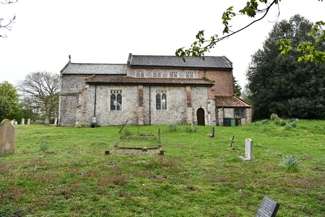
Dunham's Plantation, located in Norfolk, is a historical site known for its sprawling woodlands and dense forested areas. Covering a vast expanse of land, this plantation is renowned for its natural beauty and rich biodiversity. The plantation is situated in the county of Norfolk, which is in the eastern part of England.

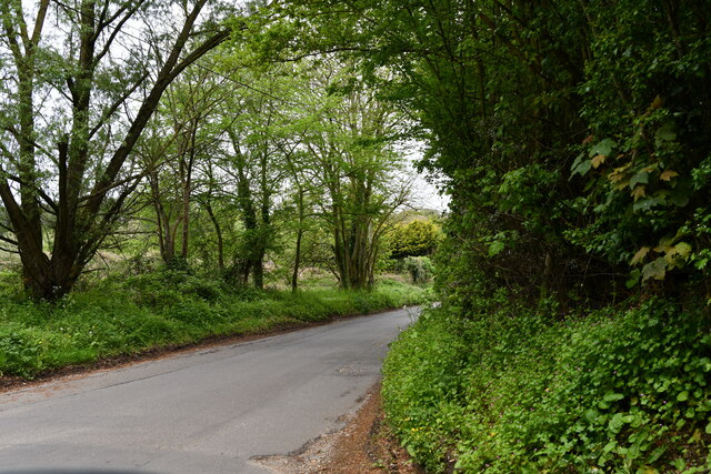
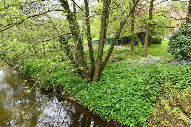
Dunham's Plantation is characterized by its lush greenery, consisting of a variety of tree species such as oak, beech, and pine. The forested areas provide a haven for numerous wildlife species, including deer, squirrels, and various bird species. The plantation's extensive network of walking trails allows visitors to immerse themselves in the tranquility of nature while exploring the vast woodland.

The site holds historical significance as it was once a working plantation. It served as a center for agriculture, primarily focused on the cultivation of crops like wheat and barley. The plantation also housed a variety of farm animals, contributing to its self-sustaining nature.

Today, Dunham's Plantation has been preserved as a natural reserve, attracting nature enthusiasts, hikers, and history buffs alike. The plantation offers a range of activities, including guided nature walks, birdwatching, and educational programs for visitors of all ages. The site also features picnic areas and amenities to ensure a comfortable and enjoyable experience.

Dunham's Plantation in Norfolk stands as a testament to the region's natural beauty, history, and commitment to conservation. It serves as a haven for both wildlife and visitors, providing a unique and enriching experience in the heart of nature.

If you have any feedback on the listing, please let us know in the comments section below.

Dunham's Plantation Images

Images are sourced within 2km of 52.648764/1.1706966 or Grid Reference TG1410. Thanks to Geograph Open Source API. All images are credited.

Easton: Stylish rubbish bin
Easton, St. Peter's Church: The rendered nave, southern aspect
Easton, St. Peter's Church: Southern aspect
Easton, St. Peter's Church: Eastern aspect
Easton, St. Peter's Church: Grave of Flight Lieutenant J.A Capka
Easton, St. Peter's Church: North eastern aspect
Easton, St. Peter's Church: Western aspect
Easton, St. Peter's Church: Northern aspect
Easton, St. Peter's Church: Sundial on the south porch
Easton, St. Peter's Church: Milestone in front of the church
Easton, St. Peter's Church: Norman south doorway (detail) 1
Easton, St. Peter's Church: Norman south doorway (detail) 2
Easton, St. Peter's Church: Norman south doorway (detail) 3
Easton, St. Peter's Church: Norman south doorway (detail) 4
Easton, St. Peter's Church: Norman south doorway (detail) 5
Easton: Ringland Road
Easton: River Tud
Easton: River Tud
Show me another place!

Dunham's Plantation is located at Grid Ref: TG1410 (Lat: 52.648764, Lng: 1.1706966)

Administrative County: Norfolk

District: South Norfolk

Police Authority: Norfolk

What 3 Words

///engages.cowering.bids. Near Costessey, Norfolk

Related Wikis

Easton College

Easton College is a college of further and higher education in Norfolk, United Kingdom. It is located on a 200-hectare (490-acre) campus in the village...

Easton, Norfolk

Easton is a village and civil parish in the English county of Norfolk. The village is located 6.2 miles (10.0 km) north-west of Norwich and 9 miles (14...

Marlingford

Marlingford is a village and former civil parish, 6 miles (9.7 km) west of Norwich, now in the parish of Marlingford and Colton, in the South Norfolk district...

Bawburgh

Bawburgh () is a village and civil parish in the South Norfolk district of Norfolk, England, lying in the valley of the River Yare about 5 miles (8.0 km...

Nearby Amenities

Located within 500m of 52.648764,1.1706966
Crossing
Crossing: uncontrolled
Crossing Ref: zebra
Lat/Long: 52.6519874/1.1692634
Crossing
Crossing: unmarked
Lat/Long: 52.6518637/1.1751911
Post Box
Collection Times: Mo-Fr 16:00; Sa 11:00
Note: Only accessible on show days
Operator: Royal Mail
Postal Code: NR5
Ref: NR5 507
Lat/Long: 52.6481811/1.1731902
Toilets
Lat/Long: 52.6464247/1.1756825
Bus Stop
Showground, adj
Naptan AtcoCode: 2900C2772
Naptan Bearing: NW
Naptan CommonName: Showground
Naptan Indicator: adj
Naptan Landmark: main gate
Naptan Locality: New Costessey
Naptan NaptanCode: nfoajwag
Naptan ShortCommonName: Showground
Naptan Street: Dereham Road
Naptan Verified: no
Public Transport: platform
Source: naptan_import
Lat/Long: 52.6518307/1.1757569
Bus Stop
Showground, opp
Naptan AtcoCode: 2900C2773
Naptan Bearing: SE
Naptan CommonName: Showground
Naptan Indicator: opp
Naptan Landmark: opp main gate
Naptan Locality: New Costessey
Naptan NaptanCode: nfoajwaj
Naptan ShortCommonName: Showground
Naptan Street: Dereham Road
Naptan Verified: no
Public Transport: platform
Source: naptan_import
Lat/Long: 52.6519282/1.1758083
Countryside Trail
Board Type: plants
Information: board
Tourism: information
Lat/Long: 52.6504088/1.1714181
Countryside Trail
Board Type: plants
Information: board
Tourism: information
Lat/Long: 52.6505692/1.1708672
Countryside Trail
Board Type: plants
Information: board
Tourism: information
Lat/Long: 52.6506565/1.170861
Countryside Trail
Board Type: plants
Information: board
Tourism: information
Lat/Long: 52.650668/1.1713002
Countryside Trail
Board Type: plants
Information: board
Tourism: information
Lat/Long: 52.6508793/1.1710133
Countryside Trail
Board Type: nature
Information: board
Tourism: information
Lat/Long: 52.6514842/1.1713077
Countryside Trail
Board Type: plants
Information: board
Tourism: information
Lat/Long: 52.6515801/1.1711624
Ditches
Board Type: plants
Information: board
Tourism: information
Lat/Long: 52.650863/1.1711583
Kestrel
Board Type: nature
Information: board
Tourism: information
Lat/Long: 52.6506749/1.1708153
Little Owl
Board Type: nature
Information: board
Tourism: information
Lat/Long: 52.6505997/1.171477
Pollard Tree
Board Type: plants
Information: board
Tourism: information
Lat/Long: 52.6506602/1.170816
Tawny Owl
Board Type: nature
Information: board
Tourism: information
Lat/Long: 52.6502165/1.1712955
Tawny Owl
Board Type: nature
Information: board
Tourism: information
Lat/Long: 52.651332/1.1708416
Waste Basket
Waste: dog_excrement
Lat/Long: 52.6498531/1.1711074
Milestone
Distance Dereham: 11 mi
Distance Norwich: 5 mi
Marker: stone
Lat/Long: 52.6523884/1.1713991
Crossing
Crossing: unmarked
Lat/Long: 52.6521897/1.1720872
Give Way
Lat/Long: 52.6524619/1.1694088
Location Transition: yes
Power: pole
Transformer: distribution
Lat/Long: 52.6525654/1.169942
Power: pole
Transformer: distribution
Lat/Long: 52.6523783/1.169242
Power: pole
Lat/Long: 52.6522123/1.1686036
Power: pole
Lat/Long: 52.6522888/1.1673886
Peter Field
Shop: golf
Lat/Long: 52.6457544/1.1659294
Addr Housename: Costessey Lodge
Addr Street: Dereham Road
Lat/Long: 52.6525614/1.1730205
Golf: pin
Lat/Long: 52.6451941/1.1724846
Golf: pin
Lat/Long: 52.6451601/1.1716627
The data included in this document is from www.openstreetmap.org. The data is made available under ODbL.

Have you been to Dunham's Plantation?

Leave your review of Dunham's Plantation below (or comments, questions and feedback).