Clint Plantation

Wood, Forest in Suffolk Mid Suffolk

England

Clint Plantation

Thornton church lychgate and village sign
Thornton church lychgate and village sign Credit: Helen Steed

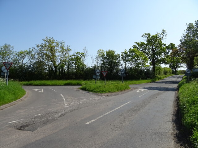
Clint Plantation, located in Suffolk, is a picturesque wood and forest area that covers a vast expanse of land. Spread over acres of rolling hills and lush greenery, this plantation offers a tranquil and serene escape from the hustle and bustle of city life.

The plantation is home to a diverse range of flora and fauna, making it an ideal destination for nature enthusiasts and wildlife lovers. Towering oak and beech trees dominate the landscape, providing a dense canopy that filters sunlight and creates an enchanting atmosphere. A variety of smaller plant species, including wildflowers and ferns, add color and vibrancy to the plantation.

One of the notable features of Clint Plantation is its well-maintained network of walking trails. These paths wind through the forest, allowing visitors to explore the plantation at their own pace. The trails offer breathtaking views of the surrounding countryside and provide ample opportunities for birdwatching and wildlife spotting.

Additionally, Clint Plantation provides a range of recreational activities for visitors. There are designated picnic areas, perfect for enjoying a leisurely lunch amidst nature. The plantation also offers camping facilities, allowing visitors to spend a night under the starry sky and experience the true essence of the wilderness.

Overall, Clint Plantation in Suffolk is a haven for those seeking solace in nature. With its stunning landscapes, diverse flora and fauna, and recreational activities, it offers a memorable experience for all who visit.

If you have any feedback on the listing, please let us know in the comments section below.

Clint Plantation Images

Images are sourced within 2km of 52.300255/1.1435084 or Grid Reference TM1471. Thanks to Geograph Open Source API. All images are credited.

Thornton church lychgate and village sign
Lychgate to All Saints Church, Thorndon The lychgate contains two war memorial plaques.
Lychgate to All Saints Church, Thorndon
The lychgate contains two war memorial plaques.
War memorial inside the lychgate of All Saints church, Thorndon
B1077 towards Eye
B1077 towards Eye
Rishangles Road junction with the B1077
Sprouting crop field off Rishangles Road
Rishangles Road towards Thorndon
Church of All Saints, Thorndon <span class="nowrap"><a title="https://historicengland.org.uk/listing/the-list/list-entry/1215792?section=official-list-entry" rel="nofollow ugc noopener" href="https://historicengland.org.uk/listing/the-list/list-entry/1215792?section=official-list-entry">Link</a><img style="margin-left:2px;" alt="External link" title="External link - shift click to open in new window" src="https://s1.geograph.org.uk/img/external.png" width="10" height="10"/></span>
Church of All Saints, Thorndon
Font at Church of All Saints, Thorndon <span class="nowrap"><a title="https://historicengland.org.uk/listing/the-list/list-entry/1215792?section=official-list-entry" rel="nofollow ugc noopener" href="https://historicengland.org.uk/listing/the-list/list-entry/1215792?section=official-list-entry">Link</a><img style="margin-left:2px;" alt="External link" title="External link - shift click to open in new window" src="https://s1.geograph.org.uk/img/external.png" width="10" height="10"/></span>
Font at Church of All Saints, Thorndon
Interior of Church of All Saints, Thorndon <span class="nowrap"><a title="https://historicengland.org.uk/listing/the-list/list-entry/1215792?section=official-list-entry" rel="nofollow ugc noopener" href="https://historicengland.org.uk/listing/the-list/list-entry/1215792?section=official-list-entry">Link</a><img style="margin-left:2px;" alt="External link" title="External link - shift click to open in new window" src="https://s1.geograph.org.uk/img/external.png" width="10" height="10"/></span>
Interior of Church of All Saints, Thorndon
Church of All Saints, Thorndon <span class="nowrap"><a title="https://historicengland.org.uk/listing/the-list/list-entry/1215792?section=official-list-entry" rel="nofollow ugc noopener" href="https://historicengland.org.uk/listing/the-list/list-entry/1215792?section=official-list-entry">Link</a><img style="margin-left:2px;" alt="External link" title="External link - shift click to open in new window" src="https://s1.geograph.org.uk/img/external.png" width="10" height="10"/></span>
Church of All Saints, Thorndon
Manor Farmhouse, Thorndon <span class="nowrap"><a title="https://historicengland.org.uk/listing/the-list/list-entry/1032355?section=official-list-entry" rel="nofollow ugc noopener" href="https://historicengland.org.uk/listing/the-list/list-entry/1032355?section=official-list-entry">Link</a><img style="margin-left:2px;" alt="External link" title="External link - shift click to open in new window" src="https://s1.geograph.org.uk/img/external.png" width="10" height="10"/></span>
Manor Farmhouse, Thorndon
All Saints Church, Thorndon
The Black Horse Inn, Thorndon The Black Horse was badly damaged by fire in the 1990s and was closed for a long time but has since reopened.
The Black Horse Inn, Thorndon
The Black Horse was badly damaged by fire in the 1990s and was closed for a long time but has since reopened.
Direction sign Direction signpost Thorndon Suffolk.
Direction sign
Direction signpost Thorndon Suffolk.
Guide Stone According to and old web site Milestones In Suffolk this is a guide stone not a milestone pointing the way for Stoke Ash and Debenham near to Thorndon, Suffolk. for close up view see <a title="https://www.geograph.org.uk/photo/3617298" href="https://www.geograph.org.uk/photo/3617298">Link</a>
Guide Stone
According to and old web site Milestones In Suffolk this is a guide stone not a milestone pointing the way for Stoke Ash and Debenham near to Thorndon, Suffolk. for close up view see Link
Thorndon All Saints church The nave was built in the 13th century and the tower was added a century later for the purpose of combining a porch with somewhere to hang the bells. A stoup with a cusped arch and hood sits in the angle of a buttress near the door. On the south wall is what appears to be a semi intramural burial, with a low arch and stone coffin lid behind a table tomb. At the west end, the church is bang up to date, with toilets and a small kitchen being fitted when I visited. The octagonal font is typical 15th century East Anglian style and virtually unmarked. Also in pristine condition is the lovely cusped piscina, beside which are sedilia into which has been set the altar rail. I was pleased to see the rood stairs open from bottom to top. Nearby is the Stuart pulpit. The corbels supporting the roof are unusually large angels.
Thorndon All Saints church
The nave was built in the 13th century and the tower was added a century later for the purpose of combining a porch with somewhere to hang the bells. A stoup with a cusped arch and hood sits in the angle of a buttress near the door. On the south wall is what appears to be a semi intramural burial, with a low arch and stone coffin lid behind a table tomb. At the west end, the church is bang up to date, with toilets and a small kitchen being fitted when I visited. The octagonal font is typical 15th century East Anglian style and virtually unmarked. Also in pristine condition is the lovely cusped piscina, beside which are sedilia into which has been set the altar rail. I was pleased to see the rood stairs open from bottom to top. Nearby is the Stuart pulpit. The corbels supporting the roof are unusually large angels.
Show me another place!

Clint Plantation is located at Grid Ref: TM1471 (Lat: 52.300255, Lng: 1.1435084)

Administrative County: Suffolk

District: Mid Suffolk

Police Authority: Suffolk

What 3 Words

///realm.static.galaxy. Near Scole, Norfolk

Related Wikis

Thorndon, Suffolk

Thorndon is a village and civil parish in the Mid Suffolk district of Suffolk in eastern England. The village is located around three miles south of Eye...

Braiseworth

Braiseworth is a village in Suffolk, England. It has never reached any great size, and no longer has its own parish church. The medieval church was dismantled...

The Pennings, Eye

The Pennings is a 2.7 hectare Local Nature Reserve in Eye in Suffolk. It is owned and managed by Mid Suffolk District Council.This site on the east bank...

Eye railway station

Eye railway station was located in Eye, Suffolk on a branch from Mellis. It was 94 miles 24 chains (151.8 km) down-line from London Liverpool Street. It...

Nearby Amenities

Located within 500m of 52.300255,1.1435084
School
Clint Farm Riding School
Sport: equestrian
Lat/Long: 52.2992114/1.1424315
Power: pole
Lat/Long: 52.3029355/1.1484551
Power: pole
Lat/Long: 52.2982755/1.1480027
Power: pole
Lat/Long: 52.3007339/1.1484205
Power: pole
Lat/Long: 52.2991199/1.1481341
Power: pole
Lat/Long: 52.3017523/1.148629
Power: pole
Lat/Long: 52.2972332/1.1478035
Power: pole
Lat/Long: 52.2998578/1.1482527
Power: pole
Lat/Long: 52.2964815/1.1436803
Power: pole
Lat/Long: 52.2962001/1.1449343
Power: pole
Lat/Long: 52.2979364/1.1417964
Power: pole
Lat/Long: 52.2970005/1.1412421
Power: pole
Lat/Long: 52.2967916/1.1423955
Power: pole
Lat/Long: 52.3025379/1.1405466
Power: pole
Lat/Long: 52.3035621/1.1409428
Power: pole
Lat/Long: 52.3043041/1.1412744
Power: pole
Lat/Long: 52.3035356/1.1454241
Power: pole
Lat/Long: 52.3039822/1.1427445
Power: pole
Lat/Long: 52.3036637/1.1442284
Power: pole
Lat/Long: 52.3033901/1.1466127
Power: pole
Lat/Long: 52.3030946/1.1481097
The data included in this document is from www.openstreetmap.org. The data is made available under ODbL.

Have you been to Clint Plantation?

Leave your review of Clint Plantation below (or comments, questions and feedback).