Chesterfield Wood
Wood, Forest in Kent Shepway
England
Chesterfield Wood

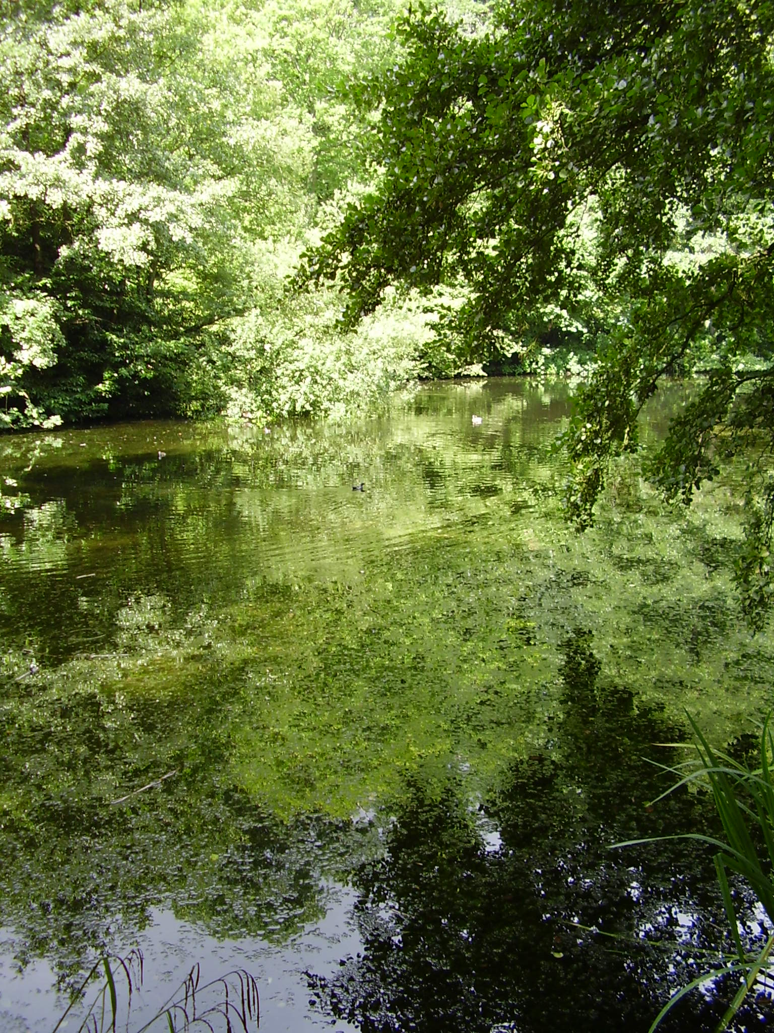
Chesterfield Wood, located in the county of Kent, is a picturesque forest that offers visitors a serene and tranquil escape from the hustle and bustle of everyday life. Spanning an area of approximately 100 hectares, this wood is renowned for its beautiful and diverse range of trees, making it a haven for nature enthusiasts and outdoor lovers.
The wood is predominantly made up of broadleaved trees, including oak, beech, ash, and birch. These majestic trees create a stunning canopy that provides shade during the summer months and bursts into a vibrant display of colors during the autumn season. The forest floor is carpeted with a rich variety of plant life, including bluebells, wild garlic, and ferns, which add to the enchanting atmosphere of the woodland.
Chesterfield Wood is home to an array of wildlife, making it a popular spot for birdwatching and animal spotting. Visitors may catch a glimpse of various bird species, such as the great spotted woodpecker, tawny owl, and common buzzard. The wood is also inhabited by mammals like deer, foxes, and badgers, adding to the biodiversity of the area.
The wood offers several walking trails, providing visitors with the opportunity to explore its natural beauty at their own pace. These well-maintained paths wind through the forest, offering glimpses of picturesque ponds and streams along the way. With its peaceful ambiance and abundant wildlife, Chesterfield Wood is a haven for nature lovers seeking solace in the heart of Kent's countryside.
Overall, Chesterfield Wood in Kent is a captivating and idyllic woodland that showcases the natural beauty and biodiversity of the region. Whether it's a leisurely stroll or a birdwatching adventure, visitors are sure to find tranquility and natural wonder in this enchanting forest.
If you have any feedback on the listing, please let us know in the comments section below.
Chesterfield Wood Images
Images are sourced within 2km of 51.084077/1.0586574 or Grid Reference TR1436. Thanks to Geograph Open Source API. All images are credited.


Chesterfield Wood is located at Grid Ref: TR1436 (Lat: 51.084077, Lng: 1.0586574)
Administrative County: Kent
District: Shepway
Police Authority: Kent
What 3 Words
///rejoined.operated.falters. Near Lympne, Kent
Nearby Locations
Related Wikis
Brockhill Country Park
Brockhill Country Park is in Saltwood, near Hythe in Kent, England. The park was a former estate with landscaped gardens and has subsequently been sub...

Pedlinge
Pedlinge is a hamlet on the edge of the village of Saltwood in Kent, England. It has its own church, though this is officially classified as a District...
Brockhill Park Performing Arts College
Brockhill Park Performing Arts College (BPPAC) is a coeducational secondary school and sixth form located in Saltwood, Kent near the coastal town of Hythe...

Sandling railway station
Sandling railway station is on the South Eastern Main Line in England, serving the village of Sandling and the town of Hythe, Kent. It is 65 miles 36 chains...
Saltwood
Saltwood is a village and civil parish in the Folkestone and Hythe District of Kent, England. Within the parish are the small hamlets of Pedlinge and Sandling...

Folkestone services
Folkestone services is a motorway service station on the M20 motorway at Westenhanger, seven miles from Folkestone in Kent, England. They are the second...
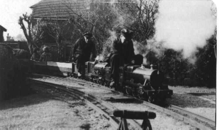
Saltwood Miniature Railway
Saltwood Miniature Railway was a 7+1⁄4 in (184 mm) gauge miniature railway which first opened in Sheffield, but subsequently relocated to Saltwood in Kent...

Newingreen
Newingreen is a village near Folkestone in Kent, England. It is situated on the junction of the A20 and the historic Stone Street between Lympne and Canterbury...
Nearby Amenities
Located within 500m of 51.084077,1.0586574Have you been to Chesterfield Wood?
Leave your review of Chesterfield Wood below (or comments, questions and feedback).