Church Wood

Wood, Forest in Kent Shepway

England

Church Wood

Footpath sign and stile The start of a footpath principally to Stelling Minnis common. Despite foreground appearances, this is the junction of two tarmac lanes. There is a lot of mud washed down the lanes to this low point.
Footpath sign and stile Credit: Robin Webster

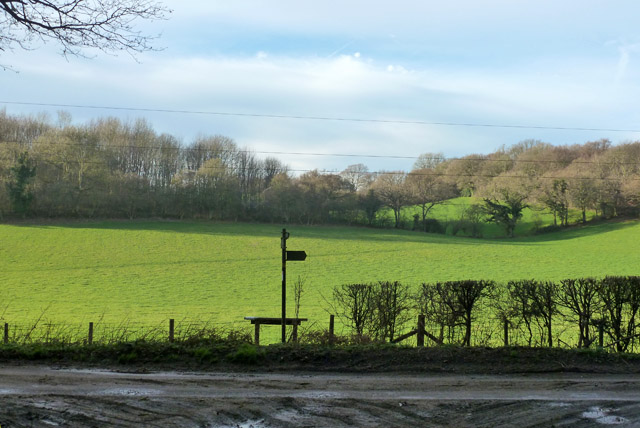
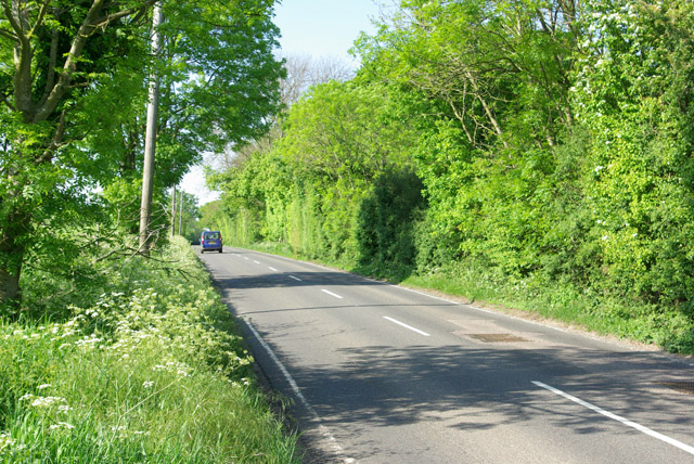
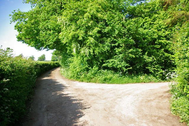
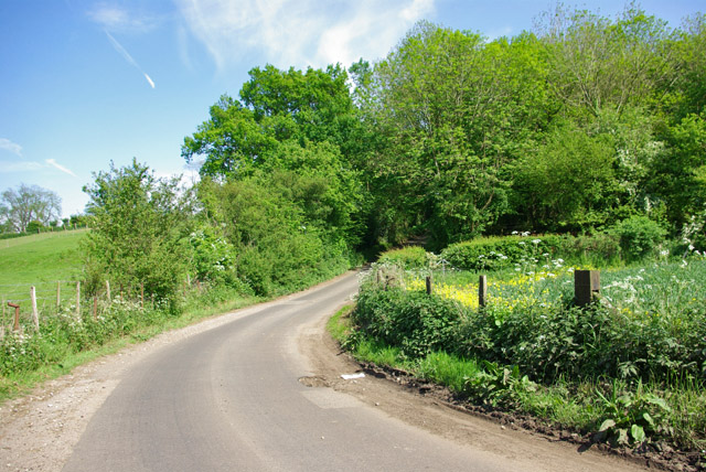
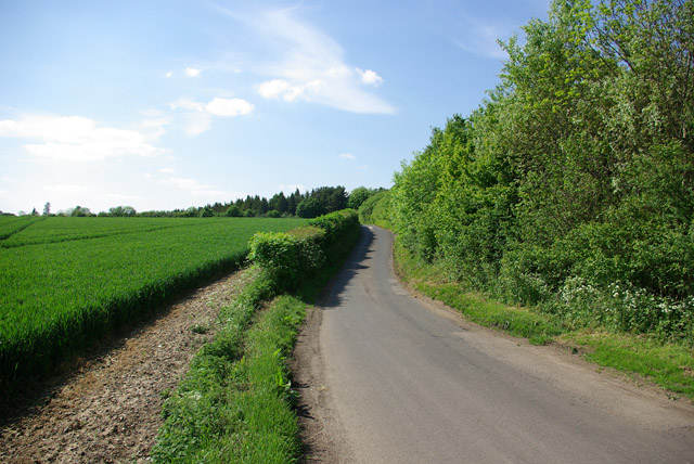
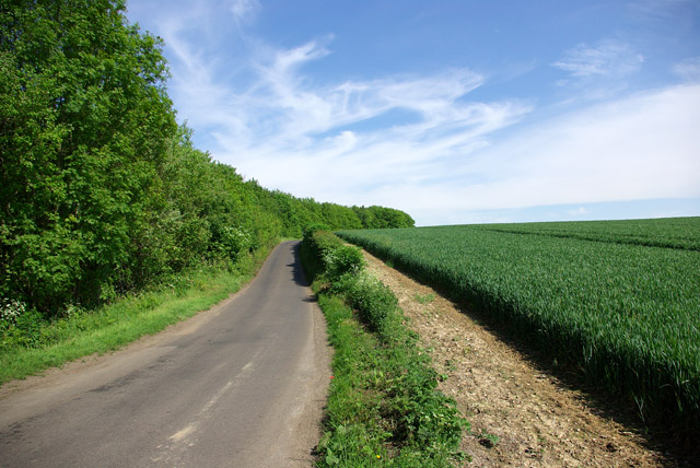
Church Wood is a beautiful woodland located in the county of Kent, England. Situated near the village of Otford, the wood covers an area of approximately 50 acres and is a popular destination for nature enthusiasts and walkers alike.

The wood is known for its diverse range of tree species, including oak, beech, and ash, which create a rich and vibrant canopy. The undergrowth is home to a variety of plants such as bluebells, wild garlic, and ferns, adding to the woodland's charm and natural beauty.

Church Wood is also a haven for wildlife, with a wide range of bird species including woodpeckers, tits, and finches, making it a perfect spot for birdwatching. Additionally, the wood is home to mammals such as deer, foxes, and squirrels, which can often be spotted darting through the trees.

A network of well-maintained footpaths crisscrosses the wood, allowing visitors to explore its hidden corners and enjoy the peaceful atmosphere. The paths are clearly marked, making it easy to navigate through the woodland and discover its hidden gems, such as a picturesque pond and a small stream.

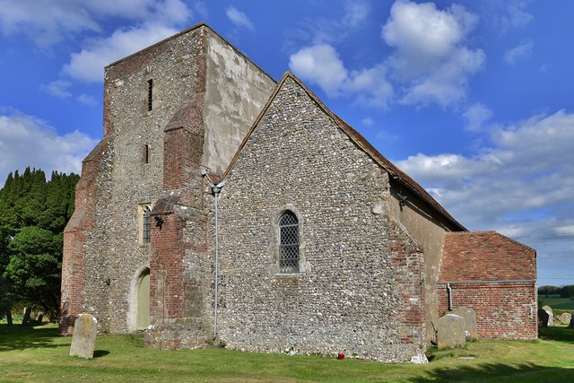
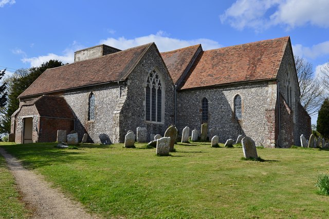
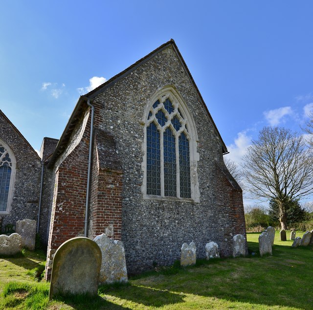
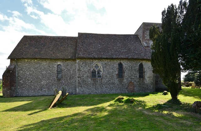
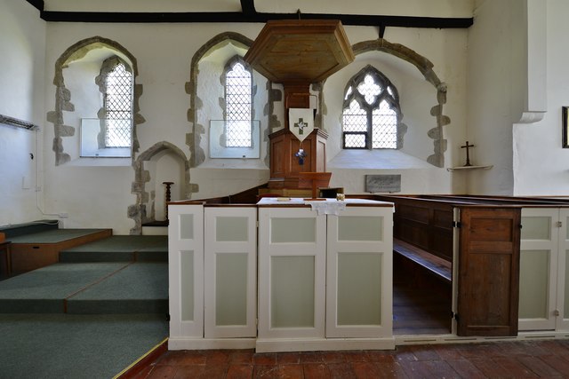
One of the highlights of Church Wood is its historic association with the nearby St. Bartholomew's Church, which dates back to the 12th century. The wood is believed to have been managed by the church for centuries, and remnants of ancient boundary markers can still be seen within its boundaries.

Overall, Church Wood is a delightful place to visit, offering a tranquil escape from the bustle of everyday life and providing a glimpse into the natural beauty of Kent's woodlands.

If you have any feedback on the listing, please let us know in the comments section below.

Church Wood Images

Images are sourced within 2km of 51.192899/1.0654044 or Grid Reference TR1448. Thanks to Geograph Open Source API. All images are credited.

Footpath sign and stile The start of a footpath principally to Stelling Minnis common. Despite foreground appearances, this is the junction of two tarmac lanes. There is a lot of mud washed down the lanes to this low point.
Footpath sign and stile
The start of a footpath principally to Stelling Minnis common. Despite foreground appearances, this is the junction of two tarmac lanes. There is a lot of mud washed down the lanes to this low point.
Stone Street - a Roman road The B2068 aligns with the Roman road south from Canterbury to the former coast at Lympne.
Stone Street - a Roman road
The B2068 aligns with the Roman road south from Canterbury to the former coast at Lympne.
Lane junction near North Leigh The through route turns right. Straight on is a short approach to premises with no public continuation.
Lane junction near North Leigh
The through route turns right. Straight on is a short approach to premises with no public continuation.
Lime Kiln Lane From Bossingham towards Stone Street.
Lime Kiln Lane
From Bossingham towards Stone Street.
Lime Kiln Lane From Bossingham towards Stone Street.
Lime Kiln Lane
From Bossingham towards Stone Street.
Lime Kiln Lane From Stone Street towards Bossingham.
Lime Kiln Lane
From Stone Street towards Bossingham.
Stelling: St. Mary's Church
Stelling, St. Mary's Church: Rustic Georgian interior 1
Stelling, St. Mary's Church: Rustic Georgian interior 2
Stelling, St. Mary's Church: Rustic Georgian interior 3, three-decker pulpit
Stelling, St. Mary's Church: Rustic Georgian interior 4, three-decker pulpit
Stelling, St. Mary's Church: Rustic Georgian interior 5
Stelling, St. Mary's Church: The font
Stelling, St. Mary's Church: Rustic Georgian interior 6
Stelling, St. Mary's Church: Rustic Georgian interior 7
Show me another place!

Church Wood is located at Grid Ref: TR1448 (Lat: 51.192899, Lng: 1.0654044)

Administrative County: Kent

District: Shepway

Police Authority: Kent

What 3 Words

///manhole.equity.staples. Near Barham, Kent

Nearby Locations

Church Wood

Related Wikis

Bossingham

Bossingham is a village in the parish of Upper Hardres and the district of the City of Canterbury, Kent, England. It is located about five miles (8 km...

Stelling Minnis

Stelling Minnis is a village and civil parish in the Folkestone and Hythe district in Kent, England. The village lies 13 kilometres (8 mi) to the south...

Davison's Mill, Stelling Minnis

Davison's Mill, also known as Stelling Minnis Windmill, is a Grade I listed smock mill in Stelling Minnis, Kent, England that was built in 1866. It was...

Lynsore Bottom

Lynsore Bottom is a 70.6-hectare (174-acre) biological Site of Special Scientific Interest north of Folkestone in Kent.These coppice with standards woods...

Nearby Amenities

Located within 500m of 51.192899,1.0654044
Post Box
Postal Code: CT4
Ref: CT4 330
Source: survey
Lat/Long: 51.1922116/1.0715135
Bus Stop
Locks Garage
Flag: no
Naptan AtcoCode: 2400A043210A
Naptan Bearing: S
Naptan BusStopType: CUS
Naptan CommonName: Locks Garage
Naptan Indicator: opp
Naptan Landmark: Split Lane
Naptan NaptanCode: kntdtpag
Naptan Street: Bossingham Road
Naptan Verified: no
Public Transport: platform
Source: naptan_import
Lat/Long: 51.1932843/1.0721226
Barrier: stile
Lat/Long: 51.1889743/1.062317
Barrier: bollard
Lat/Long: 51.189432/1.0669012
Barrier: stile
Lat/Long: 51.192645/1.0640477
Barrier: bollard
Lat/Long: 51.1933403/1.07168
Barrier: stile
Lat/Long: 51.193849/1.071299
Barrier: stile
Lat/Long: 51.1965594/1.0650824
Generator Method: photovoltaic
Generator Output Electricity: yes
Generator Source: solar
Generator Type: solar_photovoltaic_panel
Location: roof
Power: generator
Lat/Long: 51.1901239/1.0698929
Generator Method: photovoltaic
Generator Output Electricity: yes
Generator Source: solar
Generator Type: solar_photovoltaic_panel
Location: roof
Power: generator
Lat/Long: 51.1901491/1.0699587
Generator Method: photovoltaic
Generator Output Electricity: yes
Generator Source: solar
Generator Type: solar_photovoltaic_panel
Location: roof
Power: generator
Lat/Long: 51.1901962/1.0699265
Generator Method: photovoltaic
Generator Output Electricity: yes
Generator Source: solar
Generator Type: solar_photovoltaic_panel
Location: roof
Power: generator
Lat/Long: 51.1901231/1.0700364
Power: pole
Lat/Long: 51.1943721/1.0605772
Power: pole
Lat/Long: 51.1944742/1.062036
Power: pole
Lat/Long: 51.1946216/1.0634276
Power: pole
Lat/Long: 51.1934253/1.0586275
Power: pole
Lat/Long: 51.1922501/1.0584618
Power: pole
Lat/Long: 51.1955321/1.0647012
Power: pole
Lat/Long: 51.1963371/1.0657579
Power: pole
Lat/Long: 51.1970894/1.0668363
Power: pole
Lat/Long: 51.1947882/1.0637001
The data included in this document is from www.openstreetmap.org. The data is made available under ODbL.

Have you been to Church Wood?

Leave your review of Church Wood below (or comments, questions and feedback).