Auchertyre

Settlement in Ross-shire

Scotland

Auchertyre

A87 at Nostie Bridge
A87 at Nostie Bridge Credit: Steven Brown

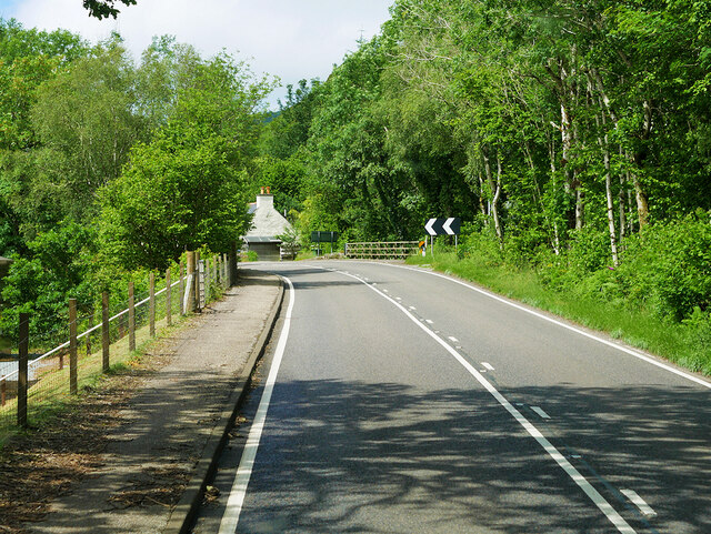
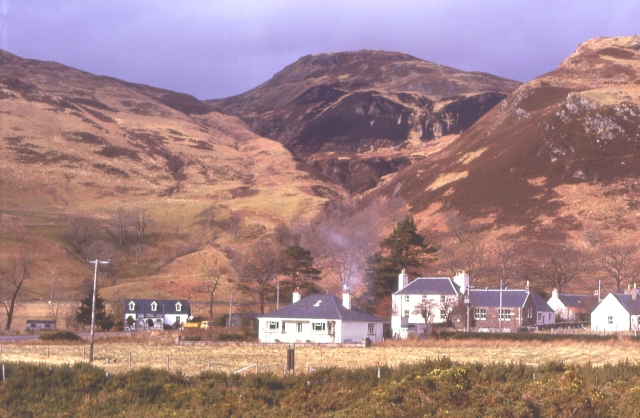
Auchertyre is a small village located in Ross-shire, Scotland. Situated near the western coast of the Highlands, it is nestled within a picturesque landscape renowned for its rugged beauty. The village lies approximately 14 miles northwest of Dingwall and is easily accessible by road.

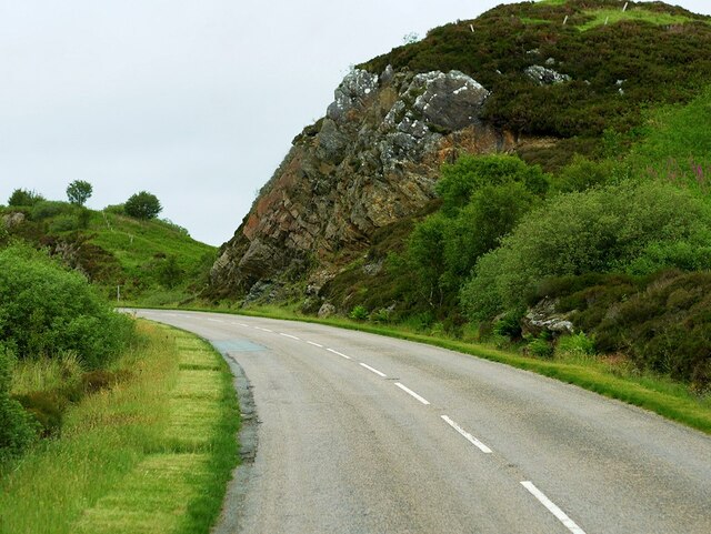
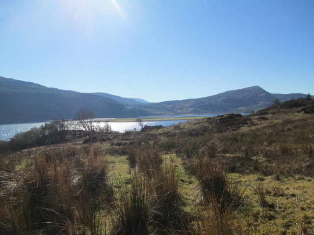
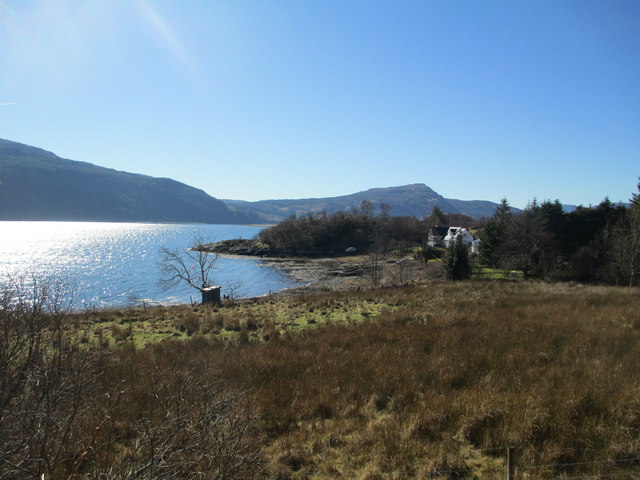
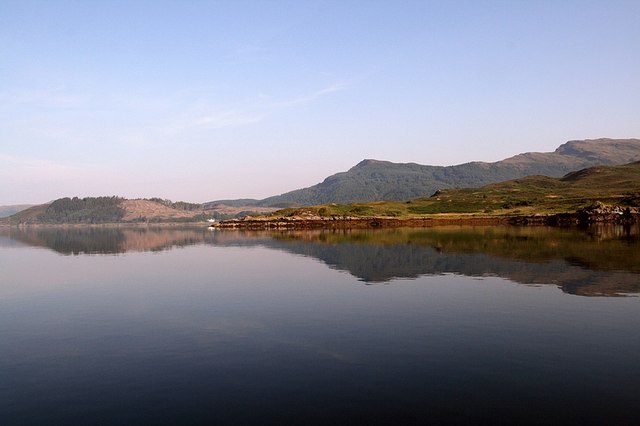
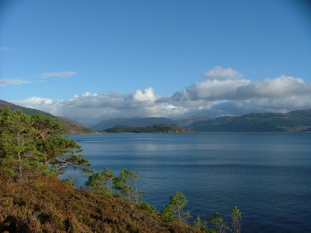
Auchertyre is defined by its tranquil and idyllic setting, surrounded by rolling hills, lush greenery, and panoramic views of the nearby lochs and mountains. The area offers a haven for outdoor enthusiasts, with ample opportunities for hiking, fishing, and wildlife spotting. The nearby Fannichs mountain range attracts climbers and hillwalkers from far and wide.

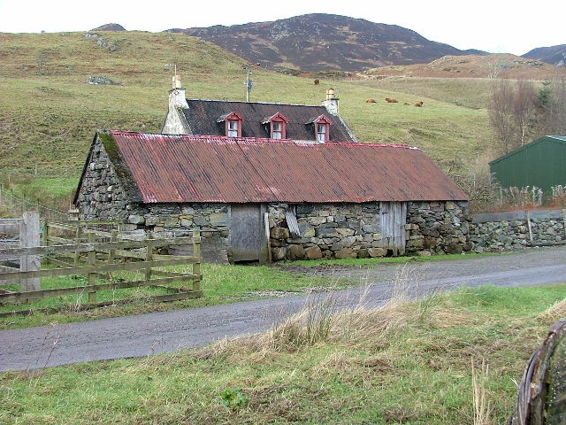
The village itself has a small population, with a tight-knit community that takes pride in its heritage and natural surroundings. Traditional Scottish architecture can be seen in the quaint stone houses and buildings that line the streets. Auchertyre has limited amenities, with a few local shops, a pub, and a primary school serving the local residents.

Despite its remote location, Auchertyre is not far from larger towns and cities. Inverness, the capital of the Highlands, is approximately a 40-minute drive away, offering a wider range of amenities, shopping centers, and transport links.

Auchertyre is a hidden gem for those seeking a peaceful retreat in the heart of the Scottish Highlands, where natural beauty and a strong sense of community prevail.

If you have any feedback on the listing, please let us know in the comments section below.

Auchertyre Images

Images are sourced within 2km of 57.282398/-5.5853711 or Grid Reference NG8427. Thanks to Geograph Open Source API. All images are credited.

A87 at Nostie Bridge
A87 at Kirkton
A87 at Kirkton
Lichens on Old Oak In amongst the small pocket of Atlantic Oakwoods above Reraig and this old dead oak has an array of lichens - probably Beard or Horsehair Lichen - growing on it.
A lovely walk to do on a wet summer's day. Some information here:-
<span class="nowrap"><a title="https://forestryandland.gov.scot/visit/balmacara-woods" rel="nofollow ugc noopener" href="https://forestryandland.gov.scot/visit/balmacara-woods">Link</a><img style="margin-left:2px;" alt="External link" title="External link - shift click to open in new window" src="https://s1.geograph.org.uk/img/external.png" width="10" height="10"/></span>
Lichens on Old Oak
In amongst the small pocket of Atlantic Oakwoods above Reraig and this old dead oak has an array of lichens - probably Beard or Horsehair Lichen - growing on it. A lovely walk to do on a wet summer's day. Some information here:- LinkExternal link
Mighty Larch Trunks These big mature Larch Trees are at the bottom of one of the woodland walks above Reraig and Balmacara. You can see evidence of the damage from last winter's storms.
Mighty Larch Trunks
These big mature Larch Trees are at the bottom of one of the woodland walks above Reraig and Balmacara. You can see evidence of the damage from last winter's storms.
A87 at Nostie Bridge
A87 approaching Junction with A890 The A87 is a primary route  in the Highland region of Scotland. It runs west for 99 miles from its junction with the A82 at Invergarry, along the north shores of Loch Garry and Loch Cluanie, then through Glen Shiel and along Loch Duich to Kyle of Lochalsh before crossing the Skye Bridge to Kyleakin, Broadford, and Portree, before terminating at Uig in the north of the Isle of Skye.
A87 approaching Junction with A890
The A87 is a primary route in the Highland region of Scotland. It runs west for 99 miles from its junction with the A82 at Invergarry, along the north shores of Loch Garry and Loch Cluanie, then through Glen Shiel and along Loch Duich to Kyle of Lochalsh before crossing the Skye Bridge to Kyleakin, Broadford, and Portree, before terminating at Uig in the north of the Isle of Skye.
A87, Auchtertyre The A87 is a primary route  in the Highland region of Scotland. It runs west for 99 miles from its junction with the A82 at Invergarry, along the north shores of Loch Garry and Loch Cluanie, then through Glen Shiel and along Loch Duich to Kyle of Lochalsh before crossing the Skye Bridge to Kyleakin, Broadford, and Portree, before terminating at Uig in the north of the Isle of Skye.
A87, Auchtertyre
The A87 is a primary route in the Highland region of Scotland. It runs west for 99 miles from its junction with the A82 at Invergarry, along the north shores of Loch Garry and Loch Cluanie, then through Glen Shiel and along Loch Duich to Kyle of Lochalsh before crossing the Skye Bridge to Kyleakin, Broadford, and Portree, before terminating at Uig in the north of the Isle of Skye.
Eastbound A87 near Kirkton The A87 is a primary route  in the Highland region of Scotland. It runs west for 99 miles from its junction with the A82 at Invergarry, along the north shores of Loch Garry and Loch Cluanie, then through Glen Shiel and along Loch Duich to Kyle of Lochalsh before crossing the Skye Bridge to Kyleakin, Broadford, and Portree, before terminating at Uig in the north of the Isle of Skye.
Eastbound A87 near Kirkton
The A87 is a primary route in the Highland region of Scotland. It runs west for 99 miles from its junction with the A82 at Invergarry, along the north shores of Loch Garry and Loch Cluanie, then through Glen Shiel and along Loch Duich to Kyle of Lochalsh before crossing the Skye Bridge to Kyleakin, Broadford, and Portree, before terminating at Uig in the north of the Isle of Skye.
A87 at Kirkton The A87 is a primary route  in the Highland region of Scotland. It runs west for 99 miles from its junction with the A82 at Invergarry, along the north shores of Loch Garry and Loch Cluanie, then through Glen Shiel and along Loch Duich to Kyle of Lochalsh before crossing the Skye Bridge to Kyleakin, Broadford, and Portree, before terminating at Uig in the north of the Isle of Skye.
A87 at Kirkton
The A87 is a primary route in the Highland region of Scotland. It runs west for 99 miles from its junction with the A82 at Invergarry, along the north shores of Loch Garry and Loch Cluanie, then through Glen Shiel and along Loch Duich to Kyle of Lochalsh before crossing the Skye Bridge to Kyleakin, Broadford, and Portree, before terminating at Uig in the north of the Isle of Skye.
A890 above Auchtertyre After leaving the A87 at Auchtertyre, the A890 rises steeply through the rocky terrain.
A890 above Auchtertyre
After leaving the A87 at Auchtertyre, the A890 rises steeply through the rocky terrain.
A890, Gleann Udalain The A890 is a non-primary cross-country route in sparsely populated, mountainous terrain from Lochalsh and Skye on the west coast of the Highlands to Achnasheen where it joins the A832 to Inverness. Like many Highland roads, the A890 was entirely single track until the 1960s, but road improvements in recent years (along with improvements on the A832) have made it increasingly popular as an alternative route between Inverness and the Isle of Skye, avoiding the A82 along Loch Ness. It is also an important route for residents of the Lochalsh, Applecross and Strathcarron areas, connecting them to the services of  Kyle of Lochalsh , as well as the High School in Plockton.
A890, Gleann Udalain
The A890 is a non-primary cross-country route in sparsely populated, mountainous terrain from Lochalsh and Skye on the west coast of the Highlands to Achnasheen where it joins the A832 to Inverness. Like many Highland roads, the A890 was entirely single track until the 1960s, but road improvements in recent years (along with improvements on the A832) have made it increasingly popular as an alternative route between Inverness and the Isle of Skye, avoiding the A82 along Loch Ness. It is also an important route for residents of the Lochalsh, Applecross and Strathcarron areas, connecting them to the services of Kyle of Lochalsh , as well as the High School in Plockton.
A87 near Reraig
A87 near Reraig
A87 at Auchtertyre
A87 at Auchtertyre
The A890 near Loch Alsh. 1966 Then a single carriageway road, photographed from a Passing place whilst waiting for a vehicle coming up hill. Note the white post near the centre of the picture, this marks the next passing place.
The A890 near Loch Alsh. 1966
Then a single carriageway road, photographed from a Passing place whilst waiting for a vehicle coming up hill. Note the white post near the centre of the picture, this marks the next passing place.
Dun NW of Kirkton, Lochalsh "A kind of hill fort and also a kind of Atlantic roundhouse."
In this case all that remains are a moss covered circle of stones.
See also <span class="nowrap"><a title="http://canmore.org.uk/site/11859/kirkton" rel="nofollow ugc noopener" href="http://canmore.org.uk/site/11859/kirkton">Link</a><img style="margin-left:2px;" alt="External link" title="External link - shift click to open in new window" src="https://s1.geograph.org.uk/img/external.png" width="10" height="10"/></span>
Dun NW of Kirkton, Lochalsh
"A kind of hill fort and also a kind of Atlantic roundhouse." In this case all that remains are a moss covered circle of stones. See also LinkExternal link
Footpath - the Red Trail Part of the Forestry Commission walks network starting from Balmacara Square.
This is the steep(-er than it looks) section in the oak wood above the path between Reraig and Kirkton.
Footpath - the Red Trail
Part of the Forestry Commission walks network starting from Balmacara Square. This is the steep(-er than it looks) section in the oak wood above the path between Reraig and Kirkton.
Loch Alsh from Avernish
Nostie Bay
Nostie Bay
Show me another place!

Auchertyre is located at Grid Ref: NG8427 (Lat: 57.282398, Lng: -5.5853711)

Unitary Authority: Highland

Police Authority: Highlands and Islands

What 3 Words

///unsecured.fond.loaded. Near Glenelg, Highland

Nearby Locations

Auchertyre

Related Wikis

Auchtertyre

Auchtertyre (Scottish Gaelic: Uachdar Thìre, "Upper Land") is a village, lying half a mile from the north shore of Loch Alsh near Kyle of Lochalsh, in...

Avernish

Avernish (Scottish Gaelic: Abhairnis) is a small, scenic, rural community located in the Highlands of Scotland. Nearby attractions include The Eilean...

Nostie

Nostie (Scottish Gaelic: Ceann na Mòna) is a small remote hamlet, lying on Nostie Bay, an inlet at the northeastern end of the sea loch, Loch Alsh in the...

Balmacara Square

Balmacara Square (Scottish Gaelic: Ceàrnag Bhaile Mac Carra) is a small village, close to Balmacara, in Lochlash, Scottish Highlands and is in the council...

Balmacara

Balmacara (Scottish Gaelic: Baile MacRath) is a scattered village on the north shore of Loch Alsh near Kyle of Lochalsh, Ross-shire, Highland and is in...

Ardelve

Ardelve (Scottish Gaelic: Àird Eilbh) is a village in Highland, Scotland, on Loch Alsh. It overlooks the Eilean Donan Castle, which is in Dornie, also...

Caisteal Grugaig

Caisteal Grugaig (or Dun Totaig) is an Iron Age broch near the eastern end of Loch Alsh in the Scottish Highlands (grid reference NG86682508). == Location... ==

Balmacara Bay

Balmacara Bay is a remote wide mouthed embayment on a 193° orientation, located on the north shore of the Lochalsh peninsula, on the north coast of sea...

Nearby Amenities

Located within 500m of 57.282398,-5.5853711
Created By: Merkaartor 0.12
Lat/Long: 57.285649/-5.58106
Created By: Merkaartor 0.12
Lat/Long: 57.2855089/-5.5804754
Created By: Merkaartor 0.12
Lat/Long: 57.2867507/-5.586801
Created By: Merkaartor 0.12
Lat/Long: 57.28676/-5.5863729
Auchtertyre
Name Gd: Uachdar Thire
Place: village
Source: survey
Wikidata: Q4819478
Wikipedia: en:Auchtertyre
Lat/Long: 57.2862138/-5.5851768
Post Box
Ref: IV40 2
Source: survey
Source Ref: dracos
Lat/Long: 57.2865749/-5.5856214
Bus Stop
Bus: yes
Public Transport: platform
Source: survey
Lat/Long: 57.2865985/-5.5857129
Bus Stop
Auchtertyre
Direction: E
Long Name: Auchtertyre, opp Business Park
Naptan AtcoCode: 6700712382
Naptan Bearing: E
Naptan CommonName: Auchtertyre
Naptan Indicator: at Road End
Naptan Landmark: Auchtertyre Main Road
Naptan NaptanCode: 45323767
Naptan Street: A87
Naptan Verified: no
Source: naptan_import
Lat/Long: 57.285877/-5.5867908
Bus Stop
Auchtertyre
Naptan AtcoCode: 6700712382A
Naptan Bearing: W
Naptan CommonName: Auchtertyre
Naptan Indicator: opp School Road End
Naptan Landmark: School Road End
Naptan NaptanCode: 45324693
Naptan Street: A87
Naptan Verified: no
Source: naptan_import
Lat/Long: 57.2855906/-5.5864309
Ele: 126
Natural: peak
Lat/Long: 57.281227/-5.5832802
Power: pole
Lat/Long: 57.2840047/-5.5779854
Power: pole
Lat/Long: 57.2839206/-5.5794442
Power: pole
Lat/Long: 57.2838417/-5.5808488
Power: pole
Lat/Long: 57.2853715/-5.5913528
Power: pole
Lat/Long: 57.2853159/-5.5894052
Power: pole
Lat/Long: 57.2852562/-5.5875418
Power: pole
Lat/Long: 57.2855213/-5.5868171
Power: pole
Lat/Long: 57.2854373/-5.5858845
Power: pole
Lat/Long: 57.285327/-5.584774
Power: pole
Lat/Long: 57.2851691/-5.5831934
Power: pole
Lat/Long: 57.2847476/-5.5824424
Power: pole
Lat/Long: 57.2843103/-5.5816737
Power: pole
Lat/Long: 57.2856372/-5.5856389
Power: pole
Lat/Long: 57.286246/-5.5849869
Power: pole
Lat/Long: 57.2865666/-5.5846399
The data included in this document is from www.openstreetmap.org. The data is made available under ODbL.

Have you been to Auchertyre?

Leave your review of Auchertyre below (or comments, questions and feedback).