Violet Grove

Wood, Forest in Essex Tendring

England

Violet Grove

Weeley Footpath 18 A short path before it becomes St Osyth Footpath 15.
Weeley Footpath 18 Credit: Glyn Baker

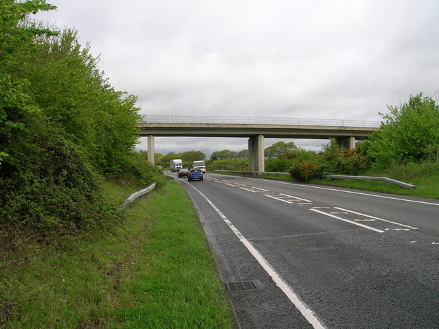
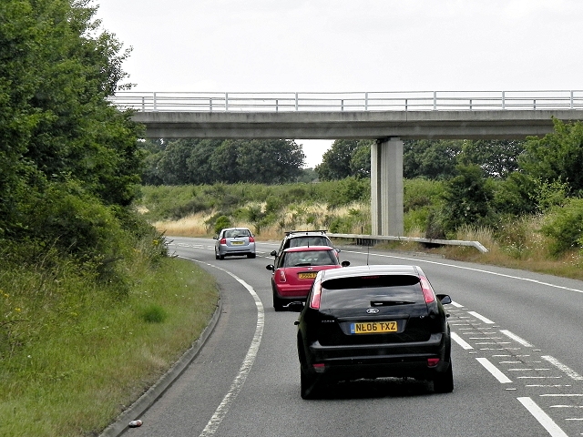
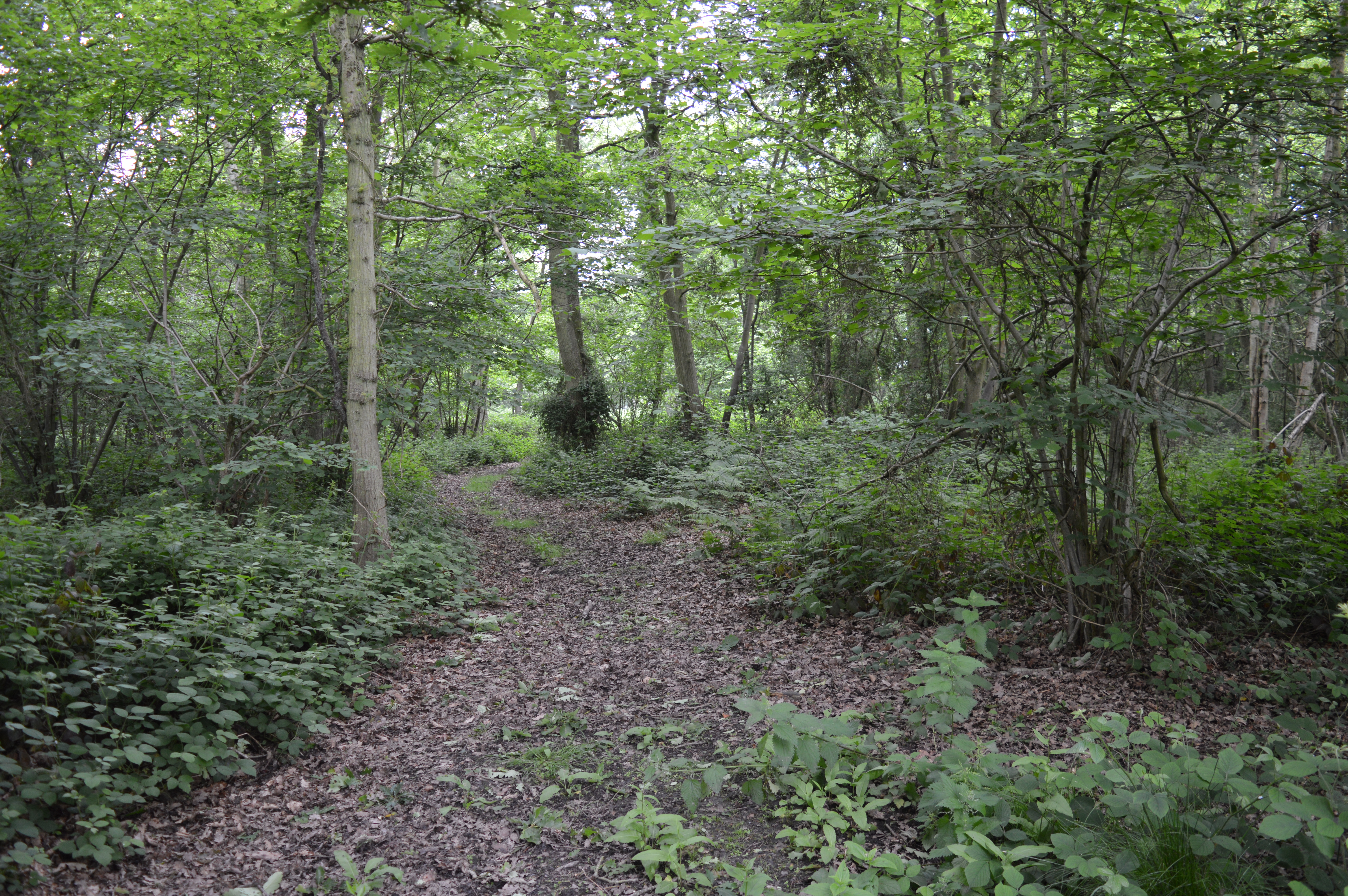
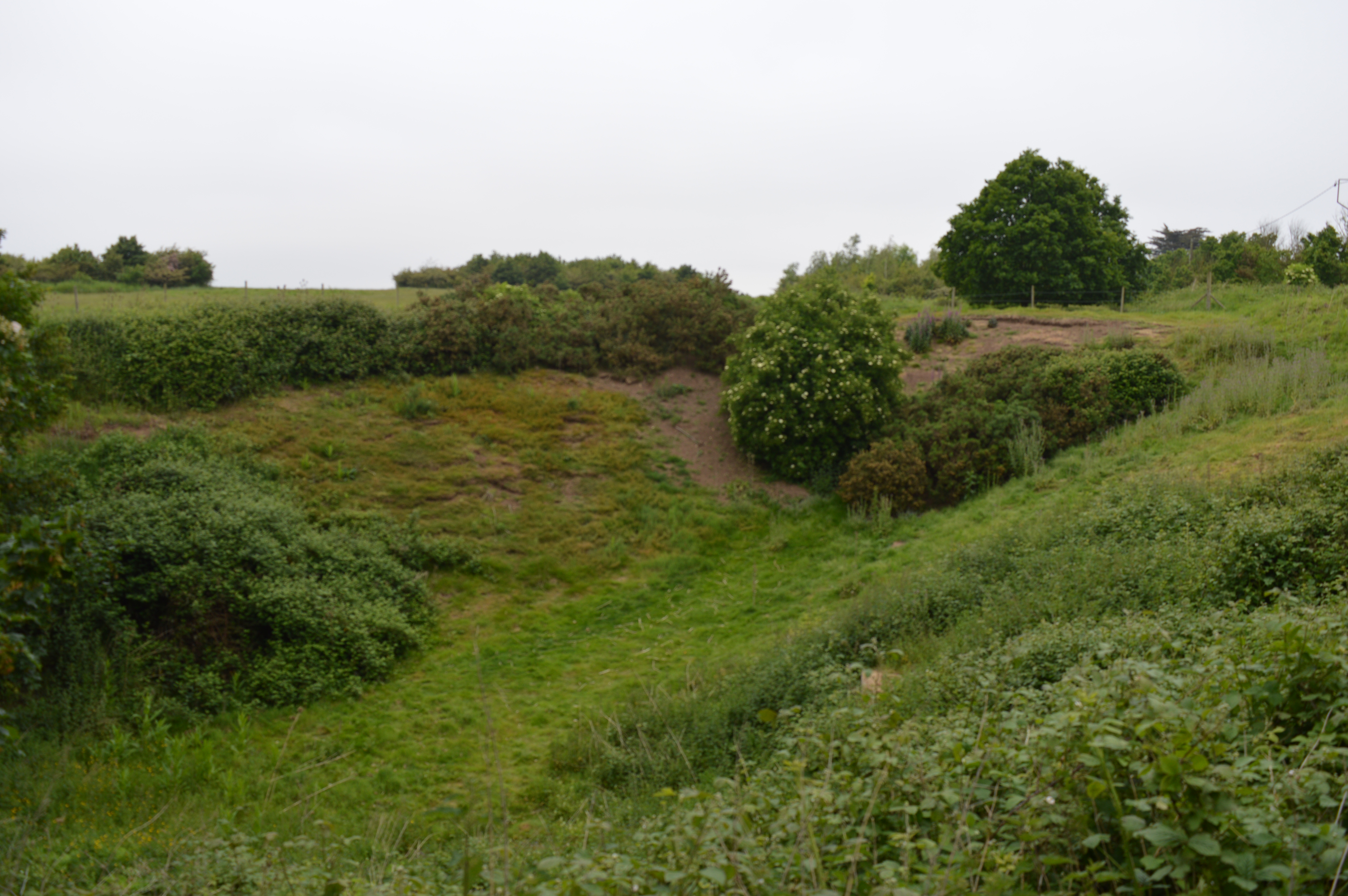
Violet Grove is a charming residential area located in the county of Essex, England. Situated amidst the scenic woodlands and forests, it offers a tranquil and picturesque setting for its residents. The community is nestled in a verdant landscape, surrounded by lush greenery and tall trees, providing a peaceful and idyllic environment.

The village of Violet Grove is known for its natural beauty and is often sought after by nature enthusiasts and those seeking a retreat from the bustling city life. The woodlands and forests in the vicinity offer ample opportunities for outdoor activities such as hiking, cycling, and birdwatching. The area is also home to an array of native wildlife, making it a haven for nature lovers.

Despite its serene atmosphere, Violet Grove is well-connected to the surrounding areas. It is conveniently located near major transportation routes, allowing residents easy access to nearby towns and cities. The village is also equipped with essential amenities, including shops, schools, and healthcare facilities, ensuring that residents have all the necessary conveniences within reach.

The architectural style of the houses in Violet Grove reflects a blend of traditional and contemporary designs, offering a variety of housing options to suit different preferences. The community prides itself on its close-knit atmosphere, with friendly neighbors and a strong sense of community spirit.

In summary, Violet Grove in Essex is a charming village nestled in woodlands and forests. With its natural beauty, convenient location, and strong community spirit, it offers a peaceful and picturesque place to call home.

If you have any feedback on the listing, please let us know in the comments section below.

Violet Grove Images

Images are sourced within 2km of 51.829035/1.0995942 or Grid Reference TM1319. Thanks to Geograph Open Source API. All images are credited.

Weeley Footpath 18 A short path before it becomes St Osyth Footpath 15.
Weeley Footpath 18
A short path before it becomes St Osyth Footpath 15.
Bentley Road Bridge over A133 Passing over  <a href="https://www.geograph.org.uk/photo/7592415">TM1420 : The A133</a>
Bentley Road Bridge over A133
Passing over TM1420 : The A133
The A133 The Clacton to Colchester Rd looking towards Colchester. 
Taken from <a href="https://www.geograph.org.uk/photo/7592412">TM1420 : Bentley Road Bridge over A133</a>
The A133
The Clacton to Colchester Rd looking towards Colchester. Taken from TM1420 : Bentley Road Bridge over A133
Gate to Little Tofts Wood Little Tofts is privately owned. However behind it marked on the OS 1:25,000 map  is a right to roam area. This is Tofts Wood it is owned by the Woodland Trust <span class="nowrap"><a title="https://www.woodlandtrust.org.uk/visiting-woods/woods/tofts-wood/" rel="nofollow ugc noopener" href="https://www.woodlandtrust.org.uk/visiting-woods/woods/tofts-wood/">Link</a><img style="margin-left:2px;" alt="External link" title="External link - shift click to open in new window" src="https://s1.geograph.org.uk/img/external.png" width="10" height="10"/></span> however there are no signs erected to show it. You can take a look inside at <a title="https://www.geograph.org.uk/search.php?i=188397281" href="https://www.geograph.org.uk/search.php?i=188397281">Link</a>
Gate to Little Tofts Wood
Little Tofts is privately owned. However behind it marked on the OS 1:25,000 map is a right to roam area. This is Tofts Wood it is owned by the Woodland Trust LinkExternal link however there are no signs erected to show it. You can take a look inside at Link
St Osyth Footpath 22 Revisited I had a distinct feeling of  Déjà vu when taking this shot. When I got  home I found memory was not playing tricks see <a href="https://www.geograph.org.uk/photo/2379816">TM1320 : Footpath Past Tofts Wood</a>.
St Osyth Footpath 22 Revisited
I had a distinct feeling of Déjà vu when taking this shot. When I got home I found memory was not playing tricks see TM1320 : Footpath Past Tofts Wood.
Weeley By-pass (Mk 2) About a kilometre of road was built in the 1930s to bypass Weeley and the level crossing at <a href="https://www.geograph.org.uk/photo/124828">TM1421 : Weeley railway station</a>. That was insufficient and now this road, a 7 km stretch of the A133, has been built to enable traffic to zoom past Weeley, Weeley Heath and Little Clacton on their way to <a href="https://www.geograph.org.uk/gridref/TM1714">TM1714</a> Clacton-on-Sea. This view is from Bentley Road looking north west. The land hereabouts is described as "a fertile loamy soil, resting on gravel" <span class="nowrap"><a title="http://www.archipel.demon.co.uk/Tendring/Tend1.html" rel="nofollow ugc noopener" href="http://www.archipel.demon.co.uk/Tendring/Tend1.html">Link</a><img style="margin-left:2px;" alt="External link" title="External link - shift click to open in new window" src="https://s1.geograph.org.uk/img/external.png" width="10" height="10"/></span> . In this cutting the gravel has been exposed and gorse has started to grow on it.
Weeley By-pass (Mk 2)
About a kilometre of road was built in the 1930s to bypass Weeley and the level crossing at TM1421 : Weeley railway station. That was insufficient and now this road, a 7 km stretch of the A133, has been built to enable traffic to zoom past Weeley, Weeley Heath and Little Clacton on their way to TM1714 Clacton-on-Sea. This view is from Bentley Road looking north west. The land hereabouts is described as "a fertile loamy soil, resting on gravel" LinkExternal link . In this cutting the gravel has been exposed and gorse has started to grow on it.
Laurel House The occupiers of this house in Bentley Road, Weeley Heath value their privacy so much that they have allowed this hedge to grow to about 4 metres high.
Laurel House
The occupiers of this house in Bentley Road, Weeley Heath value their privacy so much that they have allowed this hedge to grow to about 4 metres high.
Moynes Farm in Wick Road, Great Bentley
Moynes Farm
in Wick Road, Great Bentley
Norwood Lodge
Norwood Lodge
Footpath Past Tofts Wood This footpath runs past the Woodland Trust's <span class="nowrap"><a title="http://www.woodlandtrust.org.uk/en/our-woods/Pages/about-this-wood.aspx?wood=5587" rel="nofollow ugc noopener" href="http://www.woodlandtrust.org.uk/en/our-woods/Pages/about-this-wood.aspx?wood=5587">Link</a><img style="margin-left:2px;" alt="External link" title="External link - shift click to open in new window" src="https://s1.geograph.org.uk/img/external.png" width="10" height="10"/></span> <a href="https://www.geograph.org.uk/photo/2379819">TM1320 : Tofts Wood</a> towards Gutteridge Hall
Footpath Past Tofts Wood
This footpath runs past the Woodland Trust's LinkExternal link TM1320 : Tofts Wood towards Gutteridge Hall
Tofts Wood Crab Apple blossom in the Woodland Trust's Tofts Wood <span class="nowrap"><a title="http://www.woodlandtrust.org.uk/en/our-woods/Pages/about-this-wood.aspx?wood=5587" rel="nofollow ugc noopener" href="http://www.woodlandtrust.org.uk/en/our-woods/Pages/about-this-wood.aspx?wood=5587">Link</a><img style="margin-left:2px;" alt="External link" title="External link - shift click to open in new window" src="https://s1.geograph.org.uk/img/external.png" width="10" height="10"/></span>
Tofts Wood
Crab Apple blossom in the Woodland Trust's Tofts Wood LinkExternal link
Bluebells in Toft's Wood A smattering of bluebells in the Woodland Trust's <a href="https://www.geograph.org.uk/photo/2379819">TM1320 : Tofts Wood</a>
Bluebells in Toft's Wood
A smattering of bluebells in the Woodland Trust's TM1320 : Tofts Wood
Bridge over the A133 
The A133 road runs for 19 miles between Colchester and Clacton-on-Sea. One end is at Cymbeline Way in Lexden, from where the road runs through the Avenue of Remembrance, bypassing Colchester town centre. It also runs past Wivenhoe Park, through Elmstead Market, Frating Green, meeting a spur from the A120 road at Great Bentley. The road by-passes Weeley, Weeley Heath, Little Clacton, Great Clacton ending in Clacton on Sea (<span class="nowrap"><a title="http://en.wikipedia.org/wiki/A133_road" rel="nofollow ugc noopener" href="http://en.wikipedia.org/wiki/A133_road">Link</a><img style="margin-left:2px;" alt="External link" title="External link - shift click to open in new window" src="https://s1.geograph.org.uk/img/external.png" width="10" height="10"/></span>  Wikipedia).
Bridge over the A133
The A133 road runs for 19 miles between Colchester and Clacton-on-Sea. One end is at Cymbeline Way in Lexden, from where the road runs through the Avenue of Remembrance, bypassing Colchester town centre. It also runs past Wivenhoe Park, through Elmstead Market, Frating Green, meeting a spur from the A120 road at Great Bentley. The road by-passes Weeley, Weeley Heath, Little Clacton, Great Clacton ending in Clacton on Sea (LinkExternal link Wikipedia).
A133 towards Colchester 
The A133 road runs for 19 miles between Colchester and Clacton-on-Sea. One end is at Cymbeline Way in Lexden, from where the road runs through the Avenue of Remembrance, bypassing Colchester town centre. It also runs past Wivenhoe Park, through Elmstead Market, Frating Green, meeting a spur from the A120 road at Great Bentley. The road by-passes Weeley, Weeley Heath, Little Clacton, Great Clacton ending in Clacton on Sea (<span class="nowrap"><a title="http://en.wikipedia.org/wiki/A133_road" rel="nofollow ugc noopener" href="http://en.wikipedia.org/wiki/A133_road">Link</a><img style="margin-left:2px;" alt="External link" title="External link - shift click to open in new window" src="https://s1.geograph.org.uk/img/external.png" width="10" height="10"/></span>  Wikipedia).
A133 towards Colchester
The A133 road runs for 19 miles between Colchester and Clacton-on-Sea. One end is at Cymbeline Way in Lexden, from where the road runs through the Avenue of Remembrance, bypassing Colchester town centre. It also runs past Wivenhoe Park, through Elmstead Market, Frating Green, meeting a spur from the A120 road at Great Bentley. The road by-passes Weeley, Weeley Heath, Little Clacton, Great Clacton ending in Clacton on Sea (LinkExternal link Wikipedia).
Farmland, Weeley Heath
Wet arable land near Moynes Farm, Great Bentley Very heavy rainfall the previous day has left its mark in the tractor tracks on this arable land near Moynes Farm, Great Bentley.
Wet arable land near Moynes Farm, Great Bentley
Very heavy rainfall the previous day has left its mark in the tractor tracks on this arable land near Moynes Farm, Great Bentley.
Dog training ground, Tye Lodge, Great Bentley What appears to be various apparatus for training dogs, as seen from a public footpath near Tye Lodge, Great Bentley.
Dog training ground, Tye Lodge, Great Bentley
What appears to be various apparatus for training dogs, as seen from a public footpath near Tye Lodge, Great Bentley.
Rectory Road Bridge over the A133 at Weeley Heath 
The A133 road runs for 19 miles between Colchester and Clacton-on-Sea. One end is at Cymbeline Way in Lexden, from where the road runs through the Avenue of Remembrance, bypassing Colchester town centre. It also runs past Wivenhoe Park, through Elmstead Market, Frating Green, meeting a spur from the A120 road at Great Bentley. The road by-passes Weeley, Weeley Heath, Little Clacton, Great Clacton ending in Clacton on Sea (<span class="nowrap"><a title="http://en.wikipedia.org/wiki/A133_road" rel="nofollow ugc noopener" href="http://en.wikipedia.org/wiki/A133_road">Link</a><img style="margin-left:2px;" alt="External link" title="External link - shift click to open in new window" src="https://s1.geograph.org.uk/img/external.png" width="10" height="10"/></span>  Wikipedia).
Rectory Road Bridge over the A133 at Weeley Heath
The A133 road runs for 19 miles between Colchester and Clacton-on-Sea. One end is at Cymbeline Way in Lexden, from where the road runs through the Avenue of Remembrance, bypassing Colchester town centre. It also runs past Wivenhoe Park, through Elmstead Market, Frating Green, meeting a spur from the A120 road at Great Bentley. The road by-passes Weeley, Weeley Heath, Little Clacton, Great Clacton ending in Clacton on Sea (LinkExternal link Wikipedia).
Show me another place!

Violet Grove is located at Grid Ref: TM1319 (Lat: 51.829035, Lng: 1.0995942)

Administrative County: Essex

District: Tendring

Police Authority: Essex

What 3 Words

///improvise.reissued.looked. Near Little Clacton, Essex

Related Wikis

St Osyth Heath

St Osyth Heath is a hamlet in the Tendring district, in the county of Essex, England. Until the mid-1900s, The Heath was a thriving community with shops...

Riddles Wood

Riddles Wood is a 37.3-hectare (92-acre) biological Site of Special Scientific Interest between Brightlingsea and Clacton-on-Sea in Essex.The site has...

Row Heath

Row Heath is a hamlet on Rectory Road in the Tendring district, in the county of Essex, England. The hamlet is near the A133 road between Weeley Heath...

Weeley Heath

Weeley Heath is a hamlet on the B1441 road and the B1414 road, in the Tendring district, in the English county of Essex. Nearby settlements include the...

Weeley

Weeley is a village and civil parish in Tendring, east Essex, England. The population of the parish at the 2011 Census was 1,768. It is served by Weeley...

Little Clacton

Little Clacton is a village and civil parish in the Tendring district, in the county of Essex, England. It is located on the Tendring Peninsula, close...

St Osyth Pit

St Osyth Pit is a 0.1-hectare (0.25-acre) geological Site of Special Scientific Interest north of St Osyth in Essex. It is a Geological Conservation Review...

Weeleyhall Wood

Weeleyhall Wood is a 31 hectare biological Site of Special Scientific Interest north of Clacton-on-Sea in Essex. It is managed by the Essex Wildlife Trust...

Nearby Amenities

Located within 500m of 51.829035,1.0995942
Power: pole
Source: bing
Lat/Long: 51.830389/1.1000955
Power: pole
Source: bing
Lat/Long: 51.830761/1.0960673
Power: pole
Source: bing
Lat/Long: 51.8303589/1.09734
Power: pole
Source: bing
Lat/Long: 51.8304566/1.102772
Power: pole
Source: bing
Lat/Long: 51.8288543/1.0961027
Power: pole
Source: bing
Lat/Long: 51.8304112/1.1012346
Power: pole
Source: bing
Lat/Long: 51.8303686/1.0986586
Power: pole
Source: bing
Lat/Long: 51.8296644/1.0967784
Power: pole
Source: bing
Lat/Long: 51.8311647/1.0948131
The data included in this document is from www.openstreetmap.org. The data is made available under ODbL.

Have you been to Violet Grove?

Leave your review of Violet Grove below (or comments, questions and feedback).