Shair Wood

Wood, Forest in Essex Tendring

England

Shair Wood

Rowhernes Lane Again <a href="https://www.geograph.org.uk/photo/7571126">TM1023 : Rowhernes Lane</a> is an other route with public access it is giving a passable impression of a field margin at this point.
Rowhernes Lane Again Credit: Glyn Baker

Shair Wood is a charming and picturesque forest area located in Essex, England. Covering an expansive area, it is nestled amidst the beautiful countryside, offering a tranquil and serene environment for visitors to enjoy.

The woodland is primarily composed of a mixture of deciduous and coniferous trees, creating a rich and diverse ecosystem. Ancient oaks, beech, and birch trees dominate the landscape, providing a haven for various bird species, small mammals, and insects. The forest floor is adorned with carpets of wildflowers, adding bursts of color to the greenery.

Visitors to Shair Wood can explore the area via numerous walking trails that wind through the forest. These well-maintained paths offer opportunities to immerse oneself in nature, with the chance to spot wildlife and appreciate the stunning scenery. The wood is also a popular spot for birdwatching enthusiasts, who can observe species such as woodpeckers, owls, and warblers.

In addition to its natural beauty, Shair Wood offers various recreational activities for visitors. There are designated picnic areas and benches where families and friends can relax and enjoy a leisurely meal surrounded by nature. The wood also features a children's playground, providing entertainment for younger visitors.

Shair Wood is easily accessible, with ample parking available nearby. Its location away from busy urban areas ensures a peaceful visit, making it an ideal destination for those seeking an escape from the hustle and bustle of daily life.

Overall, Shair Wood in Essex is a haven of tranquility, offering a diverse range of flora and fauna, picturesque walking trails, and recreational facilities for visitors to enjoy.

If you have any feedback on the listing, please let us know in the comments section below.

Shair Wood Images

Images are sourced within 2km of 51.865738/1.0918038 or Grid Reference TM1223. Thanks to Geograph Open Source API. All images are credited.

Rowhernes Lane Again <a href="https://www.geograph.org.uk/photo/7571126">TM1023 : Rowhernes Lane</a> is an other route with public access it is giving a passable impression of a field margin at this point.
Rowhernes Lane Again
TM1023 : Rowhernes Lane is an other route with public access it is giving a passable impression of a field margin at this point.
Approaching Rowhernes On Rowhernes Lane
Approaching Rowhernes
On Rowhernes Lane
A133 Colchester Rd At Little Bentley Service Station
A133 Colchester Rd
At Little Bentley Service Station
Great Bentley Footpath 1 The path connects the A133 Colchester Rd with Heckford's Rd.
Great Bentley Footpath 1
The path connects the A133 Colchester Rd with Heckford's Rd.
Harvest Home and Admiral's Turf Farm On Great Bentley Footpath 2.
Harvest Home and Admiral's Turf Farm
On Great Bentley Footpath 2.
Footpath to Colchester Rd This is the start of Great Bentley footpath 2.
Footpath to Colchester Rd
This is the start of Great Bentley footpath 2.
Admirals Farm Drive There are extensive fields of turf around here see <a href="https://www.geograph.org.uk/photo/7571167">TM1123 : Harvest Home and Admiral's Turf Farm</a>
Admirals Farm Drive
There are extensive fields of turf around here see TM1123 : Harvest Home and Admiral's Turf Farm
The Black Boy Pub The name refers to Charles II see <a href="https://www.geograph.org.uk/photo/7592334">TM1422 : Black Boy Explanation</a>
The Black Boy Pub
The name refers to Charles II see TM1422 : Black Boy Explanation
Black Boy Explanation This sign is on the wall of the <a href="https://www.geograph.org.uk/photo/7592323">TM1422 : The Black Boy Pub</a> in Weeley.
Black Boy Explanation
This sign is on the wall of the TM1422 : The Black Boy Pub in Weeley.
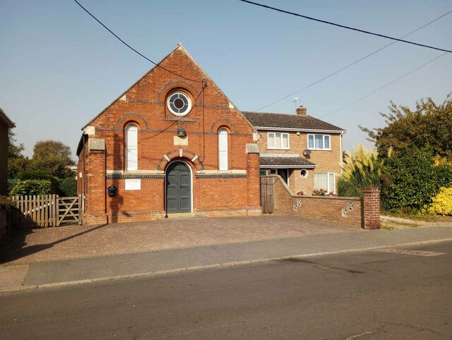
Plymouth Brethren Church In my book a place of this size in a village would be a chapel. However it is proudly proclaimed to be a church.
Plymouth Brethren Church
In my book a place of this size in a village would be a chapel. However it is proudly proclaimed to be a church.
The Street Looking towards First Avenue at Weeley House.
The Street
Looking towards First Avenue at Weeley House.
National School, Tendring in The Street. Built in 1842. Now the village hall.
National School, Tendring
in The Street. Built in 1842. Now the village hall.
Pylons From Crown Lane, Tendring looking south east.
Pylons
From Crown Lane, Tendring looking south east.
The Black Boy Thorpe Road, Weeley opposite The Street. This page <span class="nowrap"><a title="http://www.homeschool.co.uk/resource/the-great-historical-sandwich-by-dr-donald-stevens.html" rel="nofollow ugc noopener" href="http://www.homeschool.co.uk/resource/the-great-historical-sandwich-by-dr-donald-stevens.html">Link</a><img style="margin-left:2px;" alt="External link" title="External link - shift click to open in new window" src="https://s1.geograph.org.uk/img/external.png" width="10" height="10"/></span> claims that "any public house called The Black Boy is named after Charles II". Certainly, in this case Charles II appears on the inn sign - just visible at far left.
The Black Boy
Thorpe Road, Weeley opposite The Street. This page LinkExternal link claims that "any public house called The Black Boy is named after Charles II". Certainly, in this case Charles II appears on the inn sign - just visible at far left.
Brett's Hall in Crown Lane, Tendring
Brett's Hall
in Crown Lane, Tendring
Bowling Green pub in the service area at the point where the new <a href="https://www.geograph.org.uk/photo/124855">TM1420 : Weeley By-pass (Mk 2)</a> branches off from Colchester Road, Weeley
Bowling Green pub
in the service area at the point where the new TM1420 : Weeley By-pass (Mk 2) branches off from Colchester Road, Weeley
Shair Lane House on the corner of Colchester Road and Shair Lane. In fact this is in Tendring civil parish.
Shair Lane
House on the corner of Colchester Road and Shair Lane. In fact this is in Tendring civil parish.
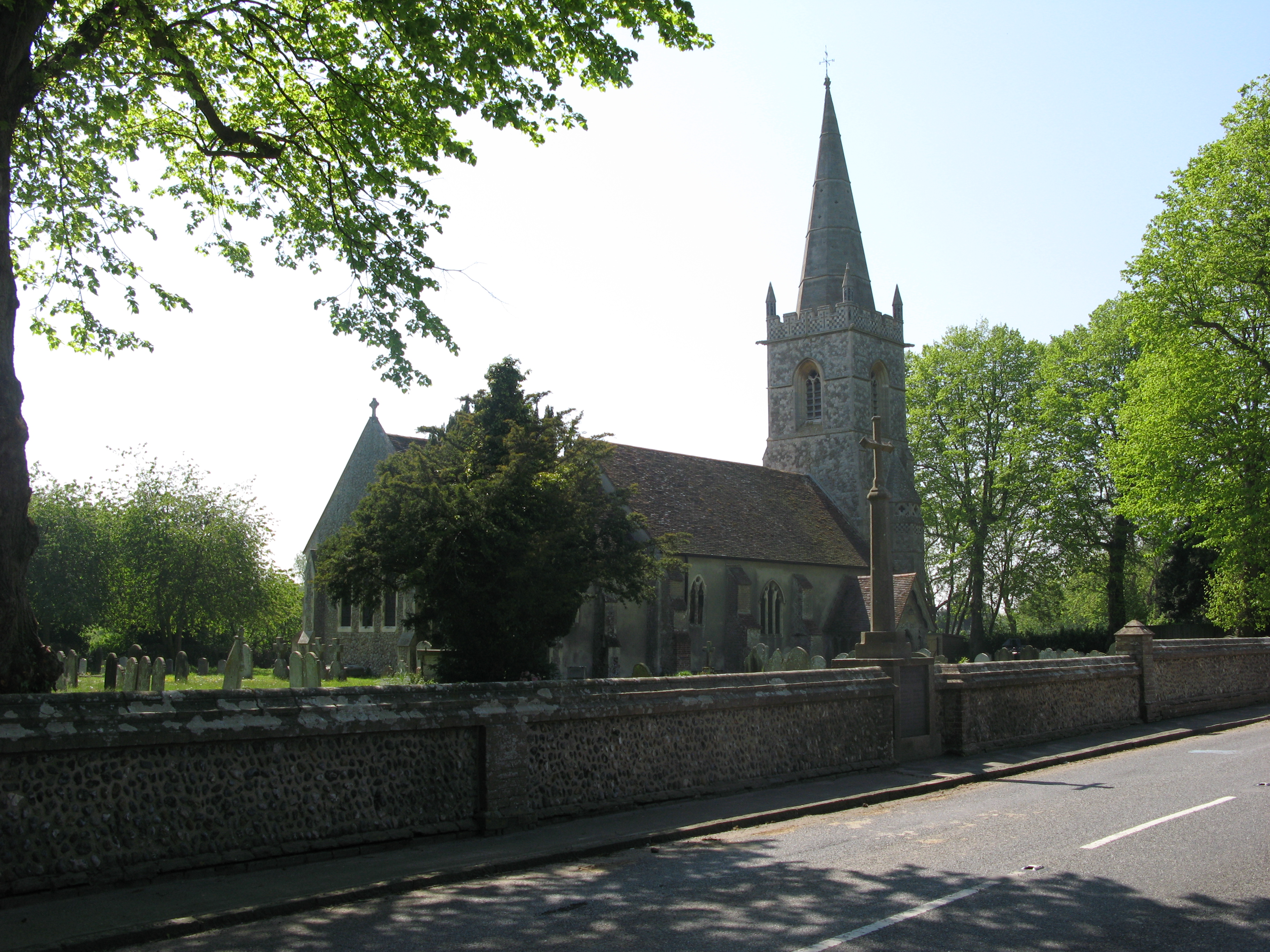
Spring House in Church Road, Little Bentley
Spring House
in Church Road, Little Bentley
Show me another place!

Shair Wood is located at Grid Ref: TM1223 (Lat: 51.865738, Lng: 1.0918038)

Administrative County: Essex

District: Tendring

Police Authority: Essex

What 3 Words

///sifts.finalists.stuck. Near Great Bentley, Essex

Nearby Locations

Shair Wood

Related Wikis

Tendring

Tendring is a village and civil parish in Essex. It gives its name to the Tendring District and before that the Tendring Hundred. Its name was given to...

Weeley railway station

Weeley railway station is on the Sunshine Coast Line, a branch of the Great Eastern Main Line, in the East of England, serving the village of Weeley, Essex...

Great Bentley railway station

Great Bentley railway station is on the Sunshine Coast Line, a branch of the Great Eastern Main Line, in the East of England, serving the village of Great...

Great Bentley

Great Bentley is a village, civil parish and electoral ward in the Tendring district of north Essex, England, located seven miles east of Colchester. The...

Weeley

Weeley is a village and civil parish in Tendring, east Essex, England. The population of the parish at the 2011 Census was 1,768. It is served by Weeley...

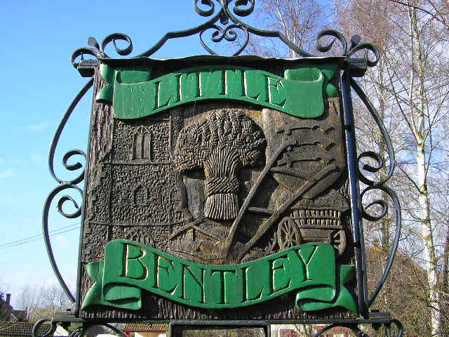
Little Bentley

Little Bentley is a village and civil parish in the Tendring district of Essex, England. It sits on rising ground just to the west of the Holland Brook...

Weeley Heath

Weeley Heath is a hamlet on the B1441 road and the B1414 road, in the Tendring district, in the English county of Essex. Nearby settlements include the...

Weeleyhall Wood

Weeleyhall Wood is a 31 hectare biological Site of Special Scientific Interest north of Clacton-on-Sea in Essex. It is managed by the Essex Wildlife Trust...

Nearby Amenities

Located within 500m of 51.865738,1.0918038
Bus Stop
Shair Lane
Bench: no
Bin: no
Lit: no
Naptan AtcoCode: 1500WEELY2
Naptan Bearing: W
Naptan CommonName: Shair Lane
Naptan Crossing: Shair Lane
Naptan Indicator: Adj
Naptan Landmark: Shair Lane
Naptan NaptanCode: esxjapmj
Naptan Street: Colchester Road
Naptan Verified: no
Public Transport: platform
Shelter: no
Source: naptan_import
Tactile Paving: no
Lat/Long: 51.8632479/1.0906816
Bus Stop
Shair Lane
Layby: yes
Naptan AtcoCode: 1500WEELYA
Naptan Bearing: SE
Naptan CommonName: Shair Lane
Naptan Crossing: Shair Lane
Naptan Indicator: Opp
Naptan Landmark: Shair Lane
Naptan NaptanCode: esxjapmp
Naptan Street: Colchester Road
Public Transport: platform
Route Ref: 76
Source: naptan_import; survey
Lat/Long: 51.8629912/1.0921497
The data included in this document is from www.openstreetmap.org. The data is made available under ODbL.

Have you been to Shair Wood?

Leave your review of Shair Wood below (or comments, questions and feedback).