Edards Wood

Wood, Forest in Kent Shepway

England

Edards Wood

Lane junction near North Leigh The through route turns right. Straight on is a short approach to premises with no public continuation.
Lane junction near North Leigh Credit: Robin Webster

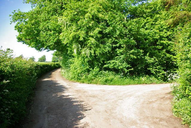
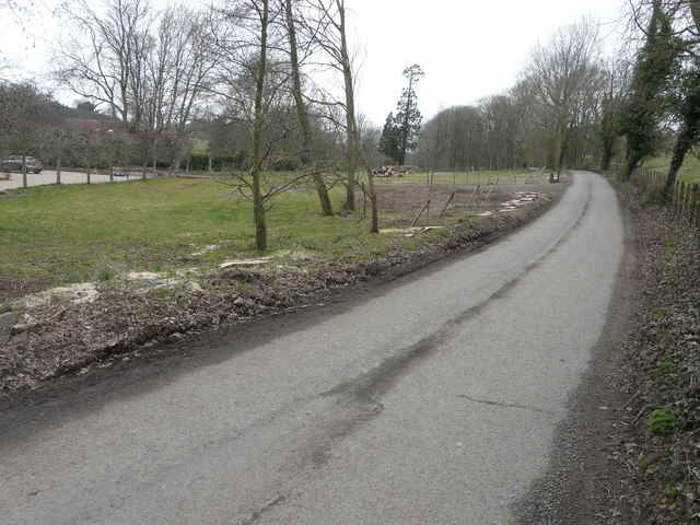
Edards Wood, located in Kent, is a picturesque forest known for its stunning natural beauty and tranquil ambiance. Spread across a vast expanse of land, this woodland offers a serene escape from the hustle and bustle of everyday life.

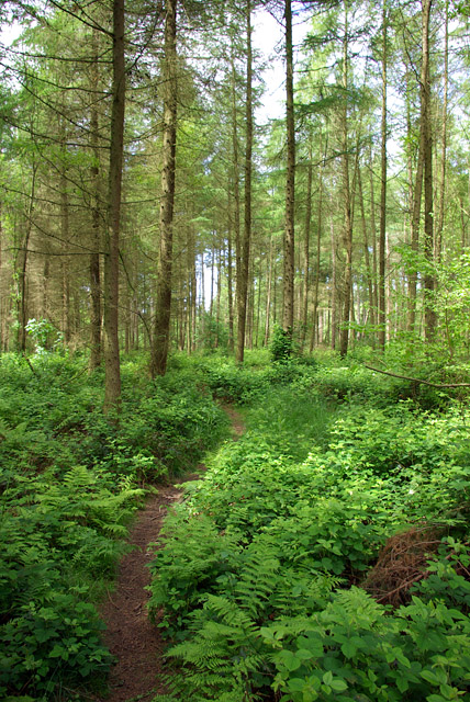
The forest is characterized by its dense canopy of trees, predominantly consisting of oak, beech, and ash. These towering giants provide shade and shelter to a variety of wildlife that thrives in this habitat. Visitors to Edards Wood can expect to spot a diverse range of fauna, including deer, foxes, squirrels, and numerous bird species.

The woodland floor is adorned with a carpet of wildflowers, creating a vibrant and colorful tapestry. During springtime, the forest truly comes alive as bluebells carpet the forest floor, creating a breathtakingly beautiful sight.

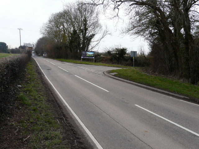
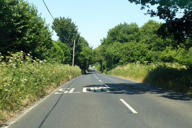
Edards Wood offers numerous walking trails that wind through the forest, allowing visitors to explore its hidden gems. These trails are well-maintained and suitable for individuals of all ages and fitness levels. Along the way, there are several designated picnic areas, providing an opportunity to enjoy a peaceful outdoor meal surrounded by nature.

The forest is managed by a dedicated team of conservationists who work tirelessly to preserve its natural beauty and protect its inhabitants. They regularly organize guided nature walks and educational programs, enhancing visitors' understanding and appreciation of the local ecosystem.

In conclusion, Edards Wood in Kent is a haven of tranquility and natural beauty. With its diverse wildlife, vibrant flora, and well-maintained walking trails, it offers a perfect escape for nature enthusiasts and those seeking a peaceful retreat.

If you have any feedback on the listing, please let us know in the comments section below.

Edards Wood Images

Images are sourced within 2km of 51.166087/1.0443691 or Grid Reference TR1245. Thanks to Geograph Open Source API. All images are credited.

Lane junction near North Leigh The through route turns right. Straight on is a short approach to premises with no public continuation.
Lane junction near North Leigh
The through route turns right. Straight on is a short approach to premises with no public continuation.
Path in West Wood Forestry Commission access woodland.
Path in West Wood
Forestry Commission access woodland.
Ride in West Wood Forestry Commission access woodland. This is also a public footpath.
Ride in West Wood
Forestry Commission access woodland. This is also a public footpath.
Large White butterfly, West Wood A Large White rather than a Small White, as the black on the outer tip of the forewing (seen here through the wing) extends some way along the outer (here the bottom) margin. It is also larger, but that is sometimes hard to judge in isolation.
Large White butterfly, West Wood
A Large White rather than a Small White, as the black on the outer tip of the forewing (seen here through the wing) extends some way along the outer (here the bottom) margin. It is also larger, but that is sometimes hard to judge in isolation.
Muddy path in West Wood Forestry Commission access woodland.
Muddy path in West Wood
Forestry Commission access woodland.
Path in West Wood Forestry Commission access woodland.
Path in West Wood
Forestry Commission access woodland.
Lane from Stowting Common towards Elmstead
Elmstead church St. James's is a grade I listed building, oldest parts from 11th or 12th centuries.
Elmstead church
St. James's is a grade I listed building, oldest parts from 11th or 12th centuries.
Lane towards Great Holt Farm And onwards to Bodsham.
Lane towards Great Holt Farm
And onwards to Bodsham.
Little Holt Farm Reached via a drive off the public road at Great Holt Farm.
Little Holt Farm
Reached via a drive off the public road at Great Holt Farm.
Newly planted trees beside a lane A row of crack willows (salix fragilis), which were planted immediately beside the lane, has been cut down and their trunks and branches stacked further back from the lane. A row of young trees has been planted behind the stumps.
Newly planted trees beside a lane
A row of crack willows (salix fragilis), which were planted immediately beside the lane, has been cut down and their trunks and branches stacked further back from the lane. A row of young trees has been planted behind the stumps.
Stonegate Business Park, Stone Street Planning permission was approved, with conditions, by Folkestone and Hythe  District Council under application number Y15/1292/SH for the “demolition of buildings and structures, remediation of land and the erection of 30 houses and two B1 office units of 465m2 floor area, plus the closure of existing access to Stone Street and creation of new access to Thorn Lane”. 

This image shows where the access to/from Thorn Lane will be located.
Stonegate Business Park, Stone Street
Planning permission was approved, with conditions, by Folkestone and Hythe District Council under application number Y15/1292/SH for the “demolition of buildings and structures, remediation of land and the erection of 30 houses and two B1 office units of 465m2 floor area, plus the closure of existing access to Stone Street and creation of new access to Thorn Lane”. This image shows where the access to/from Thorn Lane will be located.
Stonegate Business Park, Stone Street Planning permission was approved, with conditions, by Folkestone and Hythe  District Council under application number Y15/1292/SH for the “demolition of buildings and structures, remediation of land and the erection of 30 houses and two B1 office units of 465m2 floor area, plus the closure of existing access to Stone Street and creation of new access to Thorn Lane”.

This image shows the information board depicting Stonegate Business Park.    

A resident from Stelling Minnis told me that the road junction at this location is to be redesigned to reduce the speed of traffic on Stone Street and make it safer for vehicles turning into Thorn Lane.
Stonegate Business Park, Stone Street
Planning permission was approved, with conditions, by Folkestone and Hythe District Council under application number Y15/1292/SH for the “demolition of buildings and structures, remediation of land and the erection of 30 houses and two B1 office units of 465m2 floor area, plus the closure of existing access to Stone Street and creation of new access to Thorn Lane”. This image shows the information board depicting Stonegate Business Park. A resident from Stelling Minnis told me that the road junction at this location is to be redesigned to reduce the speed of traffic on Stone Street and make it safer for vehicles turning into Thorn Lane.
Stonegate Business Park, Stone Street Planning permission was approved, with conditions, by Folkestone and Hythe  District Council under application number Y15/1292/SH for the “demolition of buildings and structures, remediation of land and the erection of 30 houses and two B1 office units of 465m2 floor area, plus the closure of existing access to Stone Street and creation of new access to Thorn Lane”.

This image shows the main entrance into the site from Stone Street.
Stonegate Business Park, Stone Street
Planning permission was approved, with conditions, by Folkestone and Hythe District Council under application number Y15/1292/SH for the “demolition of buildings and structures, remediation of land and the erection of 30 houses and two B1 office units of 465m2 floor area, plus the closure of existing access to Stone Street and creation of new access to Thorn Lane”. This image shows the main entrance into the site from Stone Street.
B2068 Stone Street towards Canterbury The Roman road approaches the George Inn.
B2068 Stone Street towards Canterbury
The Roman road approaches the George Inn.
B2068 Stone Street towards Canterbury Passing Stone Hall on the right.
B2068 Stone Street towards Canterbury
Passing Stone Hall on the right.
B2068 Stone Street towards Canterbury The Roman road nears an area with several turnings.
B2068 Stone Street towards Canterbury
The Roman road nears an area with several turnings.
Park Wood East of the road between Stelling Minnis and Rhodes Minnis.
Park Wood
East of the road between Stelling Minnis and Rhodes Minnis.
Show me another place!

Edards Wood is located at Grid Ref: TR1245 (Lat: 51.166087, Lng: 1.0443691)

Administrative County: Kent

District: Shepway

Police Authority: Kent

What 3 Words

///thighs.minerals.escalated. Near Lyminge, Kent

Nearby Locations

Edards Wood Spong Wood

Related Wikis

Spong Wood

Spong Wood is a 18-hectare (44-acre) nature reserve west of Stelling Minnis in Kent. It is managed by Kent Wildlife Trust.Common trees in this coppiced...

Elmsted

Elmsted is a village and civil parish in the Folkestone and Hythe District of Kent, England. It is located west of Stone Street (the B2068), the Roman...

Stelling Minnis

Stelling Minnis is a village and civil parish in the Folkestone and Hythe district in Kent, England. The village lies 13 kilometres (8 mi) to the south...

Davison's Mill, Stelling Minnis

Davison's Mill, also known as Stelling Minnis Windmill, is a Grade I listed smock mill in Stelling Minnis, Kent, England that was built in 1866. It was...

Yockletts Bank

Yockletts Bank is a 25.4-hectare (63-acre) biological Site of Special Scientific Interest west of Stelling Minnis in Kent. It is managed by KWT and is...

Park Gate Down

Park Gate Down or Parkgate Down is a 7-hectare (17-acre) biological Site of Special Scientific Interest south-east of Stelling Minnis in Kent. It is also...

Rhodes Minnis

Rhodes Minnis is a village near Folkestone in Kent, England, located between Lyminge and Stelling Minnis. It is in the civil parish of Elham. It was a...

Hastingleigh

Hastingleigh is a small civil parish centred on an escarpment of the Kent Downs. The parish is three miles east of Wye and ten miles south of Canterbury...

Nearby Amenities

Located within 500m of 51.166087,1.0443691
Barrier: stile
Lat/Long: 51.1639502/1.044965
Barrier: stile
Lat/Long: 51.1644777/1.0430241
The data included in this document is from www.openstreetmap.org. The data is made available under ODbL.

Have you been to Edards Wood?

Leave your review of Edards Wood below (or comments, questions and feedback).