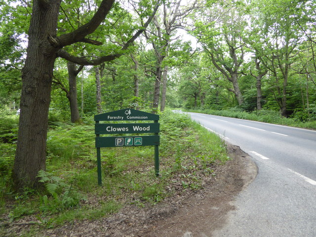
Clowes Wood

Wood, Forest in Kent Canterbury

England

Clowes Wood

A299 Thanet Way Eastbound
A299 Thanet Way Eastbound Credit: Mark Anderson

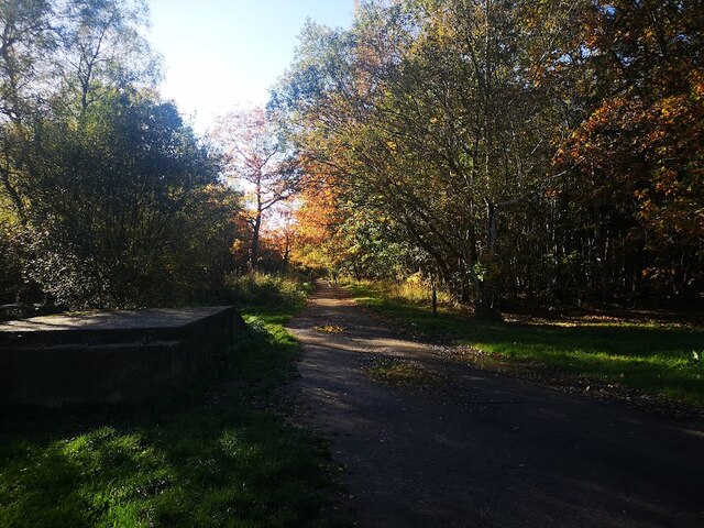
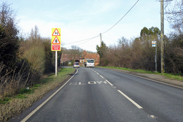
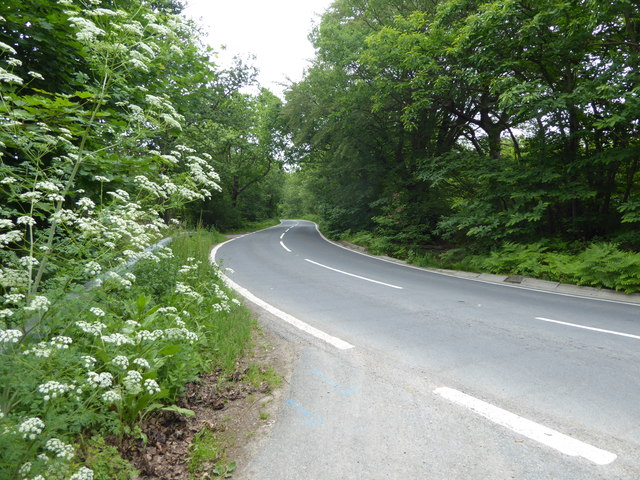
Clowes Wood is a picturesque woodland located in the county of Kent, England. Situated just south of the village of Canterbury, it covers an area of approximately 37 hectares (91 acres). The woodland is part of the Blean complex, which is one of the largest areas of ancient woodland in England.

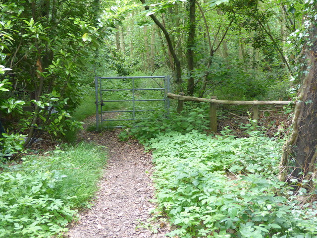
Clowes Wood is known for its diverse range of flora and fauna, making it a popular destination for nature enthusiasts and wildlife lovers. The woodland is characterized by its mixed broadleaf trees, including oak, beech, and birch, which provide a rich habitat for a variety of bird species, mammals, and insects.

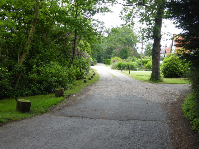
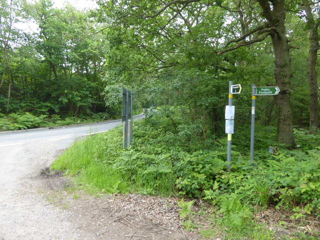
Visitors to Clowes Wood can explore its numerous walking trails, which meander through the dense woodland and offer stunning views of the surrounding countryside. The wood also boasts a number of well-maintained picnic areas and benches, allowing visitors to relax and enjoy the tranquil atmosphere.

In addition to its natural beauty, Clowes Wood has a rich history. It is believed to have been part of a larger hunting forest during medieval times and has remnants of ancient wood banks and ditches. The woodland has also been managed for centuries, with evidence of coppicing, a traditional woodland management technique, still visible today.

Overall, Clowes Wood in Kent is a hidden gem, offering visitors a chance to immerse themselves in nature, explore its rich history, and experience the tranquility of an ancient woodland.

If you have any feedback on the listing, please let us know in the comments section below.
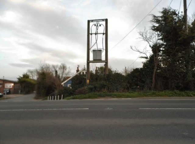
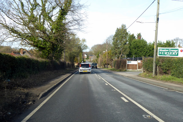
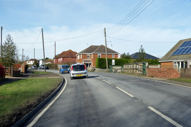
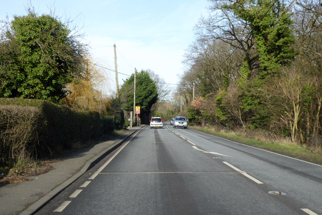
Clowes Wood Images

Images are sourced within 2km of 51.327459/1.0512609 or Grid Reference TR1263. Thanks to Geograph Open Source API. All images are credited.

A299 Thanet Way Eastbound
Thornden Wood Road through Thornden Wood This is looking south from the entrance to the West Blean  & Thornden Woods Car Park.
Thornden Wood Road through Thornden Wood
This is looking south from the entrance to the West Blean & Thornden Woods Car Park.
Path into Thornden Wood This is looking west from the West Blean & Thornden Woods Car Park into Thornden Wood. West Blean and Thornden Woods are managed by Kent Wildlife Trust. They are a Site of Special Scientific Interest and in July 2022, as part of the Wilder Blean project, European bison were released into West Blean and Thornden Woods - see <span class="nowrap"><a title="https://en.wikipedia.org/wiki/West_Blean_and_Thornden_Woods" rel="nofollow ugc noopener" href="https://en.wikipedia.org/wiki/West_Blean_and_Thornden_Woods">Link</a><img style="margin-left:2px;" alt="External link" title="External link - shift click to open in new window" src="https://s1.geograph.org.uk/img/external.png" width="10" height="10"/></span>
Path into Thornden Wood
This is looking west from the West Blean & Thornden Woods Car Park into Thornden Wood. West Blean and Thornden Woods are managed by Kent Wildlife Trust. They are a Site of Special Scientific Interest and in July 2022, as part of the Wilder Blean project, European bison were released into West Blean and Thornden Woods - see LinkExternal link
Path into Thornden Wood West Blean and Thornden Woods are managed by Kent Wildlife Trust. They are a Site of Special Scientific Interest and in July 2022, as part of the Wilder Blean project, European bison were released into West Blean and Thornden Woods - see <span class="nowrap"><a title="https://en.wikipedia.org/wiki/West_Blean_and_Thornden_Woods" rel="nofollow ugc noopener" href="https://en.wikipedia.org/wiki/West_Blean_and_Thornden_Woods">Link</a><img style="margin-left:2px;" alt="External link" title="External link - shift click to open in new window" src="https://s1.geograph.org.uk/img/external.png" width="10" height="10"/></span>
Path into Thornden Wood
West Blean and Thornden Woods are managed by Kent Wildlife Trust. They are a Site of Special Scientific Interest and in July 2022, as part of the Wilder Blean project, European bison were released into West Blean and Thornden Woods - see LinkExternal link
Clowes Wood
Clowes Wood
South Street, near Whitstable
Bogshole Lane, Whitstable
Clapham Hill at the junction of Pye Alley Lane
Electricity transformer on Pean Hill, Whitstable
A290 past Meadow Grange Nursery Heading towards Whitstable.
A290 past Meadow Grange Nursery
Heading towards Whitstable.
A290 towards Whitstable
A290 Pean Hill Heading towards Whitstable.
A290 Pean Hill
Heading towards Whitstable.
A290 towards Whitstable The inconveniently situated bus stop is called Pye Alley, the left turn ahead is Pye Alley Lane.
A290 towards Whitstable
The inconveniently situated bus stop is called Pye Alley, the left turn ahead is Pye Alley Lane.
Broomfield Gate This is a private road off Radfall Hill and on the edge of Thornden Wood.
Broomfield Gate
This is a private road off Radfall Hill and on the edge of Thornden Wood.
Entrance to Thornden Wood There is extensive woodland in this area between Chestfield and Canterbury. It is part of Blean Wood National Nature Reserve - see <span class="nowrap"><a title="https://explorekent.org/activities/blean-woods-national-nature-reserve/" rel="nofollow ugc noopener" href="https://explorekent.org/activities/blean-woods-national-nature-reserve/">Link</a><img style="margin-left:2px;" alt="External link" title="External link - shift click to open in new window" src="https://s1.geograph.org.uk/img/external.png" width="10" height="10"/></span>  This entrance to Thornden Wood is where the private Broomfield Gate meets Radfall Hill.
Entrance to Thornden Wood
There is extensive woodland in this area between Chestfield and Canterbury. It is part of Blean Wood National Nature Reserve - see LinkExternal link This entrance to Thornden Wood is where the private Broomfield Gate meets Radfall Hill.
Footpaths into Clowes Wood Clowes Wood is one of several large woodlands north of Canterbury known as the Blean. This is one of the most important areas of ancient woodland in Britain, including woodland types of international importance. The Blean was traditionally coppiced and parts of Clowes Wood are still managed in this way. One of the rarer trees here is the small-leaved lime. It grows in just one location here but was once one of the commonest trees in southern England. Its decline is thought to be due to the effects of grazing animals and a change in the climate.

This looks along Radfall Road with Clowes Wood away to the right and Thornden Wood across the road to the left.

For more about Blean Wood National Nature Reserve - see <span class="nowrap"><a title="https://explorekent.org/activities/blean-woods-national-nature-reserve/" rel="nofollow ugc noopener" href="https://explorekent.org/activities/blean-woods-national-nature-reserve/">Link</a><img style="margin-left:2px;" alt="External link" title="External link - shift click to open in new window" src="https://s1.geograph.org.uk/img/external.png" width="10" height="10"/></span>
Footpaths into Clowes Wood
Clowes Wood is one of several large woodlands north of Canterbury known as the Blean. This is one of the most important areas of ancient woodland in Britain, including woodland types of international importance. The Blean was traditionally coppiced and parts of Clowes Wood are still managed in this way. One of the rarer trees here is the small-leaved lime. It grows in just one location here but was once one of the commonest trees in southern England. Its decline is thought to be due to the effects of grazing animals and a change in the climate. This looks along Radfall Road with Clowes Wood away to the right and Thornden Wood across the road to the left. For more about Blean Wood National Nature Reserve - see LinkExternal link
Radfall Road at Gypsy Corner Clowes Wood to the left here is one of several large woodlands north of Canterbury known as the Blean. This is one of the most important areas of ancient woodland in Britain, including woodland types of international importance. The Blean was traditionally coppiced and parts of Clowes Wood are still managed in this way. One of the rarer trees here is the small-leaved lime. It grows in just one location here but was once one of the commonest trees in southern England. Its decline is thought to be due to the effects of grazing animals and a change in the climate.

This looks along Radfall Road with Clowes Wood on the left and Thornden Wood across the road to the right.

For more about Blean Wood National Nature Reserve - see <span class="nowrap"><a title="https://explorekent.org/activities/blean-woods-national-nature-reserve/" rel="nofollow ugc noopener" href="https://explorekent.org/activities/blean-woods-national-nature-reserve/">Link</a><img style="margin-left:2px;" alt="External link" title="External link - shift click to open in new window" src="https://s1.geograph.org.uk/img/external.png" width="10" height="10"/></span>
Radfall Road at Gypsy Corner
Clowes Wood to the left here is one of several large woodlands north of Canterbury known as the Blean. This is one of the most important areas of ancient woodland in Britain, including woodland types of international importance. The Blean was traditionally coppiced and parts of Clowes Wood are still managed in this way. One of the rarer trees here is the small-leaved lime. It grows in just one location here but was once one of the commonest trees in southern England. Its decline is thought to be due to the effects of grazing animals and a change in the climate. This looks along Radfall Road with Clowes Wood on the left and Thornden Wood across the road to the right. For more about Blean Wood National Nature Reserve - see LinkExternal link
Entrance to Clowes Wood Clowes Wood is one of several large woodlands north of Canterbury known as the Blean. This is one of the most important areas of ancient woodland in Britain, including woodland types of international importance. The Blean was traditionally coppiced and parts of Clowes Wood are still managed in this way. One of the rarer trees here is the small-leaved lime. It grows in just one location here but was once one of the commonest trees in southern England. Its decline is thought to be due to the effects of grazing animals and a change in the climate.

This looks along Radfall Road with Clowes Wood away to the left and Thornden Wood across the road to the right.

For more about Blean Wood National Nature Reserve - see <span class="nowrap"><a title="https://explorekent.org/activities/blean-woods-national-nature-reserve/" rel="nofollow ugc noopener" href="https://explorekent.org/activities/blean-woods-national-nature-reserve/">Link</a><img style="margin-left:2px;" alt="External link" title="External link - shift click to open in new window" src="https://s1.geograph.org.uk/img/external.png" width="10" height="10"/></span>
Entrance to Clowes Wood
Clowes Wood is one of several large woodlands north of Canterbury known as the Blean. This is one of the most important areas of ancient woodland in Britain, including woodland types of international importance. The Blean was traditionally coppiced and parts of Clowes Wood are still managed in this way. One of the rarer trees here is the small-leaved lime. It grows in just one location here but was once one of the commonest trees in southern England. Its decline is thought to be due to the effects of grazing animals and a change in the climate. This looks along Radfall Road with Clowes Wood away to the left and Thornden Wood across the road to the right. For more about Blean Wood National Nature Reserve - see LinkExternal link
Show me another place!

Clowes Wood is located at Grid Ref: TR1263 (Lat: 51.327459, Lng: 1.0512609)

Administrative County: Kent

District: Canterbury

Police Authority: Kent

What 3 Words

///cave.enthused.intend. Near Blean, Kent

Nearby Locations

Clowes Wood

Related Wikis

Blean and Tyler Hill Halt railway station

Blean and Tyler Hill Halt was a minor station on the Canterbury and Whitstable Railway at Tyler Hill, Kent. It opened in 1908 and closed in 1931. ��2...

Radfall

Radfall is a hamlet between Whitstable and Canterbury, in southeast England. It lies between the Thanet Way and Thornden Wood, in the Canterbury district...

Honey Hill, Kent

Honey Hill is a hamlet on the A290 road, near the village of Blean, in the Canterbury district, in the English county of Kent.

South Street Halt railway station

South Street Halt was a minor station on the Canterbury and Whitstable Railway at Tankerton, Kent. It opened in 1911 and closed in 1931. == History... ==

Nearby Amenities

Located within 500m of 51.327459,1.0512609
Leisure: picnic_table
Lat/Long: 51.3234941/1.0500564
Millennium Milepost Clowes Wood
Description: 1) Canterbury 4.5 2) Whitstable 3
Image: https://www.cyclestreets.net/location/185572/cyclestreets185572.jpg
Information: guidepost
Ncn Milepost: mills
Sustrans Ref: MP 620
Tourism: information
Lat/Long: 51.3233318/1.0500072
Power: tower
Source: Bing
Lat/Long: 51.3265134/1.047062
Power: tower
Source: Bing
Lat/Long: 51.3250068/1.0511777
Bench
Backrest: yes
Designation: Park bench
Source: survey
Lat/Long: 51.3255285/1.0497402
The data included in this document is from www.openstreetmap.org. The data is made available under ODbL.

Have you been to Clowes Wood?

Leave your review of Clowes Wood below (or comments, questions and feedback).