Britton's Grove

Wood, Forest in Norfolk Broadland

England

Britton's Grove

Honingham: Blind Lane
Honingham: Blind Lane Credit: Michael Garlick

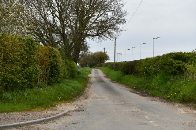
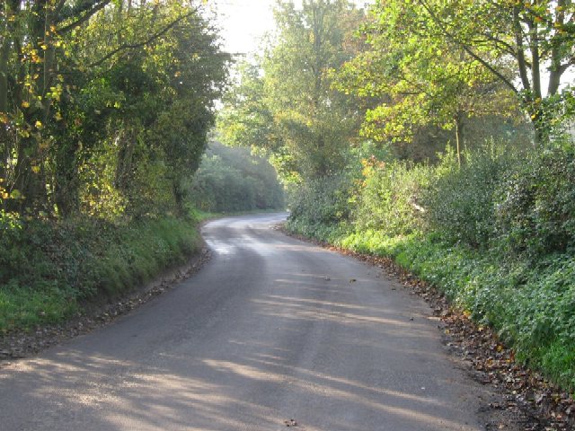
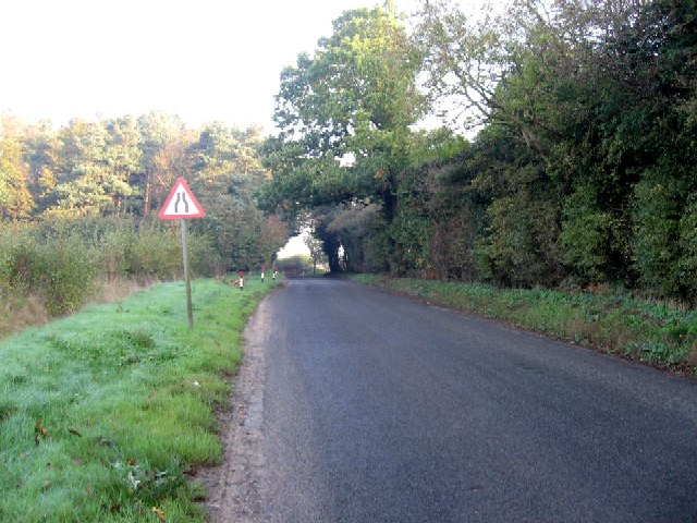
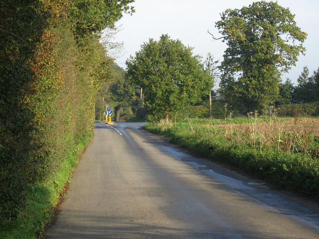
Britton's Grove, Norfolk is a picturesque woodland area located in the eastern part of England. It is situated in the county of Norfolk, known for its stunning natural landscapes and rich biodiversity. Britton's Grove is a densely wooded area, primarily composed of a variety of trees such as oak, beech, and pine.

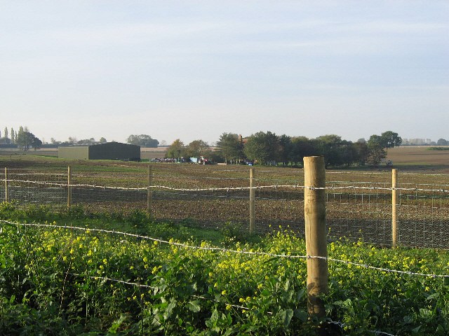
This woodland is characterized by its serene atmosphere and peaceful surroundings, making it a popular destination for nature lovers and hikers. The forest floor is covered in lush vegetation, including ferns, wildflowers, and mosses, creating a vibrant and diverse ecosystem. Additionally, the grove is home to various animal species, including deer, foxes, and a wide range of bird species.

The dense tree canopy provides ample shade, making it an ideal spot for picnics and outdoor activities during the warmer months. Several well-maintained walking trails wind their way through the grove, allowing visitors to explore the area and appreciate its natural beauty.

Britton's Grove is also notable for its historical significance. The woodland has been present for centuries and has witnessed various historical events in Norfolk. It provides a glimpse into the region's past and offers a serene retreat away from the hustle and bustle of modern life.

Overall, Britton's Grove, Norfolk is a stunning woodland area that offers a tranquil escape and an opportunity to connect with nature. Its rich biodiversity and historical significance make it a cherished destination for both locals and tourists alike.

If you have any feedback on the listing, please let us know in the comments section below.

Britton's Grove Images

Images are sourced within 2km of 52.659725/1.1117968 or Grid Reference TG1011. Thanks to Geograph Open Source API. All images are credited.

Honingham: Blind Lane
Easton: Food Enterprise Park
Honingham: Ian's Wood
Honingham: Car park for industrial estate
Old Milestone by Dereham Road, Honingham Parish Metal plate attached to stone post by the UC road, in parish of HONINGHAM (BROADLAND District), Dereham Road, opposite No. 43, on grass verge, on North side of road. Dereham iron plate, erected by the Norwich & Swaffham turnpike trust in the 19th century. 

Inscription reads:- : NORWICH 8 / DEREHAM / 8 : 
Rivet on top; carved benchmark top front and lower front. 

Milestone Society National ID: NO_NSM08.
Old Milestone by Dereham Road, Honingham Parish
Metal plate attached to stone post by the UC road, in parish of HONINGHAM (BROADLAND District), Dereham Road, opposite No. 43, on grass verge, on North side of road. Dereham iron plate, erected by the Norwich & Swaffham turnpike trust in the 19th century. Inscription reads:- : NORWICH 8 / DEREHAM / 8 : Rivet on top; carved benchmark top front and lower front. Milestone Society National ID: NO_NSM08.
Colton: Private farm access
Colton: 'The Old Post Office'
Barnham Broom Road Looking towards the A47.
Barnham Broom Road
Looking towards the A47.
An Artificial Lake Recently created alongside the road to Barnham Broom from the A47.
An Artificial Lake
Recently created alongside the road to Barnham Broom from the A47.
The Road To Barnham Broom From Weston Green.
The Road To Barnham Broom
From Weston Green.
The Road To Weston Green From Barnham Broom.
The Road To Weston Green
From Barnham Broom.
To Barnham Broom From the A47 on Barnham Broom Road.
To Barnham Broom
From the A47 on Barnham Broom Road.
The Road To The A47 From Barnham Broom.
The Road To The A47
From Barnham Broom.
Change Of Use The indications are that some kind of leisure site is being prepared beside the artificial lake.
Change Of Use
The indications are that some kind of leisure site is being prepared beside the artificial lake.
The Road To The A47 From Barnham Broom.
The Road To The A47
From Barnham Broom.
One Part Of Grange Farm Grange Farm covers a large acreage close to the A47.
One Part Of Grange Farm
Grange Farm covers a large acreage close to the A47.
More Of Grange Farm Parts of the farm are more like parkland.
More Of Grange Farm
Parts of the farm are more like parkland.
The Road To The A47 From Weston Green.
The Road To The A47
From Weston Green.
Show me another place!

Britton's Grove is located at Grid Ref: TG1011 (Lat: 52.659725, Lng: 1.1117968)

Administrative County: Norfolk

District: Broadland

Police Authority: Norfolk

What 3 Words

///equivocal.eating.coach. Near Mattishall, Norfolk

Nearby Locations

Britton's Grove Honingham

Related Wikis

Honingham

Honingham is a village and civil parish in the English county of Norfolk, located 8 miles (13 km) to the west of Norwich along the A47 trunk road. It covers...

Honingham Hall

Honingham Hall was a large country house at Honingham in Norfolk. == History == The house was commissioned by Sir Thomas Richardson, Chief Justice of the...

Colton, Norfolk

Colton is a village and former civil parish, 8 miles (13 km) west of Norwich, now in the parish of Marlingford and Colton, in the South Norfolk district...

East Tuddenham

East Tuddenham is a village in the English county of Norfolk. The village is located 5.6 miles (9.0 km) south-west of Dereham and 9.5 miles (15.3 km) north...

Marlingford and Colton

Marlingford and Colton, formerly Marlingford is a civil parish in the English county of Norfolk, made from the villages of Colton and Marlingford. It covers...

Easton, Norfolk

Easton is a village and civil parish in the English county of Norfolk. The village is located 6.2 miles (10.0 km) north-west of Norwich and 9 miles (14...

Hockering

Hockering is a village and civil parish in Norfolk, England. At the 2001 census the parish had a population of 628. By 2007, the district estimated that...

Marlingford

Marlingford is a village and former civil parish, 6 miles (9.7 km) west of Norwich, now in the parish of Marlingford and Colton, in the South Norfolk district...

Nearby Amenities

Located within 500m of 52.659725,1.1117968
Bus Stop
The Street, adj
Naptan AtcoCode: 2900H421
Naptan Bearing: NW
Naptan BusStopType: CUS
Naptan CommonName: The Street
Naptan Indicator: adj
Naptan Landmark: os The Buck Public House
Naptan Locality: Honingham
Naptan NaptanCode: nfoawptd
Naptan Street: The Street
Naptan Verified: no
Shelter: no
Source: naptan_import
Lat/Long: 52.6631688/1.1080783
Bus Stop
The Street, opp
Naptan AtcoCode: 2900H422
Naptan Bearing: SE
Naptan BusStopType: CUS
Naptan CommonName: The Street
Naptan Indicator: opp
Naptan Landmark: At Village Pump opp The Buck Inn
Naptan Locality: Honingham
Naptan NaptanCode: nfoawptg
Naptan Street: The Street
Naptan Verified: no
Shelter: no
Source: naptan_import
Lat/Long: 52.6632595/1.1082175
Colton Road, adj
Naptan AtcoCode: 2900H423
Naptan Bearing: E
Naptan BusStopType: CUS
Naptan CommonName: Colton Road
Naptan Indicator: adj
Naptan Landmark: Colton Road
Naptan Locality: Honingham
Naptan NaptanCode: nfogmdjw
Naptan Street: Mattishall Road
Naptan Verified: no
Source: naptan_import
Lat/Long: 52.6582013/1.1085391
Colton Road, opp
Naptan AtcoCode: 2900H424
Naptan Bearing: W
Naptan BusStopType: CUS
Naptan CommonName: Colton Road
Naptan Indicator: opp
Naptan Locality: Honingham
Naptan NaptanCode: nfogmdma
Naptan Street: Mattishall Road
Naptan Verified: no
Source: naptan_import
Lat/Long: 52.6581205/1.1085333
Honingham
Place: village
Lat/Long: 52.6623289/1.1081171
Honingham & East Tuddenham Roll of Honour
Historic: memorial
Inscription: In memory of Curly and / So he passed over and all the trumpets sounded for him on the other side
Website: http://www.breckland-rollofhonour.org.uk/e_tudd.html
Lat/Long: 52.6634335/1.108086
Bench
Backrest: yes
Material: wood
Seats: 3
Lat/Long: 52.6634825/1.1080326
Bench
Backrest: yes
Inscription: This seat was presented to Honingham by Carol 4th Lord Ailwyn and Lady Ailwyn / -1983-
Material: wood
Seats: 3
Lat/Long: 52.663486/1.1080718
Post Box
Collection Times: Mo-Fr 17:15; Sa 11:15
Operator: Royal Mail
Post Box Type: lamp
Ref: NR9 965
Royal Cypher: EIIR
Royal Cypher Wikidata: Q33102113
Lat/Long: 52.6621608/1.108706
Public Bookcase
Booth: K6
Man Made: telephone_box
Note: It is a peoples library and information point in a red phone box.
Public Bookcase Type: phone_box
Lat/Long: 52.663234/1.1082281
Honingham Parish Pump
Historic: yes
Man Made: pump
Pump: manual
Lat/Long: 52.6632925/1.1082532
Give Way
Lat/Long: 52.6591503/1.1163544
Honingham
Colour: black
Inscription: E II R / Silver Jubilee / 1952 – 1977
Man Made: village_sign
Material: metal
Lat/Long: 52.6616407/1.1095977
Give Way
Lat/Long: 52.6617499/1.1094326
Give Way
Lat/Long: 52.6618018/1.1092961
Traffic Signals
Peak Time Only: yes
Traffic Signals Direction: backward
Lat/Long: 52.6584409/1.1183049
Power: pole
Lat/Long: 52.6626851/1.1108315
Power: pole
Lat/Long: 52.6638369/1.1132562
Power: pole
Lat/Long: 52.6632358/1.1121646
Crossing
Crossing: unmarked
Lat/Long: 52.6601542/1.1081862
The data included in this document is from www.openstreetmap.org. The data is made available under ODbL.

Have you been to Britton's Grove?

Leave your review of Britton's Grove below (or comments, questions and feedback).