Denge Wood

Wood, Forest in Kent Canterbury

England

Denge Wood

Field by Anvil Green Road
Field by Anvil Green Road Credit: David Howard

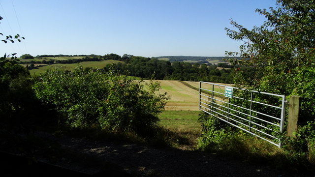
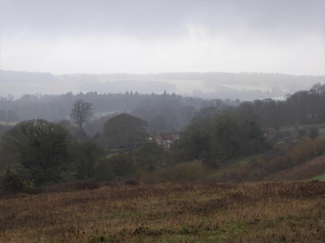
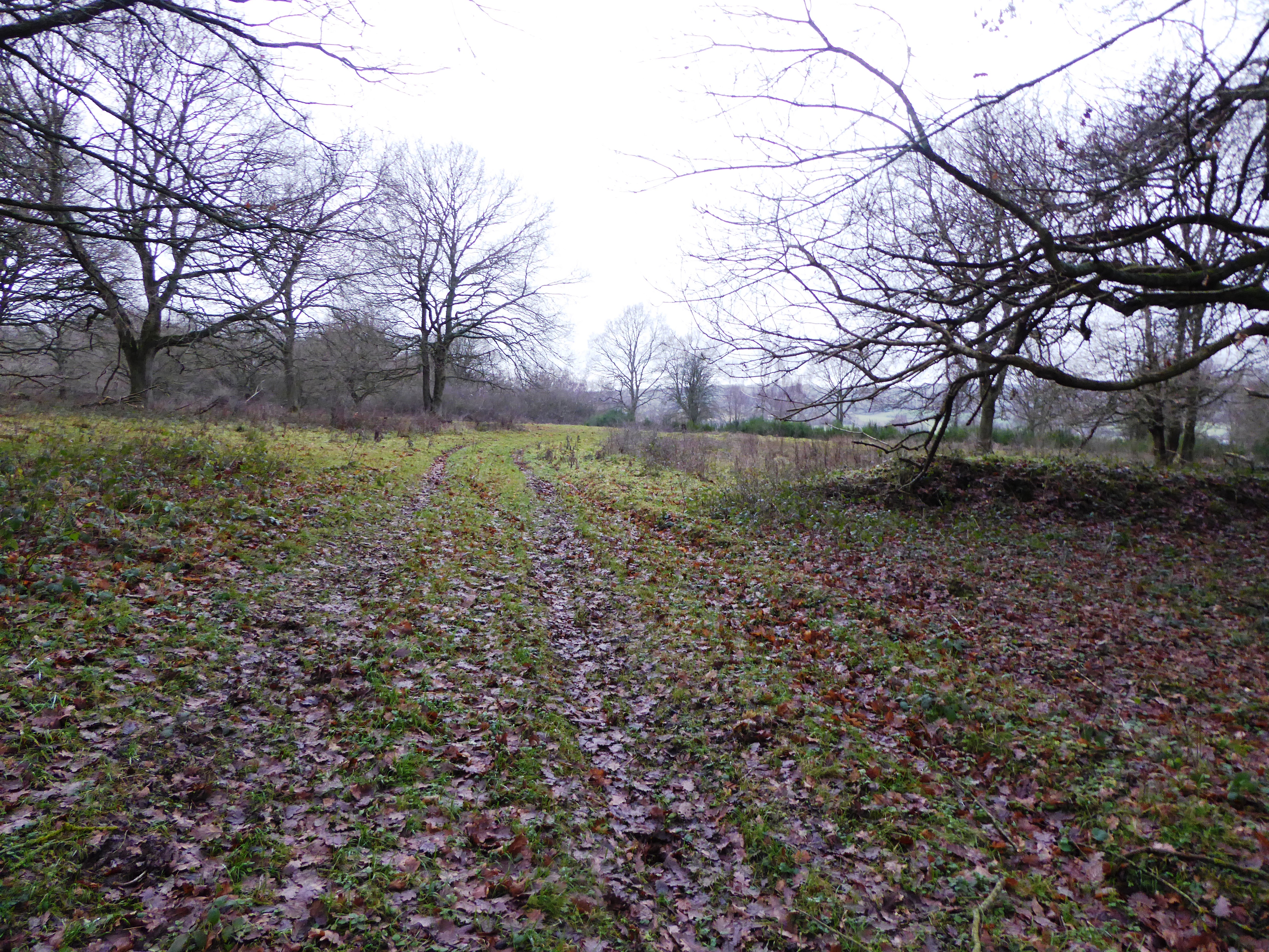
Denge Wood is a picturesque woodland area located in the county of Kent, England. Covering an area of approximately 270 acres, it is situated near the village of Lydd, on the Romney Marshes. The wood is managed by the Forestry Commission and is a popular destination for nature enthusiasts and walkers.

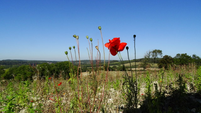
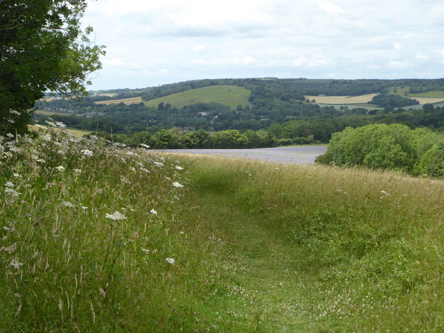
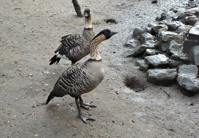
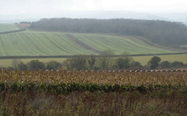
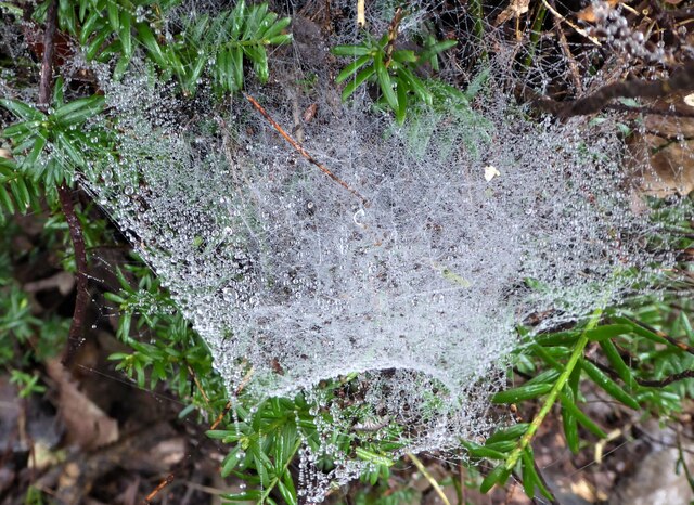
Denge Wood is predominantly made up of mixed deciduous and coniferous trees, creating a diverse and vibrant environment. The wood is home to a variety of wildlife, including deer, badgers, foxes, and numerous species of birds. It is also known for its rich flora, with a carpet of bluebells covering the forest floor during springtime.

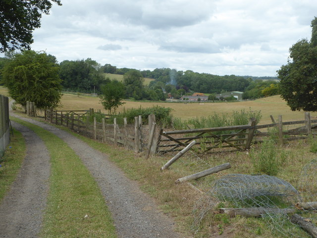
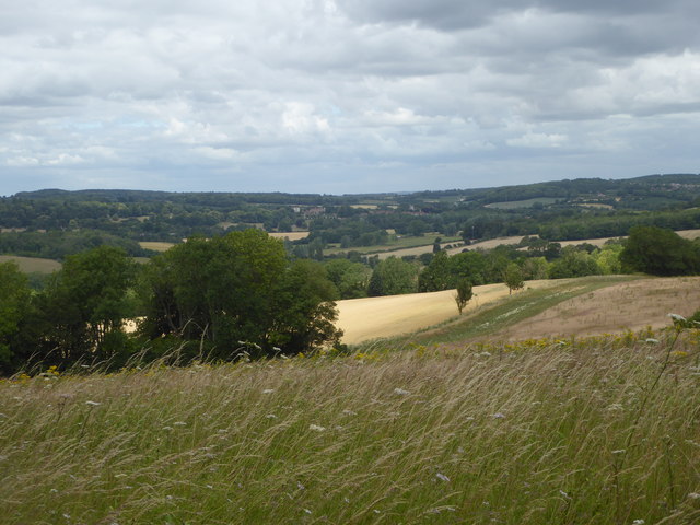
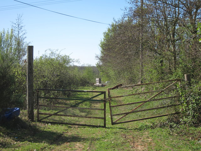
The wood offers a range of walking trails, allowing visitors to explore its beauty at their own pace. These trails are well-marked and provide an opportunity to immerse oneself in the peaceful surroundings while enjoying the sights and sounds of nature. Additionally, Denge Wood is part of the wider Dungeness, Romney Marsh, and Rye Bay Site of Special Scientific Interest (SSSI), adding to its ecological importance.

The wood is easily accessible, with ample parking available for visitors. There are picnic areas and benches scattered throughout the woodland, providing a perfect spot to relax and enjoy a picnic amidst the tranquil surroundings. Denge Wood is open to the public throughout the year, and entrance is free, making it a popular choice for families, nature lovers, and those seeking solace in nature.

If you have any feedback on the listing, please let us know in the comments section below.

Denge Wood Images

Images are sourced within 2km of 51.22281/1.0056569 or Grid Reference TR0951. Thanks to Geograph Open Source API. All images are credited.

Field by Anvil Green Road
Old pit at edge of woodland There were two or three hereabouts. They look like filled in bell-pits, most often found for extracting iron, but flints are more likely on this geology.
Old pit at edge of woodland
There were two or three hereabouts. They look like filled in bell-pits, most often found for extracting iron, but flints are more likely on this geology.
On Stour Valley Walk, view W from NE of Woodsdale Farm, Godmersham
On Stour Valley Walk, poppies below Blue Downs, Godmersham
Penny Pot Lane, Sole Street Looking northwards from the hamlet of Sole Street with Eggringe Wood on the left.
Penny Pot Lane, Sole Street
Looking northwards from the hamlet of Sole Street with Eggringe Wood on the left.
Thruxted Mill, Penny Pot Lane North of Sole Street. Not as lovely as the name suggests, this was an animal  rendering plant that dealt with cattle infected with BSE.  A legal challenge in the High Court has halted a planned housing development on the site. It follows the granting of planning permission in 2018 for up to 20 homes to be built on the heavily contaminated site.
Thruxted Mill, Penny Pot Lane
North of Sole Street. Not as lovely as the name suggests, this was an animal rendering plant that dealt with cattle infected with BSE. A legal challenge in the High Court has halted a planned housing development on the site. It follows the granting of planning permission in 2018 for up to 20 homes to be built on the heavily contaminated site.
Track leading to Woodsdale Farm, Godmersham The farm buildings are on the right.
Track leading to Woodsdale Farm, Godmersham
The farm buildings are on the right.
View from the Stour Valley Walk, near Godmersham With the village of Chilham in the far distance showing Chilham Castle to the left of the village and the church to the right.
View from the Stour Valley Walk, near Godmersham
With the village of Chilham in the far distance showing Chilham Castle to the left of the village and the church to the right.
Footpath, Blue Downs above Godmersham
Path and track leading to Woodsdale Farm Woodsdale Farm is a small hamlet north of Eggringe Wood and near the village of Chilham.
Path and track leading to Woodsdale Farm
Woodsdale Farm is a small hamlet north of Eggringe Wood and near the village of Chilham.
Geese by a pond near Woodsdale Farm The pond and surrounding area is a home for very many unusual waterfowl. This pair are nene (Branta sandvicensis), also known as Hawaiian geese, a species of bird that comes from the Hawaiian Islands.
Geese by a pond near Woodsdale Farm
The pond and surrounding area is a home for very many unusual waterfowl. This pair are nene (Branta sandvicensis), also known as Hawaiian geese, a species of bird that comes from the Hawaiian Islands.
Track to Woodsdale Farm A hamlet north of Eggringe Wood. The mist obscures the farm buildings that would normally be seen on the right.
Track to Woodsdale Farm
A hamlet north of Eggringe Wood. The mist obscures the farm buildings that would normally be seen on the right.
Woodsdale Farm, north of Eggringe Wood Hay bales on a steep field near Woodsdale Farm. Viewed from the Stour Valley Walk.
Woodsdale Farm, north of Eggringe Wood
Hay bales on a steep field near Woodsdale Farm. Viewed from the Stour Valley Walk.
View from Blue Downs near Godmersham North east of the village on a misty morning.
View from Blue Downs near Godmersham
North east of the village on a misty morning.
View from Blue Downs near Godmersham Looking towards the fields of Woodsdale Farm.
View from Blue Downs near Godmersham
Looking towards the fields of Woodsdale Farm.
Spider web in Eggringe Wood Next to a footpath running along the south west edge.
Spider web in Eggringe Wood
Next to a footpath running along the south west edge.
Track to Upper Mystole Park Farm Not the main entrance track, though is much shorter to the road.
Track to Upper Mystole Park Farm
Not the main entrance track, though is much shorter to the road.
Show me another place!

Denge Wood is located at Grid Ref: TR0951 (Lat: 51.22281, Lng: 1.0056569)

Administrative County: Kent

District: Canterbury

Police Authority: Kent

What 3 Words

///broad.dragon.health. Near Chartham, Kent

Nearby Locations

Denge Wood

Related Wikis

Denge Wood

Denge Wood is a wood located 8 miles southwest of Canterbury in Kent, England. The wood is owned by the Forestry Commission and the Woodland Trust. Part...

Down Bank

Down Bank is a 5.9-hectare (15-acre) biological Site of Special Scientific Interest south-west of Canterbury in Kent.This sloping chalk meadow has the...

Anvil Green

Anvil Green is a small settlement located near Waltham in Kent, England, about nine miles (14.4 km) north east of Ashford. == External links == Media...

Stour Valley Walk

The Stour Valley Walk is a recreational walking route that follows the River Stour, through the Low Weald and Kent Downs, from its source at Lenham to...

Broadham Down

Broadham Down is a 16-hectare (40-acre) nature reserve east of Chilham and west of Canterbury in Kent. It is managed by the Kent Wildlife Trust.This nature...

Waltham, Kent

Waltham is a village and civil parish 7 miles (11 km) southwest of Canterbury in Kent, England. == History == The village was once associated with the...

Petham

Petham is a rural village and civil parish in the North Downs, five miles south of Canterbury in Kent, South East England. The village church is All Saints...

Julliberrie's Grave

Julliberrie's Grave, also known as The Giant's Grave or The Grave, is an unchambered long barrow located near to the village of Chilham in the south-eastern...

Nearby Amenities

Located within 500m of 51.22281,1.0056569
map board
Description: Denge & Pennypot Woods "Public Access". https://www.woodlandtrust.org.uk/visiting-woods/woods/denge-pennypot-wood/ The Management Plan refers only to pedestrian access and Squeeze Gap entry points thus preventing cycle and horse access.
Tourism: information
Lat/Long: 51.2245332/0.9992445
The data included in this document is from www.openstreetmap.org. The data is made available under ODbL.

Have you been to Denge Wood?

Leave your review of Denge Wood below (or comments, questions and feedback).