Four Roads

Settlement in Carmarthenshire

Wales

Four Roads

The boundary of Meinciau
The boundary of Meinciau Credit: David Medcalf

Four Roads is a small village located in the county of Carmarthenshire, Wales. Situated in the southwestern part of the country, it is nestled between the towns of Kidwelly and Pontyberem. The village is surrounded by picturesque countryside, with rolling hills and farmland dominating the landscape.

The history of Four Roads dates back centuries, with evidence of settlements in the area dating back to the Iron Age. Today, the village maintains a rural and tranquil atmosphere, with a close-knit community that takes pride in its heritage.

Four Roads is predominantly a residential area, with a small number of local amenities serving the needs of its residents. These include a village hall, a primary school, and a post office. There are also a few small businesses, such as a local shop and a pub, which act as social hubs for the community.

The village is well-connected to the surrounding areas, with good road links to nearby towns and cities. The A484 road passes through Four Roads, providing easy access to Carmarthen, the county town of Carmarthenshire, as well as Llanelli and Swansea.

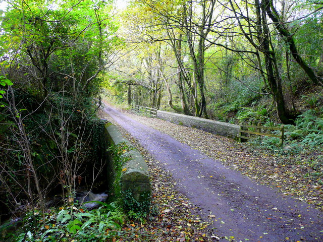
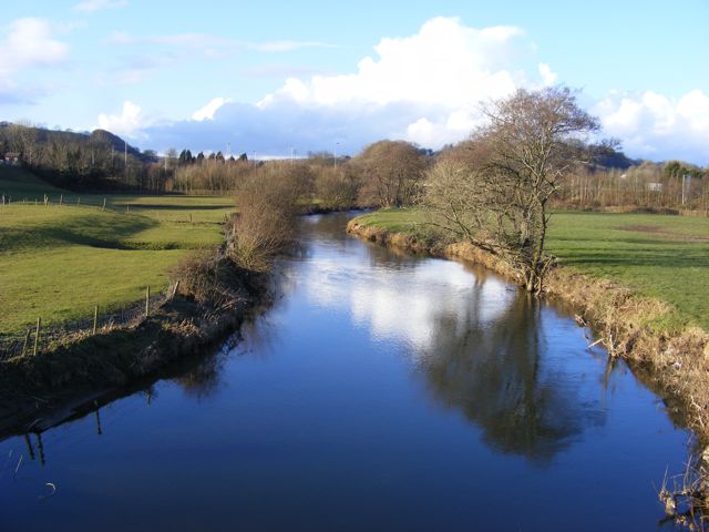
For those seeking outdoor activities, Four Roads is ideally located. The nearby countryside offers opportunities for walking, cycling, and exploring nature. The village is also within close proximity to the stunning coastline of Carmarthenshire, with beautiful beaches and coastal paths just a short drive away.

In summary, Four Roads is a charming village in Carmarthenshire, Wales, known for its rural beauty, strong sense of community, and convenient location for both countryside and coastal activities.

If you have any feedback on the listing, please let us know in the comments section below.
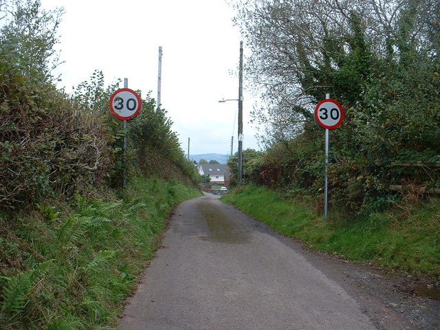
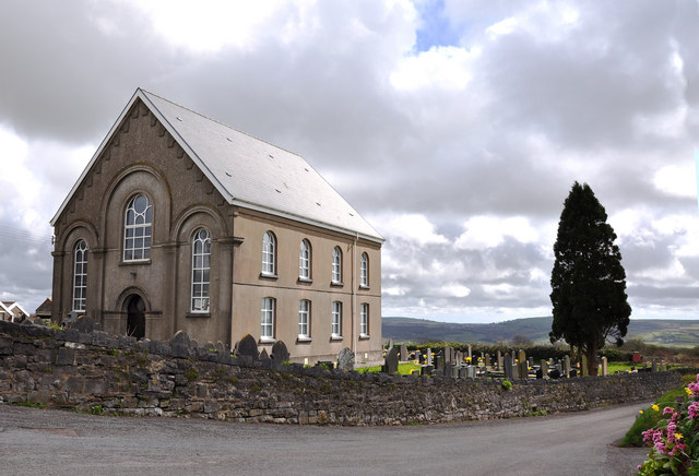
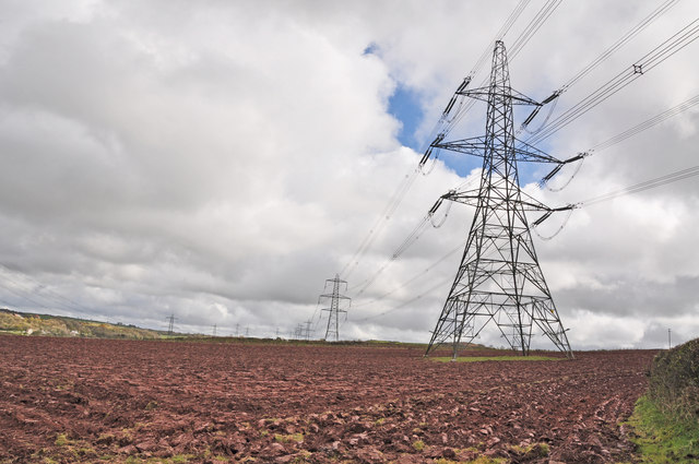
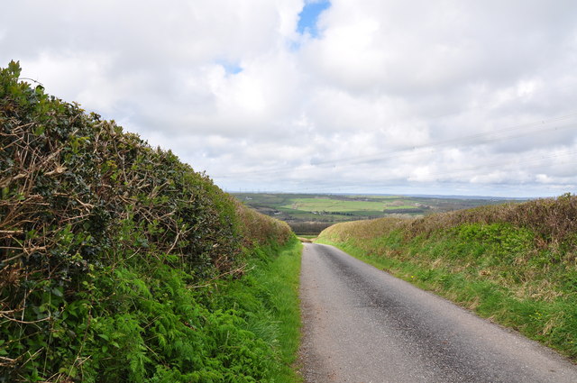
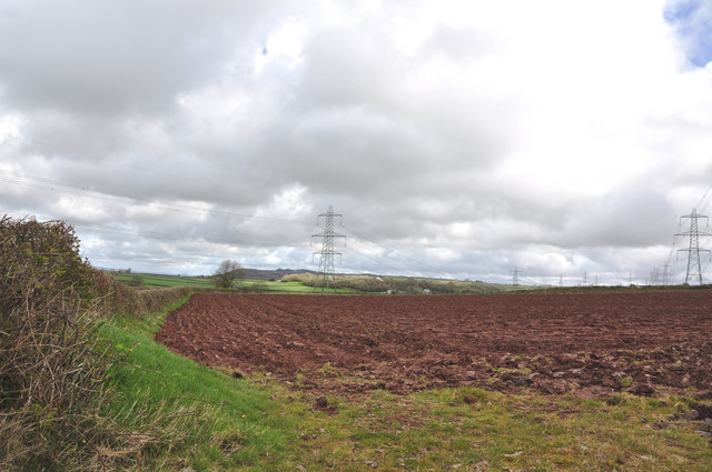
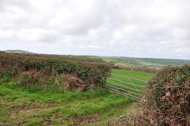
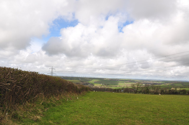
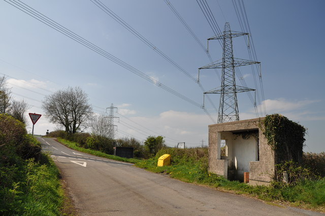
Four Roads Images

Images are sourced within 2km of 51.762761/-4.254737 or Grid Reference SN4409. Thanks to Geograph Open Source API. All images are credited.

The boundary of Meinciau
Chapel at Meinciau
Chapel at Meinciau
Pylons and ploughed field west of Meinciau
Country road west of Meinciau
Pylons and ploughed field west of Meinciau This view looking to the north east.
Pylons and ploughed field west of Meinciau
This view looking to the north east.
Gateway west of Meinciau
Hedgerow and fields west of Meinciau
Farm track west of Meinciau
Hedgerow running toward Llancwm Farm and beneath power lines
Land Rover in a layby An abandoned toy jeep rather than a Land Rover, together with a variety of electrical devices of no further use other than to afford the previous owners an excuse to get out and enjoy the countryside!
Land Rover in a layby
An abandoned toy jeep rather than a Land Rover, together with a variety of electrical devices of no further use other than to afford the previous owners an excuse to get out and enjoy the countryside!
Crossroads, bus shelter and pylon north west of Meinciau
Road junction
Road junction
Four roads at Four Roads The crossroads which presumably give the village its name.
Four roads at Four Roads
The crossroads which presumably give the village its name.
Farmland near Bryncoch
Looking toward Carmarthen from path 11/18 Mynydd y Garreg
Bridge over a stream Within the wooded valley of Coed y Glyn.
Bridge over a stream
Within the wooded valley of Coed y Glyn.
Woodland lane This small lane links isolated houses and farms north-east of Kidwelly.
Woodland lane
This small lane links isolated houses and farms north-east of Kidwelly.
Town sign - Mynyddygarreg
Show me another place!

Four Roads is located at Grid Ref: SN4409 (Lat: 51.762761, Lng: -4.254737)

Unitary Authority: Carmarthenshire

Police Authority: Dyfed Powys

Also known as: Pedair-hewl

What 3 Words

///hydration.strain.cosmic. Near Pontyates, Carmarthenshire

Related Wikis

Smarts Quarry

Smarts Quarry is a Site of Special Scientific Interest (SSSI) in Carmarthenshire, Wales, designated in 1987 for its geological features. == SSSI == Smarts...

River Gwili

For the river which flows into the River Loughor see Afon Gwili (Loughor)The River Gwili (Welsh: Afon Gwili) in Carmarthenshire, is a tributary of the...

Coed Gwempa

Coed Gwempa is a Site of Special Scientific Interest in Carmarthen & Dinefwr, Wales. It is managed by the Woodland Trust, who describe it as mixed native...

Mynydd-y-Garreg

Mynydd-y-Garreg or Mynyddygarreg ("The mountain of the stone") is a village in the county of Carmarthenshire, West Wales. It borders the historic town...

Glyn Abbey railway station

Glyn Abbey railway station was opened in 1909 as Pontnewydd Halt It continued to serve the inhabitants of the Pont-newydd area and hinterland between 1909...

Pontyates railway station

Pontyates railway station was opened in 1909 It continued to serve the inhabitants of the Pontyates / Pont-iets area and hinterland between 1909 and 1953...

Pontyates

Pontyates (Welsh: Pont-iets) is a village straddling two communities situated in the Gwendraeth Valley halfway between Carmarthen and Llanelli in Carmarthenshire...

Ponthenry railway station

Ponthenry railway station was opened in 1909 It continued to serve the inhabitants of the Pont-henri area and hinterland between 1909 and 1953; it was...

Nearby Amenities

Located within 500m of 51.762761,-4.254737
Four Roads
Name Cy: Pedair-hewl
Place: hamlet
Source: Enwau Lleoedd Safonol Cymru
Lat/Long: 51.7620891/-4.2511151
Power: pole
Lat/Long: 51.7613825/-4.253895
Power: pole
Lat/Long: 51.7602619/-4.2545468
Power: pole
Lat/Long: 51.7596592/-4.254874
Power: pole
Lat/Long: 51.7589288/-4.2553246
Power: pole
Lat/Long: 51.7586366/-4.2550913
Power: pole
Lat/Long: 51.7597306/-4.2544207
Power: pole
Lat/Long: 51.760735/-4.2537823
Power: pole
Lat/Long: 51.7615452/-4.2532915
Power: pole
Lat/Long: 51.7623188/-4.2527899
Power: pole
Lat/Long: 51.7630143/-4.2513898
Power: pole
Lat/Long: 51.7635572/-4.2503142
Power: pole
Lat/Long: 51.7643656/-4.2487451
Direction: SW
Generator Method: photovoltaic
Generator Output Electricity: yes
Generator Solar Modules: 14
Generator Source: solar
Generator Type: solar_photovoltaic_panel
Location: roof
Power: generator
Lat/Long: 51.7612779/-4.2531493
Telephone
Defibrillator
Booth: K6
Covered: booth
Defibrillator Location: inside old red phone box in Four Roads
Emergency: defibrillator
Man Made: telephone_box
Lat/Long: 51.761385/-4.251026
Give Way
Direction: backward
Lat/Long: 51.7614078/-4.2508328
Give Way
Direction: backward
Lat/Long: 51.7613783/-4.2507042
Bus Stop
Four Roads Post Office
Bus: yes
Naptan AtcoCode: 5220CMA01545
Naptan NaptanCode: crmdmgm
Note: No Post Office nearby, but this is the name of the stop
Public Transport: platform
Ref: SW
Lat/Long: 51.7613409/-4.2507086
Bench
Lat/Long: 51.7614372/-4.2505316
Post Box
Post Box Type: lamp
Royal Cypher: EIIR
Royal Cypher Wikidata: Q33102113
Lat/Long: 51.7615744/-4.2513658
Historic: water_pump
Lat/Long: 51.7615634/-4.2512531
Bus Stop
Four Roads Post Office
Bus: yes
Naptan AtcoCode: 5220CMA01547
Naptan NaptanCode: crmdmgp
Note: No Post Office nearby, but this is the name of the stop
Public Transport: platform
Ref: NE
Lat/Long: 51.7613372/-4.2509824
Bus Stop
Four Roads Post Office
Bus: yes
Naptan AtcoCode: 5220WDB47351
Naptan NaptanCode: crmptwd
Note: No Post Office nearby, but this is the name of the stop
Public Transport: platform
Ref: SE
Lat/Long: 51.7614494/-4.2507893
Bus Stop
Tŷ-Mynydd
Bus: yes
Naptan AtcoCode: 5220WDB48078
Naptan NaptanCode: crmtwmd
Public Transport: platform
Lat/Long: 51.7628238/-4.260489
Bus: yes
Public Transport: stop_position
Lat/Long: 51.7627862/-4.2604123
Bus: yes
Public Transport: stop_position
Lat/Long: 51.7614199/-4.2508804
Bus: yes
Public Transport: stop_position
Lat/Long: 51.7613273/-4.2508653
Bus: yes
Public Transport: stop_position
Lat/Long: 51.7613641/-4.2506331
The data included in this document is from www.openstreetmap.org. The data is made available under ODbL.

Have you been to Four Roads?

Leave your review of Four Roads below (or comments, questions and feedback).