Stone Pit Plantation

Wood, Forest in Norfolk North Norfolk

England

Stone Pit Plantation

Platform 2 at Holt Station This train is standing at Platform 2 at Holt Station, waiting to return to Sheringham on the North Norfolk Railway. The platforms at Holt are staggered and this image is taken from the inner end of Platform 1.
Platform 2 at Holt Station Credit: Glen Denny

Stone Pit Plantation is a sprawling woodland area located in Norfolk, England. Covering an extensive area, the plantation is known for its dense forests and diverse range of trees, making it a prime location for nature lovers and outdoor enthusiasts.

The plantation is predominantly made up of mixed broadleaf woodland, consisting of a variety of tree species including oak, birch, beech, and ash. These trees create a picturesque landscape, especially during autumn when their leaves turn vibrant shades of red, orange, and yellow. Additionally, the woodland is home to a plethora of wildlife, including deer, foxes, squirrels, and a wide array of bird species.

Visitors to Stone Pit Plantation can explore its network of well-maintained footpaths and trails, which provide access to the heart of the woodland and its hidden gems. The plantation is also equipped with picnic areas, allowing visitors to enjoy a peaceful outdoor lunch amidst the serene surroundings.

The management of Stone Pit Plantation is dedicated to preserving its natural beauty and biodiversity. Regular maintenance and conservation efforts are undertaken to ensure the health and longevity of the woodland, including tree planting initiatives and the removal of invasive species.

Stone Pit Plantation is open to the public year-round and offers a tranquil retreat from the bustling city life. Whether it's a leisurely walk through the woods, birdwatching, or simply immersing oneself in the beauty of nature, this Norfolk woodland provides a rejuvenating experience for all who visit.

If you have any feedback on the listing, please let us know in the comments section below.

Stone Pit Plantation Images

Images are sourced within 2km of 52.924055/1.1115519 or Grid Reference TG0940. Thanks to Geograph Open Source API. All images are credited.

Platform 2 at Holt Station This train is standing at Platform 2 at Holt Station, waiting to return to Sheringham on the North Norfolk Railway. The platforms at Holt are staggered and this image is taken from the inner end of Platform 1.
Platform 2 at Holt Station
This train is standing at Platform 2 at Holt Station, waiting to return to Sheringham on the North Norfolk Railway. The platforms at Holt are staggered and this image is taken from the inner end of Platform 1.
Holt Minor Station Adjacent to the North Norfolk Railway station at Holt is a passenger carrying miniature railway. This building serves as station for the miniature railway.
Holt Minor Station
Adjacent to the North Norfolk Railway station at Holt is a passenger carrying miniature railway. This building serves as station for the miniature railway.
North Norfolk Railway at Holt This is the view from Platform 1 at Holt Station, towards Weybourne and Sheringham. Although there are two lines in the station area, the line becomes single track at the far signal, with the second line beyond this point being used as a siding. On the left can be seen the signal box, along with the newly constructed water crane, at the end of what will become an extended Platform 1. Behind the signal box is another siding.
North Norfolk Railway at Holt
This is the view from Platform 1 at Holt Station, towards Weybourne and Sheringham. Although there are two lines in the station area, the line becomes single track at the far signal, with the second line beyond this point being used as a siding. On the left can be seen the signal box, along with the newly constructed water crane, at the end of what will become an extended Platform 1. Behind the signal box is another siding.
Platform 2 at Holt Station The two platforms at Holt Station are staggered and this is the view from part way along Platform 1 of Platform 2. The two tracks shown are connected at the far end of Platform 2, which allows locomotives to run round. To the right can be seen part of the station car park, with additional car parking facilities being found in the field behind Platform 2.
Platform 2 at Holt Station
The two platforms at Holt Station are staggered and this is the view from part way along Platform 1 of Platform 2. The two tracks shown are connected at the far end of Platform 2, which allows locomotives to run round. To the right can be seen part of the station car park, with additional car parking facilities being found in the field behind Platform 2.
M&GN Brake Van Midland and Great Northern Joint Railway brake van number No. 12. Built for the Lynn and Fakenham in 1881 at Birmingham carriage works. It passed onto the Eastern and Midlands railway (who built this line). The E&MR was absorbed by the new M&GN in 1893. 
The vehicle was once part of the Melton constable break down train.
Before <a href="https://www.geograph.org.uk/photo/1185762">TG1141 : M&GN vehicles in the carriage sheds</a> and mid term <a href="https://www.geograph.org.uk/photo/1481156">TG1141 : M&GN Brake van number 12</a>
M&GN Brake Van
Midland and Great Northern Joint Railway brake van number No. 12. Built for the Lynn and Fakenham in 1881 at Birmingham carriage works. It passed onto the Eastern and Midlands railway (who built this line). The E&MR was absorbed by the new M&GN in 1893. The vehicle was once part of the Melton constable break down train. Before TG1141 : M&GN vehicles in the carriage sheds and mid term TG1141 : M&GN Brake van number 12
L99 at Holt GWR pannier 7715 was the last steam engine used on the underground. It has been restored as L99 in London Transport maroon. The engine is taking water from a recently installed Eastern and Midlands railway water column.
L99 at Holt
GWR pannier 7715 was the last steam engine used on the underground. It has been restored as L99 in London Transport maroon. The engine is taking water from a recently installed Eastern and Midlands railway water column.
Railway Cottage is Complete The coach, with lottery funding has been converted to a typical cottage. <a href="https://www.geograph.org.uk/photo/2022005">TG0939 : GER 523 5-compartment 4-wheel Suburban Second  built 1899</a>.
Railway Cottage is Complete
The coach, with lottery funding has been converted to a typical cottage. TG0939 : GER 523 5-compartment 4-wheel Suburban Second built 1899.
A Steam Train A steam train awaits its orders, which are to be 'haul the carriages back to Sheringham'.
A Steam Train
A steam train awaits its orders, which are to be 'haul the carriages back to Sheringham'.
Train at Holt All prepared to return to Sheringham
Train at Holt
All prepared to return to Sheringham
Holt Station Building This building is not original at this location.  It was built in 1878 as the station at Stalham on the Broads.  It was reconstructed here by the preserved steam line's volunteers, using 90% original material.
Holt Station Building
This building is not original at this location. It was built in 1878 as the station at Stalham on the Broads. It was reconstructed here by the preserved steam line's volunteers, using 90% original material.
Holt Station Platform The signal box at the end of the platform has been restored to fully operational by the volunteers of the heritage North Norfolk Railway.
Holt Station Platform
The signal box at the end of the platform has been restored to fully operational by the volunteers of the heritage North Norfolk Railway.
Railway Tracks at Holt This railway line closed in the 1960s, but has been restored for steam train services by the North Norfolk Railway.
Railway Tracks at Holt
This railway line closed in the 1960s, but has been restored for steam train services by the North Norfolk Railway.
Entrance to Holt Steam Railway Station The entrance to this heritage railway station is off the road that runs through Holt village.  This used to be the main A148 road, but that has now been realigned, using part of the old railway track bed, bypassing the centre of the village.
Entrance to Holt Steam Railway Station
The entrance to this heritage railway station is off the road that runs through Holt village. This used to be the main A148 road, but that has now been realigned, using part of the old railway track bed, bypassing the centre of the village.
White House at Holt This fine-looking house stands near the local hospital, and within sight of Holt Station.
White House at Holt
This fine-looking house stands near the local hospital, and within sight of Holt Station.
A 148 Holt Bypass This village bypass is partly built along the track of a former railway line which was closed in the 1960s.
A 148 Holt Bypass
This village bypass is partly built along the track of a former railway line which was closed in the 1960s.
A LNER steam engine at Holt station on the North Norfolk Railway This steam railway runs from Holt to Sheringham.  It also operates diesel locomotives. <span class="nowrap"><a title="http://www.nnrailway.co.uk/index.php" rel="nofollow ugc noopener" href="http://www.nnrailway.co.uk/index.php">Link</a><img style="margin-left:2px;" alt="External link" title="External link - shift click to open in new window" src="https://s1.geograph.org.uk/img/external.png" width="10" height="10"/></span>
A LNER steam engine at Holt station on the North Norfolk Railway
This steam railway runs from Holt to Sheringham. It also operates diesel locomotives. LinkExternal link
A148 looking west near Holt
Holt Station, North Norfolk Railway Holt is the western terminus of this preserved railway.  4-6-2 locomotive 70013 'Oliver Cromwell' , of the British Railways Britannia class is seen here.
Holt Station, North Norfolk Railway
Holt is the western terminus of this preserved railway. 4-6-2 locomotive 70013 'Oliver Cromwell' , of the British Railways Britannia class is seen here.
Show me another place!

Stone Pit Plantation is located at Grid Ref: TG0940 (Lat: 52.924055, Lng: 1.1115519)

Administrative County: Norfolk

District: North Norfolk

Police Authority: Norfolk

What 3 Words

///stunner.resorting.strength. Near Sheringham, Norfolk

Related Wikis

Kelling Hall

Kelling Hall is a Grade II* listed building situated in the civil parish of Kelling in the English county of Norfolk. It is 0.7 miles from the parish of...

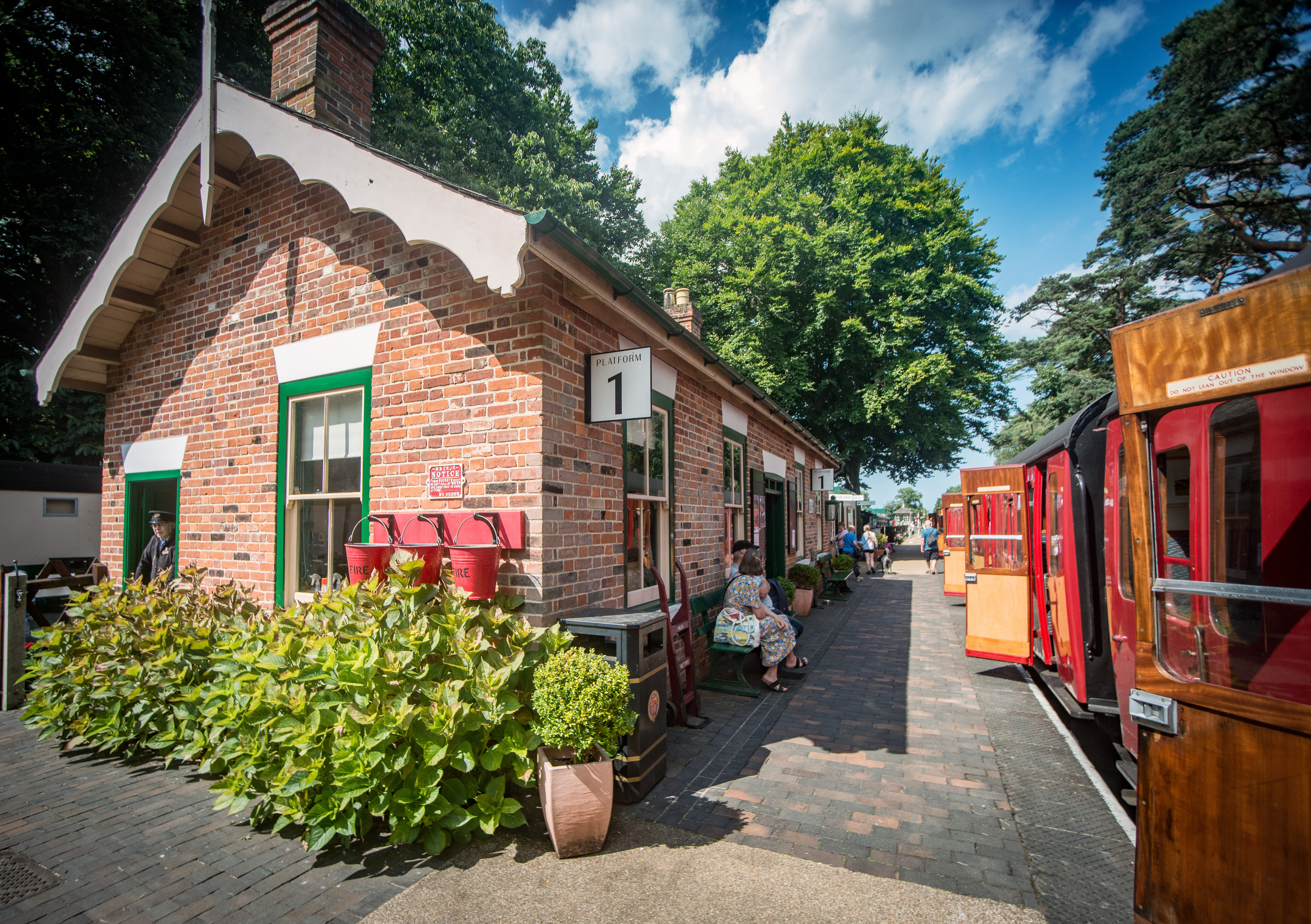
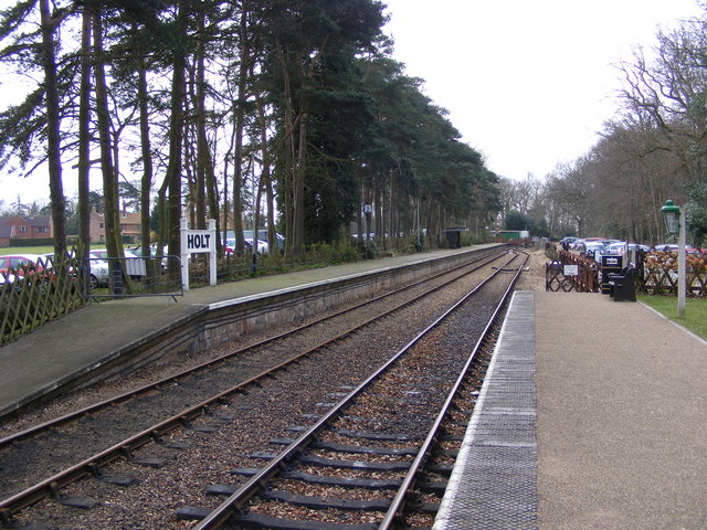
Holt railway station (North Norfolk Railway)

Holt railway station, opened in 1987, is the current terminus of the North Norfolk Railway and is a new-build station half a mile south of the proposed...
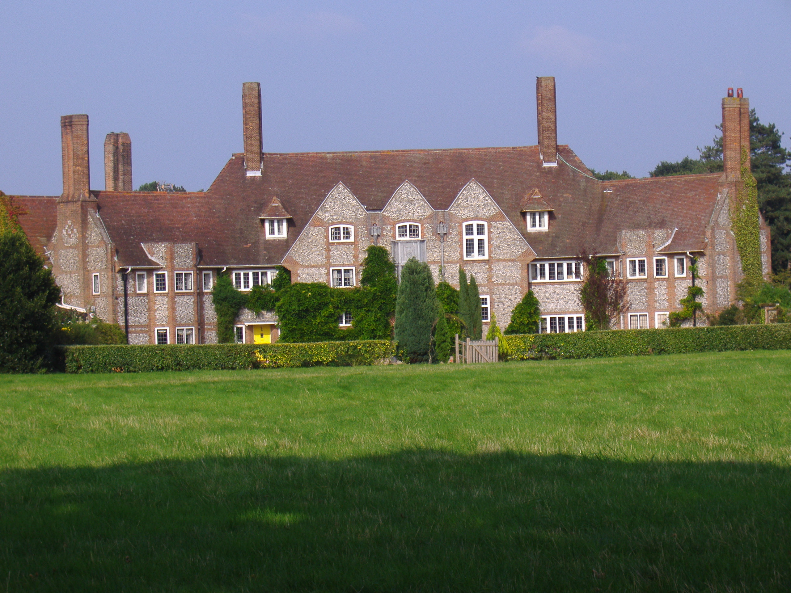
Home Place, Kelling

Home Place, also called Voewood, is an Arts and Crafts style house in High Kelling, near Holt, Norfolk, England, designed (1903–5) by Edward Schroeder...
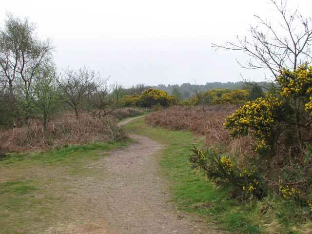
Kelling Heath

Kelling Heath is an 89.4-hectare (221-acre) biological Site of Special Scientific Interest between Holt and Weybourne in Norfolk. It is in the Norfolk...

Farfield

Farfield is one of the seven boarding houses at Gresham's, an English public school at Holt, Norfolk. Farfield is currently home to approximately fifty...

High Kelling

High Kelling is a village and civil parish in the north of the English county of Norfolk. The village is located on the A148 road which links Cromer to...

Gresham's School

Gresham's School is a public school (English fee-charging boarding and day school) in Holt, Norfolk, England, one of the top thirty International Baccalaureate...

Kelling

Kelling (also known as Low Kelling and as Lower Kelling) is a village and a civil parish in the English county of Norfolk. The village is 10.1 miles...

Nearby Amenities

Located within 500m of 52.924055,1.1115519
Railway: switch
Lat/Long: 52.919872/1.1141461
Cat Pits Bungalow
Place: isolated_dwelling
Lat/Long: 52.9224238/1.1052107
Kelling Park
Place: locality
Lat/Long: 52.9264318/1.1150563
The Heater
Place: locality
Lat/Long: 52.9256678/1.1067899
Parking
Access: yes
Fee: no
Parking: surface
Surface: ground
Lat/Long: 52.9231263/1.1114335
Give Way
Lat/Long: 52.9255617/1.1077041
Give Way
Lat/Long: 52.9255232/1.1077675
Give Way
Lat/Long: 52.9244864/1.1057246
The data included in this document is from www.openstreetmap.org. The data is made available under ODbL.

Have you been to Stone Pit Plantation?

Leave your review of Stone Pit Plantation below (or comments, questions and feedback).