Hustlers Grove

Wood, Forest in Suffolk Babergh

England

Hustlers Grove

Rectory Hill East Bergholt
Rectory Hill East Bergholt Credit: Roy Hughes

Hustlers Grove, located in Suffolk, is a picturesque wood and forest area known for its natural beauty and tranquility. Stretching over a vast expanse of land, the grove is a haven for nature enthusiasts, hikers, and those seeking solace in the midst of serene surroundings.

The forest is primarily composed of deciduous trees, with a diverse range of species including oak, beech, and birch. These towering trees create a dense canopy that provides shade and shelter for a variety of wildlife. Visitors can expect to spot an array of woodland creatures such as deer, foxes, rabbits, and a wide range of bird species.

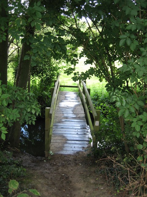
Trails wind through the grove, offering adventurers the opportunity to explore its hidden gems. These well-maintained paths cater to both casual strollers and avid hikers, accommodating various fitness levels. Along the way, visitors can admire vibrant wildflowers, listen to the melodic chirping of birds, and breathe in the crisp, fresh air.

Hustlers Grove also boasts a small, secluded pond that adds to its charm. The pond is teeming with fish, making it a popular spot for anglers seeking a tranquil fishing experience. Anglers can sit by the water's edge, casting their lines and enjoying the peaceful ambiance.

In addition to its natural wonders, Hustlers Grove features picnic areas and rest spots where visitors can relax and rejuvenate. These designated areas provide a perfect setting for family outings, picnics, or simply unwinding amidst the beauty of nature.

Overall, Hustlers Grove in Suffolk is a true gem for nature enthusiasts, offering a chance to escape the hustle and bustle of everyday life and immerse oneself in the tranquility of a stunning woodland retreat.

If you have any feedback on the listing, please let us know in the comments section below.

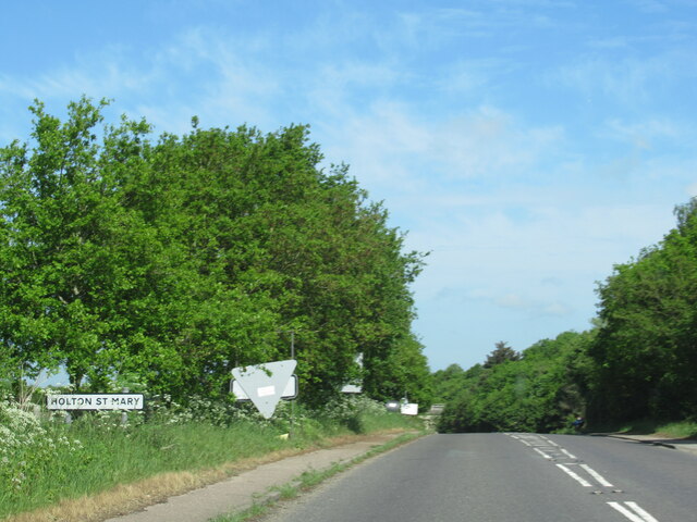
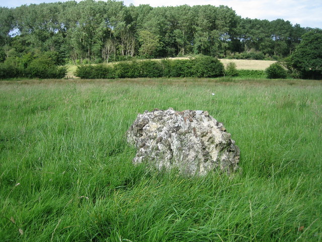
Hustlers Grove Images

Images are sourced within 2km of 51.983686/1.036156 or Grid Reference TM0836. Thanks to Geograph Open Source API. All images are credited.

Rectory Hill East Bergholt
Gaston Street at Chaplin Road East Bergholt
Gaston Street junction with the B1070 East Bergholt
Beehive Corner East Bergholt
Holton St Mary village sign on B1070
Esso Service Station on A12 north near Capel St Mary
The A12, Capel St Mary I've been here before. <a title="https://www.geograph.org.uk/photo/5377066" href="https://www.geograph.org.uk/photo/5377066">Link</a>
The A12, Capel St Mary
I've been here before. Link
The A12, Capel St Mary
Layby on the A12, East Bergholt
The A12, East Bergholt
View east off Cutlers Lane
View south off Cutlers Lane
The Place for Plants: Garden & Arboretum, East Bergholt This is a garden centre with an garden & arboretum attached. The garden dates from the turn of the 20th century.
The Place for Plants: Garden & Arboretum, East Bergholt
This is a garden centre with an garden & arboretum attached. The garden dates from the turn of the 20th century.
Last Remains of Dodnash C12th Priory by footpath Beside the footpath from East End, East Bergholt to Dodnash Wood (seen in background), you pass the last remaining lump of stones from the twelfth century Augustinian Priory that existed on this spot.  Continue up the hill and through the wood for a rewarding ramble
Last Remains of Dodnash C12th Priory by footpath
Beside the footpath from East End, East Bergholt to Dodnash Wood (seen in background), you pass the last remaining lump of stones from the twelfth century Augustinian Priory that existed on this spot. Continue up the hill and through the wood for a rewarding ramble
Footbridge over Dodnash Brook towards East End Coming south from Bentley and passing across the marsh where there are remains of Dodnash Priory, you cross this bridge before going up the footpath to the top of the next field
Footbridge over Dodnash Brook towards East End
Coming south from Bentley and passing across the marsh where there are remains of Dodnash Priory, you cross this bridge before going up the footpath to the top of the next field
Weight limit on weak bridge between East End & Bentley Even rural road signs are not safe from graffiti!  This sign warns drivers going north towards Bentley from East End, East Bergholt that they had better weigh no more than 8 tonnes.  The road is narrow too! Downstream from this bridge are two footbridges (at least) over Dodnash Brook - one in this square and one in TM1135, to the east.
Weight limit on weak bridge between East End & Bentley
Even rural road signs are not safe from graffiti! This sign warns drivers going north towards Bentley from East End, East Bergholt that they had better weigh no more than 8 tonnes. The road is narrow too! Downstream from this bridge are two footbridges (at least) over Dodnash Brook - one in this square and one in TM1135, to the east.
Footpath fork: left to Dodnash Wood, right to East End Coming from Bentley on the road towards East End, East Bergholt, you cross Dodnash Brook and climb the hill to a sharp right turn. At that point you can take a footpath right to East End or turn back left and go to the south side of Dodnash Wood
Footpath fork: left to Dodnash Wood, right to East End
Coming from Bentley on the road towards East End, East Bergholt, you cross Dodnash Brook and climb the hill to a sharp right turn. At that point you can take a footpath right to East End or turn back left and go to the south side of Dodnash Wood
Two Footpath signs in East End Lane, East Bergholt The trees in the distance are in Dodnash Wood.
Two Footpath signs in East End Lane, East Bergholt
The trees in the distance are in Dodnash Wood.
Show me another place!

Hustlers Grove is located at Grid Ref: TM0836 (Lat: 51.983686, Lng: 1.036156)

Administrative County: Suffolk

District: Babergh

Police Authority: Suffolk

What 3 Words

///repeat.speeches.balancing. Near East Bergholt, Suffolk

Nearby Locations

Hustlers Grove

Related Wikis

East Bergholt High School

East Bergholt High School is a secondary school in East Bergholt, Suffolk, 11 miles (18 km) north of Colchester, Essex, and nine miles (14 km) south of...

East Bergholt

East Bergholt is a village in the Babergh District of Suffolk, England, just north of the Essex border. The nearest town and railway station is Manningtree...

Samford Rural District

Samford Rural District was a rural district within the administrative county of East Suffolk between 1894 and 1974. It was created out of the earlier Samford...

Dodnash Priory

Dodnash Priory was a small Augustinian priory located in Bentley, Suffolk, England, near the village's boundary with East Bergholt. It was situated close...

Nearby Amenities

Located within 500m of 51.983686,1.036156
Power: tower
Lat/Long: 51.9824463/1.0419402
Power: tower
Lat/Long: 51.9808148/1.0400734
Power: pole
Lat/Long: 51.9805783/1.0320361
Power: pole
Lat/Long: 51.9800034/1.0330271
Barrier: entrance
Lat/Long: 51.9795971/1.0346675
Barrier: entrance
Lat/Long: 51.9797375/1.0348282
The data included in this document is from www.openstreetmap.org. The data is made available under ODbL.

Have you been to Hustlers Grove?

Leave your review of Hustlers Grove below (or comments, questions and feedback).